| Lanak La | |
|---|---|
| ལ་ནག་ལ | |
 Lanak La  Lanak La | |
| Elevation | 5,466 m (17,933 ft) |
| Traversed by | Tibet Provincial Road S519 |
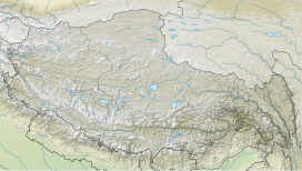
| Location | Tibet, China |
| Coordinates | 34°23′38″N79°32′21″E / 34.3938°N 79.5391°E |
- ↑ Drew, Frederic (1875), The Jummoo and Kashmir Territories: A Geographical Account, E. Stanford – via archive.org
- ↑ Richardson, H. E. (1962). A Short History of Tibet. E. P. Dutton. p. 225.[ dead link ][ ISBN missing ]
- ↑ Wellby, M.S. (1898). Through Unknown Tibet. Lippincott. p. 78. ISBN 9788120610583.
- ↑ Carey, A. D. (1887). "A Journey round Chinese Turkistan and along the Northern frontier of Tibet". Proceedings of the Royal Geographical Society. 9 (12): 731–752. doi:10.2307/1801130. JSTOR 1801130.
- ↑ Bower, Hamilton, Diary of A Journey across Tibet, London, 1894
- ↑ Rawling, C. G., The Great Plateau Being An Account Of Exploration In Central Tibet, 1903, And Of The Gartok Expedition 1904-1905, p 38, London, 1905
- ↑ Deasy, H. H. P. (August 1900). "Journeys in Central Asia". The Geographical Journal. 6 (2): 142. Bibcode:1900GeogJ..16..141D. doi:10.2307/1774554. JSTOR 1774554.
- ↑ Bruce, C. D. (June 1907). "A Journey across Asia from Leh to Peking". The Geographical Journal. 29 (6): 600. Bibcode:1907GeogJ..29..597B. doi:10.2307/1776269. JSTOR 1776269.
- ↑ "Report of the Officials of the Governments of India and the People's Republic of China on the Boundary Question - Part 2" (PDF). Ministry of External Affairs, India, 1961. Archived from the original (PDF) on 21 September 2013. Retrieved 30 August 2013.
- ↑ Verma, Virendra Sahai (2006). "Sino-Indian Border Dispute At Aksai Chin - A Middle Path For Resolution" (PDF). Journal of Development Alternatives and Area Studies. 25 (3): 6–8. ISSN 1651-9728 . Retrieved 30 August 2013.
- ↑ Fisher, Rose & Huttenback (1963) , p. 112
- ↑ Karackattu, Joe Thomas (2020). "The Corrosive Compromise of the Sino-Indian Border Management Framework: From Doklam to Galwan". Asian Affairs. 51 (3): 590–604. doi:10.1080/03068374.2020.1804726. S2CID 222093756.
- ↑ Hoffmann (1990) , p. 77: "This company was commanded by the most experienced Indian patrol leader in Ladakh, one Karam Singh, who (the previous June) had taken a patrol through Hot Spring, Kongka Pass, and then forty miles further to Lanak La. No sign of a Chinese presence had been seen then..."
- ↑ Mullik, B. N. (1971), My Years with Nehru: The Chinese Betrayal, Allied Publishers, p. 627
- ↑ Hudson, Geoffrey Francis (1963). Far Eastern Affairs, Volume 3. St. Martin's Press. p. 20.
- ↑ "Notes, Memoranda and letters Exchanged and Agreements signed between The Governments of India and China - White Paper VIII" (PDF). Archived from the original (PDF) on 21 September 2013. Retrieved 30 August 2013.
- ↑ Hoffmann (1990) , p. 77: "It happened two miles west of the pass, on the banks of the Chang Chenmo River." (emphasis added)
- 1 2 Maxwell, Neville (1970). India's China War. New York: Pantheon. p. 13.
- ↑ Wortzel, Larry (2003). Burkitt, Laurie; Scobell, Andrew; Wortzel, Larry (eds.). The Lessons of History: The Chinese People's Liberation Army at 75 (PDF). Strategic Studies Institute, U.S. Army War College. p. 331. ISBN 9781428916517.
- ↑ Whiting, Allen S. (1987). "The Sino-Soviet Split". In MacFarquhar, Roderick; Fairbank, John K. (eds.). The Cambridge History of China, Volume 14. Cambridge University Press. p. 512. ISBN 978-0-521-24336-0.
- ↑ Fisher, Rose & Huttenback (1963) , p. 101: "Confusion as to the extent of the Chang Chenmo valley between the Lanak and Kongka passes continued to be a feature of Chinese cartography even after the Communists came to power.... the flexibility shown by official Chinese cartographers here and on other sections of the border makes mockery of China's oft-repeated claim that its concept of the border has a solid basis in history."
- ↑ Van Eekelen, Willem Frederik (1967), Indian Foreign Policy and the Border Dispute with China, Springer, p. 164, ISBN 978-94-017-6555-8,
The Chinese could not quote a single document confirming that the Kongka Pass constituted the boundary.... The thorough approach of the Indian side generally contrasted with an inconsistent and almost careless presentation by the Chinese officials.
Bibliography
- Fisher, Margaret W.; Rose, Leo E.; Huttenback, Robert A. (1963), Himalayan Battleground: Sino-Indian Rivalry in Ladakh, Praeger – via archive.org
- Hoffmann, Steven A. (1 January 1990). India and the China Crisis. University of California Press. ISBN 978-0-520-06537-6.
External links
| Lanak La | |||||||||
|---|---|---|---|---|---|---|---|---|---|
| Chinese name | |||||||||
| Chinese | 拉那克山口 | ||||||||
| |||||||||
| |||||||||
| On the border | |||||||||||
|---|---|---|---|---|---|---|---|---|---|---|---|
| In the interior |
| ||||||||||