Tulung La

Last updated

Tulung La
Tibet loc rel map.svg
Red pog.svg
Tulung La
India Arunachal Pradesh relief map.svg
Red pog.svg
Tulung La
Elevation 17,250 feet (5,260 m)
Location Tsona County, Tibet, China -
Tawang, Arunachal Pradesh, India
Range Himalaya
Coordinates 27°52′57″N92°15′04″E / 27.8825°N 92.2511°E / 27.8825; 92.2511
Tulung La

Tulung La [lower-alpha 1] (Tibetan : ཐུ་ལུང་ལ་, Wylie : thu lung la) [4] is a border pass between the Tsona County in the Tibet region of China and India's Tawang district in Arunachal Pradesh. It is in the eastern part of the two districts, close to the Gori Chen cluster of mountains, on a watershed between the Tsona Chu river in Tibet and the Tawang Chu in the Tawang district. The watershed ridge forms the border between Tibet and India as per the McMahon Line. [1] [5] Tulung La provided an invasion route to China during the 1962 Sino-Indian War. It is also the scene of occasional clashes between the two sides.

Contents

Geography

Map of Tsona Dzong and the Tawang region by Bailey and Morshead, showing "Talung La" Nyamjang Chu and Tawang Chu rivers mapped by Morshead and Bailey, 1913.jpg
Map of Tsona Dzong and the Tawang region by Bailey and Morshead, showing "Talung La"

Tulung La is at the northeastern corner of the Tawang district. The British political officer F. M. Bailey, who travelled through Tibet in 1912–1913, observed a "main Himalayan range" that runs from the high peaks of Namcha Barwa in an unbroken line till Tulung La. He observed that it continues west towards the border of Bhutan but in a somewhat "broken" way, [1] passing through Milakatong La mentioned earlier by Indian explorer Nain Singh (now recognised as Bum La Pass). [6]

To the north of Tulung La rises one of the headwaters of Seti Chu, a tributary of Tsona Chu, which it joins near the town of Lampug (Langpo). Another headwater of Seti Chu comes from Pen La, connecting the valley to that of the Subansiri valley. To the south of Tulung La is one of the headwaters of Goshu Chu (also called Goro Chu), which joins two other rivers near Mago ( 27°41′15″N92°12′26″E / 27.6876°N 92.2072°E / 27.6876; 92.2072 (Mago) ) to form Tawang Chu. One of the three rivers, Gorjo Chu, comes from the southeast, providing an alternative route into the West Kameng district via Tse La. [7]

The Tulung La ridge runs west-southwest dividing the waters of Seti Chu in the north and the Tawang Chu tributaries in the south. It runs till a location called Yangtse, where Tsona Chu runs break through the ridge line, and receives the spectacular Chumi Gyatse Falls falling down a near vertical cliff of the ridge. The entire ridgeline between Tulung La and Yangtse has also been called the "Yangtse ridge" in recent times.

History

During the 1914 Simla Convention conference, the British Indian foreign secretary Henry McMahon and the Tibetan plenipotentiary Lonchen Shatra negotiated the mutual boundary between the two countries, which came to be known as the McMahon Line. McMahon summarised the decision as follows: [3]

the boundary line ...follows the crest of the mountain range which runs from peak 21431 through Tu Lung La and Menlaka-thong La to the Bhutan border. This is the highest mountain range in this tract of country. To the north of it are people of Tibetan descent, to the south the inhabitants are of Bhutanese and Aka extraction. It is unquestionably the correct boundary. [3]

The Republic of China, which did not sign the Simla Convention, disavowed the McMahon boundary by around 1935, and so has the People's Republic of China that succeed it. The border dispute continues between China and India to the present day.

In 1962, China launched a war on India, invading the Tawang district from the north. Tulung La was one of the passes through which the Chinese forces came in. They went via Poshing La and threatened the road route between Bomdila and the Se La pass, an action that made the Indian positions at Se La untenable. [8] [9] [10] India lost the war. But China withdrew to the former positions at the end of the war, declaring that it would work on the border settlement through negotiations. As of 2023, no settlement has yet been reached.

In October 1975, there was a clash at the Tulung La pass. The Chinese border troops fired on an Indian patrol belonging to Assam Rifles, killing four out of the six men. According to India, the Chinese ambushed Indian troops 500 metres south of Tulung La and the clash took place on Indian territory. China denied the claim, and blamed the Indian troops who were said to have entered Chinese territory and initiated the clash. [11] [12] [13] The Indian military officer who went to receive the bodies a week later, opined that the soldiers were likely not killed in the shooting, but were subsequently tortured to death. [14] In November 2020, the Chhetri War Memorial was set up at Tulung La to commemorate the slain soldiers, inaugurated by the Arunachal Pradesh chief minister Pema Khandu. [15]

The 1975 Tulung La incident was reminiscent of other peacetime firing incidents prior to the 1962 war, viz., the 1959 Longju incident and the 1959 Kongka Pass incident, which vitiated the relations between the two countries to such an extent that the war became inevitable. [16] However, after 1975, there were no further firing incidents. In 1993, India and China signed a Border Peace and Tranquility Agreement, prohibiting the use of firearms in the vicinity of the border.
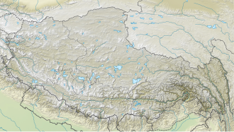
See also

Notes

  1. Alternative spellings: Tulang La, [1] Talung La, [2] and Tu Lung La. [3]

Related Research Articles

<span class="mw-page-title-main">Sino-Indian War</span> 1962 war between China and India

The Sino-Indian War, also known as the China–India War or the Indo-China War, was an armed conflict between China and India that took place from October to November 1962. It was a military escalation of the Sino-Indian border dispute. Fighting occurred along India's border with China, in India's North-East Frontier Agency east of Bhutan, and in Aksai Chin west of Nepal.

<span class="mw-page-title-main">McMahon Line</span> Boundary between the Tibetan region of China and India

The McMahon Line is the boundary between Tibet and British India as agreed in the maps and notes exchanged by the respective plenipotentiaries on 24–25 March 1914 at Delhi, as part of the 1914 Simla Convention. The line delimited the respective spheres of influence of the two countries in the eastern Himalayan region along northeast India and northern Burma (Myanmar), which were earlier undefined. The Republic of China was not a party to the McMahon Line agreement, but the line was part of the overall boundary of Tibet defined in the Simla Convention, initialled by all three parties and later repudiated by the government of China. The Indian part of the Line currently serves as the de facto boundary between China and India, although its legal status is disputed by the People's Republic of China. The Burmese part of the Line was renegotiated by the People's Republic of China and Myanmar.

<span class="mw-page-title-main">Tawang district</span> District of Arunachal Pradesh in India

Tawang district is the smallest of the 26 administrative districts of Arunachal Pradesh state in northeastern India. With a population of 49,977, it is the eighth least populous district in the country.

<span class="mw-page-title-main">Tawang</span> Town in Arunachal Pradesh, India

Tawang is a town and administrative headquarter of Tawang district in the Indian state of Arunachal Pradesh. It lies on NH-13 section of Trans-Arunachal Highway. The town was once the capital of the Tawang Tract, which is now divided into the Tawang district and the West Kameng district. Tawang continues as the headquarters of the former. Tawang is the number one tourist destination of Arunachal Pradesh.

<span class="mw-page-title-main">Bomê County</span> County in Tibet, China

Pome County or Bomê County is a county of Nyingchi Prefecture in the south-east of the Tibet Autonomous Region. Historically known as Powo or Poyul, it was the seat of a quasi-independent kingdom until the early 20th century when troops of the Dalai Lama's Lhasa government integrated it into the central Tibetan realm. The population was 25,897 in 2004.

A long series of events triggered the Sino-Indian War in 1962. According to John W. Garver, Chinese perceptions about the Indian designs for Tibet, and the failure to demarcate a common border between China and India were important in China's decision to fight a war with India.

<span class="mw-page-title-main">Sino-Indian border dispute</span> Border dispute between China and India

The Sino-Indian border dispute is an ongoing territorial dispute over the sovereignty of two relatively large, and several smaller, separated pieces of territory between China and India. The first of the territories, Aksai Chin, is administered by China as part of the Xinjiang Uyghur Autonomous Region and Tibet Autonomous Region and claimed by India as part of the union territory of Ladakh; it is mostly uninhabited high-altitude wasteland in the larger regions of Kashmir and Tibet and is crossed by the Xinjiang-Tibet Highway, but with some significant pasture lands at the margins. The other disputed territory is south of the McMahon Line, in the area formerly known as the North-East Frontier Agency and now called Arunachal Pradesh which is administered by India. The McMahon Line was part of the 1914 Simla Convention signed between British India and Tibet, without China's agreement. China disowns the agreement, stating that Tibet was never independent when it signed the Simla Convention.

<span class="mw-page-title-main">Tsona</span> County-level city in Tibet, China

Tsona City, formerly Tsona County, is a county-level city in Shannan Prefecture in southern part of the Tibet region of China. Tsona means "The face of the [Nara Yumco] lake" in Tibetan. It lies immediately to the north of the McMahon Line agreed as the mutual border between British India and Tibet in 1914. China has not accepted the 1914 border delineation, but treats it as the Line of Actual Control (LAC). Tsona also borders Bhutan on its southwest.

South Tibet is a literal translation of the Chinese term '藏南', which may refer to different geographic areas:

<span class="mw-page-title-main">Bum La Pass</span>

The Bum La Pass is a border pass between China's Tsona County in Tibet and India's Tawang district in Arunachal Pradesh. It is 37 km away from the town of Tawang in India's Tawang district and 43 km from the town of Tsona Dzong in China's Tsona County. The pass currently serves as a trading point between Arunachal Pradesh and Tibet. It is also an agreed Border Personnel Meeting point for the security forces of China and India.

Milakatong La or Menlakathong La is a historic mountain pass along the trade route between Tawang in India's Arunachal Pradesh and Tsona Dzong in Tibet's Shannan province via the valley of Tsona Chu.

Sumdorong Chu is a tributary of the Nyamjang Chu river that flows along the disputed Sino-Indian border between the Tsona County of Tibet and the Tawang district of Arunachal Pradesh. It originates in the Tokpo Shiri Glacier, about 7–10 kilometres east of Nyamjang Chu, and flows down to the river. Its junction with Nyamjang Chu is to the north of that of Namka Chu, another contested river valley, by about two kilometers.

<span class="mw-page-title-main">Namka Chu</span>

Namka Chu or Kejielang River is a tributary of Nyamjang Chu that flows along the disputed border between India and China. The Indian side of the border is the Tawang district in Arunachal Pradesh. The Tibetan side of the border is in Tsona Dzong, Shannan province of Tibet. Namka Chu originates near the trijunction of Tibet, Bhutan and India and flows east for 26 km before joining Nyamjang Chu. It is about 200 kilometers away from the Misamari railhead and 60 kilometers from the Tawang road head. The Namka Chu valley was the scene of some of the most fierce fighting between India and China during the 1962 Sino-Indian war.

Nyamjang Chu, or Nyashang Chu (Tibetan: ཉ་བཤང་ཆུ, Wylie: nya bshang chu, THL: nya shang chu) is a cross-border perennial river that originates in the Shannan Prefecture of Tibet and flows into the Arunachal Pradesh state of India, joining the Tawang Chu river just before it enters Bhutan. The Nyamjang Chu valley has provided the traditional communication route between Tawang and Tibet. The valley near town of Zemithang in the Tawang district, called the Pangchen Valley, is known for its serene beauty and forms one of the wintering locations for the black-necked crane.

<span class="mw-page-title-main">Tawang Chu</span> River in ; Trashiyangtse and Trashigang, India; Bhutan

Tawang Chu is the main river of the Tawang district in Arunachal Pradesh, India. The entire district may be regarded as the basin of the Tawang Chu river. In addition, two south-flowing rivers from Tibet, viz., Tsona Chu and Nyamjang Chu, join the river within the district. The combined river flows west into Bhutan, where it progresses to the Manas River and flows into the Assam state of India.

Migyitun, also called Tsari or Zhari, is a town in the Lhöntse County of Tibet's Shannan Prefecture. It is on the banks of the Tsari Chu river close to the McMahon Line, the de facto border with India's Arunachal Pradesh. It is also a key part of the Buddhist Tsari pilgrimage, made once in twelve years, that makes a wide circumambulation of the Dakpa Sheri mountain.

Longju or Longzu is a disputed area in the eastern sector of the China–India border, controlled by China but claimed by India. The village of Longju is located in the Tsari Chu valley 2.5 kilometres (1.6 mi) south of the town of Migyitun, considered the historical border of Tibet. The area of Longju southwards is populated by the Tagin tribe of Arunachal Pradesh.

<span class="mw-page-title-main">Rima, Tibet</span> Village in Tibet, Peoples Republic of China

Rima is the former capital of the Zayul in the southeastern Tibet Autonomous Region of China. It is on the border with India's Arunachal Pradesh at the confluence of the Rongto Chu and Zayul Chu rivers, which join to form the Zayul River before it flows into Arunachal Pradesh. Rima was a notable border trading town, which the British contemplated as a location for a trade mart in the Lhasa Convention.

Chumi Gyatse Falls, called Domtsang and Dongzhang waterfalls in Tibetan and Chinese languages respectively, are a collection of waterfalls in the Tawang district in Arunachal Pradesh, India, close to the border with the Tibet region of China. According to the local Buddhist tradition, the 108 holly water falls which originate from in-between the mountains symbolise the blessings of Guru Padmasambhava. The Chumi Gyatse Falls are close to the Line of Actual Control, the de facto border between China and India, just 250 metres away according to one account.

<span class="mw-page-title-main">2022 Yangtse clash</span> Border clash between India and China

The Yangtse clash of 9 December 2022 occurred at night between the troops of the Indian Army and the Chinese People's Liberation Army (PLA) along their mutually contested Line of Actual Control (LAC) in the Yangtse region of Tawang in the Indian state of Arunachal Pradesh. Violent clashes ensued after the two armies confronted each other with nail-studded clubs and other melee weapons near positions on a border ridgeline in close vicinity of the revered Buddhist site of Chumi Gyatse Falls. The border incident marked the most serious clash between the two armies along their undemarcated frontier since the Galwan Valley clash in June 2020, which had led to the deaths of 20 Indian soldiers and an unknown number of dead on the Chinese side.

References

  1. 1 2 3 Bailey, Exploration on the Tsangpo (1914), p. 579.
  2. Bailey, Exploration on the Tsangpo (1914), attached map.
  3. 1 2 3 Mehra, The McMahon Line and After (1974), p. 232.
  4. "Geographical names of Tibet AR (China): Tibet Autonomous Region". KNAB Place Name Database. Institute of the Estonian Language. 3 June 2018.
  5. Arpi, 1962 and the McMahon Line Saga (1997), pp. 96–97.
  6. Bailey, Exploration on the North-East Frontier (1914), p. 16: "The main Himalayan range would appear to run west from Gori Chen through the Tulung La (17,250 feet) and thence through the Mila Katong La [possibly Bum La] (14,210 feet) which Nain Singh crossed.".
  7. Johri, Chinese Invasion of NEFA (1965), pp. 90–92.
  8. Johri, Chinese Invasion of NEFA (1965), pp. 148–149, 191.
  9. Hoffmann, Steven A. (1990), India and the China Crisis, University of California Press, pp. 188–190, ISBN   978-0-520-06537-6
  10. Kapadia, Harish (2005), Into the Untravelled Himalaya: Travels, Treks, and Climbs, Indus Publishing, p. 55, ISBN   978-81-7387-181-8
  11. Krishnan, Ananth (14 June 2020). "1975: Last firing on the India-China border". The Hindu. ISSN   0971-751X . Retrieved 29 December 2022.
  12. India-China Clash on '62 Battle Site, The New York Times, 3 November 1975. ProQuest   120269057
  13. Clash in Himalayas Confirmed by China; Indians Are Blamed, The New York Times, 4 November 1975. ProQuest   120262764
  14. Krishnan, Ananth (20 September 2020). "Torture, not firing, behind China border deaths in 1975, recalls veteran". The Hindu. ISSN   0971-751X . Retrieved 29 December 2022.
  15. Deka, Bitopan (3 November 2020). "Chhetri War Memorial inaugurated: Know the Indian heroes who fought China in 1975". EastMojo. Retrieved 29 December 2022.
  16. Hoffmann, Steven A. (October–December 1973), "Perceived Hostility and the Indian Reaction to China", India Quarterly, 20 (4): 283–299, doi:10.1177/097492847302900401, JSTOR   45070057, S2CID   152421080

Bibliography