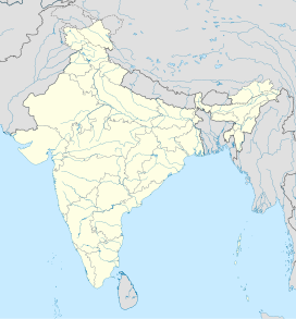
Ladakh is a region administered by India as a union territory and constitutes an eastern portion of the larger Kashmir region that has been the subject of a dispute between India and Pakistan since 1947 and India and China since 1959. Ladakh is bordered by the Tibet Autonomous Region to the east, the Indian state of Himachal Pradesh to the south, both the Indian-administered union territory of Jammu and Kashmir and the Pakistan-administered Gilgit-Baltistan to the west, and the southwest corner of Xinjiang across the Karakoram Pass in the far north. It extends from the Siachen Glacier in the Karakoram range to the north to the main Great Himalayas to the south. The eastern end, consisting of the uninhabited Aksai Chin plains, is claimed by the Indian Government as part of Ladakh, but has been under Chinese control.

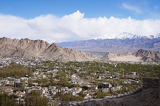
Leh is a city in Indian-administered Ladakh in the disputed Kashmir region. It is the largest city and the joint capital of Ladakh. Leh, located in the Leh district, was also the historical capital of the Kingdom of Ladakh. The seat of the kingdom, Leh Palace, the former residence of the royal family of Ladakh, was built in the same style and about the same time as the Potala Palace in Tibet. Since they were both constructed in a similar style and at roughly the same time, the Potala Palace in Tibet and Leh Palace, the royal residence, are frequently contrasted. Leh is at an altitude of 3,524 m (11,562 ft), and is connected via National Highway 1 to Srinagar in the southwest and to Manali in the south via the Leh-Manali Highway.

Kargil district is a district in Indian-administered Ladakh in the disputed Kashmir-region, which is administered as a union territory of Ladakh. It is named after the city of Kargil, where the district headquarters lies. The district is bounded by the Indian-administered union territory of Jammu and Kashmir to the west, the Pakistani-administered administrative territory of Gilgit–Baltistan to the north, Ladakh's Leh district to the east, and the Indian state of Himachal Pradesh to the south. Encompassing three historical regions known as Purig, Dras and Zanskar, the district lies to the northeast of the Great Himalayas and encompasses the majority of the Zanskar Range. Its population inhabits the river valleys of the Dras, Suru, Wakha Rong, and Zanskar.

Nubra, also called Dumra, is a historical region of Ladakh, India that is currently administered as a subdivision and a tehsil in the Nubra district. Its inhabited areas form a tri-armed valley cut by the Nubra and Shyok rivers. Its Tibetan name Dumra means "valley of flowers". Demands have been raised and BJP has hinted at creation of Nubra as a new district. Diskit, the headquarters of Nubra, is 120 km north of Leh, the capital of Ladakh.

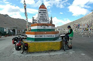
Chang La is a high mountain pass in Ladakh at an elevation of 5,391.3024 m (17,688.000 ft) in the Ladakh Range between Leh and the Shyok River valley. The Chang La, on Leh to Pangong Lake road, lies on the Leh-Karu-Sakti-Zingral-Chang La-Durbuk-Tangtse-Pangong Lake motorable road. Karu, which lies on Leh-Manali NH-3, connects Chang La and Pangong Lake to Leh and the rest of India. In September 2021, BRO opened another alternate motorable asphalt road between Zingral and Tangtse via Ke La pass and Taruk.

Leh district is a district in Indian-administered Ladakh in the disputed Kashmir-region. Ladakh is an Indian-administered union territory. With an area of 45,110 km2, it is the second largest district in the country, second only to Kutch. It is bounded on the north by Gilgit-Baltistan's Kharmang and Ghanche districts and Xinjiang's Kashgar Prefecture and Hotan Prefecture, to which it connects via the historic Karakoram Pass. Aksai Chin and Tibet are to the east, Kargil district to the west, and Lahul and Spiti to the south. The district headquarters is in Leh. It lies between 32 and 36 degree north latitude and 75 to 80 degree east longitude.

Kargil or Kargyil is a city in Indian-administered Ladakh in the disputed Kashmir region. It is the joint capital of Ladakh, an Indian-administered union territory. It is also the headquarters of the Kargil district. It is the second-largest city in Ladakh after Leh. Kargil is located 204 kilometres (127 mi) east of Srinagar in Jammu and Kashmir, and 234 kilometres (145 mi) to the west of Leh. It is on the bank of the Suru River near its confluence with the Wakha Rong river, the latter providing the most accessible route to Leh.

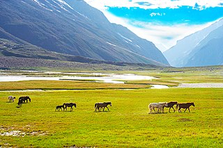
The Suru Valley is a valley in the Kargil District in the Union Territory of Ladakh, India. It is drained by the Suru River, a tributary of the Indus River. The valley's most significant town is Sankoo.

The Ladakh Range is a mountain range in central Ladakh in India with its northern tip extending into Baltistan in Pakistan. It lies between the Indus and Shyok river valleys, stretching to 230 miles (370 km). Leh, the capital city of Ladakh, is on the foot of Ladakh Range in the Indus river valley.

Tourism is one of the economic contributors to the union territory of Ladakh in Northern India. This union territory is located between the Karakoram mountain range to the north and the Himalayas to the south, and is situated at a height of 11,400 ft. Ladakh is composed of Leh and Kargil districts. The region contains prominent Buddhist sites and has an ecotourism industry.

Dras, also known locally in Shina as Himababs, Hembabs, or Humas, is a town and hill station, and the headquarters of Drass district of the union territory of Ladakh in India. It is on the NH 1 between Zoji La pass and Kargil. A tourist hub for its high-altitude trekking routes and tourist sites, it is often called "The Gateway to Ladakh". The government's official spelling of the town's name is "Drass".

Fotu La or Fatu La is a mountain pass on the Srinagar-Leh highway in the Zanskar Range of the Himalayas in India. At an elevation of 4,108 metres (13,478 ft), it is the highest point on the highway, surpassing the famed Zoji La.

National Highway 1D, also known as Srinagar–Leh Highway, was a National Highway in the state of Jammu and Kashmir that connected Srinagar to Leh in Ladakh. The Srinagar-Leh Highway was declared as National Highway in 2006. It is now part of National Highway 1 that extends west to Uri.

The Doda River or the Stod River is a river 79 kilometres (49 mi) long, which forms the Stod Valley in the Zanskar valley of the Leh district in the Union Territory of Ladakh in India.

Tsarap River, also known as Tsarap Chu, forms the eastern part of the Zanskar valley, in the Ladakh union territory of India. The 182 km (113 mi) long river is used for irrigation in riparian villages, and for adventure sports by tourists.
Maryul, also called mar-yul of mnga'-ris, was the western-most Tibetan kingdom based in modern-day Ladakh and some parts of Tibet. The kingdom had its capital at Shey.

Zoji La is a high mountain pass in the Himalayas. It is in the Kargil district, Indian Union territory of Ladakh. Located in the Dras subdivision, the pass connects the Kashmir Valley to its west with the Dras and Suru valleys to its northeast and the Indus valley further east. National Highway #1 between Srinagar and Leh in the western section of the Himalayan mountain range, traverses the pass. As of late 2022, an all-weather Zoji-la Tunnel is under construction to mitigate seasonal road blockages due to heavy snowfall.

National Highway 1 in India runs between the union territories of Jammu & Kashmir and Ladakh. It comprises parts of old NH1A and NH1D. The number 1 indicates, under the new numbering system, that it is the northernmost East-West highway in India.
Tangtse or Drangtse (Tibetan: བྲང་རྩེ, Wylie: brang rtse, THL: drang tsé) is a village in the Leh district of Ladakh, India. It is located in the Durbuk tehsil. Traditionally, it was regarded as the border between the Nubra region to the north and the Pangong region to the south. It was a key halting place on the trade route between Turkestan and Tibet. It was also a site of wars between Ladakh and Tibet.
Durbuk or Darbuk, is a village and the headquarters of the eponymous subdivision and block in the Leh district of Ladakh, India. It is located in the Durbuk tehsil, and falls between Chang La mountain pass and Tangste village on the way to Pangong Tso Lake.


