Alchi is a village in the Leh district of Ladakh, India. It is located in the Likir tehsil, on the banks of the Indus River 70km (43.49miles) downstream from the capital Leh. Unlike the other gompas in Ladakh, Alchi is situated on lowland, not on a hilltop.

Hemis, also spelled Hamis, is a village in the Leh district of Ladakh, India. It is located in the Kharu tehsil, 40 km southeast of Leh town on the Leh-Manali Highway and under-construction Bhanupli–Leh line.

Stok is a village in the Leh district of Ladakh, India. It is located in the Leh tehsil, in the Indus Valley 17 km southeast of the Leh town.

Chemrey is a village in the Leh district of Ladakh, India. It is located in the Kharu tehsil. The Chemrey Monastery is located in this village.

Thiksey is a village and the headquarters of its eponymous block in Leh district, Ladakh, India. It is located in the Leh tehsil. The Thikse Monastery is located here.

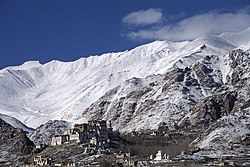
Stakna is a village in the Leh district of Ladakh, India. It is located in the Leh tehsil, on the banks of the Indus River. The Stakna Monastery is located here.
Kharnak is a village in the Leh district of Ladakh, India. It is located in the Nyoma tehsil.
Chiling Sumda is a village in the Leh district of Ladakh, India. It is located Nimmu–Padum–Darcha road (NPDR) or Zanskar Highway in the Likir tehsil, on the bank of the Zanskar River in Zanskar region. It serves as a base camp for the Chadar Trek in the winters and is used to raft the Zanskar river in the summers.

Giramangu, also known as Gaira Mangue or Mangyu, is a village in the Leh district of Ladakh, India. It is located in the Likir tehsil. The Mangyu temple complex is located near this village.

Lingshet is the headquarter of Singelalok block in the Leh district of Ladakh, India. It is located in the Khalsi tehsil, about a day's trek from the nearest road. The village can be accessed via a road through Singela from Lamayuru.

Lamayouro is a village in the Leh district of Ladakh, India. The Lamayuru Monastery is located nearby. It is located in the Khalsi tehsil. The region is also referred to as ‘Moon Land’, due to its terrain's resemblance to the surface of the Moon.
Bazgoo is a village in the Leh district of Ladakh, India. It is located in the Likir tehsil.
Taroo is a village in the Leh district of Ladakh, India. It is located in the Likir tehsil.

Temisgam is a village in the Leh district of Ladakh, India. It is located in the Khalsi tehsil. The Tingmosgang castle and monastery are located here.
Rumbak is a village in the Leh district of Ladakh, India. It is located in the Likir tehsil and lies within Hemis National Park.
Umla is a village in the Leh district of Ladakh, India. It is located in the Likir tehsil.
Saspochey is a village in the Leh district of Ladakh, India. It is located in the Likir tehsil. One of the early period temples with paintings that may be dated to late 12th century is located here. The paintings are in a very bad state of preservation, with only two walls and a small portion of the remaining two walls having surviving paintings.

Sakti is a village in the Leh district of Ladakh, India. It is located in the Leh tehsil. The Takthok Monastery is located here.
Sumoor is a village and tehsil in the Leh district of Ladakh, India.
Skiumarkha is a census village in the Leh district of Ladakh, India. It is located in the Likir tehsil.