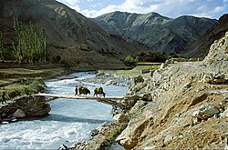
Likir is a village and headquarter of eponymous Subdivision in the Leh district of Ladakh, India. It is located in the Likir tehsil, in the Ladakh region. Khalatse is a nearby trekking place.

Alchi is a village in the Leh district of Ladakh, India. It is located in the Likir tehsil, on the banks of the Indus River 70 km downstream from the capital Leh. Unlike the other gompas in Ladakh, Alchi is situated on lowland, not on a hilltop.

Stok is a village in the Leh district of Ladakh, India. It is located in the Leh tehsil, in the Indus Valley 17 km southeast of the Leh town.

Upshi is a village and road junction on the Leh-Manali Highway in the union territory of Ladakh in India. It is located 47 km (29 mi) to the southeast of Leh along the Indus river valley and Tanglang La on the Leh-Manali highway. Gya is also to the south.

Nimo or Nyemo is a village and the headquarters of an eponymous community development block in the Leh district of Ladakh, India. It is located in the Leh tehsil, 35 km from Leh.

Diskit is a village and headquarter of the Nubra tehsil and the Nubra subdivision in the Leh district of Ladakh, India. The Diskit Monastery is located in this village.

Stakna is a village in the Leh district of Ladakh, India. It is located in the Leh tehsil, on the banks of the Indus River. The Stakna Monastery is located here.
Chiling Sumda is a village in the Leh district of Ladakh, India. It is located Nimmu–Padum–Darcha road (NPDR) or Zanskar Highway in the Likir tehsil, on the bank of the Zanskar River in Zanskar region. It serves as a base camp for the Chadar Trek in the winters and is used to raft the Zanskar river in the summers.
Partap Pore or Pratap Pur is a village in the Leh district of Ladakh, India. It is located in the Nubra tehsil near Hundar.
Chuchot Gongma is a village-group and the headquarter of Chuchot block in the Leh district of Ladakh, India. It is located in the Leh tehsil. This village Chuchot is divided into three villages: Yokma, Shamma and Chuchot Gongma. Chuchot village is the longest village of ladakh. It starts from Choglamsar and stretches up to Stakna by the bank of the Indus River, and this river is the source of water for irrigating fields.
Chuchot Shama is a village in the Leh district of Ladakh, India. It is located in the Leh tehsil. The village is located on the banks of river Indus (sindh).
Fotoksar or Photoksar is a village in the Leh district of Ladakh, India. It is located in the Khalsi tehsil.
Warisfistan is a village in the Leh district of Ladakh, India. It is located in the Nubra tehsil, on the bank of Siachin third glacier River. The Chogling Gompa is located nearby.
Changa is a village in the Leh district of Ladakh, India. It is located in the Kharu tehsil, on the bank of the Indus River.
Hundri is a village in the Leh district of Ladakh, India. It is located in the Nubra tehsil, beside the Shayok River. There is no bridge in village Hundri. Terchey and Udmaru are neighbours of Hundri. Fruits such as apricot, mulberry, apple, strawberry are grown there.

Gya or Gia is a village in the Leh district of Ladakh in India. It is located in the Kharu tehsil, off the Leh–Manali Highway, close to Tso Kar.
Udmaru is a village in the Leh district of Ladakh, India. It is located in the Nubra tehsil, on the banks of Shyok River.
Ney is a village in the Leh district of Ladakh, India. It is located in the Leh tehsil.
Miru or Meroo is a village in the Leh district of Ladakh, India. It is located in the Kharu tehsil. The Leh–Manali Highway passes through Miru.
Skitmang is a village in the Leh district of the Indian union territory of Ladakh. It is located in the Leh tehsil.


