
Nubra, also called Dumra, is a historical region of Ladakh, India that is currently administered as a subdivision and a tehsil in the Leh district. Its inhabited areas form a tri-armed valley cut by the Nubra and Shyok rivers. Its Tibetan name Dumra means "valley of flowers". Demands have been raised and BJP has hinted at creation of Nubra as a new district. Diskit, the headquarters of Nubra, is 120 km north of Leh, the capital of Ladakh.
Tegar, also known as Kyagar, is a high-altitude village in the Leh district of Ladakh, India. It is located in the Nubra tehsil, in the Nubra Valley.
Chalunka is a small mountainous village, in Nubra tehsil and Turtuk community development block, in Chorbat area of Shyok River valley in Ladakh, India. At the end of the Indo-Pakistani War of 1947, it was on the cease-fire line agreed between the India and Pakistan. After the Indo-Pakistani War of 1971, the village came under the jurisdiction of Indian-administered Jammu & Kashmir.

Diskit is a village and headquarter of the Nubra tehsil and the Nubra subdivision in the Leh district of Ladakh, India. The Diskit Monastery is located in this village.
Hundar Dok is a village in the Leh district of Ladakh, India. It is located in the Nubra tehsil.
Partap Pore or Pratap Pur is a village in the Leh district of Ladakh, India. It is located in the Nubra tehsil near Hundar.
Skanpuk is a village in the Leh district of Ladakh, India. It is located in the Nubra tehsil. It is on the way to Turtuk, Nubra.
Bogdang is a village in the Leh district of Ladakh, India. It is located in Nubra tehsil.
Khemakhungiu is a village in the Leh district of Ladakh, India. It is located in the Nubra tehsil.
Durbuk or Darbuk, is a village and the headquarters of the eponymous subdivision and block in the Leh district of Ladakh, India. It is located in the Durbuk tehsil, and falls between Chang La mountain pass and Tangste village on the way to Pangong Tso Lake.

Phyang is a village in Leh district of Ladakh in India. It is in the Leh tehsil. The Phyang Monastery is in this village. This is one of the largest inhabited villages of Ladakh, comprising eight clusters: Phulungs, Phyang, Tsakma, Changmachan, Gaon, Thangnak, Chusgo and Mankhang. It is in a south-facing valley in the Ladakh Range of mountains. The village is about 15 km (9.3 mi) long and 1.5 km (0.93 mi) average width. There is an old dilapidated castle near the cluster of Phyang on a hilltop. Just below this castle, there is a single-room temple, Lobon, with paintings of Ladakh, but in the tourism industry, it is known as Guru Lhakhang. The Tokpo river is in the middle of the valley. The source of the river is small glaciers in upper Spangkul and Lungnak valley northwest of the village at an altitude of about 5,200 m (17,100 ft). The river joins the Indus River near Phey village at a lower altitude of 3,250 m (10,660 ft). The village has some tourist facilities, including a guesthouse and campsites. Hidden North guesthouse is just opposite the site of Guru Lhakhang at Tsakma cluster.
Udmaru is a village in the Leh district of Ladakh, India. It is located in the Nubra tehsil, on the banks of Shyok River.
Terchey is a village in the Leh district of Ladakh, India. It is located in the Nubra tehsil.

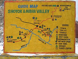
Khardong is a village in the Leh district of Ladakh, India. It is located in the Nubra tehsil, 31 km by road north of Khardung La.
Tangyar is a village in the Leh district of Ladakh, India. It is located in the Nubra tehsil.
Takshi, also known as Tyakshi or Taqsi, is a remote village in Nubra valley, located on the banks of the Shayok River in the Leh district of UT Ladakh, India. It lies in the historical Chorbat Valley of the Baltistan region, which was divided between India and Pakistan by the modified ceasefire line that was established in the 1972 Shimla Agreement. Tyakshi, along with Chalunka, Turtuk and Thang, became part of the Pakistani-administered Northern Areas following the Indo-Pakistani War of 1947–1948. All four of these villages were captured by Indian forces during the Indo-Pakistani War of 1971, after which they were incorporated into the erstwhile Indian-administered state of Jammu and Kashmir. Following the revocation of Article 370 by the Government of India in August 2019, Tyakshi formally fell under the jurisdiction of the Indian-administered union territory of Ladakh. After 1971 war four villages Pakistan controlled Kashmir were retained by India while many Indian villages in Chhamb sector were retained by Pakistan and line of control was defined.
Sumoor is a village and tehsil in the Leh district of Ladakh, India.
Kubed is a village in the Leh district of Ladakh, India. It is located in the Nubra tehsil.
Panamic or Panamik is a village in the Leh district of Ladakh in India. It is located in the Nubra tehsil. Hot sulphur springs are found in the village. Panamik is a contraction of སྤང་ན་ཆུ་མིག་ 'Spang na Chumik', meaning 'the spring in the meadows'.


