The geographical region of Ladakh union territory is the highest altitude plateau region in India, incorporating parts of the Himalayan and Karakoram mountain ranges and the upper Indus River and valley.

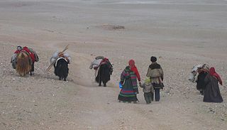
The Changtang is a part of the high altitude Tibetan Plateau in western and northern Tibet extending into the southern edges of Xinjiang as well as southeastern Ladakh, India, with vast highlands and giant lakes. From eastern Ladakh, the Changtang stretches approximately 1,600 kilometres (990 mi) east into Tibet as far as modern Qinghai. The Changtang is home to the Changpa, a nomadic Tibetan people. The two largest settlements within the Tibetan Changtang are Rutog Town the seat of Rutog County and Domar Township the seat of Shuanghu County.

Tourism is one of an economic contributor to the union territory of Ladakh in Northern India. The union territory is sandwiched between the Karakoram mountain range to the north and the Himalayas to the south and is situated at the height of 11,400 ft. Ladakh is composed of the Leh and Kargil districts. The region contains prominent Buddhist sites and has an ecotourism industry.

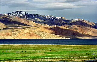
Tso Moriri or Lake Moriri or "Mountain Lake", is a lake in the Changthang Plateau of Ladakh in India. The lake and surrounding area are protected as the Tso Moriri Wetland Conservation Reserve.

Tegar, also known as Kyagar, is a high-altitude village in the Leh district of Ladakh, India. It is located in the Nubra tehsil, in the Nubra Valley.
Rupshu is a high altitude plateau and valley and an eponymous community development block in southeast Ladakh.

Upshi is a village and road junction on the Leh-Manali Highway in the union territory of Ladakh in India. It is located 47 km (29 mi) to the southeast of Leh along the Indus river valley and Tanglang La on the Leh-Manali highway. Gya is also to the south.

Nimo or Nyemo is a village and the headquarters of an eponymous community development block in the Leh district of Ladakh, India. It is located in the Leh tehsil, 35 km from Leh.

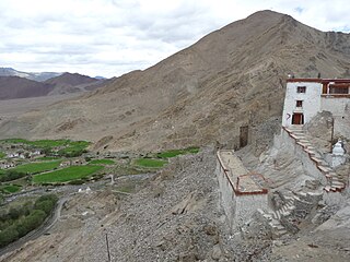
Korzok, is a Tibetan Buddhist monastery belonging to the Drukpa Lineage. It is located in the Korzok village, on the northwestern bank of Tso Moriri (lake) in Leh District, Ladakh, India. The gompa (monastery), at 4,560 metres (14,960 ft), houses a Shakyamuni Buddha and other statues. It is home to about 70 monks.

Nyoma is a principal village of southern Ladakh in India, the headquarters of an eponymous subdivision, tehsil and community development block in the Leh district. It is located on the bank of Indus River, after its 90-degree bend near Dungti and before the valley narrows to a gorge near Mahe. A Buddhist monastery ("gompa") is located on the hill at the back of the village.

The Tso Kar or Tsho kar is a fluctuating salt lake known for its size and depth situated in the Rupshu Plateau and valley in the southern part of Ladakh in India. It is also recognised as India's 42nd Ramsar site.

Chumathang is a village in Leh District, Ladakh in northern India on the banks of the Indus river.

Kargyam is a village in Leh district of the Indian union territory of Ladakh. It is located in the Durbuk tehsil (subdistrict), in the Long Parma valley between Tangtse and Chushul. Kargyam is famous for its wetlands and Blackneck crane and nomadic lifestyle.
Man Pangong is a village in the Leh district of the Indian union territory of Ladakh. It is located in the Durbuk tehsil, near the Pangong Tso lake.
Durbuk or Darbuk, is a village and the headquarters of the eponymous subdivision and block in the Leh district of Ladakh, India. It is located in the Durbuk tehsil, and falls between Chang La mountain pass and Tangste village on the way to Pangong Tso Lake.

Gia or Gya is a village in the Leh district of Ladakh in India. It is located in the Kharu tehsil, off the Leh–Manali Highway, close to Tso Kar.
Teri is a village in the Leh district of Ladakh, India. It is located in the Nyoma tehsil.
Skitmang is a village in the Leh district of the Indian union territory of Ladakh. It is located in the Leh tehsil.
Shara is a village in the Leh district of Ladakh, India. It is located in the Kharu tehsil.
Kyagar Tso or Kyagar Lake is a small brackish lake surrounded by mountains situated in the Ladakh region of the northern Indian Union Territory of Ladakh in India. From afar, it can be spotted by its turquoise colour.


