Zanskar River

Last updated
Zanskar River
Indus River - 2018.jpg
Zanskar River
Indus river.svg
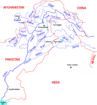
Map of the Indus River System - the Zanskar is a tributary of the Indus
India relief location map.jpg
Red pog.svg
Location of mouth
Location
Country India
State Ladakh
Physical characteristics
Mouth  
  coordinates
33°46′19″N76°50′43″E / 33.7719174°N 76.8453493°E / 33.7719174; 76.8453493
Basin features
River system Indus River
The confluence of the Zanskar River (from top) and the Indus (bottom flowing from left to right) is 3 km southeast of Nimmu village in Ladakh. Indus Zanskar confluence.jpg
The confluence of the Zanskar River (from top) and the Indus (bottom flowing from left to right) is 3 km southeast of Nimmu village in Ladakh.

The Zanskar River is the first major tributary of the Indus River, equal or greater in volume than the main river, [1] which flows entirely within Ladakh, India. It originates northeast of the Great Himalayan range and drains both the Himalayas and the Zanskar Range within the region of Zanskar. It flows northeast to join the Indus River near Nimo.

Contents

Etymology

Zanskar (Zangs-kar) means "white copper" or brass. [2]

Course

In its upper reaches, the Zanskar has two main branches. First of these, the Doda, has its source near the Pensi-la 4,400 m (14,400 ft) mountain-pass and flows south-eastwards along the main Zanskar valley leading towards Padum, the capital of Zanskar. The second branch is formed by two main tributaries known as Kargyag river, with its source near the Shingo La 5,091 m (16,703 ft), and Tsarap river, with its source near the Baralacha-La. These two rivers unite below the village of Purne to form the Lungnak river (also known as the Lingti or Tsarap). The Lungnak river then flows north-westwards along a narrow gorge towards Zanskar's central valley (known locally as gzhung khor), where it unites with the Doda river to form the main Zanskar river. This river then takes a north-eastern course through the dramatic Zanskar Gorge until it joins the Indus near "Nimmu" in Ladakh. [3]

Tourism

Area has homestays, Buddhist monastery and valley tourism.

Lower (northern) sections of that gorge are popular in summer with tourists making rafting trips, typically from Chiling to Nimmu. In winter when the road to Zanskar is closed by snow on the high passes, the only overland route to Padum is by walking along the frozen river, a multi-day hike that is now sold as an adventure activity called the Chadar Trek ('ice sheet'). [4] This trek will eventually be rendered obsolete once the road from Chiling to Padum is completed. [5]

See also

Related Research Articles

<span class="mw-page-title-main">Zanskar</span> Tehsil of Kargil district, Ladakh, India

Zanskar, Zahar (locally) or Zangskar, is a tehsil of Kargil district, in the Indian union territory of Ladakh. The administrative centre is Padum. Zanskar, together with the neighboring region of Ladakh, was briefly a part of the kingdom of Guge in Western Tibet. Zanskar lies 250 km south of Kargil town on NH301.

<span class="mw-page-title-main">Kargil district</span> District of Indian-administered Ladakh, Kashmir region

Kargil district is a district in Indian-administered Ladakh in the disputed Kashmir-region. It is one of the two districts comprising the Indian-administered union territory of Ladakh. The district headquarters are in the city of Kargil. The district is bounded by the Indian-administered union territory of Jammu and Kashmir to the west, the Pakistani-administered administrative territory of Gilgit–Baltistan to the north, Ladakh's Leh district to the east, and the Indian state of Himachal Pradesh to the south. Encompassing three historical regions known as Purig, Dras and Zanskar, the district lies to the northeast of the Great Himalayas and encompasses the majority of the Zanskar Range. Its population inhabits the river valleys of the Dras, Suru, Wakha Rong, and Zanskar.

<span class="mw-page-title-main">Nubra</span> Region in Ladakh, India

Nubra, also called Dumra, is a historical region of Ladakh, India that is currently administered as a subdivision and a tehsil in the Leh district. Its inhabited areas form a tri-armed valley cut by the Nubra and Shyok rivers. Its Tibetan name Dumra means "valley of flowers". Demands have been raised and BJP has hinted at creation of Nubra as a new district. Diskit, the headquarters of Nubra, is 120 km north of Leh, the capital of Ladakh.

Chadar may refer to:

<span class="mw-page-title-main">Padum</span> Town in Ladakh, India

Padum is the main town and the administrative centre of the Zanskar tehsil in Kargil district, Ladakh, India. Name after the Buddhist guru Padmasambhava, it was historically one of the two main capitals of the Zanskar Kingdom, the other being Zangla. It is 235 km (146 mi) via the link road from Kargil city. The new Nimmu–Padum–Darcha road connects Padum directly to Leh in the east and to Darcha in Himachal Pradesh.

<span class="mw-page-title-main">Geography of Ladakh</span> Aspect of geography

Ladakh is an administrative territory of India that has been under its control since 1947. The geographical region of Ladakh union territory is the highest altitude plateau region in India, incorporating parts of the Himalayan and Karakoram mountain ranges and the upper Indus River and valley.

<span class="mw-page-title-main">Shingo La</span> Mountain pass in India

Shingo La is a mountain pass in India, on the state boundary between Ladakh and Himachal Pradesh. It connects the Lahaul region of Himachal Pradesh with the Zanskar region of Ladakh. A strategic road is being built on the pass to ensure an all-weather route to Ladakh, as an alternative to the Leh–Manali Highway.

<span class="mw-page-title-main">Pensi La</span>

Pensi-la is a mountain pass in the Ladakh union territory of India, which is known as the Gateway to Zanskar. Pensi La is 4,400 metres (14,400 ft) above sea level and connects the Suru Valley region to the Zanskar Valley region. The summit at this end of the Suru Valley, the only peak which can be seen, is 7,012 metres (23,005 ft) high, while the mountain to the north is 6,873 metres (22,549 ft). The pass is about 25 km from Rangdum Monastery.

<span class="mw-page-title-main">Tourism in Ladakh</span>

Tourism is one of an economic contributor to the union territory of Ladakh in Northern India. The union territory is sandwiched between the Karakoram mountain range to the north and the Himalayas to the south and is situated at the height of 11,400 ft. Ladakh is composed of the Leh and Kargil districts. The region contains prominent Buddhist sites and has an ecotourism industry.

<span class="mw-page-title-main">Zorawar Singh (Dogra general)</span> Dogra general of the Sikh Empire (1784–1841)

Zorawar Singh was a military general of the Dogra Rajput ruler, Gulab Singh of Jammu. He served as the governor (wazir-e-wazarat) of Kishtwar and extended the territories of the kingdom by conquering Ladakh and Baltistan. He also boldly attempted the conquest of Western Tibet but was killed in battle of To-yo during the Dogra-Tibetan war. In reference to his legacy of conquests in the Himalaya Mountains including Ladakh, Tibet, Baltistan and Skardu as General and Wazir, Zorowar Singh has been referred to as the "Napoleon of India", and "Conqueror of Ladakh".

<span class="mw-page-title-main">Indian Himalayan Region</span> Region in northern India

The Indian Himalayan Region is the section of the Himalayas within the Republic of India, spanning thirteen Indian states and union territories, namely Ladakh, Jammu and Kashmir, Himachal Pradesh, Uttarakhand, Sikkim, West Bengal, Manipur, Meghalaya, Mizoram, Nagaland, Tripura, Assam, and Arunachal Pradesh. The region is responsible for providing water to a large part of the Indian subcontinent and contains various flora and fauna.

<span class="mw-page-title-main">Phugtal Monastery</span>

Phuktal Monastery or Phuktal Gompa is a Buddhist monastery located in the remote Lungnak Valley in south-eastern Zanskar, in the Himalayan region of Ladakh, in Northern India. It is 52 km southeast of Padum on Nimmu–Padum–Darcha road (NPDR). Solar power was installed at the Phugtal monastery in 2016.

<span class="mw-page-title-main">Doda River</span> River in India

The Doda River or the Stod River is a river 79 kilometres (49 mi) long, which forms the Stod Valley in the Zanskar valley of the Leh district in the Union Territory of Ladakh.

<span class="mw-page-title-main">Kursha Monastery</span> Tibetan Buddhist monastery at Pensi-la, Ladakh, India

Karsha Monastery or Karsha Gompa is a Buddhist monastery in the Padum Valley of the Zanskar region of the union territory of Ladakh in northern India. The Doda River flows past the monastery from its source at the Drang Drung Glacier of the Pensi La. It was founded by the translator Phagspa Shesrab. The monastery, also known by the name Karsha Chamspaling, was founded by Phagspa Shesrab, under the Gelugpa Order or Yellow Hats. It is 11 km north of Padum in Zanskar River valley.

<span class="mw-page-title-main">Tsarap River</span> Indian river

The Tsarap River or the Tsarap Chu forms the eastern part of the Zanskar valley, in the Ladakh union territory of India. The 182 km (113 mi) long river is used for irrigation in riparian villages, and for adventure sports by tourists.

Zangskari is an endangered Tibetic language. It is mostly spoken in the Zanskar region of the Kargil district of Ladakh, India and also by Buddhists in the upper reaches of Lahaul, Himachal Pradesh, and Paddar, Jammu and Kashmir. It is written using the Tibetan script.

<span class="mw-page-title-main">Chadar trek</span> Winter trail in Ladakh in India

Chiling Sumda is a village in the Leh district of Ladakh, India. It is located Nimmu–Padum–Darcha road (NPDR) or Zanskar Highway in the Likir tehsil, on the bank of the Zanskar River in Zanskar region. It serves as a base camp for the Chadar Trek in the winters and is used to raft the Zanskar river in the summers.

Durbuk or Darbuk, is a village and the headquarters of the eponymous subdivision and block in the Leh district of Ladakh, India. It is located in the Durbuk tehsil, and falls between Chang La mountain pass and Tangste village on the way to Pangong Tso Lake.

<span class="mw-page-title-main">Nimmu–Padum–Darcha road</span> Road in India

Nimmu–Padum–Darcha road (NPDR) or Zanskar Highway is a road under construction between the Indian union territory of Ladakh and the state of Himachal Pradesh, passing through the region of Zanskar. It connects Nimmu in the Indus Valley to Padum, the capital of Zanskar, to Darcha village in Lahul and Spiti. It provides an alternative to the Leh–Manali Highway in linking Ladakh with the rest of India. It is being built by the Border Roads Organisation (BRO) of the Indian army. Construction of road is expected to be completed by late 2023. The already completed Atal tunnel and the proposed Shingo La Tunnel which is expected to be completed by 2025 will provide all weather connectivity.

References

  1. Cunningham, Ladak (1854), p. 88.
  2. Cunningham, Ladak (1854), p. 22.
  3. Phartiyal, Binita; Singh, Randheer; Nag, Debarati (2017), "Trans- and Tethyan Himalayan Rivers: In Reference to Ladakh and Lahaul-Spiti, NW Himalaya", in Dhruv Sen Singh (ed.), The Indian Rivers: Scientific and Socio-economic Aspects, Springer, p. 375, ISBN   978-981-10-2984-4
  4. Sumitran, Neha (1 April 2014). "On the Mighty Chadar, Everything Freezes but Tears". National Geographic Traveller India. Retrieved 2 February 2020.
  5. Trekking in the Indian Himalaya by Garry Weare, Lonely Planet guide, page 71

Bibliography