Jhelum River

Last updated

Jhelum
Hydaspes, [1] Bidaspes, [2] Vitastā, [3] Bihat, Vehat, Bihatab, Biyatta, Jailam, [4] Vyath [5]
Jhelum River-Pakistan.jpg
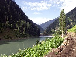
Jhelum River photographed in Pakistan, c.2006
Jhelum River
Interactive Map
Location
Countries India, Pakistan
Physical characteristics
Source 
  location Verinag Spring
  coordinates 33°32′05″N75°14′59″E / 33.53472°N 75.24972°E / 33.53472; 75.24972
Mouth  
  location
Chenab River at Trimmu, Jhang District
  coordinates
31°10′N72°09′E / 31.17°N 72.15°E / 31.17; 72.15
Length725 km (450 mi)
Discharge 
  average1,026.6 m3/s (36,250 cu ft/s) (near Mangla Dam)
  minimum234.19 m3/s (8,270 cu ft/s) (near Mangla Dam)
  maximum26,419.13 m3/s (932,983 cu ft/s) (near Mangla Dam)
Discharge 
  average313.19 m3/s (11,060 cu ft/s) (near Domel)
Discharge 
  average229.20 m3/s (8,094 cu ft/s) (near Baramulla)
Basin features
River system Indus River
Tributaries 
  left Poonch River, Sukhnag River
  right Arpath River, Lidder River, Kishanganga River/Neelum River, Sind River, Kunhar River, Pohru River, Erin River

The Jhelum River [a] is a major river in South Asia, flowing through India and Pakistan, and is the westernmost of the five major rivers of the Punjab region. It originates at Verinag and flows through the Indian-administered territory of Jammu and Kashmir, into Pakistan-administered Azad Kashmir, then the Pakistani province of Punjab. It is a tributary of the Chenab River and has a total length of about 725 kilometres (450 mi). [6]

Contents

Etymology

Verinag Spring is a major source of Jhelum River Vitasta at Verinag.jpg
Verinag Spring is a major source of Jhelum River

A Pakistani author, Anjum Sultan Shahbaz, recorded some stories of the name Jhelum in his book Tareekh-e-Jhelum:

'Many writers have different opinions about the name of Jhelum. One suggestion is that in ancient days Jhelumabad was known as Jalham. The word Jhelum is reportedly derived from the words Jal (pure water) and Ham (snow). The name thus refers to the waters of a river (flowing beside the city) which have their origins in the snow-capped Himalayas. [7]

The Sanskrit name for the river is Vitástā, derived from an apocryphal[ citation needed ] legend regarding the origin of the river in the Nilamata Purana. The name survives in the Kashmiri name for this river, Vyath and in Punjabi (and more commonly in Saraiki [8] ) as Vehat. [9] It was called the Hydaspes by the armies of Alexander the Great. [10]

History

A passenger traversing the river precariously seated in a small suspended cradle Circa 1900 Picjhelum.jpg
A passenger traversing the river precariously seated in a small suspended cradle Circa 1900

The river Jhelum was originally recognized by the name Vitasta. The river was called Hydaspes (Greek : Ὑδάσπης) by the ancient Greeks.

Alexander III of Macedon and his army crossed the Jhelum in BCE 326 at the Battle of the Hydaspes River, where he defeated an Indian king, Porus. According to Arrian ( Anabasis , 29), he built a city "on the spot whence he started to cross the river Hydaspes", which he named Bukephala (or Bucephala) to honour his famous horse Bucephalus, buried in present-day Jalalpur Sharif. It is thought that ancient Bukephala was near the site of modern Jhelum.[ citation needed ] According to Gujrat district historian Mansoor Behzad Butt, Bukephalus was buried in Jalalpur Sharif, but the people of Mandi Bahauddin, a district close to Jehlum, believed that their tehsil Phalia was named after Alexander's dead horse, saying that the name Phalia was a distortion of Bucephala.

The waters of the Jhelum are allocated to Pakistan under the terms of the Indus Waters Treaty. India is working on a hydropower project on a tributary of Jhelum river to establish first-use rights on the river water over Pakistan as per the Indus Waters Treaty. [11]

Legends

The creation of the Jhelum river according to Hindu theology Art captioned "Hindoo (Hindu) picture emblematic of the creation of the river Jhelum or Vetasta", ca.1882.webp
The creation of the Jhelum river according to Hindu theology

According to Hindu puranas, the goddess Parvati was requested by the sage Kashyapa to come to Kashmir to purify the land from the evil practices and impurities of the pishachas living there. Parvati assumed the form of a river in the netherworld. Her consort Shiva struck with his spear near the abode of Nila, (Verinag spring). With this stroke of the spear, Parvati emerged from the netherworld. He excavated a ditch measuring one vitasti using the spear, [12] through which the river, originating from the netherworld, came out, and so he gave her the name Vitástā. [13]

The ancient Greeks also regarded the river as a god, as they did most mountains and streams. The poet Nonnus in the Dionysiaca [14] calls the Hydaspes a titan-descended god, the son of the sea-god Thaumas and the cloud-goddess Elektra, the brother of Iris, goddess of the rainbow, and half-brother to the harpies, the snatching winds. Since the river is in a foreign country, it is not clear whether they named the river after the god, or whether the god Hydaspes was named after the river.

Course

The river Jhelum rises from Verinag spring at the foot of the Pir Panjal in the southeastern Kashmir Valley administered by India. It is joined by its tributaries

It flows through Srinagar and Wular Lake before entering Pakistan-administered Kashmir through a deep narrow gorge. The Kishanganga River/Neelum River, the largest tributary of the Jhelum, joins it at Domel, Muzaffarabad, as does the next largest, the Kunhar River of Kaghan Valley. It is then joined by the Poonch River, and flows into the Mangla Dam reservoir in the Mirpur District. The Jhelum enters Pakistani Punjab in the Jhelum District. From there, it flows through the plains of Pakistan's Punjab, forming the boundary between the Jech and Sindh Sagar Doabs. It ends in a confluence with the Chenab River at Trimmu in the Jhang District. The Chenab merges with the Sutlej to form the Panjnad River, which joins the Indus River at Mithankot.

Most of the villages and important cities of Kashmir valley are situated on the banks of Jhelum. [15]

Lakes

Dams, barrages and bridges

The river has rich power generation potential in India. Water control structures are being built as a result of the Indus Basin Project, including the following:

Canals

See also

Notes

    1. Kashmiri pronunciation: [ʋʲatʰdərʲjaːʋ] ; Punjabi pronunciation: [d͡ʒéˈlɐm/véːt̪ᵊnəˈd̪iː] ; Saraiki pronunciation: [veˈɦət̪dəɾˌjɑː] ; Hindustani pronunciation: [dəɾˌjɑː.ed͡ʒeɦˈləm]

    Related Research Articles

    <span class="mw-page-title-main">Ravi River</span> River in India and Pakistan

    The Ravi River is a transboundary river in South Asia, flowing through northwestern India and eastern Pakistan, and is one of five major rivers of the Punjab region.

    <span class="mw-page-title-main">Chenab River</span> River in India and Pakistan

    The Chenab River is a major river in South Asia, flowing through India and Pakistan, and is one of the 5 major rivers of the Punjab region. It is formed by the union of two headwaters, Chandra and Bhaga, which rise in the upper Himalayas in the Lahaul region of Himachal Pradesh, India. The Chenab flows through the Jammu region of Indian-administered Jammu and Kashmir, into the plains of Punjab, Pakistan, before ultimately flowing into the Indus River.

    <span class="mw-page-title-main">Mangla Dam</span> Multipurpose dam in Azad Kashmir, Pakistan

    The Mangla Dam is a multipurpose dam situated on the Jhelum River, lying in the Mirpur District of Azad Kashmir and the Jhelum District in Punjab, Pakistan. It is the sixth-largest dam in the world. The village of Mangla, which sits at the mouth of the dam, serves as its namesake. In November 1961, the project's selected contractors were revealed; it was announced that Binnie & Partners, a British engineering firm, was going to serve as the lead designers, engineers, and inspectors for the construction of the dam. The project was undertaken by a consortium known as the Mangla Dam Contractors, which consisted of eight American construction firms sponsored by the Guy F. Atkinson Company based in South San Francisco, California.

    <span class="mw-page-title-main">Wular Lake</span> Fresh water lake in Jammu and Kashmir, India

    Wular Lake, also known as Wolar in Kashmiri, is one of the largest fresh water lakes in South Asia. It is located near Bandipora town in the Bandipora district of Jammu and Kashmir, India. The lake basin was formed as a result of tectonic activity and is fed by the Jhelum River and stream Madhumati and Arin.

    <span class="mw-page-title-main">Pir Panjal Range</span> Mountain range of the Lower Himalayas

    The Pir Panjal Range is a range of mountains in the Lower Himalayan region located in the Western Himalayas of northern Indian subcontinent. It runs southeast to northwest between the Beas and Neelam/Kishanganga rivers, in the Indian state of Himachal Pradesh and Indian-administered union territory of Jammu and Kashmir, with its northwestern end extending into territory administered by Pakistan. The Himalayas show a gradual elevation towards the Dhauladhar and Pir Panjal ranges. Pir Panjal is the largest and westernmost range of the Lesser Himalayas. Near the bank of the Sutlej River, it dissociates itself from the main Himalayan range and forms a divide between the Beas and Ravi rivers on one side and the Chenab on the other. Further west, the Pir Panjal range forms the southwestern boundary of the Kashmir Valley, separating it from the hills of Jammu region, forming a divide between the Jhelum and Chenab rivers.

    <span class="mw-page-title-main">Indus Waters Treaty</span> Water-distribution treaty between India and Pakistan

    The Indus Water Treaty (IWT) is a water-distribution treaty between India and Pakistan, arranged and negotiated by the World Bank, to use the water available in the Indus River and its tributaries. It was signed in Karachi on 19 September 1960 by then Indian Prime Minister Jawaharlal Nehru and then Pakistani president Field Marshal Ayub Khan.

    <span class="mw-page-title-main">Neelum River</span> River in India and Pakistan

    The Neelum River, or Kishanganga River, is a river in the Kashmir region in the Indian subcontinent. It originates in Ganderbal district of Indian-administered Kashmir, flows through the Neelam Valley into Pakistani-administered Kashmir, where parts of its course fall along the Line of Control, before merging with the Jhelum River near the city of Muzaffarabad.

    <span class="mw-page-title-main">Baglihar Dam</span> Dam in Jammu and Kashmir, India

    Baglihar Dam, also known as Baglihar Hydroelectric Power Project, is a run-of-the-river power project on the Chenab River in the Ramban district of Jammu and Kashmir, India. The first power project executed by the Jammu and Kashmir Power Development Corporation, it was conceived in 1992 and approved in 1996, with construction begun in 1999. The project was estimated to cost US$1 billion. The project consists of two-stage of 450MW each. The first stage of the project was completed in 2008-09 and was dedicated to the nation by the Prime Minister Manmohan Singh of India. The second stage of the project was completed in 2015–16, and was subsequently dedicated to the nation by the Prime Minister Narendra Modi.

    <span class="mw-page-title-main">Salal Dam</span> Dam in Jammu and Kashmir

    Salal Dam, also known as Salal Hydroelectric Power Station, is a run-of-the-river hydropower project on the Chenab River in the Reasi district of the Jammu and Kashmir. It was the first hydropower project built by India in Jammu and Kashmir under the Indus Water Treaty regime. After having reached a bilateral agreement with Pakistan in 1978, with significant concessions made to Pakistan in the design of the dam, reducing its height, eliminating operating pool, and plugging the under-sluices meant for sediment management, India completed the project in 1987. The concessions made in the interest of bilateralism damaged the long-term sustainability of the dam, which silted up in five years. It currently runs at 57% capacity factor. Its long-term future is uncertain.

    <span class="mw-page-title-main">Marala Headworks</span> Barrage in Punjab, Pakistan

    Marala Headworks is a headworks situated on the Chenab River near the city of Sialkot in Gujrat district in Punjab, Pakistan. A weir was first built during 1906–1912 in the British India to feed the Upper Chenab Canal, as part of the 'Triple Canals Project'. A new Marala Barrage was constructed in 1968 to feed the Marala–Ravi Link Canal in addition to the original Upper Chenab Canal.

    Dul Hasti is a 390 MW hydroelectric power plant in Kishtwar district of Jammu and Kashmir, India built by NHPC. The power plant is a run-of-the-river type on the Chenab River, in a rugged, mountainous section of the Himalayas, and several hundred kilometers from larger cities in the Jammu Division. It consists of a 70 m (230 ft) tall gravity dam which diverts water through a 9.5 km (5.9 mi) long headrace tunnel to the power station which discharges back into the Chenab. The project provides peaking power to the Northern Grid with beneficiary states being Jammu and Kashmir, Punjab, Haryana, Uttar Pradesh, Uttarakhand, Rajasthan, Delhi and Union Territory of Chandigarh. It was constructed between 1985 and 2007.

    Uri Dam is a 480 MW hydroelectric power station on the Jhelum River near Uri in Baramula district of the Jammu and Kashmir, India. It is located very near to the Line of Control, the de facto border between India and Pakistan. The station is largely built under a hill with a 10 km tunnel. It is of the run-of-the-river type without a large dam, since the Indus Waters Treaty gives Pakistan the exclusive right to regulate the Jhelum River. On 4 July 2014 a 240 MW Uri-II power project which is a new project located just downstream of Uri I, was inaugurated.

    Rasul Barrage is a barrage on the River Jehlum between Jhelum District and Mandi Bahauddin District of the Punjab province of Pakistan. It is situated 72 km downstream of Mangla Dam.

    <span class="mw-page-title-main">Topography of Pakistan</span>

    The topography of Pakistan is divided into seven geographic areas: the northern highlands, the Indus River plain, the desert areas, the Pothohar Plateau, Balochistan Plateau, Salt Range, and the Sistan Basin. All the rivers of Pakistan, i.e. Sindh, Ravi River, Chenab River, Jhelum River, and Sutlej River, originate from the Himalayas mountain range. Some geographers designate Plateau as to the west of the imaginary southwest line; and the Indus Plain lies to the east of that line.

    The Kishanganga Hydroelectric Project is a run-of-the-river hydroelectric scheme in Jammu and Kashmir, India. Its dam diverts water from the Kishanganga River to a power plant in the Jhelum River basin. It is located near Dharmahama Village, 5 km (3 mi) north of Bandipore in the Kashmir valley and has an installed capacity of 330 MW.

    <span class="mw-page-title-main">Upper Jhelum Canal</span>

    The Upper Jhelum Canal is an irrigation canal in Pakistan that provides water to 1.8 million acres of farmland.

    The Ratle Hydroelectric Plant is a run-of-the-river hydroelectric power station, with permitted pondage under the Indus Water Treaty, currently under construction on the Chenab River, downstream of the village near Drabshalla in Kishtwar district of the Indian Union Territory of Jammu and Kashmir. The project includes a 133 m (436 ft) tall gravity dam and two power stations adjacent to one another. Water from the dam will be diverted through four intake tunnels about 400 m (0.25 mi) southwest to the power stations. The main power station will contain four 205 MW Francis turbines and the auxiliary power station will contain one 30 MW Francis turbine. The installed capacity of both power stations will be 850 MW. On 25 June 2013, Prime Minister Manmohan Singh laid the foundation stone for the dam. Pakistan has frequently alleged that it violates the Indus Waters Treaty.

    <span class="mw-page-title-main">Western Himalayas</span> Western section of the Himalayas

    The Western Himalayas are the western half of the Himalayas, in northwestern India and northern Pakistan. Four of the five tributaries of the Indus River in Punjab rise in the Western Himalayas; while the fifth, the Sutlej cuts through the range after rising in Tibet.

    <span class="mw-page-title-main">Punjab Irrigation Department</span> Pakistani provincial ministry department

    The Punjab Irrigation Department is a provincial government department responsible for irrigation in the Punjab province of Pakistan. It irrigates 21 million acres (8,500,000 ha) of the agricultural land in the province.

    <span class="mw-page-title-main">Indus Basin</span> Part of Asia

    The Indus Basin is the part of Asia drained by the Indus River and its tributaries. The basin covers an area of 1,120,000 km2 (430,000 sq mi) traversing four countries: Afghanistan, China, India, and Pakistan, with most of the area lying predominantly in the latter two countries.

    References

    1. The Quarterly Review. Murray. 1816. p. 170. Archived from the original on 16 July 2023. Retrieved 17 March 2017.
    2. Bakshi, S. R. (1997). Kashmir Through Ages. Sarup & Sons. p. 110. ISBN   9788185431710. Archived from the original on 16 July 2023. Retrieved 17 March 2017. Five volumes.
    3. Rapson, E. J. (9 June 2011). Ancient India: From the Earliest Times to the First Century AD. Cambridge University Press. p. 171. ISBN   9780521229371. Archived from the original on 16 July 2023. Retrieved 1 November 2020.
    4. Naqvi, Saiyid Ali (November 2012). Indus Waters and Social Change: The Evolution and Transition of Agrarian Society in Pakistan. Oxford University Press Pakistan. p. 10. ISBN   9780199063963. Archived from the original on 16 July 2023. Retrieved 17 March 2017.
    5. Know Your State: Jammu and Kashmir. Arihant Publications (India) Ltd. November 2012. p. 35. ISBN   9789313169161. Archived from the original on 7 April 2022. Retrieved 6 November 2021.
    6. "Jhelum River". Encyclopædia Britannica . Archived 1 May 2015 at the Wayback Machine . Retrieved on 4 October 2013.
    7. Shahbaz, Anjum Sultan (2003). Tārīkh-i Jihlam (in Urdu). Main Bazar, Jhelum: Buk Kārnar [Book Corner]. OCLC   60589679.
    8. "Punjab Portal" . Retrieved 12 June 2024. or Vehat, the latter name being more common towards the south of the district.
    9. Soofi, Mushtaq (20 November 2015). "Punjab Notes: Vehat: where great warriors clashed". DAWN.COM. Retrieved 12 June 2024.
    10. Locke, Ralph P. (2016). "Alexander the Great and the Indian Rajah Puru. Exoticism in a Metastasio Libretto As Set by Hasse and by Handel". Revue de Musicologie. 102 (2): 275–317. ISSN   0035-1601. JSTOR   44739484. The elephants of Puru's army were overwhelmed by the Greeks' horses in 326 BC on the left bank of the Hydaspes, a river - also known as the Jhelum or Jhelam - that is located in what is today Pakistan
    11. "India fast-tracks work on Jhelum river hydroelectric power project". Archived from the original on 3 June 2010. Retrieved 25 May 2010.
    12. (a particular measure of length defined either as a long span between the extended thumb and little finger, or as the distance between the wrist and the tip of the fingers, and said to be about 9 inches
    13. Nilamata Purana English Translation by Dr. Ved Kumari Ghai, verses 247–261.
    14. section 26, line 350
    15. "District Survey Report On Kashmir" (PDF). District Survey Report. Archived (PDF) from the original on 14 February 2022. Retrieved 13 February 2022.
    16. "NHPC Limited : Projects : Power Stations : Uri – I". www.nhpcindia.com. Archived from the original on 5 April 2022. Retrieved 14 February 2021.
    17. "NHPC Limited : Projects : Power Stations : Uri-II". www.nhpcindia.com. Archived from the original on 30 October 2019. Retrieved 14 February 2021.
    18. "NHPC Limited : Projects : Power Stations : Kishanganga". www.nhpcindia.com. Retrieved 14 February 2021.