
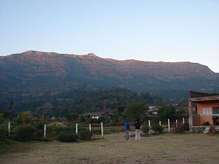
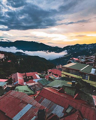
Pachmarhi is a hill station in the Hoshangabad district of Madhya Pradesh state of central India. It has been the location of a cantonment since the British Raj. The municipality is located in a valley of the Satpura Range and is widely known as Satpura ki Rani.
Kalsubai is a mountain in the Western Ghats, located in the Indian state of Maharashtra. Kalsubai is the highest peak in Maharashtra and is located in Ahmednagar district in Akole Taluka. Its summit, situated at an elevation of 1,646 metres (5,400 ft), is the highest point in Maharashtra and hence it is known as the "Everest of Maharashtra".

The Kinnaur Kailasha is a mountain in the Kinnaur district of the Indian state of Himachal Pradesh. As per Hindu mythology, Lord Shiva and goddess Parvati reside in Kinner Kailash. It is the fourth most important peak among the group of five separate peaks in Himalayas in separate locations collectively known as the Panch Kailash or "Five Kailashas", other being Mount Kailash in first place, Adi Kailash in second, Shikhar Kailash in third, and Manimahesh Kailash in fifth place in terms of importance. As a result, it is deeply revered by Hindus. Kinnaur Kailash peak has a height of 6050 meters and is considered sacred by both Hindu and Buddhist Kinnauris. This mountain is sometimes confused with the Mount Kailash in Tibet.
Pauri Garhwal is a district in the Indian state of Uttarakhand. Its headquarters is in the town of Pauri. It is sometimes referred to simply as Garhwal district, though it should not be confused with the larger Garhwal region of which it is only a part of.
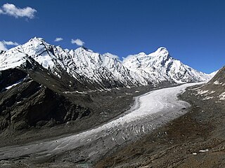
The Drang-Drung Glacier is a mountain glacier near the Pensi La pass on the Kargil-Zanskar Road in the Kargil district of Ladakh in India.

Rudraprayag is a city and a municipality in Rudraprayag district in the Indian state of Uttarakhand. Rudraprayag is one of the Panch Prayag of Alaknanda River, the point of confluence of rivers Alaknanda and Mandakini. Kedarnath, a Hindu holy city is located 86 km from Rudraprayag. The man-eating Leopard of Rudraprayag hunted and written about by Jim Corbett dwelled here.

Dras, also known locally in Shina as Himababs, Hembabs, or Humas, is a town and hill station, near Kargil in the Kargil district of the union territory of Ladakh in India. It is on the NH 1 between Zoji La pass and Kargil. A tourist hub for its high-altitude trekking routes and tourist sites, it is often called "The Gateway to Ladakh". The government's official spelling of the town's name is "Drass".

Sonamarg or Sonmarg, known as Sonamarag in Kashmiri, is a hill station located in the Ganderbal District of Jammu and Kashmir, India. It is located about 62 kilometers from Ganderbal Town and 80 kilometres (50 mi) northeast of the capital city, Srinagar.

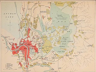
Jammu and Kashmir is home to several valleys such as the Kashmir Valley, Chenab Valley, Sindh Valley and Lidder Valley. Some major tourist attractions in Jammu and Kashmir are Srinagar, with its renowned Dal Lake and Mughal Gardens, Gulmarg, Pahalgam, Bhaderwah, Patnitop and Jammu. Every year, thousands of Hindu pilgrims visit holy shrines of Vaishno Devi and Amarnath which has had a significant impact on the state's economy.
Mt Harmukh is a mountain with a peak elevation of 5,142 metres (16,870 ft), in Ganderbal district of Jammu and Kashmir in India. Harmukh is part of the Himalayas Range and is located between Sind River in the south and Kishanganga River in the north, rising above Gangabal Lake in the vicinity of Kashmir valley. It is mostly climbed from the northwestern side of Arin, via Kudara, Bandipore. Harmukh is considered sacred in Hinduism.

Ajinkyatara Fort, also known as the "Fort of the Sapta-Rishi," is a historical hill fort located on Ajinkyatara Mountain, one of the seven mountains surrounding the city of Satara in the Sahyadri Mountains of Maharashtra, India. Situated at an altitude of 3,300 feet, the fort overlooks Satara City and is considered one of the major heritage sites in Maharashtra.

Yusmarg or Yousmarg is a hill station in the western part of the Budgam district of Jammu and Kashmir, India. It is situated 53 km (33 mi) south of Srinagar, the summer capital of the state. Yousmarg provides space for beautiful landscapes, young pine nurseries, green pastures and heart touching lotic and lentic water bodies. Nilnag, Doodhganga and a nascently created artificial dam adds more to the beauty of the meadows. Nature has bestowed Yusmarg with pleasant flora and fauna. Yusmarg is often referred to as a trekkers paradise.Yusmarg has some modest stay options but some new homestays have come up around the area.Tribe homestay and cafè located at the nearest village Nagbal is gaining popularity especially among the youth. The place is rustic, wooden and reflects the Kashmiri architectural heritage. Among fauna, locals claim that they often sight wolves, bears, apes, cats, aves of various types. Among aquatic fauna, schizothoraxic is abundant one in catch.

Karsog is a town and municipal area in the state of Himachal Pradesh in northern India.

The Tarsar Lake or Tar Sar is an almond-shaped, oligotrophic alpine lake situated in the Anantnag district of Jammu and Kashmir, India. On its west side lies Dachigam National Park, and on its south side lies Tral. The shortest route for reaching it, is from Surfraw Ganderbal, but it has a difficult terrain. Other trek routes to the lake are from Lidderwat and Nagaberan forest areas which fall in south Kashmir.

The Zabarwan Range is a short sub-mountain range between Pir Panjal and Great Himalayan Range in the central part of the Kashmir Valley in the Union Territory of Jammu and Kashmir in India.

Sinthan Top is a mountain pass, a popular tourist destination located in Kishtwar district and borders with South Kashmir's Breng Valley of Anantnag district in the Indian union territory of Jammu and Kashmir. Majority of the area lies on the Kishtwar side. The top acts as a sort of base camp to several alpine lakes in the region.
Tourism in Himachal Pradesh relates to tourism in the Indian state of Himachal Pradesh. This is popularly renowned for its Himalayan landscapes and popular hill-stations. Many outdoor activities such as rock climbing, mountain biking, paragliding, ice-skating, trekking, rafting, and heli-skiing are popular tourist attractions in Himachal Pradesh.
Adi Kailash, also known as Shiva Kailash, Chota Kailash, Baba Kailash or Jonglingkong Peak, is a mountain located in the Himalayan mountain range in the Pithoragarh district of Uttarakhand, India. It is the second most important peak among the group of five separate peaks in Himalayas in separate locations collectively known as the Panch Kailash or "Five Kailashas", others being Mount Kailash in the first place, Shikhar Kailash in the third, Kinnaur Kailash in the fourth and Manimahesh Kailash in the fifth place in terms of importance. Gauri Kund and Parvati Tal glacial lakes are at the base of the Adi Parvat.
New Theed is a notified area in Srinagar city known for its historical significance and natural surroundings.

Shrikhand Mahadev Kailash, also called Shikhar Kailash, is a Hindu pilgrimage site in Nirmand sub-division of Kullu, Himachal Pradesh, India, considered to be an abode of Lord Shiva and his wife Goddess Parvati. It is considered to be one of the toughest treks in India. It is the third most important peak among the group of five separate peaks in Himalayas in separate locations collectively known as the Panch Kailash or "Five Kailashas", other being Mount Kailash in first place, Adi Kailash in second, Kinnaur Kailash in fouth and Manimahesh Kailash in fifth place in terms of importance. The 75 feet Shivalingam at the top of the Shrikhand Mahadev mountain is at a height of 18,570 feet.


