With a documented history of at least 2,500 years, a succession of people and empires have vied for control over all or parts of this territory. In the 18th century it came under the rule of the Qing dynasty, which was later replaced by the Republic of China. Since 1949 and the Chinese Civil War, it has been part of the People's Republic of China. In 1954, the Chinese Communist Party (CCP) established the Xinjiang Production and Construction Corps (XPCC) to strengthen border defense against the Soviet Union and promote the local economy by settling soldiers into the region.[24] In 1955, Xinjiang was administratively changed from a province into an autonomous region. In recent decades, abundant oil and mineral reserves have been found in Xinjiang and it has become China's largest natural-gas-producing region.
The general region of Xinjiang has been known by many different names,including Altishahr—the historical Uyghur name for the southern half of the region referring to "the six cities" of the Tarim Basin—Khotan,Khotay,Chinese Tartary,High Tartary,East Chagatay (it was the eastern part of the Chagatai Khanate),Moghulistan ("land of the Mongols"),Kashgaria,Little Bokhara,Serindia (due to Indian cultural influence)[30] and,in Chinese,Xiyu (西域),meaning "Western Regions".[31]
Between the 2nd century BC and 2nd century AD,the Han Empire established the Protectorate of the Western Regions or Xiyu Protectorate (西域都護府) in an effort to secure the profitable routes of the Silk Road.[32] The Western Regions during the Tang era were known as Qixi (磧西). Qi refers to the Gobi Desert and Xi refers to the west. The Tang Empire established the Protectorate General to Pacify the West or Anxi Protectorate (安西都護府) in 640 to control the region.
During the Qing dynasty,the northern part of Xinjiang,Dzungaria,was known as Zhunbu (準部,"Dzungar region") and the Southern Tarim Basin as Huijiang (回疆,"Muslim Frontier"). Both regions merged after the Qing dynasty suppressed the Revolt of the Altishahr Khojas in 1759,becoming "Xiyu Xinjiang" (西域新疆,literally "Western Regions' New Frontier"),later simplified as "Xinjiang" (新疆;formerly romanized as "Sinkiang"). The official name was given during the reign of the Guangxu Emperor in 1878.[33] It can be translated as "new frontier" or "new territory".[34] In fact,the term "Xinjiang" was used in many other places conquered but never ruled by Chinese empires directly until the gradual Gaitu Guiliu administrative reform,including regions in Southern China.[35] For instance,present-day Jinchuan County in Sichuan was then known as "Jinchuan Xinjiang",Zhaotong in Yunnan was named "Xinjiang",Qiandongnan region,Anshun and Zhenning were named "Liangyou Xinjiang",etc.[36]
In 1955,Xinjiang Province was renamed "Xinjiang Uygur Autonomous Region". The name originally proposed was simply "Xinjiang Autonomous Region" because that was the name of the imperial territory. This proposal was not well received by Uyghurs in the Communist Party,who found the name colonialist since it meant "new territory". Seypidin Azizi,the first chairman of Xinjiang,expressed his strong objection to the proposed name to Mao Zedong,arguing that "autonomy is not given to mountains and rivers. It is given to particular nationalities." Some Uyghur Communists proposed the name "Tian Shan Uyghur Autonomous Region" instead. The Han Communists in the central government denied the name Xinjiang was colonialist or that the central government could be colonialist,both because they were communists and because China was a victim of colonialism. But due to the Uyghur complaints,the administrative region was named "Xinjiang Uygur Autonomous Region".[37][34]
Description
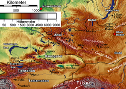
Dzungaria (red) and the Tarim Basin / Altishahr (blue)Physical map showing the separation of Dzungaria and the Tarim Basin (Altishahr) by the Tien Shan Mountains
Xinjiang consists of two main geographically,historically,and ethnically distinct regions with different historical names,Dzungaria north of the Tianshan Mountains and the Tarim Basin south of the Tianshan Mountains. Qing China unified them into one political entity,Xinjiang Province,in 1884. At the time of the Qing conquest in 1759,Dzungaria was inhabited by steppe-dwelling,nomadic Tibetan Buddhist Dzungar people and the Tarim Basin by sedentary,oasis-dwelling,Turkic-speaking Muslim farmers,now known as the Uyghurs,who were governed separately until 1884.[citation needed]
The Qing dynasty was well aware of the differences between the former Buddhist Mongol area in the north and the Turkic Muslim area in the south,and ruled them in separate administrative units at first.[38] But Qing people began to think of both areas as part of a single region called Xinjiang.[39] The very concept of Xinjiang as a single geographic identity was created by the Qing.[40] During Qing rule,ordinary Xinjiang people had no sense of "regional identity";rather,Xinjiang's distinct identity was given to the region by the Qing,since it had distinctive geography,history,and culture,while at the same time it was created by the Chinese,multicultural,settled by Han and Hui,and separated from Central Asia for over a century and a half.[41]
In the late 19th century,some people were still proposing that two separate regions be created out of Xinjiang,the area north of the Tianshan and the area south of the Tianshan,while it was being debated whether to make Xinjiang a province.[42]
The east–west chain of the Tian Shan separates Dzungaria in the north from the Tarim Basin in the south. Dzungaria is a dry steppe and the Tarim Basin contains the massive Taklamakan Desert,surrounded by oases. In the east is the Turpan Depression. In the west,the Tian Shan split,forming the Ili River valley.
Map of Han Dynasty in 2 AD. Light blue is the Tarim Basin protectorate.
The earliest inhabitants of the region encompassing modern day Xinjiang were genetically of Ancient North Eurasian and Northeast Asian origin, with later geneflow from during the Bronze Age linked to the expansion of early Indo-Europeans. These population dynamics gave rise to a heterogeneous demographic makeup. Iron Age samples from Xinjiang show intensified levels of admixture between Steppe pastoralists and northeast Asians, with northern and eastern Xinjiang showing more affinities with northeast Asians, and southern Xinjiang showing more affinity with central Asians.[43][44]
Between 2009 and 2015, the remains of 92 individuals in the Xiaohe Cemetery were analyzed for Y chromosome and mitochondrial DNA markers. Genetic analyses of the mummies showed that the paternal lineages of the Xiaohe people were of almost all European[45] origin, while the maternal lineages of the early population were diverse, featuring both East Eurasian and West Eurasian lineages, as well as a smaller number of Indian / South Asian lineages. Over time, the west Eurasian maternal lineages were gradually replaced by east Eurasian maternal lineages. Outmarriage to women from Siberian communities, led to the loss of the original diversity of mtDNA lineages observed in the earlier Xiaohe population.[46][47][48]
The Tarim population was therefore always notably diverse, reflecting a complex history of admixture between people of Ancient North Eurasian, South Asian and Northeast Asian descent. The Tarim mummies have been found in various locations in the Western Tarim Basin such as Loulan, the Xiaohe Tomb complex and Qäwrighul. These mummies have been previously suggested to have been Tocharian or Indo-European speakers, but recent evidence suggest that the earliest mummies belonged to a distinct population unrelated to Indo-European pastoralists and spoke an unknown language, probably a language isolate.[49]
Although many of the Tarim mummies were classified as Caucasoid by anthropologists, Tarim Basin sites also contain both "Caucasoid" and "Mongoloid" remains, indicating contact between newly arrived western nomads and agricultural communities in the east.[50] Mummies have been found in various locations in the Western Tarim Basin such as Loulan, the Xiaohe Tomb complex and Qäwrighul.
Nomadic tribes such as the Yuezhi, Saka and Wusun were probably part of the migration of Indo-European speakers who had settled in Tarim Basin of Xinjiang long before the Xiongnu and Han Chinese. By the time the Han dynasty under Emperor Wu (r. 141–87 BC) wrested the western Tarim Basin away from its previous overlords (the Xiongnu), it was inhabited by various peoples who included the Indo-European-speaking Tocharians in Turfan and Kucha, the Saka peoples centered in the Shule Kingdom and the Kingdom of Khotan, the various Tibeto-Burmese groups (especially people related to the Qiang) as well as the Han Chinese people.[51] Some linguists posit that the Tocharian language had high amounts of influence from Paleosiberian languages,[52] such as Uralic and Yeniseian languages.
Yuezhi culture is documented in the region. The first known reference to the Yuezhi was in 645 BC by the Chinese chancellor Guan Zhong in his work, Guanzi (管子, Guanzi Essays: 73: 78: 80: 81). He described the Yúshì, 禺氏 (or Niúshì, 牛氏), as a people from the north-west who supplied jade to the Chinese from the nearby mountains (also known as Yushi) in Gansu.[53] The longtime jade supply[54] from the Tarim Basin is well-documented archaeologically: "It is well known that ancient Chinese rulers had a strong attachment to jade. All of the jade items excavated from the tomb of Fuhao of the Shang dynasty, more than 750 pieces, were from Khotan in modern Xinjiang. As early as the mid-first millennium BC, the Yuezhi engaged in the jade trade, of which the major consumers were the rulers of agricultural China."[55]
Crossed by the Northern Silk Road,[56] the Tarim and Dzungaria regions were known as the Western Regions. At the beginning of the Han dynasty the region was ruled by the Xiongnu, a powerful nomadic people.[57]:148 During the 2nd century BC, the Han dynasty prepared for war against Xiongnu when Emperor Wu of Han dispatched Zhang Qian to explore the mysterious kingdoms to the west and form an alliance with the Yuezhi against the Xiongnu. As a result of the war, the Chinese controlled the strategic region from the Ordos and Gansu corridor to Lop Nor. They separated the Xiongnu from the Qiang people on the south and gained direct access to the Western Regions. Han China sent Zhang Qian as an envoy to the states of the region, beginning several decades of struggle between the Xiongnu and Han China in which China eventually prevailed. During the 100s BCE, the Silk Road brought increasing Chinese economic and cultural influence to the region.[57]:148 In 60 BCE, Han China established the Protectorate of the Western Regions (西域都護府) at Wulei (烏壘, near modern Luntai), to oversee the region as far west as the Pamir Mountains. The protectorate was seized during the civil war against Wang Mang (r. AD 9–23), returning to Han control in 91 due to the efforts of general Ban Chao.
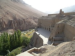
Old Uyghur / Yugur art from the Bezeklik muralsThe Tarim Basin in the 3rd century AD
The Western Jin dynasty succumbed to successive waves of invasions by nomads from the north at the beginning of the 4th century. The short-lived kingdoms that ruled northwestern China one after the other, including Former Liang, Former Qin, Later Liang and Western Liáng, all attempted to maintain the protectorate, with varying degrees of success. After the final reunification of Northern China under the Northern Wei empire, its protectorate controlled what is now the southeastern region of Xinjiang. Local states such as Shule, Yutian, Guizi and Qiemo controlled the western region, while the central region around Turpan was controlled by Gaochang, remnants of a state (Northern Liang) that once ruled part of what is now Gansu province in northwestern China.
During the Anshi Rebellion, which nearly destroyed the Tang dynasty, Tibet invaded the Tang on a broad front from Xinjiang to Yunnan. It occupied the Tang capital of Chang'an in 763 for 16 days, and controlled southern Xinjiang by the end of the century. The Uyghur Khaganate took control of Northern Xinjiang, much of Central Asia and Mongolia at the same time.
As Tibet and the Uyghur Khaganate declined in the mid-9th century, the Kara-Khanid Khanate (a confederation of Turkic tribes including the Karluks, Chigils and Yaghmas)[61] controlled Western Xinjiang during the 10th and 11th centuries. After the Uyghur Khaganate in Mongolia was destroyed by the Kirghiz in 840, branches of the Uyghurs established themselves in Qocha (Karakhoja) and Beshbalik (near present-day Turfan and Ürümqi). The Uyghur state remained in eastern Xinjiang until the 13th century, although it was ruled by foreign overlords. The Kara-Khanids converted to Islam. The Uyghur state in Eastern Xinjiang, initially Manichean, later converted to Buddhism.
Remnants of the Liao dynasty from Manchuria entered Xinjiang in 1132, fleeing rebellion by the neighboring Jurchens. They established a new empire, the Qara Khitai (Western Liao), which ruled the Kara-Khanid and Uyghur-held parts of the Tarim Basin for the next century. Although Khitan and Chinese were the primary administrative languages, Persian and Uyghur were also used.[62]
Present-day Xinjiang consisted of the Tarim Basin and Dzungaria and was originally inhabited by Indo-European Tocharians and Iranian Sakas who practiced Buddhism and Zoroastrianism. The Turfan and Tarim Basins were inhabited by speakers of Tocharian languages,[63] with Caucasian mummies found in the region.[64] The area became Islamified during the 10th century with the conversion of the Kara-Khanid Khanate, who occupied Kashgar. During the mid-10th century, the Saka Buddhist Kingdom of Khotan was attacked by the Turkic Muslim Karakhanid ruler Musa; the Karakhanid leader Yusuf Qadir Khan conquered Khotan around 1006.[65]
After Genghis Khan unified Mongolia and began his advance west the Uyghur state in the Turpan-Urumchi region offered its allegiance to the Mongols in 1209, contributing taxes and troops to the Mongol imperial effort. In return, the Uyghur rulers retained control of their kingdom; Genghis Khan's Mongol Empire conquered the Qara Khitai in 1218. Xinjiang was a stronghold of Ögedei Khan and later came under the control of his descendant, Kaidu. This branch of the Mongol family kept the Yuan dynasty at bay until their rule ended.
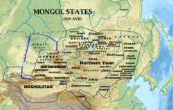
During the Mongol Empire era the Yuan dynasty vied with the Chagatai Khanate for rule of the region and the latter controlled most of it. After the Chagatai Khanate divided into smaller khanates during the mid-14th century, the politically fractured region was ruled by a number of Persianized Mongol Khans, including those from Moghulistan (with the assistance of local Dughlat emirs), Uigurstan (later Turpan) and Kashgaria. These leaders warred with each other and the Timurids of Transoxiana to the west and the Oirats to the east: the successor Chagatai regime based in Mongolia and China. During the 17th century, the Dzungars established an empire over much of the region.
The Mongolian Dzungars were the collective identity of several Oirat tribes which formed and maintained, one of the last nomadic empires. The Dzungar Khanate covered Dzungaria, extending from the western Great Wall of China to present-day Eastern Kazakhstan and from present-day Northern Kyrgyzstan to Southern Siberia. Most of the region was renamed "Xinjiang" by the Chinese after the fall of the Dzungar Empire, which existed from the early 17th to the mid-18th century.[66]
The Dzungar–Qing Wars, between the Qing Dynasty and the Dzungar Khanate
The sedentary Turkic Muslims of the Tarim Basin were originally ruled by the Chagatai Khanate and the nomadic Buddhist Oirat Mongols in Dzungaria ruled the Dzungar Khanate. The Naqshbandi Sufi Khojas, descendants of Muhammad, had replaced the Chagatayid Khans as rulers of the Tarim Basin during the early 17th century. There was a struggle between two Khoja factions: the Afaqi (White Mountain) and the Ishaqi (Black Mountain). The Ishaqi defeated the Afaqi and the Afaq Khoja invited the 5th Dalai Lama (the leader of the Tibetans) to intervene on his behalf in 1677. The Dalai Lama then called on his Dzungar Buddhist followers in the Dzungar Khanate to act on the invitation. The Dzungar Khanate conquered the Tarim Basin in 1680, setting up the Afaqi Khoja as their puppet ruler. After converting to Islam, the descendants of the previously-Buddhist Uyghurs in Turfan believed that the "infidel Kalmuks" (Dzungars) built Buddhist monuments in their region.[67]
The Battle of Oroi-Jalatu in 1756, between the Manchu and Oirat armiesThe Qing Empire ca. 1820Scene from the 1828 Qing campaign against rebels in Altishahr
The Turkic Muslims of the Turfan and Kumul oases then submitted to the Qing dynasty and asked China to free them from the Dzungars; the Qing accepted their rulers as vassals. They warred against the Dzungars for decades before defeating them; Qing Manchu Bannermen then conducted the Dzungar genocide, nearly eradicating them and depopulating Dzungaria. The Qing freed the Afaqi Khoja leader Burhan-ud-din and his brother, Khoja Jihan, from Dzungar imprisonment and appointed them to rule the Tarim Basin as Qing vassals. The Khoja brothers reneged on the agreement, declaring themselves independent leaders of the Tarim Basin. The Qing and the Turfan leader Emin Khoja crushed their revolt, and by 1759 China controlled Dzungaria and the Tarim Basin.[68]
The Manchu Qing dynasty gained control of eastern Xinjiang as a result of a long struggle with the Dzungars which began during the 17th century. In 1755, with the help of the Oirat noble Amursana, the Qing attacked Ghulja and captured the Dzungar khan. After Amursana's request to be declared Dzungar khan went unanswered, he led a revolt against the Qing. Qing armies destroyed the remnants of the Dzungar Khanate over the next two years, and many Han Chinese and Hui moved into the pacified areas.[69]
The native Dzungar Oirat Mongols suffered greatly from the brutal campaigns and a simultaneous smallpox epidemic. Writer Wei Yuan described the resulting desolation in present-day northern Xinjiang as "an empty plain for several thousand li, with no Oirat yurt except those surrendered."[70] It has been estimated that 80 percent of the 600,000 (or more) Dzungars died from a combination of disease and warfare,[71] and recovery took generations.[72]
Han and Hui merchants were initially only allowed to trade in the Tarim Basin; their settlement in the Tarim Basin was banned until the 1830 Muhammad Yusuf Khoja invasion, when the Qing rewarded merchants for fighting off Khoja by allowing them to settle in the basin.[73] The Uyghur Muslim Sayyid and NaqshbandiSufi rebel of the Afaqi suborder, Jahangir Khoja was sliced to death (Lingchi) in 1828 by the Manchus for leading a rebellion against the Qing. According to Robert Montgomery Martin, many Chinese with a variety of occupations were settled in Dzungaria in 1870; in Turkestan (the Tarim Basin), however, only a few Chinese merchants and garrison soldiers were interspersed with the Muslim population.[74]
The 1765 Ush rebellion by the Uyghurs against the Manchu began after Uyghur women were raped by the servants and son of Manchu official Su-cheng.[75] It was said that "Ush Muslims had long wanted to sleep on [Sucheng and son's] hides and eat their flesh" because of the months-long abuse.[76] The Manchu emperor ordered the massacre of the Uyghur rebel town; Qing forces enslaved the Uyghur children and women, and killed the Uyghur men.[77] Sexual abuse of Uyghur women by Manchu soldiers and officials triggered deep Uyghur hostility against Manchu rule.[78]
By the 1860s, Xinjiang had been under Qing rule for a century. The region was captured in 1759 from the Dzungar Khanate,[79] whose population (the Oirats) became the targets of genocide. Xinjiang was primarily semi-arid or desert and unattractive to non-trading Han settlers, and others (including the Uyghurs) settled there.[citation needed]
The Dungan Revolt by the Muslim Hui and other Muslim ethnic groups was fought in China's Shaanxi, Ningxia and Gansu provinces and in Xinjiang from 1862 to 1877. The conflict led to a reported 20.77million deaths due to migration and war, with many refugees dying of starvation.[80][failed verification] Thousands of Muslim refugees from Shaanxi fled to Gansu; some formed battalions in eastern Gansu, intending to reconquer their lands in Shaanxi. While the Hui rebels were preparing to attack Gansu and Shaanxi, Yakub Beg (an Uzbek or Tajik commander of the Kokand Khanate) fled from the khanate in 1865 after losing Tashkent to the Russians. Beg settled in Kashgar, and soon controlled Xinjiang. Although he encouraged trade, built caravansareis, canals and other irrigation systems, his regime was considered harsh. The Chinese took decisive action against Yettishar; an army under General Zuo Zongtang rapidly approached Kashgaria, reconquering it on 16 May 1877.[81]
19th-century Khotan Uyghurs in Yettishar
After reconquering Xinjiang in the late 1870s from Yakub Beg,[82] the Qing dynasty established Xinjiang ("new frontier") as a province in 1884[83]–making it part of China, and dropping the old names of Zhunbu (準部, Dzungar Region) and Huijiang (Muslimland).[84][85] Many Uyghurs subsequently migrated from southern Xinjiang to the fertile lands of the north and east, sometimes with the support of the Qing government.[86]
In 1912, the Qing dynasty was replaced by the Republic of China. The ROC continued to treat the Qing territory as its own, including Xinjiang.[87]:69 Yuan Dahua, the last Qing governor of Xinjiang, fled. One of his subordinates, Yang Zengxin, took control of the province and acceded in name to the Republic of China in March of that year. Balancing mixed ethnic constituencies, Yang controlled Xinjiang until his 1928 assassination after the Northern Expedition of the Kuomintang.[88]
The Soviet Union invaded the province; it was brought under the control of northeast Han warlord Sheng Shicai after the 1937 Xinjiang War. Sheng ruled Xinjiang for the next decade with support from the Soviet Union, many of whose ethnic and security policies he instituted. The Soviet Union maintained a military base in the province and deployed several military and economic advisors. Sheng invited a group of Chinese Communists to Xinjiang (including Mao Zedong's brother, Mao Zemin),[92]:111 but executed them all in 1943 in fear of a conspiracy. In 1944, President and Premier of ChinaChiang Kai-shek, informed by the Soviet Union of Shicai's intention to join it, transferred him to Chongqing as the Minister of Agriculture and Forestry the following year.[93] During the Ili Rebellion, the Soviet Union backed Uyghur separatists to form the Second East Turkestan Republic (ETR) in the Ili region while most of Xinjiang remained under Kuomintang control.[89]
The PRC autonomous region was established on 1 October 1955, replacing the province;[90] that year (the first modern census in China was taken in 1953), Uyghurs were 73 percent of Xinjiang's total population of 5.11 million.[37] Although Xinjiang has been designated a "Uygur Autonomous Region" since 1955, more than 50 percent of its area is designated autonomous areas for 13 native non-Uyghur groups.[96] Modern Uyghurs developed ethnogenesis in 1955, when the PRC recognized formerly separately self-identified oasis peoples.[97]
Southern Xinjiang is home to most of the Uyghur population, about nine million people, out of a total population of twenty million; fifty-five percent of Xinjiang's Han population, mainly urban, live in the north.[98][99] This created an economic imbalance, since the northern Junghar basin (Dzungaria) is more developed than the south.[100]
Land reform and collectivization occurred in Uyghur agricultural areas at the same general pace as in most of China.[101]:134 Hunger in Xinjiang was not as great as elsewhere in China during the Great Leap Forward and a million Han Chinese fleeing famine resettled in Xinjiang.[101]:134
In 1980, China allowed the United States to establish electronic listening stations in Xinjiang so the United States could monitor Soviet rocket launches in central Asia in exchange for the United States authorizing the sale of dual-use civilian and military technology and nonlethal military equipment to China.[102]
The reform and opening up since the late 1970s has exacerbated uneven regional development, more Uyghurs have migrated to Xinjiang's cities and some Han have migrated to Xinjiang for economic advancement. Chinese leaderDeng Xiaoping made a nine-day visit to Xinjiang in 1981 and described the region as "unsteady".[103] The Deng era reforms encouraged China's ethnic minorities, including Uyghurs, to establish small private companies for commodity transit, retail, and restaurants.[104] By the early 1990s, a total of 19 billion yuan had been spent in Xinjiang on large- and medium-sized industrial projects, with an emphasis on developing modern transportation, communications infrastructure, and support for the oil and gas industries.[57]:149
A brisk cross-border shuttle trade by Uyghurs further developed following the adoption of the Soviet Union's perestroika.[104]
In 2000, Uyghurs made up 45 percent of Xinjiang's population and 13 percent of Ürümqi's population. With nine percent of Xinjiang's population, Ürümqi accounts for 25 percent of the region's GDP; many rural Uyghurs have migrated to the city for work in its light, heavy and petrochemical industries.[106] Han in Xinjiang are older, better-educated and work in higher-paying professions than their Uyghur counterparts. Han are more likely to cite business reasons for moving to Ürümqi, while some Uyghurs cite legal trouble at home and family reasons for moving to the city.[107] Han and Uyghurs are equally represented in Ürümqi's floating population, which works primarily in commerce. Auto-segregation in the city is widespread in residential concentration, employment relationships and endogamy.[108] In 2010, Uyghurs were a majority in the Tarim Basin and a plurality in Xinjiang as a whole.[109]
Xinjiang has 81 public libraries and 23 museums, compared to none in 1949. It has 98 newspapers in 44 languages, compared with four in 1952. According to official statistics, the ratio of doctors, medical workers, clinics and hospital beds to the general population surpasses the national average; the immunization rate has reached 85 percent.[5]
In 2014, Chinese Communist Party (CCP) leadership in Xinjiang commenced a People's War against the "Three Evil Forces" of separatism, terrorism, and extremism. They deployed two hundred thousand party cadres to Xinjiang and the launched the Civil Servant-Family Pair Up program.[128][129]Chinese Communist Party leaderXi Jinping was dissatisfied with the initial results of the People's War and replaced Zhang Chunxian with Chen Quanguo as Party Committee Secretary in 2016. Following his appointment Chen oversaw the recruitment of tens of thousands of additional police officers and the division of society into three categories: trusted, average, untrustworthy. He instructed his subordinated to "Take this crackdown as the top project," and "to preëmpt the enemy, to strike at the outset." Following a meeting with Xi in Beijing Chen Quanguo held a rally in Ürümqi with ten thousand troops, helicopters, and armored vehicles. As they paraded he announced a "smashing, obliterating offensive," and declared that they would "bury the corpses of terrorists and terror gangs in the vast sea of the People's War."[128]
Chinese authorities have operated internment camps to indoctrinate Uyghurs and other Muslims as part of the People's War since at least 2017.[130][27] The camps have been criticized by a number of governments and human-rights organizations for patterns of abuse and mistreatment, with various characterizations up to and including that of a genocide being perpetrated by the Chinese government.[131] In 2020, CCP General Secretary Xi Jinping said: "Practice has proven that the party's strategy for governing Xinjiang in the new era is completely correct."[132]
In 2021, authorities sentenced Sattar Sawut and Shirzat Bawudun—former heads of Xinjiang's education and justice departments respectively—both to death with a two-year reprieve on separatism and bribery charges.[133] Such a sentence is usually commuted to life imprisonment.[134] Officials said Sawut was found guilty of incorporating ethnic separatism, violence, and religious extremism content into Uyghur-language textbooks, which had influenced several people to participate in attacks in Ürümqi. They said Bawudun was found guilty of colluding with ETIM and carrying out "illegal religious activities at his daughter's wedding".[133][135] Three other educators were sentenced to life in prison.[136] Chen was replaced as Community Party Secretary for Xinjiang by Ma Xingrui in December 2021.[137]
Xi Jinping made a four-day visit to Xinjiang in July 2022 where Kompas TV had documented groups of Uyghurs welcoming his arrival.[138] Xi called on local officials to do more in preserving ethnic minority culture[139] and following an inspection of the Xinjiang Production and Construction Corps, he praised the organization's "great progress" in reform and development.[140] During another visit to Xinjiang in August 2023, Xi said in a speech that the region should open up more for tourism to attract domestic and foreign visitors.[141][142]
These are then divided into 13 districts, 29 county-level cities, 62 counties and 6 autonomous counties. Twelve of the county-level cities do not belong to any prefecture and are de facto administered by the Xinjiang Production and Construction Corps (XPCC). Sub-level divisions of the Xinjiang Uygur Autonomous Region is shown in the adjacent picture and described in the table below:
* – Altay Prefecture or Tacheng Prefecture are subordinate to Ili Prefecture. / The population or area figures of Ili do not include Altay Prefecture or Tacheng Prefecture which are subordinate to Ili Prefecture.
Administrative divisions in Uyghur, Chinese and varieties of romanizations
Xinjiang is the largest political subdivision of China, accounting for more than one sixth of China's total territory and a quarter of its boundary length. Xinjiang is mostly covered with uninhabitable deserts and dry grasslands, with dotted oases conducive to habitation accounting for 9.7 percent of Xinjiang's total area by 2015[17] at the foot of Tian Shan, Kunlun Mountains and Altai Mountains, respectively.
Xinjiang is split by the Tian Shan mountain range (تەڭرى تاغ, Tengri Tagh, Тәңри Тағ), which divides it into two large basins: the Dzungarian Basin in the north and the Tarim Basin in the south. A small V-shaped wedge between these two major basins, limited by the Tian Shan's main range in the south and the Borohoro Mountains in the north, is the basin of the Ili River, which flows into Kazakhstan's Lake Balkhash; an even smaller wedge farther north is the Emin Valley.
Other major mountain ranges of Xinjiang include the Pamir Mountains and Karakoram in the southwest, the Kunlun Mountains in the south (along the border with Tibet) and the Altai Mountains in the northeast (shared with Mongolia). The region's highest point is the mountain K2, an eight-thousander located 8,611 metres (28,251ft) above sea level in the Karakoram Mountains on the border with Pakistan.
Much of the Tarim Basin is dominated by the Taklamakan Desert. North of it is the Turpan Depression, which contains the lowest point in Xinjiang and in the entire PRC, at 155 metres (509ft) below sea level.
The Dzungarian Basin is slightly cooler, and receives somewhat more precipitation, than the Tarim Basin. Nonetheless, it, too, has a large Gurbantünggüt Desert (also known as Dzoosotoyn Elisen) in its center.
Xinjiang is geologically young. Collision of the Indian and the Eurasian plates formed the Tian Shan, Kunlun Shan, and Pamir mountain ranges; said tectonics render it a very active earthquake zone. Older geological formations are located in the far north, where Kazakhstania is geologically part of Kazakhstan, and in the east, where is part of the North China Craton.[citation needed]
Having hot summer and low precipitation, most of Xinjiang is endorheic. Its rivers either disappear in the desert, or terminate in salt lakes (within Xinjiang itself, or in neighboring Kazakhstan), instead of running towards an ocean. The northernmost part of the region, with the Irtysh River rising in the Altai Mountains, that flows (via Kazakhstan and Russia) toward the Arctic Ocean, is the only exception. But even so, a significant part of the Irtysh's waters were artificially diverted via the Irtysh–Karamay–Ürümqi Canal to the drier regions of southern Dzungarian Basin.
Elsewhere, most of Xinjiang's rivers are comparatively short streams fed by the snows of the several ranges of the Tian Shan. Once they enter the populated areas in the mountains' foothills, their waters are extensively used for irrigation, so that the river often disappears in the desert instead of reaching the lake to whose basin it nominally belongs. This is the case even with the main river of the Tarim Basin, the Tarim, which has been dammed at a number of locations along its course, and whose waters have been completely diverted before they can reach the Lop Lake. In the Dzungarian basin, a similar situation occurs with most rivers that historically flowed into Lake Manas. Some of the salt lakes, having lost much of their fresh water inflow, are now extensively use for the production of mineral salts (used e.g., in the manufacturing of potassium fertilizers); this includes the Lop Lake and the Manas Lake.
Due to water scarcity, most of Xinjiang's population lives within fairly narrow belts that are stretched along the foothills of the region's mountain ranges in areas conducive to irrigated agriculture. It is in these belts where most of the region's cities are found.
A semiarid or desert climate (KöppenBSk or BWk, respectively) prevails in Xinjiang. The entire region has great seasonal differences in temperature with cold winters. The Turpan Depression often records some of the hottest temperatures nationwide in summer,[152] with air temperatures easily exceeding 40°C (104°F). Winter temperatures regularly fall below −20°C (−4°F) in the far north and highest mountain elevations. On 18 February 2024, a record low temperature for the region of −52.3°C (−62.1°F) was recorded.[153]
Continuous permafrost is typically found in the Tian Shan starting at the elevation of about 3,500–3,700 m above sea level. Discontinuous alpine permafrost usually occurs down to 2,700–3,300 m, but in certain locations, due to the peculiarity of the aspect and the microclimate, it can be found at elevations as low as 2,000 m.[154]
Despite the province's easternmost point being more than 1,600 kilometres (990mi) west of Beijing, Xinjiang, like the rest of China, is officially in the UTC+8 time zone, known by residents as Beijing Time. Despite this, some residents, local organizations and governments observe UTC+6 as the standard time and refer to this zone as Xinjiang Time.[155] Han people tend to use Beijing Time, while Uyghurs tend to use Xinjiang Time as a form of resistance to Beijing.[156] Time zones notwithstanding, most schools and businesses open and close two hours later than in the other regions of China.[157]
Xinjiang maintains the Xinjiang Production and Construction Corps (XPCC), an economic and paramilitary organization administered by the Chinese government and the Chinese Communist Party (CCP). It plays a critical role in the region's economy, owning or being otherwise connected to many companies in the region as well as dominating Xinjiang's agricultural output.[160] It additionally directly administers cities throughout Xinjiang, mainly concentrated in the northern parts. It is headed by the CCP secretary of Xinjiang, while the CCP secretary of the XPCC is considered the second most powerful person in the region.[160]
Poverty alleviation programs
Local governments in Xinjiang seek to address ethnic tensions in the region through poverty alleviation and redistributive programs.[161]:189 These efforts include working with state-owned enterprises and private enterprises in the mining sector.[161]:189 For example, during the Targeted Poverty Alleviation Campaign, officials paired 1,000 villages with 1,000 enterprises for economic development projects.[161]:189
Human Rights Watch has documented “the denial of due legal process and fair trials and failure to hold genuinely open trials as mandated by law,” for example in the cases of suspects arrested after ethnic violence in Ürümqi in 2009.[162]
The Chinese government, under Chinese Communist Party general secretary Xi Jinping, launched the Strike Hard Campaign Against Violent Terrorism in 2014.[163] Chinese official sources describe the measures as part of counter-terrorism and vocational education initiatives aimed at preventing extremism, improving employability, and promoting social stability.[163] Independent investigations and international human-rights bodies have concurrently documented mass detention, surveillance, and restrictions on religious and cultural expression, raising concerns over human-rights implications.[164]
According to Chinese government and official reports, Xinjiang has seen significant progress in poverty alleviation, infrastructure development, and social-welfare programs, which officials cite as evidence of improved living standards and social stability.[165] Other researchers and journalists have documented satellite imagery, detainee testimony, and reports of restrictions on cultural and religious activities, highlighting a complex picture of governance and social conditions.[166]
Some observers and institutions describe elements of the campaign as amounting to crimes against humanity or even genocide, whereas Chinese authorities and some commentators reject these characterizations, emphasizing legal, security, and socioeconomic development rationales.[167][168]
The Kök Bayraq has become a symbol of the East Turkestan independence movement.
Some factions in Xinjiang, most prominently Uyghur nationalists, advocate establishing an independent country named East Turkestan (also sometimes called "Uyghuristan"),[169] which has led to tension, conflict,[170] and ethnic strife in the region.[171][172][173] Autonomous regions in China do not have a legal right to secede, and each one is considered to be an "inseparable part of the People's Republic of China" by the government.[174][175] The separatist movement claims that the region is not part of China, but was invaded by the CCP in 1949 and has been under occupation since then. The Chinese government asserts that the region has been part of China since ancient times,[176] and has engaged in "strike hard" campaigns targeted at separatists.[177] The movement has been supported by both militant Islamic extremist groups such as the Turkistan Islamic Party,[178] as well as advocacy groups with no connection to extremist groups.
According to the Asia-Pacific Center for Security Studies, the two main sources for separatism in the Xinjiang Province are religion and ethnicity. Religiously, the most Uyghur peoples of Xinjiang follow Islam; in the rest of China, many are Buddhist, Taoist and Confucian, although many follow Islam as well, such as the Hui ethnic subgroup of the Han ethnicity, comprising some 10 million people. Thus, the major difference and source of friction with eastern China is ethnicity and religious doctrinal differences that differentiate them politically from other Muslim minorities elsewhere in the country.[177]
The distribution map of Xinjiang's GDP per person (2011)Ürümqi is a major industrial center within Xinjiang.Wind farm in XinjiangSunday market in Khotan
The GDP of Xinjiang was about CN¥2.053 trillion (US$289 billion) as of 2024[update].[180] Economic growth has been fueled by to discovery of the abundant reserves of coal, oil, gas as well as the China Western Development policy introduced by the State Council to boost economic development in Western China.[181] Its per capita GDP for 2022 was CN¥68,552 (US$10,191). Southern Xinjiang, with 95 percent non-Han population, has an average per capita income half that of Xinjiang as a whole.[180] XPCC plays an outsized role in Xinjiang's economy, with the organization producing CN¥350 billion (US$52 billion), or around 19.7% of Xinjiang's economy, while the per capita GDP was CN¥98,748 (US$14,680).[182][non-primary source needed]
In general, China's autonomous regions have some of the highest per capita government spending public goods and services.[183]:366 Providing public goods and services in these areas is part of a government effort to reduce regional inequalities, reduce what the government views as a risk of separatism, and stimulate economic development.[183]:366 Economic development of Xinjiang is a priority for China.[184] As of at least 2019, Xinjiang is among the regions of China with the highest total per capita government expenditure, including on health care, education, and social security.[183]:367–369
In 1997, the 26,000 km Uzbek-Kyrgyz-Chinese highway became operational.[57]:150 In 1998, the Turpan–Ürümqi–Dahuangshan Expressway was completed, linking several key areas in Xinjiang.[57]:150 In 2000, the government articulated its strategy for developing the western regions of the country, and that plan made Xinjiang a major focus.[184] Accelerating development in Xinjiang is intended by China to achieve a number of objectives, including narrowing the economic gap between Xinjiang and the more developed eastern provinces, as well as alleviating political discontent and security problems by alleviating poverty and raising the standard of living in order to increase stability.[184] From 2014 to 2020, fiscal transfers from China's central government to Xinjiang grew by an average of 10.4% per year.[185]:110
Local governments in China's 19 provinces and municipalities, including Beijing, Shanghai, Guangdong, Zhejiang and Liaoning, are engaged in the commitment of "pairing assistance" support projects in Xinjiang to promote the development of agriculture, industry, technology, education and health services in the region.
Xinjiang has traditionally been an agricultural region, but is also rich in minerals and oil. Xinjiang is a major producer of solar panel components due to its large production of the base material polysilicon. In 2020 45 percent of global production of solar-grade polysilicon occurred in Xinjiang. Concerns have been raised both within the solar industry and outside it that forced labor may occur in the Xinjiang part of the supply chain.[187] The global solar panel industry is under pressure to move sourcing away from the region due to human rights and liability concerns.[188] China's solar association claimed the allegations were baseless and unfairly stigmatized firms with operations there.[189] A 2021 investigation in the United Kingdom found that 40 percent of solar farms in the UK had been built using panels from Chinese companies linked to forced labor in Xinjiang.[190]
Agriculture and fishing
Main area is of irrigated agriculture. By 2015, the agricultural land area of the region is 631 thousand km2 or 63.1 million ha, of which 6.1 million ha is arable land.[191][needs update] In 2016, the total cultivated land rose to 6.2 million ha, with the crop production reaching 15.1 million tons.[192] Agriculture in Xinjiang is dominated by the XPCC, which employs a majority of the organization's workforce.[193]Wheat was the main staple crop of the region, maize grown as well, millet found in the south, while only a few areas (in particular, Aksu) grew rice.[194]
Cotton became an important crop in several oases, notably Hotan, Yarkand and Turpan by the late 19th century.[194]Sericulture is also practiced.[195] The Xinjiang cotton industry is the world's largest cotton exporter, producing 84 percent of Chinese cotton while the country provides 26 percent of global cotton export.[196] Xinjiang also produces peppers and pepper pigments used in cosmetics such lipstick for export.[197]
Xinjiang is famous for its tomatoes, grapes and melons, particularly Hami melons and Turpan raisins.[198] The region is a leading source for tomato paste, which it supplies for international brands.[196]
The main livestock of the region have traditionally been sheep. Much of the region's pasture land is in its northern part, where more precipitation is available,[199] but there are mountain pastures throughout the region.[200]:29
Due to the lack of access to the ocean and limited amount of inland water, Xinjiang's fish resources are somewhat limited. Nonetheless, there is a significant amount of fishing in Lake Ulungur and Lake Bosten and in the Irtysh River. A large number of fish ponds have been constructed since the 1970s, their total surface exceeding 10,000 hectares by the 1990s. In 2000, the total of 58,835 tons of fish was produced in Xinjiang, 85 percent of which came from aquaculture.[201][needs update] The Sayram Lake is both the largest alpine lake and highest altitude lake in Xinjiang, and is the location of a major cold-water fishery.[citation needed] Originally Sayram had no fish but in 1998, northern whitefish (Coregonus peled) from Russia were introduced and investment in breeding infrastructure and technology has consequently made Sayram into the country's largest exporter of northern whitefish with an annual output of over 400 metric tons.[202][bettersourceneeded]
Xinjiang was known for producing salt, sodium, borax, gold, and jade in the 19th century.[203]
The Lop Lake was once a large brackish lake during the end of the Pleistocene but has slowly dried up in the Holocene where average annual precipitation in the area has declined to just 31.2 millimeters (1.2 inches), and experiences annual evaporation rate of 2,901 millimeters (114 inches). The area is rich in brine potash, a key ingredient in fertilizer and is the second-largest source of potash in the country. Discovery of potash in the mid-1990s, has transformed Lop Nur into a major potash mining industry.[204]
The oil and gas extraction industry in Aksu and Karamay is growing, with the West–East Gas Pipeline linking to Shanghai. The oil and petrochemical sector get up to 60 percent of Xinjiang's economy.[205] The region contains over a fifth of China's hydrocarbon resources and has the highest concentration of fossil fuel reserves of any region in the country.[206] The region is rich in coal and contains 40 percent of the country's coal reserves or around 2.2 trillion tonnes, which is enough to supply China's thermal coal demand for more than 100 years even if only 15 percent of the estimated coal reserve prove recoverable.[207][208]
Tarim basin is the largest oil and gas bearing area in the country with about 16 billion tonnes of oil and gas reserves discovered.[209] The area is still actively explored and in 2021, China National Petroleum Corporation found a new oil field reserve of 1 billion tons (about 907 million tonnes). That find is regarded as being the largest one in recent decades. As of 2021, the basin produces hydrocarbons at an annual rate of 2 million tons, up from 1.52 million tons from 2020.[210]
Foreign trade
Trade with Central Asian countries is crucial to Xinjiang's economy.[211] Most of the overall import / export volume in Xinjiang was directed to and from Kazakhstan through Ala Pass. China's first border free trade zone (Horgos Free Trade Zone) was located at the Xinjiang-Kazakhstan border city of Horgos.[212] Horgos is the largest "land port" in China's western region and it has easy access to the Central Asian market. Xinjiang also opened its second border trade market to Kazakhstan in March 2006, the Jeminay Border Trade Zone.[213]
Vietnam is a major importer of Xinjiang cotton.[214]:45
Ürümqi Economic & Technological Development Zone is northwest of Ürümqi. It was approved in 1994 by the State Council as a national level economic and technological development zones. It is 1.5km (0.93mi) from the Ürümqi International Airport, 2km (1.2mi) from the North Railway Station and 10km (6.2mi) from the city center. Wu Chang Expressway and 312 National Road passes through the zone. The development has unique resources and geographical advantages. Xinjiang's vast land, rich in resources, borders eight countries. As the leading economic zone, it brings together the resources of Xinjiang's industrial development, capital, technology, information, personnel and other factors of production.[218]
Ürümqi Export Processing Zone is in Urumuqi Economic and Technology Development Zone. It was established in 2007 as a state-level export processing zone.[219]
Ürümqi New & Hi-Tech Industrial Development Zone was established in 1992 and it is the only high-tech development zone in Xinjiang, China. There are more than 3470 enterprises in the zone, of which 23 are Fortune 500 companies. It has a planned area of 9.8km2 (3.8sqmi) and it is divided into four zones. There are plans to expand the zone.[220]
For a time after the July 2009 riots, authorities placed restrictions on the internet and text messaging, gradually permitting access to state-controlled websites like Xinhua News Agency,[224] until restoring Internet to the same level as the rest of China on 14 May 2010.[225][226][227]
The earliest Tarim mummies, dated to 1800 BC, are of a Caucasoid physical type.[239] East Asian migrants arrived in the eastern portions of the Tarim Basin about 3000 years ago and the Uyghur peoples appeared after the collapse of the Orkhon Uyghur Kingdom, based in modern-day Mongolia, around 842 AD.[240][241]
The Han Chinese of Xinjiang arrived at different times from different directions and social backgrounds. There are now descendants of criminals and officials who had been exiled from China during the second half of the 18th and the first half of the 19th centuries; descendants of families of military and civil officers from Hunan, Yunnan, Gansu and Manchuria; descendants of merchants from Shanxi, Tianjin, Hubei and Hunan; and descendants of peasants who started immigrating into the region in 1776.[243]
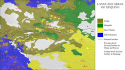
The languages of Xinjiang Uygur Autonomous RegionUyghur girl in KashgarCounty-level ethnicity map of Xinjiang as of 2018
Some Uyghur scholars claim descent from both the Turkic Uyghurs and the pre-Turkic Tocharians (or Tokharians, whose language was Indo-European); also, Uyghurs often have relatively-fair skin, hair and eyes and other Caucasoid physical traits.
In 2002, there were 9,632,600 males (growth rate of 1.0 percent) and 9,419,300 females (growth rate of 2.2 percent). The population overall growth rate was 1.09 percent, with 1.63 percent of birth rate and 0.54 percent mortality rate.
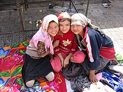
Three Uyghur girls at a Sunday market in the oasis city Khotan
The Qing began a process of settling Han, Hui, and Uyghur settlers into Northern Xinjiang (Dzungaria) in the 18th century. At the start of the 19th century, 40 years after the Qing reconquest, there were around 155,000 Han and Hui Chinese in northern Xinjiang and somewhat more than twice that number of Uyghurs in Southern Xinjiang.[244] A census of Xinjiang under Qing rule in the early 19th century tabulated ethnic shares of the population as 30 percent Han and 60 percent Turkic and it dramatically shifted to 6 percent Han and 75 percent Uyghur in the 1953 census. However, a situation similar to the Qing era's demographics with a large number of Han had been restored by 2000, with 40.57 percent Han and 45.21 percent Uyghur.[245] Professor Stanley W. Toops noted that today's demographic situation is similar to that of the early Qing period in Xinjiang.[246] Before 1831, only a few hundred Chinese merchants lived in Southern Xinjiang oases (Tarim Basin), and only a few Uyghurs lived in Northern Xinjiang (Dzungaria).[247]
After 1831, the Qing encouraged Han Chinese migration into the Tarim Basin, in southern Xinjiang, but with very little success, and permanent troops were stationed on the land there as well.[248] Political killings and expulsions of non-Uyghur populations during the uprisings in the 1860s[248] and the 1930s saw them experience a sharp decline as a percentage of the total population[249] though they rose once again in the periods of stability from 1880, which saw Xinjiang increase its population from 1.2 million,[250][251] to 1949. From a low of 7 percent in 1953, the Han began to return to Xinjiang between then and 1964, where they comprised 33 percent of the population (54 percent Uyghur), like in Qing times. A decade later, at the beginning of the reform and opening up in 1978, the demographic balance was 46 percent Uyghur and 40 percent Han,[245] which did not change drastically until the 2000 Census, when the Uyghur population had reduced to 42 percent.[252] In 2010, the population of Xinjiang was 45.84 percent Uyghur and 40.48 percent Han. The 2020 Census showed the share of the Uyghur population decline slightly to 44.96 percent, and the Han population rise to 42.24 percent[253][254]
Military personnel are not counted and national minorities are undercounted in the Chinese census, as in some other censuses.[255] 3.6 million people reside in XPCC administered areas, around 14 percent of Xinjiang's population.[182] While some of the shift has been attributed to an increased Han presence,[18] Uyghurs have also emigrated to other parts of China, where their numbers have increased steadily. Uyghur independence activists express concern over the Han population changing the Uyghur character of the region though the Han and Hui Chinese mostly live in Northern Xinjiang Dzungaria and are separated from areas of historic Uyghur dominance south of the Tian Shan mountains (Southwestern Xinjiang), where Uyghurs account for about 90 percent of the population.[256]
In general, Uyghurs are the majority in Southwestern Xinjiang, including the prefectures of Kashgar, Khotan, Kizilsu and Aksu (about 80 percent of Xinjiang's Uyghurs live in those four prefectures) as well as Turpan Prefecture, in Eastern Xinjiang. The Han are the majority in Eastern and Northern Xinjiang (Dzungaria), including the cities of Ürümqi, Karamay, Shihezi and the prefectures of Changjyi, Bortala, Bayin'gholin, Ili (especially the cities of Kuitun) and Kumul. Kazakhs are mostly concentrated in Ili Prefecture in Northern Xinjiang. Kazakhs are the majority in the northernmost part of Xinjiang.
Largest cities in Xinjiang
Source: China Urban Construction Statistical Yearbook 2018 Urban Population and Urban Temporary Population[257]
Major ethnic groups in Xinjiang by region (2018 data)[I] P = Prefecture; AP = Autonomous prefecture; PLC = Prefecture-level city; DACLC = Directly administered county-level city.[259]
The major religions in Xinjiang are Islam, practiced largely by Uyghurs and the Hui Chinese minority, as well as Chinese folk religions, Confucianism, Taoism and Buddhism, practiced essentially by the Han Chinese. Christianity in Xinjiang is practiced by 1 percent of the population according to the Chinese General Social Survey of 2009.[262] According to a demographic analysis of the year 2010, Muslims formed 58 percent of the province's population.[263] In 1950, there were 29,000 mosques and 54,000 imams in Xinjiang, which fell to 14,000 mosques and 29,000 imams by 1966. Following the Cultural Revolution, there were only about 1,400 remaining mosques. By the mid-1980's, the number of mosques had returned to 1950 levels.[264] According to a 2020 report by the Australian Strategic Policy Institute, since 2017, Chinese authorities have destroyed or damaged 16,000 mosques in Xinjiang – 65 percent of the region's total.[265][266]
According to a DeWereldMorgen report in March 2024, there are more than 100 Islamic associations in Xinjiang where imams have lessons in theology, Arabic and Mandarin.[198] A majority of the Uyghur Muslims adhere to Sunni Islam of the Hanafi school of jurisprudence or madhab.[citation needed] A minority of Shias, almost exclusively of the Nizari Ismaili (Seveners) rites are located in the higher mountains of Tajik and Tian Shan. In the western mountains (the Tajiks), almost the entire population of Tajiks (Sarikolis and Wakhis), are Nizari Ismaili Shia.[18] In the north, in the Tian Shan, the Kazakhs and Kyrgyz are Sunni.
In 2008, according to the Xinjiang Transportation Network Plan, the government has focused construction on State Road 314, Alar-Hotan Desert Highway, State Road 218, Qingshui River Line-Yining Highway and State Road 217, as well as other roads.
The construction of the first expressway in the mountainous area of Xinjiang began a new stage in its construction on 24 July 2007. The 56km (35mi) highway linking Sayram Lake and Guozi Valley in Northern Xinjiang area had cost 2.39 billion yuan. The expressway is designed to improve the speed of national highway 312 in northern Xinjiang. The project started in August 2006 and several stages have been fully operational since March 2007. Over 3,000 construction workers have been involved. The 700 m-long Guozi Valley Cable Bridge over the expressway is now currently being constructed, with the 24 main pile foundations already completed. Highway 312 national highway Xinjiang section, connects Xinjiang with China's east coast, Central and West Asia, plus some parts of Europe. It is a key factor in Xinjiang's economic development. The population it covers is around 40 percent of the overall in Xinjiang, who contribute half of the GDP in the area.
Zulfiya Abdiqadir, head of the Transport Department was quoted as saying that 24,800,000,000 RMB had been invested into Xinjiang's road network in 2010 alone and, by this time, the roads covered approximately 152,000km (94,000mi).[272]
The Ürümqi–Dzungaria railway connects Ürümqi with coal fields in the eastern Junggar Basin. The Hami–Lop Nur railway connects Hami with potassium salt mines in and around Lop Nur. The Golmud–Korla railway, opened in 2020, provides an outlet to Qinghai. Planning is underway on additional intercity railways.[273] Railways to Pakistan and Kyrgyzstan have been proposed.[citation needed]
↑There is no official orthography for Sarikoli in China. This is the spelling used in the Sarikoli-Chinese dictionary written by linguist Gao Erqiang.[29]
126-1 自然资源划[6-1 Natural Resources] (in Chinese). Statistics Bureau of Xinjiang. Archived from the original on 22 December 2015. Retrieved 19 December 2015.
↑"新疆的历史与发展". www.gov.cn. Archived from the original on 28 May 2023. Retrieved 20 March 2023.
↑"新疆维吾尔自治区政府网(En)". The Government of Xinjiang Uygur Autonomous Region of China. Archived from the original on 7 December 2020. Retrieved 18 August 2020.
↑"EXCAVATIONS iv. In Chinese Turkestan". Encyclopædia Iranica. Retrieved 24 September 2020. In contemporary geographic terminology, Chinese Turkestan refers to Xinjiang (Sinkiang), the Uighur Autonomous Region of the People's Republic of China.
↑Sheila Hollihan-Elliot (2006). Muslims in China. Mason Crest Publishers. p.55. ISBN1-59084-880-2. For most of their history, the Uyghurs lived as tribes in a loosely affiliated nation on the northern Chinese border (sometimes called East Turkestan).
↑William Samolin (1964). East Turkistan to the Twelfth Century. The Hague: Mouton & Co. p.9. The general boundaries of East Turkistan are the Altai range on the northeast, Mongolia on the east, the Kansu corridor or the Su-lo-ho basin on the southeast, the K'un-lun system on the south, the Sarygol and Muztay-ata on the west, the main range of the T'ien-shan system on the north to the approximate longitude of Aqsu (80 deg. E), then generally northeast to the Altai system which the boundary joins in the vicinity of the Khrebët Nalinsk and Khrebët Sailjuginsk.
12Justin M. Jacobs (14 August 2019). "Episode 39: Ethnicity, Tibet, and Xinjiang in the PRC". podcasts.apple.com (Podcast). Beyond Huaxia: A College History of China and Japan. Event occurs at 60:00–62:18. Retrieved 19 March 2022.
↑"贵州通志 (四库全书本)/全览1". wikisource (in Simplified Chinese). Retrieved 31 October 2021.
↑Wang, Wenjun; Ding, Manyu; Gardner, Jacob D.; Wang, Yongqiang; Miao, Bo; Guo, Wu; Wu, Xinhua; Ruan, Qiurong; Yu, Jianjun; Hu, Xingjun; Wang, Bo (March 2021). "Ancient Xinjiang mitogenomes reveal intense admixture with high genetic diversity". Science Advances. 7 (14) eabd6690. Bibcode:2021SciA....7.6690W. doi:10.1126/sciadv.abd6690. PMC8011967. PMID33789892. In the Iron Age, in general, Steppe-related and northeastern Asian admixture intensified, with North and East Xinjiang populations showing more affinity with northeastern Asians and South Xinjiang populations showing more affinity with Central Asians. The genetic structure observed in the Historical Era of Xinjiang is similar to that in the Iron Age, demonstrating genetic continuity since the Iron Age with some additional genetic admixture with populations surrounding the Xinjiang region.
↑Betts, Allison (2019). The Cultures of Ancient Xinjiang, western China: Crossroads of the Silk Roads. Summertown, Oxford: Archaeopress. p.50. ISBN978-1-78969-407-9. "The first settlers had European paternal lineages, and maternal lineages of European and Siberian origin." [...] "a pattern that continued in to Xiaohe Phase II, in layers 3, 2 and 1, where the genes show greater mixing still (Li, et al. 2015). The origin of the mitochondrial lineages is more widespread, with the presence of west Eurasian, east Eurasian and Indian lineages." [...] "This may account for the marked genetic change over time in the Xiaohe population (Li 2010, Li, et al. 2010, Li et al. 2015)." The later Xiaohe people carried diverse east Eurasian maternal lineages, including a dominance of C4 and C5, generally linked to southern Siberia."
↑Betts 2019, p.50"This may account for the marked genetic change over time in the Xiaohe population (Li 2010, Li, et al. 2010, Li et al. 2015)." The later Xiaohe people carried diverse east Eurasian maternal lineages, including a dominance of C4 and C5, generally linked to southern Siberia."
↑Schurr, Theodore (2015). Globalization. Philadelphia: University of Pennsylvania Museum of Archaeology and Anthropology. ISBN978-1-934536-78-0. "In this regard, genetic data have recently been discovered from individuals interred in the Xiaohe cemetery from the Tarim Basin. Interestingly, they were shown to have both East Eurasian and West Eurasian mtDNA lineages, but only West Eurasian NRY lineages (Li et al. 2010)."
↑Zhang, Fan; Ning, Chao; Scott, Ashley; Fu, Qiaomei; Bjørn, Rasmus; Li, Wenying; Wei, Dong; Wang, Wenjun; Fan, Linyuan; Abuduresule, Idilisi; Hu, Xingjun (November 2021). "The genomic origins of the Bronze Age Tarim Basin mummies". Nature. 599 (7884): 256–261. Bibcode:2021Natur.599..256Z. doi:10.1038/s41586-021-04052-7. ISSN1476-4687. PMC8580821. PMID34707286. Using qpAdm, we modelled the Tarim Basin individuals as a mixture of two ancient autochthonous Asian genetic groups: the ANE, represented by an Upper Palaeolithic individual from the Afontova Gora site in the upper Yenisei River region of Siberia (AG3) (about 72%), and ancient Northeast Asians, represented by Baikal_EBA (about 28%) (Supplementary Data 1E and Fig. 3a). Tarim_EMBA2 from Beifang can also be modelled as a mixture of Tarim_EMBA1 (about 89%) and Baikal_EBA (about 11%).
↑Benjamin, Craig (3 May 2018). Empires of Ancient Eurasia: The First Silk Roads Era, 100 BCE – 250 CE. Cambridge University Press. p.45. ISBN978-1-108-63540-0. "... the fact that in cemeteries such as Yanbulaq both Europoid and Mongoloid mummies have been found together, also indicates some degree of interaction between existing farming populations and newly arrived nomadic migrants from the West."
↑Tremblay, Xavier (2007). "The Spread of Buddhism in Serindia: Buddhism Among Iranians, Tocharians and Turks before the 13th Century". In Ann Heirman & Stephan Peter Bumbacker (eds.). The Spread of Buddhism. Leiden & Boston: Koninklijke Brill. p.77. ISBN978-90-04-15830-6.
↑C. Michael Hogan (2007). "Silk Road, North China". The Megalithic Portal. Archived from the original on 2 October 2013. Retrieved 26 November 2008.
12345Sun, Yi (2024). "Necessitated by Geopolitics: China's Economic and Cultural Initiatives in Central Asia". In Fang, Qiang; Li, Xiaobing (eds.). China under Xi Jinping: A New Assessment. Leiden University Press. ISBN9789087284411.
↑Ebrey, Patricia Buckley (2010). The Cambridge Illustrated History of China. Cambridge University Press. p.111. ISBN978-0-521-12433-1.
↑Twitchett, Denis; Wechsler, Howard J. (1979). "Kao-tsung (reign 649-83) and the Empress Wu: The Inheritor and the Usurper". In Denis Twitchett; John Fairbank (eds.). The Cambridge History of China, Volume 3: Sui and T'ang China Part I. Cambridge University Press. p.228. ISBN978-0-521-21446-9.
↑Skaff, Jonathan Karem (2009). Nicola Di Cosmo (ed.). Military Culture in Imperial China. Harvard University Press. pp.183–185. ISBN978-0-674-03109-8.
↑Haines, R Spencer (2016). "The Physical Remains of the Zunghar Legacy in Central Eurasia: Some Notes from the Field". Paper Presented at the Social and Environmental Changes on the Mongolian Plateau Workshop, Canberra, ACT, Australia. The Australian National University.
↑Hamilton Alexander Rosskeen Gibb; Bernard Lewis; Johannes Hendrik Kramers; Charles Pellat; Joseph Schacht (1998). The Encyclopaedia of Islam. Brill. p.677. Archived from the original on 1 January 2016. Retrieved 10 July 2015.
↑Adle (2003), p.203, "By the autumn of 1759, the entire periphery of the Tarim basin had been pacified".
↑从 斌静案 看清代驻疆官员与新疆的稳定[Viewing the Stability of Xinjiang Officials and Xinjiang in the Case of Bin Jing] (in Chinese). Archived from the original on 20 April 2016. Retrieved 16 April 2011.
↑Gunaratna, Rohan; Pereire, Kenneth George (2006). "An al-Qaeda associate group operating in China?"(PDF). China and Eurasia Forum Quarterly. 4 (2): 59. Archived from the original(PDF) on 6 January 2011. Since the Ghulja Incident, numerous attacks including attacks on buses, clashes between ETIM militants and Chinese security forces, assassination attempts, attempts to attack Chinese key installations and government buildings have taken place, though many cases go unreported.
↑ONG HAN SEAN (20 November 2023). "China's Xinjiang: A marvel of wild beauty and a land full of culture and charm". The Star. Archived from the original on 20 November 2023. Our visit came on the heels of Chinese President Xi Jinping's visit to Ürümqi, where he reportedly stressed on the positive promotion of the region to show an open and confident Xinjiang. Xi also called for Xinjiang to be opened more widely for tourism to encourage visits from domestic and foreign tourists.
↑"China: How is Beijing whitewashing its Xinjiang policy?". Deutsche Welle. 11 September 2023. Retrieved 7 March 2024. But amid growing global attention on Xinjiang, China has been eager to portray the region as a "success story" by welcoming more tourists. In a speech that he made while visiting the region last month, Xi said Xinjiang was "no longer a remote area" and should open up more to domestic and foreign tourism.
↑"中国统计年鉴—2018". Archived from the original on 6 January 2019. Retrieved 28 January 2019.
↑Ministry of Civil Affairs. 2014年12月中华人民共和国县以上行政区划代码[Administrative code of the county or above in the People's Republic of China in December 2014] (in Simplified Chinese). Archived from the original on 2 April 2015. Retrieved 12 December 2015.
↑(in Chinese)Shenzhen Bureau of Statistics. 深圳统计年鉴2014[Shenzhen Statistical Yearbook 2014] (in Simplified Chinese). China Statistics Print. Archived from the original on 12 May 2015. Retrieved 29 May 2015.
↑国务院人口普查办公室 [Department of Population Census of the State Council]; 国家统计局人口和就业统计司编 [Department of Population and Employment Statistics, National Bureau of Statistics] (2012). 中国2010年人口普查分乡, 镇, 街道资料[China 2010 Census by Country, Town, Street Information] (in Chinese). Beijing: Z Hongguo Statistics Press. ISBN978-7-5037-6660-2. OCLC992517929.
↑"新疆维吾尔自治区第七次全国人口普查主要数据". Statistical Bureau of the Xinjiang Uygur Autonomous Region. 14 June 2021. Retrieved 22 June 2023.
↑Gorbunov, A.P. (1993), "Geocryology in Mt. Tianshan", PERMAFROST: Sixth International Conference. Proceedings. July 5–9, Beijing, China, vol.2, South China University of Technology Press, pp.1105–1107, ISBN978-7-5623-0484-5
↑Wang, Huan. "告诉你一个完整的中央新疆工作协调小组"[Tell you about the Central Xinjiang Work Coordination Group]. The Paper. Archived from the original on 19 May 2025. Retrieved 12 July 2025.
123Zhao, Huasheng (2016). "Central Asia in Chinese Strategic Thinking". The new great game: China and South and Central Asia in the era of reform. Thomas Fingar. Stanford, California: Stanford University Press. p.180. ISBN978-0-8047-9764-1. OCLC939553543.
↑12–13 主要年份农作物播种面积[12–13 Sown Area of Crops in Major Years] (in Simplified Chinese). Statistics Bureau of Xinjiang. Archived from the original on 2 January 2018. Retrieved 2 January 2018.
↑新疆维吾尔自治区2016年国民经济和社会发展统计公报[Statistical Communique of 2016 National Economic and Social Development of Xinjiang Uygur Autonomous Region] (in Simplified Chinese). Xinjiang Uygur Autonomous Region People's Government. 17 April 2017. Archived from the original on 9 June 2017. Retrieved 17 April 2017.
↑Zhao, Huasheng (2016). "Central Asia in Chinese Strategic Thinking". The new great game: China and South and Central Asia in the era of reform. Thomas Fingar. Stanford, California: Stanford University Press. p.179. ISBN978-0-8047-9764-1. OCLC939553543.
↑新疆互联网业务全面恢复[Xinjiang internet service completely restored]. Tianshan Net (in Simplified Chinese). 14 May 2010. Archived from the original on 30 September 2011. Retrieved 14 May 2010.
↑新疆"7-5"事件后全面恢复互联网业务[After the '5 July' riots, Xinjiang completely restores Internet service]. news.163.com (in Simplified Chinese). 14 May 2010. Archived from the original on 16 May 2010. Retrieved 14 May 2010.
↑Mallory, J. P.; Mair, Victor H. (2000). The Tarim Mummies: Ancient China and the Mystery of the Earliest Peoples from the West. London: Thames & Hudson. p.237.
↑2000年人口普查中国民族人口资料[Tabulation on Nationalities of 2000 Population Census of China] (in Chinese). Beijing: Nationalities Publishing House. 2003. ISBN978-7-105-05425-1. OCLC54494505.
↑3–7 各地、州、市、县(市)分民族人口数[3–7 Prefectural, Municipal, and County-level Population by Ethnicity] (in Chinese). Statistic Bureau of Xinjiang Uygur Autonomous Region. 10 June 2020. Archived from the original on 1 November 2020. Retrieved 11 October 2021.
↑Min Junqing. The Present Situation and Characteristics of Contemporary Islam in China. JISMOR, 8. 2010 Islam by province, page 29Archived 27 April 2017 at the Wayback Machine . Data from Yang Zongde, Study on Current Muslim Population in China, Jinan Muslim, 2, 2010.
↑Titu Datta Gupta (17 August 2023). "Tourism, ethnic unity in focus as Xinjiang journeys to new era". The Business Standard. Bangladesh. Retrieved 12 March 2024. In Awat county near Aksu, a huge park, with a statue of 13th century Turkish philosopher Nasiruddin Hodza at the entrance, preserves the tradition of Daolang tribe and their forest of Euphrates poplar, known locally as king of desert.
↑Su Qingxia (苏清霞), ed. (3 March 2011). "祖丽菲娅·阿不都卡德尔代表:见证新疆交通事业的日益腾飞"[Representative Zulfiya Abdiqadir: evidence that Xinjiang's transport projects are developing more with each passing day]. Tianshannet (in Simplified Chinese). Archived from the original on 24 February 2017. Retrieved 24 February 2017.
↑"新疆将重点规划城际铁路 4小时经济圈已形成"[Xinjiang will focus on planning the formation of a four-hour economic circle for intercity railways]. news.hebei.cm (in Chinese). Archived from the original on 23 September 2021. Retrieved 9 February 2021.
Sources
Adle, Chahryar, ed. (2003). History of civilizations of Central Asia. 5: Development in contrast: from the sixteenth to the mid-nineteenth century. Paris: UNESCO Publishing. ISBN978-9-231-03876-1.
Harvard Asia Quarterly. Vol.9. Harvard Asia Law Society, Harvard Asia Business Club, and Asia at the Graduate School of Design. 2005.
Association for Linguistic Typology (1998). Linguistic Typology. Vol.2. Mouton de Gruyter.
"Contents". Journal of the North-China Branch of the Royal Asiatic Society. New Series. X. Shanghai: Printed at the "Celestial Empire" Office 10-Hankow Road-10. 1876. (Another online copy)
Hill, John E. (2009). Through the Jade Gate to Rome: A Study of the Silk Routes during the Later Han Dynasty, 1st to 2nd centuries CE. Charleston, South Carolina: BookSurge. ISBN978-1-4392-2134-1.
Levene, Mark (2008). "Empires, Native Peoples, and Genocides". In Moses, A. Dirk (ed.). Empire, Colony, Genocide: Conquest, Occupation, and Subaltern Resistance in World History. Oxford and New York: Berghahn. pp.183–204. ISBN978-1-84545-452-4.
Perdue, Peter C. (October 1996), "Military Mobilization in Seventeenth and Eighteenth-Century China, Russia, and Mongolia", Modern Asian Studies, 30 (4 Special Issue: War in Modern China): 757–793, doi:10.1017/s0026749x00016796, JSTOR312949, S2CID146587527
Sinor, Denis (ed.). Aspects of Altaic Civilization III: Proceedings of the Thirtieth Meeting of the Permanent International Altaistic Conference, Indiana University, Bloomington, Indiana, June 19–25, 1987. Vol.3.
Zhao, Gang (2006). "Reinventing China Imperial Qing Ideology and the Rise of Modern Chinese National Identity in the Early Twentieth Century". Modern China. 32 (1): 3–30. doi:10.1177/0097700405282349. JSTOR20062627. S2CID144587815.
Hierman, Brent. "The Pacification of Xinjiang: Uighur Protest and the Chinese State, 1988–2002." Problems of Post-Communism, May/June 2007, Vol. 54 Issue 3, pp.48–62.
This page is based on this Wikipedia article Text is available under the CC BY-SA 4.0 license; additional terms may apply. Images, videos and audio are available under their respective licenses.