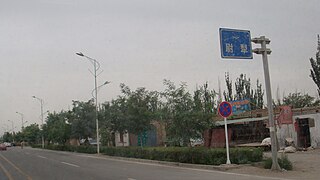
Qira County Chira, Cele, Ts'e-le | |
---|---|
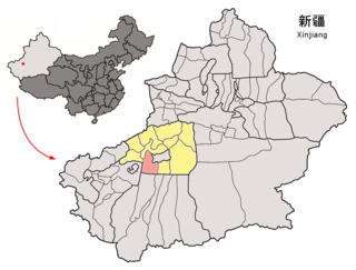
![]() Location of the county in Hotan Prefecture (yellow) and Xinjiang | |
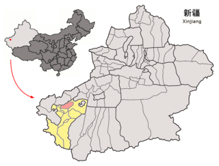
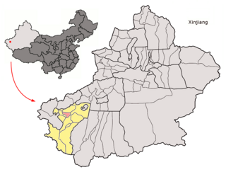
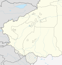
Coordinates: 37°00′N80°48′E / 37.000°N 80.800°E | |
Country | China |
Autonomous region | Xinjiang |
Prefecture | Hotan |
County seat | Qira Town |
Township-level divisions | 2 towns, 6 townships |
Area | |
• Total | 31,688.01 km2 (12,234.81 sq mi) |
Elevation | 1,500−7,282 m (4,900−23,981 ft) |
Population (2020) [4] | |
• Total | 157,792 |
• Density | 5.0/km2 (13/sq mi) |
Ethnic groups | |
• Major ethnic groups | Uyghur [1] [5] |
Time zone | UTC+8 (China Standard [a] ) |
Postal code | 848300 |
Website | xjcl |
"When I woke up one morning, I found I couldn't open the door because of the weight of sand that had accumulated overnight. My crops were buried too, so I had no choice but to move" -Memet Simay, area resident [8]
In 1983, the Qira research station of the Chinese Academy of Sciences was founded to combat drift sand. [9] A transitional zone was established with help from the scientists at the station, and the sands were pushed back over 5 kilometres (3.1 mi). [14] [ better source needed ]
In 2005, a small 1,500 year-old Buddhist temple was discovered 7 km (4.3 mi) from Damiku (Damagou). [15]
On October 20, 2014, Damiku (Damagou) was changed from a township to a town. [2]
On January 7, 2016, areas near Nur, Bostan and Ulughsay townships in Qira County were made part of the newly created Kunyu. [16] [17]
On February 28, 2017, it was announced by the county government that those who reported others for stitching the 'star and crescent moon' insignia on their clothing or personal items or having the words 'East Turkestan' on their mobile phone case, purse or other jewelry, would be eligible for cash payments. [18]
In March 2017, Salamet Memetimin, the Communist Party secretary for Chaka township's Bekchan village and ethnic Uyghur, was relieved of her duties for taking her nikah marriage vows at her home. According to the Hotan Daily, 97 officials were charged with disciplinary violations at this time. [19]
In 2018, local government authorities in the county expected to have almost 12,000 detainees in vocational camps and detention centres and some projects related to the centres outstripped budgetary limits. [20]
According to the Chinese Government, by the end of 2018, construction of Jinnan New Village ( 津南 新村 ) in Qira Town (Cele) was completed. [21] To increase aid delivery to Xinjiang, places in Xinjiang are paired with other areas of China which can provide aid. Tianjin and Hotan are paired in this program. Through assistance from the Tianjin government, a standard football field and training center was constructed at the No. 1 Primary School in the county. [22]
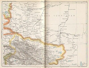
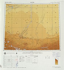
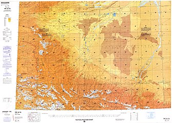
The northern part of Qira County is made up of sand dunes [10] and ends in a straight line drawn in the Taklamakan Desert that forms part of the boundary between Hotan Prefecture and Aksu Prefecture. The area is between 1,500 m (4,900 ft) and 1,800 m (5,900 ft) above sea level. [1]
Oasis areas occupy 2.9% of the total area of the county. [1] The oasis areas along China National Highway 315 include the Qira County county seat area, Gulahma and Damiku. Qaka, Ulughsay, Nur, Bostan and Kunyu's small exclaves in Qira County are located close to the Kunlun Mountains.
The southern part of Qira County is mountainous with an average elevation of 3,200 m (10,500 ft) above sea level. [1] The upper reaches of the White Jade River (Yurung Kash), which provide water for Hotan (Khotan), are found in the Kunlun Mountains [1] of southern Qira County. [23] Mountain passes in the area include Mandar Kol Dawan, Shalgon Dawan, Kuchkash Bulak Dawan, and Art Dawan. [23] One of the prominent mountains in the county is Muztag [3] [24] (K5, [25] Wu-lu-ko Ho Shan, [10] Mo-shih Shan, [10] Mu-shih Shan, [26] Muztagh Jilga; [23] 慕士山, [27] 木斯山 [28] ) which is 7,282 m (23,891 ft) above sea level. [3] The meltwater from this mountain creates the Qira River (Cele River, Ts'e-lo Ho; [10] 策勒河 [29] ) which flows through Qaka into the Qira county seat. [10]
In the mid-20th century, camping grounds in the sparsely populated southern mountainous area of the county included Chotma, Yangi kan, Zaiuk, Yaskako Tagh, Mandar Chap, and Chumik. [23]
Qira County | |||||||||||
---|---|---|---|---|---|---|---|---|---|---|---|
Uyghur name | |||||||||||
Uyghur | چىرا ناھىيىسى | ||||||||||
| |||||||||||
Chinese name | |||||||||||
Simplified Chinese | 策勒 县 | ||||||||||
Traditional Chinese | 策勒 縣 | ||||||||||
|
Qira County [3] [6] (Uyghur:چىراناھىيىسى),alternatively Chira or Cele (from Mandarin Chinese),is a county in Hotan Prefecture,Xinjiang Uyghur Autonomous Region,China. Almost all the residents of the county are Uyghurs and live around oases situated between the desolate Taklamakan Desert and Kunlun Mountains. [5] The county is bordered to the north by Aksu Prefecture,to the east by Yutian / Keriya County,to the northwest by Lop County,to the southwest by Hotan County including the China-India disputed Aksai Chin area and to the south by Rutog County,Ngari Prefecture in Tibet. [7]
The sixth century Dandan Oilik oasis town archaeological site where Buddhist shrines and texts were discovered is located in the desert of northern Qira (Chira) County.
Qira town (Chira),the town that is the current county seat of Qira County,has been forced to change locations on three occasions due to encroachment by the sands of the Taklamakan Desert. [1] [8] [9]
In his 1900-01 expedition in the region,Aurel Stein travelled across the northern section of today's Qira County,a section of the Taklamakan Desert between today's Lop County and the Keriya River. There were several wells along the course he took. [10]
Qira County was divided from Yutian / Keriya County in 1928/9. [11] [12]
In the thirty years between the 1950s and 1980s,a significant area of farmland near the county seat was taken into the desert by blown sand. [13]
Since the founding of Xinjiang Autonomous Region in 1955,Qira County has been part of Hotan Prefecture. [11]
In the 1980s,446 households living in the county seat were forced to relocate due to the effects of desertification which had brought the Taklamakan Desert within 1.5 kilometres (0.93 mi) km of their homes,sometimes burying homes in sand overnight. [8]
Climate data for Qira, elevation 1,337 m (4,386 ft), (1991–2020 normals, extremes 1981–2010) | |||||||||||||
---|---|---|---|---|---|---|---|---|---|---|---|---|---|
Month | Jan | Feb | Mar | Apr | May | Jun | Jul | Aug | Sep | Oct | Nov | Dec | Year |
Record high °C (°F) | 20.0 (68.0) | 23.7 (74.7) | 32.3 (90.1) | 36.9 (98.4) | 38.0 (100.4) | 40.5 (104.9) | 42.0 (107.6) | 40.9 (105.6) | 36.8 (98.2) | 32.1 (89.8) | 25.1 (77.2) | 19.6 (67.3) | 42.0 (107.6) |
Mean daily maximum °C (°F) | 1.8 (35.2) | 8.0 (46.4) | 17.4 (63.3) | 25.0 (77.0) | 29.1 (84.4) | 32.1 (89.8) | 33.7 (92.7) | 32.5 (90.5) | 28.5 (83.3) | 21.8 (71.2) | 12.6 (54.7) | 3.9 (39.0) | 20.5 (69.0) |
Daily mean °C (°F) | −4.4 (24.1) | 1.5 (34.7) | 10.4 (50.7) | 17.4 (63.3) | 21.5 (70.7) | 24.7 (76.5) | 26.1 (79.0) | 24.9 (76.8) | 20.4 (68.7) | 12.6 (54.7) | 4.6 (40.3) | −2.5 (27.5) | 13.1 (55.6) |
Mean daily minimum °C (°F) | −9.5 (14.9) | −4.4 (24.1) | 3.6 (38.5) | 10.2 (50.4) | 14.5 (58.1) | 18.1 (64.6) | 19.8 (67.6) | 18.7 (65.7) | 13.5 (56.3) | 5.1 (41.2) | −1.6 (29.1) | −7.4 (18.7) | 6.7 (44.1) |
Record low °C (°F) | −21.8 (−7.2) | −20.7 (−5.3) | −9.3 (15.3) | −0.7 (30.7) | 2.6 (36.7) | 8.0 (46.4) | 11.5 (52.7) | 7.4 (45.3) | 1.9 (35.4) | −4.7 (23.5) | −13.7 (7.3) | −20.5 (−4.9) | −21.8 (−7.2) |
Average precipitation mm (inches) | 1.3 (0.05) | 1.5 (0.06) | 2.3 (0.09) | 4.8 (0.19) | 8.4 (0.33) | 10.5 (0.41) | 7.7 (0.30) | 3.7 (0.15) | 6.9 (0.27) | 0.5 (0.02) | 0.5 (0.02) | 0.7 (0.03) | 48.8 (1.92) |
Average precipitation days (≥ 0.1 mm) | 1.9 | 1.3 | 0.6 | 1.3 | 1.9 | 3.6 | 2.9 | 1.8 | 1.0 | 0.3 | 0.3 | 1.3 | 18.2 |
Average snowy days | 4.5 | 2.2 | 0.5 | 0 | 0 | 0 | 0 | 0 | 0 | 0 | 0.5 | 3.0 | 10.7 |
Average relative humidity (%) | 52 | 41 | 28 | 27 | 32 | 38 | 42 | 44 | 44 | 42 | 43 | 52 | 40 |
Mean monthly sunshine hours | 180.4 | 180.9 | 202.3 | 223.7 | 260.5 | 257.4 | 246.6 | 233.9 | 237.8 | 258.1 | 216.7 | 185.0 | 2,683.3 |
Percent possible sunshine | 58 | 58 | 54 | 56 | 59 | 59 | 56 | 57 | 65 | 76 | 72 | 62 | 61 |
Source: China Meteorological Administration [30] [31] |
Qira County includes two towns and six townships : [1] [2] [32]
Name | Simplified Chinese | Hanyu Pinyin | Uyghur (UEY) | Uyghur Latin (ULY) | Administrative division code | Notes | |
---|---|---|---|---|---|---|---|
Towns | |||||||
Qira Town [3] | 策勒镇 | Cèlè Zhèn | چىرا بازىرى | chira baziri | 653225100 | ||
Gulahma Town | 固拉合玛镇 | Gùlāhémǎ Zhèn | گۇلاخما بازىرى | gulaxma baziri | 653225102 | formerly Gulahma Township (固拉合玛乡) | |
Townships | |||||||
Qira Township | 策勒乡 | Cèlè Xiāng | چىرا يېزىسى | chira yëzisi | 653225200 | ||
Damiku Township (Dumuka [33] ) | 达玛沟乡 | Dámǎgōu Xiāng | دامىكۇ يېزىسى [34] | damiku yëzisi | 653225202 | ||
Qaka Township | 恰哈乡 | Qiàhā Xiāng | چاقا يېزىسى [35] | chaqa yëzisi | 653225203 | ||
Ulughsay Township | 乌鲁克萨依乡 | Wūlǔkèsàyī Xiāng | ئۇلۇغساي يېزىسى | Ulughsay yëzisi | 653225204 | ||
Nur Township | 奴尔乡 | Nú'ěr Xiāng | نۇرى يېزىسى | nuri yëzisi | 653225205 | ||
Bostan Township | 博斯坦乡 | Bósītǎn Xiāng | بوستان يېزىسى | bostan yëzisi | 653225206 | ||
Agricultural products of the county include wheat, corn, cotton, petroleum products, melons, pomegranates, walnuts, peaches, and apricots. Livestock raised in the county include horses, cows and sheep. Industry in the country includes electronics, construction, cotton ginning and food processing (fruits). [12]
Year | Pop. | ±% p.a. |
---|---|---|
2000 | 132,139 | — |
2010 | 147,050 | +1.07% |
2015 | 166,735 | +2.54% |
[2] [36] |
As of 2015, 163,705 of the 166,735 residents of the county were Uyghur, 2,921 were Han Chinese and 109 were from other ethnic groups. [36]
As of the 2010s, the population of Qira County was more than 98% Uyghur. [1]
As of 1999, 98.45% of the population of Qira (Cele) County was Uyghur and 1.51% of the population was Han Chinese. [37]
Artush is a county-level city and the capital of Kizilsu Kyrgyz Autonomous Prefecture in Xinjiang, China. The government seat is in Guangming Road Subdistrict. As of 2018, it has a population of 285,507 people, 81.4 per cent of whom are Uyghurs.
Awat County is a county in Aksu Prefecture, Xinjiang Uyghur Autonomous Region, China. Awat County is located on the southern foot of the Tian Shan mountain range and on the northern edge of the Taklamakan Desert.
Maralbexi County, Bachu County, and Chinese: 巴尔楚克县) the former long Chinese name as well, is located in the southwest of the Xinjiang Uyghur Autonomous Region, China. The county is under the administration of the Kashgar Prefecture. It has an area of 18,491 km2 (7,139 sq mi), and surrounds, but does not administer, the sub-prefecture-level city of Tumxuk. According to the 2002 census, it has a population of 380,000.
Payzawat County, also via SASM/GNC romanization as Payziwat County, and via Mandarin Chinese as Jiashi County is a county in Kashgar Prefecture, Xinjiang Uyghur Autonomous Region, China, on the western rim of the Taklamakan Desert. To the east, the county borders Maralbexi County, to the south Yopurga County.
Kargilik County, also known as Yecheng County, is a county in southwest of the Xinjiang Uyghur Autonomous Region and is under the administration of the Kashgar Prefecture. It contains an area of 28,600 km2. To the north, the county borders Makit County. To the east, the county borders Guma County (Pishan) in Hotan Prefecture. To the west, the county borders Yarkant County, Poskam County and Taxkorgan Tajik Autonomous County. In the south, the county has a border of more than 80 km (50 mi) with Pakistan and India administered areas of Kashmir.
Yopurga County is a county in northern Kashgar Prefecture, Xinjiang Uyghur Autonomous Region. More than 96% of the residents of the county are Uyghurs and live around oases at the western edge of the desolate Taklamakan Desert. The county is bordered to the north by Jiashi County, to the east by Maralbexi County, to the west by Shule County, to the southwest by Yengisar County and to the south by Yarkant County.
Makit County is a county in Kashgar Prefecture, Xinjiang Uyghur Autonomous Region, China. It contains an area of 10,927 km2 (4,219 sq mi). The Yarkand River passes through the county. The county is bordered to the north by Maralbexi County, to the east by Guma County (Pishan) in Hotan Prefecture, to the west by Yarkant County, and to the south by Kargilik County.
Yengisar County, also known as Yingjisha County, is a county of Kashgar Prefecture in southwest Xinjiang, China. It covers an area of 3,373 km2 (1,302 sq mi). As of the 2002 census, it had a population of 230,000.
Yuli County as the official Romanized name, also transliterated from Mongolian as Lopnur County, is a county in the Xinjiang Uyghur Autonomous Region and is under the administration of the Bayin'gholin Mongol Autonomous Prefecture. It contains an area of 59,399 km2 (22,934 sq mi). According to the 2002 census, it has a population of 100,000.
Qiemo County as the official romanized name, also transliterated from Uyghur as Qarqan County, is a county under the administration of the Bayin'gholin Mongol Autonomous Prefecture in the Xinjiang Uyghur Autonomous Region of the People's Republic of China, bordering the Tibet Autonomous Region to the south. Its area is 138,645 square kilometers (53,531 sq mi) and, according to the 2002 census, it has a population of 60,000. The county seat is at Qiemo Town.
Ruoqiang County as the official romanized name, also transliterated from Uyghur as Qakilik County, is a county in the Xinjiang Uyghur Autonomous Region, China under the administration of the Bayingolin Mongol Autonomous Prefecture. It covers an area of 198,318 square kilometres (76,571 sq mi), making it the largest county-level division in the country.
Karakax County, alternatively Moyu County, also transliterated from Uyghur as Qaraqash County, alternately Qaraqash, is a county in the Xinjiang Uyghur Autonomous Region and is located in the southern edge of the Tarim Basin, it is under the administration of the Hotan Prefecture. It contains an area of 25,667 km2 (9,910 sq mi). According to the 2011 census it has a population of 577,000 and 98,1% are Uyghurs. The county is bordered to the north by Awat County in Aksu Prefecture, to the northeast by Lop County, to the southeast by Hotan County, to the northwest by Maralbexi County in Kashgar Prefecture, and to the southwest by Pishan County and Kunyu. Exclaves of Kunyu are located within the county.
Niya County, also from Mandarin Chinese as Minfeng County, is a county within the Xinjiang Uyghur Autonomous Region and is under the administration of the Hotan Prefecture. It contains an area of 56,726 km2 (21,902 sq mi). According to the 2002 census, it has a population of 30,000. The county is bordered to the north by Xayar County, to the east by Qiemo/Qarqan County, to the west by Yutian / Keriya County and to the south by Ngari Prefecture in Tibet.
Yutian County, also transliterated from Uyghur as Keriya County, is a county in Hotan Prefecture, Xinjiang Uyghur Autonomous Region, China. It is based at the Keriya Town, and is separate from Hotan County, which is another county in the same prefecture. The Yutian County has an area of 39,023 km2 (15,067 sq mi). According to the 2002 census, it has a population of 220,000. The county is bounded on the north by Aksu Prefecture, on the east by Minfeng/Niya County, on the west by Qira County and on the south by the Rutog and Gertse counties of the Tibet Autonomous Region.
Lop County, also Luopu, is a county in Hotan Prefecture, in the southwest of the Xinjiang Uyghur Autonomous Region, China. Almost all the residents of the county are Uyghur and live around oases situated between the desolate Taklamakan Desert and Kunlun Mountains. The county is bordered to the north by Aksu and Awat County in Aksu Prefecture, to the east by Qira/Chira County, to the northwest by Karakax County, to the west by Hotan (Khotan) and to the south and west by Hotan County.
Hotan County is a county in the southwest of the Xinjiang Uyghur Autonomous Region and is under the administration of the Hotan Prefecture. Almost all the residents of the county are Uyghurs and live around oases situated between the desolate Taklamakan Desert and Kunlun Mountains. Hotan County is the southernmost county-level division of Xinjiang. The county borders Karakax/Moyu County to the northwest, Hotan City and Lop County to the northeast, Qira County to the east, Pishan County to the west, and Rutog County, Tibet to the southeast. Hotan County administers most of Aksai Chin, an area disputed between China and India. The Line of Actual Control divides the India-controlled part of Ladakh union territory from the Aksai Chin area administered as part of southwest Hotan County.
Shule County, also known as Yengisheher County or Yengixahar County, is a county of Kashgar Prefecture, in Xinjiang, China. It is located to the south of Kashgar. In ancient times, the Shule area was once the home to a Xiyu oasis civilisation, the Shule Kingdom.
Pishan County as the official romanized name, also transliterated from Uyghur as Guma County, is a county within the Xinjiang Uyghur Autonomous Region and is under the administration of the Hotan Prefecture. It contains an area of 39,412 km2 (15,217 sq mi). According to the 2002 census, it has a population of 220,000. The county borders Maralbexi County and Makit County to the north, Karakax County, Hotan County and Kunyu to the east and Kargilik County to the west. The county includes lands near the Karakoram Pass which are part of the Aksai Chin area that is disputed between China and India.
Jiya is a township in the northeastern part of Hotan City in Hotan Prefecture, Xinjiang, China in an oasis area on the eastern bank of the White Jade River in the southwestern part of the Taklamakan Desert. To the north and east, Jiya borders Lop County, the county which Jiya was a part of until 2006, and to the south and west, Jiya borders the rest of Hotan city.
Qaka is a township in Qira County, Hotan Prefecture, Xinjiang, China.
策勒县位于新疆最南端,南枕昆仑山、北临塔克拉玛干大沙漠,县域总面积3.16万平方公里。全县地势总体南高北低,山区平均海拔3200米,平原区海拔1500—1800米。{...}县境内可供人类生存的绿洲面积仅占2.9%,且被沙漠和戈壁分割包围成大小不等的72块,历史上策勒县城因风沙侵袭三次被迫搬迁。策勒县总人口16.8万人,维吾尔族占总人口的98%以上。全县辖6乡2镇1街道,
2000年第五次人口普查,策勒县常住总人口132139人,{...}2003年,全县总面积31688.01平方千米,{...}2010年第六次人口普查,策勒县常住总人口147050人,其中:策勒镇14562人,策勒乡31123人,固拉哈玛乡26621人,达玛沟乡19250人,恰哈乡15010人,乌鲁克萨依乡4587人,奴尔乡11581人,博斯坦乡6626人,色日克街道15684人,兵团一牧场2006人。 2014年10月20日,自治区政府(新政函[2014]177号)同意撤销固拉合玛乡,设立固拉合玛镇。调整后,全县辖2个镇、6个乡:策勒镇、固拉哈玛镇、策勒乡、达玛沟乡、恰哈乡、乌鲁克萨依乡、奴尔乡、博斯坦乡。
Qira{...}Muztag 7282m
和田地区辖县。位于昆仑山北麓、塔克拉玛干沙漠南缘。面积3.6万平方千米,人口12.6万,有维吾尔、汉、回、藏、壮等民族。其中维吾尔族占98.4%,辖1镇7乡。
Qira county was once a kingdom on the ancient Silk Road in the days of the Eastern Han Dynasty (AD 25-220). The county seat has relocated north three times because the sands have eaten up the cultivatable land. The first relocation occurred more than 2,000 years ago and the most recent about 620 years ago. In the 1980s, the county seat faced yet another relocation because the desert was only about 1.5 km away. Many locals were forced to move because their houses were buried under sand, often overnight.{...}Memet Simay's household was one of 446 in Qira township forced to relocate in the 1980s, although the family has since returned to the area. "When I woke up one morning, I found I couldn't open the door because of the weight of sand that had accumulated overnight. My crops were buried too, so I had no choice but to move," he recalled.
DUNES{...}STEIN 1900-01{...}WELL{...}Ts'e-lo Ho{...}WU-LU-KO HO SHAN (MO-SHIH SHAN)
民国17年(公元1928年)2月23日,中华民国政府批准将策勒县佐升格为策勒县治,同年,和阗行政长官制改为和田行政长官公署,策勒县隶属新疆省和阗行政长官公署管辖。中华人民共和国成立初,策勒县隶属新疆省和阗行政公署;1955年10月1日,新疆维吾尔自治区成立,策勒县隶属新疆维吾尔自治区和田地区。
1929年由于阗县(今于田县)析置。{...}农产有小麦、玉米、小麦、棉花、油料作物及甜瓜、石榴、核桃、桃、杏等。畜产以马、牛、羊为主。工业有电力、建材、轧花、食品加工(果脯)等。
In the 30 years from the 1950s to the 1980s, shifting sand had moved about 5 km in the village of Cele located on the margin of the Cele county oasis, so that 1.333 ha farmland was desertified.
The temple, dating back more than 1,500 years, was located about seven kilometres from the Damagou Township of Cele County.
辖4个农牧团场(皮山农场、一牧场、47团、224团),其中{...}一牧场驻策勒县、
A second announcement, issued Feb. 28 by the Chira (Cele) county government, said those who report individuals for having "stitched the 'star and crescent moon' insignia on their clothing or personal items" or the words "East Turkestan"—referring to the name of a short-lived Uyghur republic—on their mobile phone case, purse or other jewelry, were also eligible for cash payments.
In March, Xinjiang authorities fired an ethnic Uyghur official for holding her wedding ceremony at home according to Islamic traditions instead of at a government-sanctioned venue. Salamet Memetimin, the communist party secretary for Chaka township's Bekchan village, in Hotan (in Chinese, Hetian) prefecture's Chira (Cele) county, was among 97 officials recently charged with disciplinary violations, according to an April 10 report by the state-run Hotan Daily newspaper. Local residents said the woman was relieved of her duties for taking her "nikah" marriage vows in her own home. "I think this may be a local policy unique to Xinjiang," the source said. "You have to first apply for a marriage certificate and then carry out the Islamic practice of nikah." "The imams aren't allowed to perform nikah if there is no marriage certificate, or they will be sent to prison."
Some local governments are struggling to maintain this pace of spending. In neighbouring Cele county, where authorities expected to have almost 12,000 detainees in vocational camps and detention centres, a budget for 2018 says: "There are still many projects not included in the budget due to a lack of funds. The financial situation in 2018 is very severe."
653225100210 220 津南新村村委会
Memet Azizi, director of Cele County's bureau of education, said that Tianjin's help had brought them hope for the future. With support from Tianjin, a standard football field and training center was constructed at Cele County's No. 1 Primary School.
Muztagh Jilga{...}Yurung Kash{...}Chotma (Camping ground){...}Yangi kan (Camping ground){...}Zaiuk (Camping ground){...}Yaskako Tagh (Camping ground){...}Mandar Chap (Camping ground){...}Chumik (Camping ground){...}Mandar Kol Dawan{...}Shalgon Dawan{...}Kuchkash Bulak Dawan{...}Art Dawan
策勒{...}木斯山
卧龙谷位于新疆和田策勒县恰哈乡玉如克塔什村,在它的怀抱里,策勒河带着这里人的喜怒哀乐悠悠地流向远方。
统计用区划代码 名称 653225100000 策勒镇 653225101000 固拉合玛镇 653225200000 策勒乡 653225202000 达玛沟乡 653225203000 恰哈乡 653225204000 乌鲁克萨依乡 653225205000 奴尔乡 653225206000 博斯坦乡 653225500000 兵团一牧场
We tried in vain to hire camles at Chira, and so went eastward a few miles to Dumuka, a neighboring village, to try again.