Kuqa Kuchar, Kucha, Kuche | |
---|---|
Coordinates: 41°43′N82°58′E / 41.717°N 82.967°E | |
Country | China |
Autonomous region | Xinjiang |
Prefecture | Aksu |
Municipal seat | Yengisheher Subdistrict (Xincheng Subdistrict) |
Area | |
• Total | 15,200 km2 (5,900 sq mi) |
Elevation | 1,072 m (3,517 ft) |
Population (2020) [2] | |
• Total | 530,328 |
• Density | 35/km2 (90/sq mi) |
Ethnic groups | |
• Major ethnic groups | Uyghur [3] |
Time zone | UTC+8 (China Standard [lower-alpha 1] ) |
Postal code | 842000 |
Website | www |
Kuqa, Xinjiang | |||||||||||
---|---|---|---|---|---|---|---|---|---|---|---|
Uyghur name | |||||||||||
Uyghur | كۇچار شەھىرى | ||||||||||
| |||||||||||
Chinese name | |||||||||||
Simplified Chinese | 库车 | ||||||||||
Traditional Chinese | 庫車 | ||||||||||
| |||||||||||
Alternative Chinese name | |||||||||||
Simplified Chinese | 龟兹 | ||||||||||
Traditional Chinese | 龜茲 | ||||||||||
|
Kuqa [4] [5] is a county-level city in Aksu Prefecture,Xinjiang Uyghur Autonomous Region,China. Other names and variants of spelling of Kuqa are Kocha,Kuchu,Kuchar, [6] [7] Kuchi,Kuchel,K'u-ch'e-chen,K'u-ch'e-hsien,Kuga,Kucha and K'u-ch'e. [8] It was once the homeland of the ancient Buddhist Kingdom of Kucha.
According to the Book of Han (completed in 111 CE), Kucha was the largest of the "Thirty-six Kingdoms of the Western Regions", with a population of 81,317, including 21,076 persons able to bear arms. [9] : 156
In 630, Xuanzang, a well-known Chinese Buddhist monk, scholar, traveler and translator visited Kucha during the Early Tang period.
In the book "Hudud ul-'alam min al-mashriq ila al-maghrib", written in 982 by an unknown Arab or Persian writer, and presented to Abu'l Haret Muhammad, the ruler of Guzgan, the following is written regarding Kucha:
"Kucha is located on the Chinese border and belongs to China, but the indigenous people, Dokuzoguzes, at times are engaged in raids and looting. This city has many advantages."
Mirza Muhammad Haidar Dughlat, a military general, in his historical book Tarikh-i-Rashidi used the word "Kūsān" for Kucha.
Mahmud Kashgari, in his Compendium of Turkic Languages (Divân-ı Lügati't-Türk), wrote the following about Kucha: "It is one of the cities built by Zülqarnayin (Alexander the Macedonian).". [10] He also wrote that Kucha was a Uyghur town. [11]
In 1758, the Qing Dynasty took control of the area, and the Chinese character name 'Kuche' (庫車) was made the name of the area. [12]
In 1991, there was a bombing attack at a Kuqa County government office and at an XPCC unit. [13]
In an interview with Radio Free Asia , an officer at the Kuchar County Police Department reported that from June to December 2018, 150 people at the No. 1 Internment Camp in the Yengisher district of Kuchar county had died, corroborating earlier reports attributed to Himit Qari, former area police chief. [6] [7]
On December 20, 2019, Kuqa County was disestablished and Kuqa City was created. [14]
There were two convents in A-li (Avania).
Another monastery, Tsio-li, north of Kucha and a famous place where Kumārajīva's mother Jīva retreated.
Known as Po-Yen, a priest from the royal family who traveled to the Chinese capital Luoyang between 256 and 260 BC. He translated six Buddhist texts into Chinese within the year 258 BC.
Po-Po-Śrīmitra is another priest from Kuqa who traveled Southern China between 307 and 312 BC and translated three Buddhist texts.
A second Buddhist priest from Kuqa, known as Po-Yen, also went to Liangzhou (present-day Wuwei district in Gansu). Although not so well known in China, he translated many texts. [15]
The city is located at the southern periphery of the Tian Shan range, the northern portion of the Tarim Basin, and the centre of the autonomous region. It occupies part of the northeastern portion of Aksu Prefecture, bordering Xinhe County, Xayar County, and Luntai County, Heiing County, and Lopnur County in Bayingolin Mongol Autonomous Region.
Kuqa has a continental desert climate (Köppen BWk), with an average annual precipitation of 74.6 millimetres (2.94 in), a majority of which occurs in summer. The monthly 24-hour average temperature ranges from −7.2 °C (19.0 °F) in January to 25.3 °C (77.5 °F) in July, and the annual mean is 11.29 °C (52.3 °F). The frost-free period lasts for 266 days on average.[ citation needed ] With monthly percent possible sunshine ranging from 54% in March to 69% in September and October, sunshine is abundant and the city receives 2,712 hours of bright sunshine annually.
Climate data for Kuqa (1991–2020 normals) | |||||||||||||
---|---|---|---|---|---|---|---|---|---|---|---|---|---|
Month | Jan | Feb | Mar | Apr | May | Jun | Jul | Aug | Sep | Oct | Nov | Dec | Year |
Record high °C (°F) | 7.8 (46.0) | 14.3 (57.7) | 24.1 (75.4) | 33.2 (91.8) | 35.1 (95.2) | 38.2 (100.8) | 40.8 (105.4) | 39.5 (103.1) | 35.2 (95.4) | 28.5 (83.3) | 20.7 (69.3) | 9.2 (48.6) | 40.8 (105.4) |
Average high °C (°F) | −1.7 (28.9) | 5.3 (41.5) | 14.1 (57.4) | 22.2 (72.0) | 26.9 (80.4) | 30.5 (86.9) | 32.1 (89.8) | 30.9 (87.6) | 26.4 (79.5) | 19.4 (66.9) | 9.7 (49.5) | 0.2 (32.4) | 18.0 (64.4) |
Daily mean °C (°F) | −7.7 (18.1) | −0.9 (30.4) | 7.7 (45.9) | 15.4 (59.7) | 19.9 (67.8) | 23.4 (74.1) | 24.9 (76.8) | 23.7 (74.7) | 18.8 (65.8) | 10.9 (51.6) | 2.7 (36.9) | −5.5 (22.1) | 11.1 (52.0) |
Average low °C (°F) | −12.8 (9.0) | −6.3 (20.7) | 1.8 (35.2) | 8.9 (48.0) | 13.0 (55.4) | 16.4 (61.5) | 18.0 (64.4) | 16.9 (62.4) | 12.1 (53.8) | 4.4 (39.9) | −2.6 (27.3) | −9.9 (14.2) | 5.0 (41.0) |
Record low °C (°F) | −23.4 (−10.1) | −20.2 (−4.4) | −8.4 (16.9) | −2.0 (28.4) | 0.7 (33.3) | 7.5 (45.5) | 10.4 (50.7) | 7.6 (45.7) | 3.2 (37.8) | −3.1 (26.4) | −16.3 (2.7) | −22.3 (−8.1) | −23.4 (−10.1) |
Average precipitation mm (inches) | 2.6 (0.10) | 3.1 (0.12) | 1.6 (0.06) | 3.5 (0.14) | 9.3 (0.37) | 19.7 (0.78) | 13.0 (0.51) | 14.6 (0.57) | 6.2 (0.24) | 4.0 (0.16) | 2.7 (0.11) | 1.9 (0.07) | 82.2 (3.23) |
Average precipitation days (≥ 0.1 mm) | 3.2 | 1.8 | 1.2 | 1.8 | 3.6 | 7.0 | 7.0 | 6.2 | 3.9 | 1.4 | 1.3 | 2.4 | 40.8 |
Average snowy days | 5.2 | 2.5 | 0.5 | 0.2 | 0 | 0 | 0 | 0 | 0 | 0 | 1.3 | 4.5 | 14.2 |
Average relative humidity (%) | 68 | 55 | 38 | 34 | 38 | 43 | 46 | 49 | 53 | 56 | 60 | 70 | 51 |
Mean monthly sunshine hours | 186.9 | 198.4 | 231.4 | 245.1 | 278.5 | 280.6 | 291.9 | 277.1 | 255.7 | 247.4 | 204.4 | 166.3 | 2,863.7 |
Percent possible sunshine | 63 | 65 | 62 | 60 | 61 | 62 | 64 | 66 | 70 | 74 | 71 | 59 | 65 |
Source: China Meteorological Administration [16] [17] [18] |
Kuqa has 4 subdistricts, 8 towns, 6 townships and one other area under its administration: [19] [20] [1] [21]
Name | Simplified Chinese | Hanyu Pinyin | Uyghur (UEY) | Uyghur Latin (ULY) | Administrative division code | |
---|---|---|---|---|---|---|
Subdistricts | ||||||
Reste Subdistrict | 热斯坦街道 | Rèsītǎn Jiēdào | رەستە كوچا باشقارمىسى | reste kocha bashqarmisi | 652902001 | |
Saqsaq Subdistrict | 萨克萨克街道 | Sàkèsàkè Jiēdào | ساقساق كوچا باشقارمىسى | saqsaq kocha bashqarmisi | 652902002 | |
Yengisheher Subdistrict (Xincheng Subdistrict) | 新城街道 | Xīnchéng Jiēdào | يېڭىشەھەر كوچا باشقارمىسى | yëngisheher kocha bashqarmisi | 652902003 | |
Sherqiy Subdistrict (Dongcheng Subdistrict) | 东城街道 | Dōngchéng Jiēdào | شەرقىي شەھەر كوچا باشقارمىسى | sherqiy sheher kocha bashqarmisi | 652902004 | |
Towns | ||||||
Uchar Town | 乌恰镇 | Wūqià Zhèn | ئۇچار بازىرى | Uchar baziri | 652902101 | |
Alakaga Town | 阿拉哈格镇 | Ālāhāgé Zhèn | ئالاقاغا بازىرى | Alaqagha baziri | 652902102 | |
Chimen Town | 齐满镇 | Qímǎn Zhèn | چىمەن بازىرى [22] | chimen baziri | 652902103 | |
Dongqotan Town | 墩阔坦镇 | Dūnkuòtǎn Zhèn | دۆڭقوتان بازىرى | döngqotan baziri | 652902104 | |
Yaqa Town | 牙哈镇 | Yáhā Zhèn | ياقا بازىرى [23] | yaqa baziri | 652902105 | |
Uzun Town | 乌尊镇 | Wūzūn Zhèn | ئۇزۇن بازىرى | Uzun baziri | 652902106 | |
Ishxila Town | 伊西哈拉镇 | Yīxīhālā Zhèn | ئىشخىلا بازىرى | Ishxila baziri | 652902107 | |
Erbatey Town | 二八台镇 | Èrbātái Zhèn | ئەرباتەي بازىرى [24] | Erbatey baziri | 652902108 | |
Townships | ||||||
Uchosteng Township | 玉奇吾斯塘乡 | Yùqíwúsītáng Xiāng | ئۈچئۆستەڭ يېزىسى | Üch'östeng yëzisi | 652902201 | |
Biyixbag Township [25] | 比西巴格乡 | Bǐxībāgé Xiāng | بېھىشباغ يېزىسى | bëhishbagh yëzisi | 652902202 | |
Xanqitam Township | 哈尼喀塔木乡 | Hāníkātǎmù Xiāng | خانقىتام يېزىسى | xanqitam yëzisi | 652902203 | |
Aqosteng Township | 阿克吾斯塘乡 | Ākèwúsītáng Xiāng | ئاقئۆستەڭ يېزىسى | Aq'östeng yëzisi | 652902204 | |
Aghi Township | 阿格乡 | Āgé Xiāng | ئاغى يېزىسى | Aghi yëzisi | 652902205 | |
Tarim Township | 塔里木乡 | Tǎlǐmù Xiāng | تارىم يېزىسى | tarim yëzisi | 652902206 | |
Agricultural products include wheat, corn, rice, cotton as well as pears, apricots, melons, grapes, pomegranates, figs, etc. Specialty products include Sanbei Sheep (三北羊) lambskin, white apricots and thin-shelled walnuts. Mineral resources include oil and coal. Industries include coal mining, tractor manufacturing and repair, construction and processing for non-staple foods. [26]
As of 1885 [update] , there was about 99,200 acres (654,476 mu ) of cultivated land in Kuqa. [27]
Year | Pop. | ±% p.a. |
---|---|---|
2000 | 388,593 | — |
2010 | 462,588 | +1.76% |
[20] |
As of 2015, 440,125 of the 492,535 residents of Kuqa County were Uyghur, 49,021 were Han Chinese and 3,389 were from other ethnic groups. [28]
As of 2002 [update] , the county had a population of 450,000.[ citation needed ]
As of 1999, 89.93% of the population of Kuqa County were Uyghur and 9.49% of the population was Han Chinese. [29]
Kuqa is served by China National Highway 217, China National Highway 314, [26] the Southern Xinjiang Railway and Kuche Qiuci Airport.
Kuqa is also the name of the central town (Chinese :库车镇), located in the easternmost area of Kuqa. It is the second largest town of Aksu Prefecture. Its area size is 14,528.74 square meters and population 470,600, composed of fourteen peoples including the Uyghurs, Hans, Huis, and Mongols. Kuqa is a thriving town of oil and natural gas development of the Tarim Basin, and of tourism, as it was once the homeland of the ancient Buddhist Kingdom of Kucha.[ citation needed ] Its tourist attractions are:
Historical English-language maps including Kuqa:
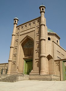
Yarkant County, also Shache County, also transliterated from Uyghur as Yakan County, is a county in the Xinjiang Uyghur Autonomous Region, China, located on the southern rim of the Taklamakan Desert in the Tarim Basin. It is one of 11 counties administered under Kashgar Prefecture. The county, usually referred to as Yarkand in English, was the seat of an ancient Buddhist kingdom on the southern branch of the Silk Road and the Yarkand Khanate. The county sits at an altitude of 1,189 metres (3,901 ft) and as of 2003 had a population of 373,492.
Artux or Artush or Atush is a county-level city and the capital of Kizilsu Kyrgyz Autonomous Prefecture in Xinjiang, China. The government seat is in Guangming Road Subdistrict. As of 2018, it has a population of 285,507 people, 81.4 per cent of whom are Uyghurs.
Xinhe County as the official romanized name, also formerly known as its Uyghur name Toksu County, is a county in Aksu Prefecture, Xinjiang Uyghur Autonomous Region, China.
Maralbexi County, Bachu County, and Chinese: 巴尔楚克县) the former long Chinese name as well, is located in the southwest of the Xinjiang Uyghur Autonomous Region, China. The county is under the administration of the Kashgar Prefecture. It has an area of 18,491 km2 (7,139 sq mi), and surrounds, but does not administer, the sub-prefecture-level city of Tumxuk. According to the 2002 census, it has a population of 380,000.
Kargilik County, also known as Yecheng County, is a county in southwest of the Xinjiang Uyghur Autonomous Region and is under the administration of the Kashgar Prefecture. It contains an area of 28,600 km². To the north, the county borders Makit County. To the east, the county borders Guma County (Pishan) in Hotan Prefecture. To the west, the county borders Yarkant County, Poskam County and Taxkorgan Tajik Autonomous County. In the south, the county has a border of more than 80 km (50 mi) with Pakistan and India administered areas of Kashmir.
Makit County is a county in Kashgar Prefecture, Xinjiang Uyghur Autonomous Region, China. It contains an area of 10,927 km2 (4,219 sq mi). The Yarkand River passes through the county. The county is bordered to the north by Maralbexi County, to the east by Guma County (Pishan) in Hotan Prefecture, to the west by Yarkant County, and to the south by Kargilik County.
Shufu County, also transliterated from Uyghur as Konaxahar County or Konasheher County/Kona Sheher County, is a county in Kashgar Prefecture, Xinjiang Uyghur Autonomous Region, China. It contains an area of 3,513 km2 (1,356 sq mi). According to the 2002 census, it has a population of 360,000.
Akto County is a county in Kizilsu Kyrgyz Autonomous Prefecture, Xinjiang Uygur Autonomous Region, China. The county borders Tajikistan and Kyrgyzstan and has two towns, 11 townships, four state-owned farms and a plant nursery under its jurisdiction with the county seat being Akto Town. The county contains an area of 24,555 km2 (9,481 sq mi) and has a population of 221,526 as of 2015, of 231,756 as of 2017.
Qiemo County as the official romanized name, also transliterated from Uyghur as Qarqan County, is a county under the administration of the Bayin'gholin Mongol Autonomous Prefecture in the Xinjiang Uyghur Autonomous Region of the People's Republic of China, bordering the Tibet Autonomous Region to the south. Its area is 138,645 square kilometers (53,531 sq mi) and, according to the 2002 census, it has a population of 60,000. The county seat is at Qiemo Town.
Karakax County, alternatively Moyu County, also transliterated from Uyghur as Qaraqash County, alternately Qaraqash, is a county in the Xinjiang Uyghur Autonomous Region and is located in the southern edge of the Tarim Basin, it is under the administration of the Hotan Prefecture. It contains an area of 25,667 km2 (9,910 sq mi). According to the 2011 census it has a population of 577,000 and 98,1% are Uyghurs. The county is bordered to the north by Awat County in Aksu Prefecture, to the northeast by Lop County, to the southeast by Hotan County, to the northwest by Maralbexi County in Kashgar Prefecture, and to the southwest by Pishan County and Kunyu. Exclaves of Kunyu are located within the county.
Yutian County, also transliterated from Uyghur as Keriya County, is a county in Hotan Prefecture, Xinjiang Uyghur Autonomous Region, China. It is based at the Keriya Town, and is separate from Hotan County, which is another county in the same prefecture. The Yutian County has an area of 39,023 km2 (15,067 sq mi). According to the 2002 census, it has a population of 220,000. The county is bounded on the north by Aksu Prefecture, on the east by Minfeng/Niya County, on the west by Qira County and on the south by the Rutog and Gertse counties of the Tibet Autonomous Region.
Hotan County is a county in the southwest of the Xinjiang Uyghur Autonomous Region and is under the administration of the Hotan Prefecture. Almost all the residents of the county are Uyghurs and live around oases situated between the desolate Taklamakan Desert and Kunlun Mountains. Hotan County is the southernmost county-level division of Xinjiang. The county borders Karakax/Moyu County to the northwest, Hotan City and Lop County to the northeast, Qira County to the east, Pishan County to the west, and Rutog County, Tibet to the southeast. Hotan County administers most of Aksai Chin, an area disputed between China and India. The Line of Actual Control divides the India-controlled part of Ladakh union territory from the Aksai Chin area administered as part of southwest Hotan County.
Shule County as the official romanized name, also transliterated from Uyghur as Kaxgar Yengixahar County or shorten as Yengixahar County, is a county situated in the Xinjiang Uyghur Autonomous Region and is under the administrative jurisdiction of the Kashgar Prefecture. It is located to the south of Kashgar City. In Ancient times, the Shule area was once the home to a Xiyu oasis civilisation, the Shule Kingdom.
Pishan County as the official romanized name, also transliterated from Uyghur as Guma County, is a county within the Xinjiang Uyghur Autonomous Region and is under the administration of the Hotan Prefecture. It contains an area of 39,412 km2 (15,217 sq mi). According to the 2002 census, it has a population of 220,000. The county borders Maralbexi County and Makit County to the north, Karakax County, Hotan County and Kunyu to the east and Kargilik County to the west. The county includes lands near the Karakoram Pass which are part of the Aksai Chin area that is disputed between China and India.
Kokyar is a township headquartered at a small oasis at the base of the Kunlun Mountains in southern Kargilik County, Kashgar Prefecture, southwestern Xinjiang, China.
Seriqbuya or Serikbuya is a town in Maralbexi (Bachu) County, Kashgar Prefecture, Xinjiang, China. It is located on Provincial Road 215, on the left (northwestern) bank of the Yarkand River and about 180 kilometers to the east of the city of Kashgar.
Koxtag is a town in Pishan/Guma County, Hotan Prefecture, Xinjiang, China.
Jiya is a township in the northeastern part of Hotan City in Hotan Prefecture, Xinjiang, China in an oasis area on the eastern bank of the White Jade River in the southwestern part of the Taklamakan Desert. To the north and east, Jiya borders Lop County, the county which Jiya was a part of until 2006, and to the south and west, Jiya borders the rest of Hotan city.
Alaqagha, Alakaga is a town in Kuqa, Aksu Prefecture, Xinjiang, China.
总面积1.52万平方公里,辖8镇、6乡、4个街道办事处,
库车县是以维吾尔族为主体的多民族聚居区。
Kuqa
It was Hoshur's Oct. 29 story that confirmed the deaths of 150 people over the course of six months at the No. 1 Internment Camp in the Yengisher district of Kuchar county, "marking the first confirmation of mass deaths since the camps were introduced in 2017," as the story notes.
乾隆二十三年(1758),龟兹归入清朝版图,定名库车。
统计用区划代码 名称 652923001000 热斯坦街道 652923002000 萨克萨克街道 652923003000 新城街道 652923004000 东城街道 652923101000 乌恰镇 652923102000 阿拉哈格镇 652923103000 齐满镇 652923104000 墩阔坦镇 652923105000 牙哈镇 652923106000 乌尊镇 652923107000 伊西哈拉镇 652923108000 二八台镇 652923201000 玉奇吾斯塘乡 652923202000 比西巴格乡 652923203000 哈尼喀塔木乡 652923204000 阿克吾斯塘乡 652923205000 阿格乡 652923206000 塔里木乡 652923500000 库车经济技术开发区
2010年第六次人口普查,库车县常住总人口462588人,其中:热斯坦街道13298人,萨克萨克街道18156人,新城街道44184人,东城街道27114人,乌恰镇41557人,阿拉哈格镇38197人,齐满镇35871人,墩阔坦镇17965人,牙哈镇31856人,乌尊镇29243人,依西哈拉镇32132人,雅克拉镇1029人,玉奇吾斯塘乡27355人,比西巴格乡26131人,哈尼喀塔木乡35430人,阿克吾斯塘乡16027人,阿格乡6960人,塔里木乡3877人,水电二处2260人,二八台农场4413人,良种繁胄场2678人,库孜翁牧场1551人,草湖牧场1136人,库车种羊场3008人,库车监狱360人,克其力克农场800人。
Distribution of Rural Poor Population in Kuche County{...}No. Town(ship){...}1 Hanikatamu{...}2 Talimu{...}3 Akewusitang{...}4 Age{...}5 Yuqiwusitang{...}6 Bixibage{...}7 Wuqia{...}8 Yixihala{...}9 Yaha{...}10 Wuzun{...}11 Qiman{...}12 Dunkuotan{...}13 Alahage{...}