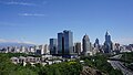
Shihezi

Last updated
Shihezi
石河子
Shihezi city 01.jpg
Shihezi
China Xinjiang Shihezi.svg
Location in Xinjiang
Shihezi
China Xinjiang Northern location map.svg
Red pog.svg
Shihezi
Location in Xinjiang
China Xinjiang adm location map.svg
Red pog.svg
Shihezi
Shihezi (Xinjiang)
China edcp location map.svg
Red pog.svg
Shihezi
Shihezi (China)
Coordinates: 44°18′19″N86°04′49″E / 44.3054°N 86.0804°E / 44.3054; 86.0804
CountryChina
Autonomous region Xinjiang
Municipal seat Hongshan Subdistrict
Government
   CCP Secretary E Hongda (Political Commissar of the 8th Division)
  MayorGe Zhihui (Commander of the 8th Division)
Area
  Total460 km2 (180 sq mi)
Population
 (2020) [1]
  Total498,587
  Density1,100/km2 (2,800/sq mi)
Time zone UTC+8 (China Standard [lower-alpha 1] )
Postal code
832000
Area code 0993
Website www.shz.gov.cn
شىخەنزەيېڭىشەھەر كوچا باشقارمىسى
Shihezi
Chinese name
Chinese 石河子
Literal meaningStony river banks
Yëngisheher kocha bashqarmisi659001001
Xiangyang Subdistrict 向阳街道Xiàngyáng Jiēdàoشياڭياڭ كوچا باشقارمىسىShyangyang kocha bashqarmisi659001002
Hongshan Subdistrict 红山街道Hóngshān Jiēdàoخۇڭشەن كوچا باشقارمىسىXungshen kocha bashqarmisi659001003
Laojie Subdistrict 老街街道Lǎojiē Jiēdàoكونا بازار كوچا باشقارمىسىKona Bazar kocha bashqarmisi659001004
Dongcheng Subdistrict 东城街道Dōngchéng Jiēdàoدۇڭچېڭ كوچا باشقارمىسىDungchëng kocha bashqarmisi659001005
Towns
Beiquan Town
(Shihezi Headquarters Farm of the 8th Division)*
北泉镇
(第八师石河子总场)
Běiquán Zhènبېيچۇەن بازىرىBëychuen baziri659001100
Shihezi Town 石河子镇Shíhézǐ Zhènشىخەنزە بازىرىShixenze baziri659001101
township-equivalent region
152nd Regiment Farm **一五二团152 Tuán152-تۇەن152-tuen659001500

Demographics

Population by ethnicity – 2010 census [2]
Ethnicity Population%
Han 349,14991.85%
Hui 15,0923.97%
Uyghur 7,5741.99%
Kazakhs 3,0420.80%
Tujia 1,5000.39%
Mongol 6240.16%
Manchu 6200.16%
Kyrgyz 3190.08%
Dongxiang 3060.08%
Xibe 1570.04%
Russian 1380.04%
Others1,6090.43%
Total380,130100%

Economy

Nowadays textile and food industries are the most important in Shihezi. The railway to Wusu and Ürümqi skirts the city, while a United Nations economic development project provided a high-quality highway system for the city. The textile industry is the primary employer, although the international trade environment on textiles has brought in fluctuations in employment. As a hub to surrounding farms, the city's destiny is currently tied with theirs. Sugar beets are cultivated near Shihezi. Cultivation of cotton in the farms was accelerated in the 1990s and now dominates the economy. [3]

Shihezi is also home to a polysilicon factory of Daqo New Energy Corp., one of the largest polysilicon producers in the world. [4]

Geography and climate

Shihezi is located at the northern foothills of the middle part of the Tian Shan range approximately 136 kilometres (85 mi) from the regional capital of Ürümqi.

Although Shihezi is almost surrounded on the east, west and north by the Changji Hui Autonomous Prefecture (which also includes the city's eastern neighbor, the much older historically Hui town of Manas), it is not a part of it.

Located in an area further from the nearest seacoast than any other region on earth, Shihezi has a continental semi-arid climate (Köppen BSk ), with a large temperature differences between summer and winter. Monthly average temperatures range from −15.3 °C (4.5 °F) in January to 25.3 °C (77.5 °F), and the annual mean temperature is 7.39 °C (45.3 °F). Precipitation is very low year-round, with an annual total of only 206 millimeters (8.11 in), compared to the annual evaporation rate, which is usually more than 1,000 millimeters (39 in). [5]

Climate data for Shihezi (1991–2020 normals, extremes 1971–2010)
MonthJanFebMarAprMayJunJulAugSepOctNovDecYear
Record high °C (°F)7.6
(45.7)
6.6
(43.9)
22.7
(72.9)
35.4
(95.7)
37.4
(99.3)
39.2
(102.6)
42.2
(108.0)
41.0
(105.8)
39.4
(102.9)
33.3
(91.9)
17.5
(63.5)
8.3
(46.9)
42.2
(108.0)
Average high °C (°F)−11.0
(12.2)
−5.8
(21.6)
6.5
(43.7)
20.7
(69.3)
27.0
(80.6)
31.7
(89.1)
33.0
(91.4)
31.7
(89.1)
25.9
(78.6)
16.5
(61.7)
4.0
(39.2)
−7.3
(18.9)
14.4
(58.0)
Daily mean °C (°F)−15.6
(3.9)
−10.6
(12.9)
1.5
(34.7)
13.5
(56.3)
19.7
(67.5)
24.5
(76.1)
25.7
(78.3)
23.7
(74.7)
17.7
(63.9)
9.1
(48.4)
−0.5
(31.1)
−11.3
(11.7)
8.1
(46.6)
Average low °C (°F)−20.2
(−4.4)
−15.3
(4.5)
−3.3
(26.1)
6.7
(44.1)
12.5
(54.5)
17.3
(63.1)
18.5
(65.3)
16.3
(61.3)
10.1
(50.2)
2.9
(37.2)
−4.3
(24.3)
−15.0
(5.0)
2.2
(35.9)
Record low °C (°F)−34.4
(−29.9)
−36.5
(−33.7)
−30.5
(−22.9)
−19.4
(−2.9)
−0.2
(31.6)
6.6
(43.9)
9.6
(49.3)
3.5
(38.3)
−0.5
(31.1)
−8.9
(16.0)
−28.9
(−20.0)
−36.0
(−32.8)
−36.5
(−33.7)
Average precipitation mm (inches)10.1
(0.40)
11.0
(0.43)
12.9
(0.51)
29.0
(1.14)
31.6
(1.24)
22.1
(0.87)
22.7
(0.89)
21.3
(0.84)
13.3
(0.52)
18.4
(0.72)
19.6
(0.77)
14.2
(0.56)
226.2
(8.89)
Average precipitation days (≥ 0.1 mm)9.47.64.86.27.47.37.56.44.44.96.89.782.4
Average snowy days14.310.74.21.1000000.76.213.450.6
Average relative humidity (%)82817149444651535463778463
Mean monthly sunshine hours 93.4125.4211.0270.4320.0318.1328.6317.6281.8237.6131.279.22,714.3
Percent possible sunshine 32425666696971757771462959
Source 1: China Meteorological Administration [6] [7]
Source 2: Weather China [5]

The Manas River forms the administrative border between Shihezi City and its eastern neighbor, Manas County. An extensive system of reservoirs (such as the Jiahezi Reservoir (夹河子水库; Jiāhézi shuǐkù, with the dam at 44°27′00″N86°7′15″E / 44.45000°N 86.12083°E / 44.45000; 86.12083 ) and irrigation canals has been constructed in the area, supporting irrigated agriculture.

Education

Shihezi University is located in Shihezi. It is the second-largest university in Xinjiang, with approximately 40,000 students.

Transport

Shihezi is served by China National Highway 312, the Northern Xinjiang and the Second Ürümqi-Jinghe Railways. Reconstruction of the Shihezi Huayuan Airport began in May 2012 and it reopened on 26 December 2015. [8]

Notes

  1. Locals in Xinjiang frequently observe UTC+6 (Xinjiang Time), 2 hours behind Beijing.

Related Research Articles

<span class="mw-page-title-main">Shangzhi</span> City in Heilongjiang province, China

Shangzhi is a county-level city under the jurisdiction of Harbin, the capital of Heilongjiang province, People's Republic of China. It is 127 kilometres (79 mi) away from central Harbin and has an area of approximately 9,000 km2 (3,500 sq mi). The city proper has a population of around 120,000, while the total administrative population is approximately 600,000 inhabitants. The most spacious county-level division of Harbin City, it borders Yanshou County to the north, Wuchang to the southwest, Acheng District to the northwest, and Bin County to the northwest, as well as the prefecture-level city of Mudanjiang to the southeast.

<span class="mw-page-title-main">Changji</span> County-level city in Xinjiang, China

Changji is a county-level city situated about 40 km (25 mi) west of the regional capital, Ürümqi in Northern Xinjiang, China and has about 390,000 inhabitants. It is the seat of Changji Hui Autonomous Prefecture. At the northeast corner of the modern city are the walls and other archaeological remains of the Tang dynasty city, usually referred to as Ancient Changji.

<span class="mw-page-title-main">Bole, Xinjiang</span> City in northern Xinjiang, China

Bole, also known by its Mongolian name Bortala, is a county-level city in Xinjiang, China. It is the seat of Bortala Mongol Autonomous Prefecture, which borders Kazakhstan. The city covers an area of 7,517 square kilometres (2,902 sq mi) and has a total population of 270,000 as of 2015. The Northern Xinjiang Railway runs through the city, as do highways to Ürümqi.

<span class="mw-page-title-main">Wusu</span> County-level city in Xinjiang, China

Usu as the official romanized name and transliterated from Mongolian, also known as Wusu, is a county-level city with more than 100,000 residents in Xinjiang, China. It is a part of Tacheng Prefecture of Ili Kazakh Autonomous Prefecture. Oil production is a major part of the economy while the county is an oasis in the Dzungarian Basin. Wusu lies between the major cities of Bole and Shihezi in Northern Xinjiang and west of Ürümqi and Kuitun, south of Karamay.

<span class="mw-page-title-main">Tacheng</span> County-level city in Xinjiang, China

Tacheng, as the official romanized name, also transliterated from Mongolian as Qoqak, is a county-level city and the administrative seat of Tacheng Prefecture, in northern Ili Kazakh Autonomous Prefecture, Xinjiang.

<span class="mw-page-title-main">Huadian, Jilin</span> County-level city in Jilin, Peoples Republic of China

Huadian is a city in south-central Jilin province, People's Republic of China. It is under the administration of the prefecture-level city of Jilin City.

<span class="mw-page-title-main">Habahe County</span> County in Xinjiang, China

Habahe County as the official romanized name, also transliterated from Uyghur as Kaba County, is a county situated in the far north of the Xinjiang Uyghur Autonomous Region and is under the administration of the Altay Prefecture. It has an area of 8,179 km2 (3,158 sq mi) with a population of 80,000. The Postcode is 836700.

<span class="mw-page-title-main">Hejing County</span> County in Xinjiang, China

Hejing County is located in the central-southern part of the Tian Shan mountains of Xinjiang, in the north-west of Bayingolin Mongol Autonomous Prefecture. The northernmost county-level division of Bayingolin, it borders Ürümqi City to the north, from which it is 190 km (120 mi) as the crow flies, and Korla City to the south, which is 80 km (50 mi) away. It borders 15 cities and counties and is the most bordered county in the world.

<span class="mw-page-title-main">Qitai County</span> County in Xinjiang, China

Qitai County as the official romanized name, also transliterated from Uyghur as Guqung County or Gucheng County, is a county in the Xinjiang Uyghur Autonomous Region of China under the administration of the Changji Hui Autonomous Prefecture. It covers an area of 16,641 square kilometres (6,425 sq mi) and as of the 2002 census had a population of 230,000.

<span class="mw-page-title-main">Manas County</span> County in Xinjiang, China

Manas County is a county in the Xinjiang Uyghur Autonomous Region under the administration of the Changji Hui Autonomous Prefecture. It covers an area of 9,174 square kilometres (3,542 sq mi) and as of the 2002 census it had a population of 170,000.

<span class="mw-page-title-main">Hutubi County</span> County in Xinjiang, China

Hutubi County as the official romanized name, also transliterated from Uyghur as Kutubi County, is a county in the Xinjiang Uyghur Autonomous Region and is under the administration of the Changji Hui Autonomous Prefecture. It contains an area of 9,476 km2. According to the 2002 census, it has a population of 210,000.

<span class="mw-page-title-main">Jinghe County</span> County in Xinjiang, China

Jinghe County as the official romanized name, also transliterated from Uyghur as Jing County, is a county of the Xinjiang Uyghur Autonomous Region and is under the administration of the Börtala Mongol Autonomous Prefecture. It contains an area of 11,181 square kilometres (4,317 sq mi). According to the 2002 census, it has a population of 120,000.

<span class="mw-page-title-main">Yiwu County</span> County in Xinjiang, China

Yiwu County as the official romanized name, also transliterated from Uyghur as Aratürük County, is a county in the northeast of the Xinjiang Uyghur Autonomous Region and is under the administration of the Hami City. It contains an area of 19,511 km2 (7,533 sq mi). According to the 2002 census, it has a population of 20,000.

<span class="mw-page-title-main">Ürümqi County</span> County in Xinjiang, China

Ürümqi County is a county of Xinjiang Uyghur Autonomous Region, Northwest China, it is under the administration of the prefecture-level city of Ürümqi, the capital of Xinjiang. It contains an area of 4,601 km² and according to the 2002 census has a population of 80,000.

<span class="mw-page-title-main">Qingchuan County</span> County in Sichuan, Peoples Republic of China

Qingchuan County is a county in the northeast of Sichuan province, China, bordering the provinces of Gansu to the north and Shaanxi to the northeast. It is the westernmost county-level division of the prefecture-level city of Guangyuan. It has an area of 3269 square kilometers and a population of 248,000, including Han Chinese as well as Hui people.

Fuyu, formerly Fuyu County, is a county-level city in northwestern Jilin province, People's Republic of China, under the administration of the prefecture-level city of Songyuan, and is Songyuan's easternmost county-level division. It has a land area of 4,464 square kilometres (1,724 sq mi), and a population of 750,000. It lies 98 kilometres (61 mi) east-southeast of Songyuan and 140 kilometres (87 mi) northeast of Changchun, the provincial capital. The county seat is located in the town of Sanchahe (三岔河镇). The city name comes from Buyeo (Fuyu), an ancient kingdom located in parts of Northeast China.

The Manasi River is in the south of Dzungarian Basin, Xinjiang, China.

<span class="mw-page-title-main">Huanan County</span> County in Heilongjiang, Peoples Republic of China

Huanan County is a county of eastern Heilongjiang province, People's Republic of China. It is under the jurisdiction of the prefecture-level city of Jiamusi.

<span class="mw-page-title-main">Baoqing County</span> County in Heilongjiang, Peoples Republic of China

Baoqing County is a county of southeastern Heilongjiang province, People's Republic of China. It is under the jurisdiction of the prefecture-level city of Shuangyashan.

<span class="mw-page-title-main">Panshi</span> County-level city in Jilin, Peoples Republic of China

Panshi is a city of south-central Jilin province of Northeast China. It is under the administration of Jilin City.

References

  1. Xinjiang: Prefectures, Cities, Districts and Counties
  2. Stanley W. Toops (August 2012). Susan M. Walcott; Corey Johnson (eds.). Eurasian Corridors of Interconnection: From the South China to the Caspian Sea. Routledge. pp. 65–66. ISBN   978-1135078751.
  3. Shihezi a 'Shining Pearl in the Gobi Desert' (China.org.cn by staff reporter Wang Qian, October 3, 2004)
  4. "Polysilicon Manufacturers: Global Top 10 | Bernreuter Research". Bernreuter Research. 12 May 2021. Retrieved 2 December 2021.
  5. 1 2 石河子城市介绍 (in Simplified Chinese). Weather China. Retrieved 2011-11-29.
  6. 中国气象数据网 – WeatherBk Data (in Simplified Chinese). China Meteorological Administration . Retrieved 10 October 2023.
  7. 中国气象数据网 (in Simplified Chinese). China Meteorological Administration . Retrieved 10 October 2023.
  8. "石河子花园机场正式通航". 163.com. 26 December 2015. Retrieved 26 December 2015.