Qinghai

Last updated
Qinghai
青海
Province of Qinghai
Name transcription(s)
  Chinese青海省 (Qīnghǎi Shěng)
  AbbreviationQH / (pinyin :Qīng)
Hoh Xil.jpg
Chaqia Salt Lake.JPG
Xining from Lete Hostel - panoramio.jpg
A Temple in Kumbum Monastery.jpg
Lijiaxialake.jpg
Clockwise from the top:
Qinghai in China (+all claims hatched).svg
Map showing the location of Qinghai Province
Coordinates: 35°N96°E / 35°N 96°E / 35; 96
CountryChina
Named for Derived from the name of Qinghai Lake ("blue/green lake").
Capital
(and largest city)
Xining
Divisions
 - Prefecture-level
 - County-level
 - Township-
level

8 prefectures
44 counties
404 towns and subdistricts
Government
  Body Qinghai Provincial People's Congress
   CCP Secretary Chen Gang
  Congress ChairmanChen Gang
   Governor Wu Xiaojun
  Provincial CPPCC ChairmanGönbo Zhaxi
   National People's Congress Representation24 deputies
Area
[1]
  Total720,000 km2 (280,000 sq mi)
  Rank 4th
Highest elevation6,860 m (22,510 ft)
Population
 (2020) [2]
  Total5,923,957
  Rank 31st
  Density8.2/km2 (21/sq mi)
   Rank 30th
Demographics
  Ethnic composition Han – 54%
Tibetan – 21%
Hui – 16%
Tu – 4%
Mongol – 1.8%
Salar – 1.8%
  Languages and dialects Zhongyuan Mandarin Chinese, Amdo Tibetan, Monguor, Oirat Mongolian, Salar and Western Yugur
GDP [3]
  Total CN¥ 361 billion
US$ 53.7 billion
  Per capitaCN¥ 60,724
US$ 9,028
ISO 3166 code CN-QH
HDI (2021)0.695 [4] (28th) – medium
Website www.qh.gov.cn OOjs UI icon edit-ltr-progressive.svg (in Chinese)
མཚོ་སྔོན་ᠬᠥᠬᠡ
ᠨᠠᠭᠤᠷ

Qinghai [lower-alpha 1] is an inland province in Northwestern China. It is the largest province of China (excluding autonomous regions) by area and has the third smallest population. Its capital and largest city is Xining.

Contents

Qinghai borders Gansu on the northeast, Xinjiang on the northwest, Sichuan on the southeast and the Tibet Autonomous Region on the southwest. Qinghai province was established in 1928 during the period of the Republic of China, and until 1949 was ruled by Chinese Muslim warlords known as the Ma clique. The Chinese name "Qinghai" is after Qinghai Lake, the largest lake in China. The lake is known as Tso ngon in Tibetan, and as Kokonor Lake in English, derived from the Mongol Oirat name for Qinghai Lake. Both Tso ngon and Kokonor are names found in historic documents to describe the region. [7]

Located mostly on the Tibetan Plateau, the province is inhabited by a number of peoples including the Han (concentrated in the provincial capital of Xining, nearby Haidong, and Haixi), Tibetans, Hui, Mongols, Monguors, and Salars. According to the 2021 census reports, Tibetans constitute a fifth of the population of Qinghai and the Hui compose roughly a sixth of the population. There are over 37 recognized ethnic groups among Qinghai's population of 5.6 million, with national minorities making up a total of 49.5% of the population.

The area of Qinghai came under the control of the Manchu-led Qing Dynasty around 1724, after their defeat of Khoshut Mongols who previously controlled most of the area. After the Xinhai Revolution and the ensuing fall of the Qing dynasty in 1912, Qinghai came under Chinese Muslim warlord Ma Qi's control until the Northern Expedition by the Republic of China consolidated central control in 1928. In the same year, the province of Qinghai was established by the Nationalist Government, with Xining as its capital. [8] [9] [10]

History

During the Bronze Age, Qinghai was home to a diverse group of nomadic tribes closely related to other Central Asians who traditionally made a living in agriculture and husbandry, the Kayue culture. The eastern part of the area of Qinghai was under the control of the Han dynasty about 2,000 years ago. It was a battleground during the Tang and subsequent Central Plain dynasties when they fought against successive Tibetan tribes. [11]

In the middle of 3rd century CE, nomadic people related to the Mongolic Xianbei migrated to pasture lands around the Qinghai Lake (Koko Nur) and established the Tuyuhun Kingdom.

In the 7th century, the Tuyuhun Kingdom was attacked by both the Tibetan Empire and the Tang dynasty as both sought control over the Silk Road trade routes. Tibetan King Songtsen Gampo was victorious, and settled the area around Tso ngon (Lake Go, or Kokonor Lake). [12] Military conflicts had severely weakened the Tuyuhun kingdom and it was incorporated into the Tibetan Empire. The Tibetan Empire continued expanding beyond Tso ngon during Trisong Detsen's and Ralpacan's reigns, and the empire controlled vast areas north and east of Tso ngon until 848, [13] which included Xi'an.

After the disintegration of the Tibetan Empire,[ clarification needed ] small local factions emerged, some under the titular authority of Central Plain polities. The Song dynasty defeated the Kokonor Kingdom in the 1070s. [14] During the Mongol-led Yuan dynasty's administrative rule of Tibet, the region comprised the headwaters of the Ma chu (Machu River, Yellow River) and the Yalong (Yangtze) rivers and was known as Amdo, but apportioned to different administrative divisions than Tibet proper. [15]

Most of Qinghai was, for a short time in the aftermath of the Yuan dynasty's overthrow, under the control of early Ming dynasty, but later gradually lost to the Khoshut Khanate founded by the Oirats. The Xunhua Salar Autonomous County is where most Salar people live in Qinghai. The Salars migrated to Qinghai from Samarkand in 1370. [16] The chief of the four upper clans around this time was Han Pao-yuan and Ming granted him office of centurion, it was at this time the people of his four clans took Han as their surname. [17] The other chief Han Shan-pa of the four lower Salar clans got the same office from Ming, and his clans were the ones who took Ma as their surname. [18]

From 1640 to 1724, a big part of the area that is now Qinghai was under Khoshut Mongol control, but in 1724 it was conquered by the armies of the Qing dynasty. [19] Xining, the capital of modern Qinghai province, began to function as the administrative center, although the city itself was then part of Gansu province within the "Tibetan frontier district". [20] [21] In 1724, 13-Article for the Effective Governing of Qinghai (Chinese:青海善后事宜十三条) was proposed by Nian Gengyao and adopted by the Central Government to gain full control of Qinghai.

Under the Qing dynasty, the governor was a viceroy of the Emperor, but local ethnic groups enjoyed significant autonomy. Many chiefs retained their traditional authority, participating in local administrations. [22] The Dungan Revolt (1862–1877) devastated the Hui Muslim population of Shaanxi, shifting the Hui center of population to Gansu and Qinghai. [23] :405 Another Dungan Revolt broke out in Qinghai in 1895 when various Muslim ethnic groups in Qinghai and Gansu rebelled against the Qing. Following the overthrow of the Qing dynasty in 1911, the region came under Chinese Muslim warlord Ma Qi control until the Northern Expedition by the Republic of China consolidated central control in 1928.

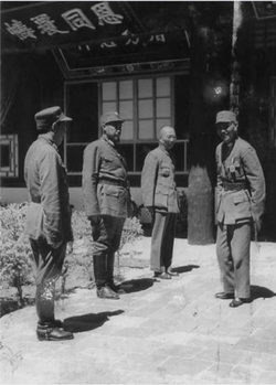
In July–August 1912, General Ma Fuxiang was "Acting Chief Executive Officer of Kokonur" (de facto Governor of the region that later became Qinghai). [24] In 1928, Qinghai province was created. The Muslim warlord and General Ma Qi became military governor of Qinghai, followed by his brother Ma Lin and then Ma Qi's son Ma Bufang. In 1932 Tibet invaded Qinghai, attempting to capture southern parts of Qinghai province, following contention in Yushu, Qinghai, over a monastery in 1932. The army of Ma Bufang defeated the Tibetan armies. Governor of Qinghai Ma Bufang was described as a socialist by American journalist John Roderick and friendly compared to the other Ma Clique warlords. [25] Ma Bufang was reported to be good humoured and jovial in contrast to the brutal reign of Ma Hongkui. [26] Most of eastern China was ravaged by the Second Sino-Japanese War and the Chinese Civil War, by contrast, Qinghai was relatively untouched.

Ma Bufang increased the prominence of the Hui and Salar people in Qinghai's politics by heavily recruiting to his army from the counties in which those ethnic groups predominated. [27] General Ma started a state run and controlled industrialization project, directly creating educational, medical, agricultural, and sanitation projects, run or assisted by the state. The state provided money for food and uniforms in all schools, state run or private. Roads and a theater were constructed. The state controlled all the press, no freedom was allowed for independent journalists. [28]

As the 1949 Chinese revolution approached Qinghai, Ma Bufang abandoned his post and flew to Hong Kong, traveling abroad but never returning to China. On January 1, 1950, the Qinghai Province People's Government was declared, owing its allegiance to the new People's Republic of China. Aside from some minor adjustments to suit the geography, the PRC maintained the province's territorial integrity. [29] Resistance to Communist rule continued in the form of the Huis' Kuomintang Islamic insurgency (1950–58), spreading past traditionally Hui areas to the ethnic-Tibetan south. [23] :408 Although the Hui composed 15.6% of Qinghai's population in 1949, making the province the second-largest concentration of Hui after Ningxia, the state denied the Hui ethnic autonomous townships and counties that their numbers warranted under Chinese law until the 1980s. [23] :411

Geography

Qinghai is located on the northeastern part of the Tibetan Plateau. By area, it is the largest province in the People's Republic of China (excluding the autonomous regions).

The Yellow River originates in the southern part of the province, while the Yangtze and Mekong have their sources in the southwestern part. Qinghai is separated by the Riyue Mountain into pastoral and agricultural zones in the west and east. [30]

The Sanjiangyuan National Nature Reserve is located in Qinghai and contains the headwaters of the Yellow River, Yangtze River, and Mekong River. The reserve was established to protect the headwaters of these three rivers and consists of 18 subareas, each containing three zones which are managed with differing degrees of strictness.

Qinghai Lake is the largest salt water lake in China, and the second largest in the world. Other large lakes are Lake Hala in the Qilian mountains, lakes Gyaring and Ngoring in the headwater region of the Yellow River, Lake Donggi Cona, and many saline and salt lakes in the western part of the province.

The Qaidam basin lies in the northwest part of the province at an altitude between 3000 and 5000 meters above sea level. About a third of this resource rich basin is desert.

Climate

Qinghai
Qinghai (Chinese characters).svg
"Qinghai" in Chinese characters

The average elevation of Qinghai is approximately 3000 m. [31] Mountain ranges include the Tanggula Mountains and Kunlun Mountains, with the highest point being Bukadaban Feng at 6860 m. [32] Due to the high altitude, Qinghai has quite cold winters (harsh in the highest elevations), mild summers, and a large diurnal temperature variation.[ citation needed ] Its mean annual temperature is approximately −5 to 8 °C (23 to 46 °F), with January temperatures ranging from −18 to −7 °C (0 to 19 °F) and July temperatures ranging from 15 to 21 °C (59 to 70 °F).[ citation needed ] It is also prone to heavy winds as well as sandstorms from February to April. Significant rainfall occurs mainly in summer, while precipitation is very low in winter and spring, and is generally low enough to keep much of the province semi-arid or arid.[ citation needed ]

Politics

The Politics of Qinghai Province in the People's Republic of China are structured in a one party-government system like all other governing institutions in mainland China.

The Governor of Qinghai (青海省省长) is the highest-ranking official in the People's Government of Qinghai. However, in the province's dual party-government governing system, the Governor has less power than the Qinghai Chinese Communist Party Committee Secretary (青海省委书记), colloquially termed the "Qinghai Party Chief".

Administrative divisions

Because the Han form Qinghai's ethnic majority [30] and because none of its many ethnic minorities have clear dominance over the rest, the province is not administered as an autonomous region. Instead, the province has many ethnic autonomous areas at the district and county levels. [27] Qinghai is administratively divided into eight prefecture-level divisions: two prefecture-level cities and six autonomous prefectures:

Administrative divisions of Qinghai
Division code [33] DivisionArea in km2 [34] Population 2010 [35] SeatDivisions [36]
Districts Counties Aut. counties CL cities
630000Qinghai Province720,000.005,626,723 Xining city72575
630100 Xining city7,424.112,208,708 Chengzhong District 511
630200 Haidong city13,043.991,396,845 Ledu District 24
632200 Haibei Tibetan Autonomous Prefecture 33,349.99273,304 Haiyan County 31
632300 Huangnan Tibetan Autonomous Prefecture 17,908.89256,716 Tongren city211
632500 Hainan Tibetan Autonomous Prefecture 43,377.11441,691 Gonghe County 5
632600 Golog Tibetan Autonomous Prefecture 76,442.38181,682 Maqên County 6
632700 Yushu Tibetan Autonomous Prefecture 197,953.70378,439 Yushu city51
632800 Haixi Mongol and Tibetan Autonomous Prefecture 300,854.48489,338 Delingha city33

The eight prefecture-level divisions of Qinghai are subdivided into 44 county-level divisions (6 districts, 4 county-level cities, 27 counties and 7 autonomous counties).

Urban areas

Population by urban areas of prefecture & county cities
#Cities2020 Urban area [37] 2010 Urban area [38] 2020 City proper
1 Xining 1,677,1771,153,4172,467,965
2 Haidong 204,784 [lower-alpha 2] 1,358,471
3 Golmud 197,153156,779part of Haixi Prefecture
4 Yushu 85,497 [lower-alpha 3] part of Yushu Prefecture
5 Delingha 65,42454,844part of Haixi Prefecture
(6) Tongren 49,962 [lower-alpha 4] part of Huangnan Prefecture
7 Mangnai 18,856 [lower-alpha 5] part of Haixi Prefecture
  1. /ɪŋˈh/ ching-HY; [5] Chinese :青海, IPA: [tɕʰíŋ.xàɪ] ; alternately romanized as Tsinghai or Chinghai) [6]
  2. Haidong Prefecture is currently known as Haidong PLC after 2010 census; Ledu County & Ping'an County is currently known as Ledu & Ping'an (core districts of Haidong) after 2010 census.
  3. Yushu County is currently known as Yushu CLC after 2010 census.
  4. Tongren County is currently known as Tongren CLC after 2020 census.
  5. Mangnai Administrative Zone & Lenghu Administrative Zone County is currently known as Mangnai CLC after 2010 census.

Population

Demographics

Historical population
YearPop.±%
1912 [39] 368,000    
1928 [40] 619,000+68.2%
1936–37 [41] 1,196,000+93.2%
1947 [42] 1,308,000+9.4%
1954 [43] 1,676,534+28.2%
1964 [44] 2,145,604+28.0%
1982 [45] 3,895,706+81.6%
1990 [46] 4,456,946+14.4%
2000 [47] 4,822,963+8.2%
2010 [48] 5,626,722+16.7%

Ethnicity

There are over 37 recognized ethnic groups among Qinghai's population of 5.6 million, with Han population standing at 50.5% of the total population and national minorities making up 49.5% of the population. [49] In 2010, Tibetan population stood at 20.7%, Hui 16%, Tu (Monguor) 4%, with also some groups of Mongol, and Salar, all of those groups being the most populous in the province. Han Chinese predominate in the cities of Xining, Haidong, Delingha and Golmud, and elsewhere in the northeast. The Hui are concentrated in Xining, Haidong, Minhe County, Hualong County, and Datong County. The Tu people predominate in Huzhu County and the Salars in Xunhua County; Tibetans and Mongols are sparsely distributed across the rural western part of the province. [27] Of the Muslim ethnic groups in China, Qinghai has communities of Hui, Salar, Dongxiang, and Bao'an. [16] The Hui dominate the wholesale business in Qinghai. [50]

Religion

Religion in Qinghai (2000s)

   Buddhism, Chinese folk religions (including Taoism), Bön and non-religious population (81.73%)
   Islam [51] (17.51%)
   Christianity [52] (0.76%)
The Dongguan Mosque in Qinghai Dongguan mosque.jpg
The Dongguan Mosque in Qinghai

The predominant religions in Qinghai are Chinese folk religions (including Taoist traditions and Confucianism) and Chinese Buddhism among the Han Chinese. The large Tibetan population practices Tibetan schools of Buddhism or traditional Tibetan Bön religion, while the Hui Chinese practice Islam. Christianity is the religion of 0.76% of the province's population according to the Chinese General Social Survey of 2004. [52] According to a survey of 2010, 17.51% of the population of Qinghai follow Islam. [51]

From September 1848, the city was the seat of a short-lived Latin Catholic Apostolic Vicariate (pre-diocesan missionary jurisdiction) of Kokonur (alias Khouhkou-noor, Kokonoor), but it was suppressed in 1861. No incumbent(s) recorded. [53]

Culture

Qinghai has been influenced by interactions "between Mongol and Tibetan culture, north to south, and Han Chinese and Inner Asia Muslim culture, east to west". [27] The languages of Qinghai have for centuries formed a Sprachbund, with Zhongyuan Mandarin, Amdo Tibetan, Salar, Yugur, and Monguor borrowing from and influencing one another. [54] In mainstream Chinese culture, Qinghai is most associated with the Tale of King Mu, Son of Heaven .[ citation needed ] According to this legend, King Mu of Zhou (r. 976–922 BCE) pursued hostile Quanrong nomads to eastern Qinghai, where the goddess Xi Wangmu threw the king a banquet in the Kunlun Mountains. [55]

The main religions in Qinghai are Tibetan Buddhism, Islam and Chinese Folk Religions. The Dongguan Mosque has been continuously operating since 1380. [23] :402 Measures of education in Qinghai are low, particularly among the ethnic minorities. [27] The yak, which is native to Qinghai, is widely used in the province for transportation and its meat. [30] The Mongols of Qinghai celebrate the Naadam festival on the Qaidam Basin every year. [56]

Economy

Oil well in Tsaidam (Qaidam), Qinghai Oil well in Tsaidam.jpg
Oil well in Tsaidam (Qaidam), Qinghai

Qinghai's economy is amongst the smallest in China. Its nominal GDP in 2022 was just RMB 361 billion (US$50 billion) and contributes to about 0.30% of the entire country's economy. Per capita GDP was RMB 60,724 (US$9,028) (nominal), the 24th in China. [3]

Its heavy industry includes iron and steel production, located near its capital city of Xining. Oil and natural gas from the Qaidam Basin have also been an important contributor to the economy. [57] Salt works operate at many of the province's numerous salt lakes.

Outside of the provincial capital, Xining, most of Qinghai remains underdeveloped. Qinghai ranks second lowest in China in terms of highway length, and will require a significant expansion of its infrastructure to capitalize on the economic potential of its rich natural resources. [57]

Economic and technological development zone

Xining Economic & Technological Development Zone (XETDZ) was approved as state-level development zone in July 2000. It has a planned area of 4.4 km2. XETDZ lies in the east of Xining, 5 km from the city centre. Xining is located in the east of the province at the upper reaches of the Huangshui River, one of the Yellow River's branches. The city is surrounded by mountains with an average elevation of 2261 m, the highest at 4393 m. XETDZ is the first of its kind at the national level on the Qinghai-Tibet Plateau. It is established to fulfill the nation's strategy of developing the west.

XETDZ enjoys a convenient transportation system, connected by the Xining-Lanzhou expressway and running through by two main roads, the broadest in the city. It is 4 km from the railway station, 15 km from Xi'ning Airport—a grade 4D airport with 14 airlines to cities such as Beijing, Guangzhou, Shanghai, Chengdu and Xi'an. Xining is Qinghai province's passage to the outside world, a transportation hub with more than ten highways, over 100 roads and two railways, Lanzhou-Qinghai and Qinghai-Tibet Railways in and out of the city.

It focuses on the development of following industries: chemicals based on salt lake resources, nonferrous metals, and petroleum and natural gas processing; special medicine, foods and bio-chemicals using local plateau animals and plants; new products involving ecological and environmental protection, high technology, new materials as well as information technology; and services such as logistics, banking, real estate, tourism, hotel, catering, agency and international trade. [58]

Tourism

View of the Qinghai Lake. Qinghailakeerlangjian.png
View of the Qinghai Lake.

Many tourist attractions center on Xining, the provincial seat of Qinghai.

During the hot summer months, many tourists from the hot southern and eastern parts of China travel to Xining, as the climate of Xining in July and August is quite mild and comfortable, making the city an ideal summer retreat.

Qinghai Lake (青海湖; qīnghǎi hú) is another tourist attraction, albeit further from Xining than Kumbum Monastery (Ta'er Si). The lake is the largest saltwater lake in China, and is also located on the "Roof of the World", the Tibetan Plateau. The lake itself lies at 3,600 m elevation. The surrounding area is made up of rolling grasslands and populated by ethnic Tibetans. Most pre-arranged tours stop at Bird Island (鸟岛; niǎo dǎo). An international bicycle race takes place annually from Xining to Qinghai Lake.

Transportation

China National Highway 109 in Qinghai Qingzangxian,China National Highway 109,qinghai,china.JPG
China National Highway 109 in Qinghai

The Lanqing Railway, running between Lanzhou, Gansu and Xining, the province's capital, was completed in 1959 and is the major transportation route in and out of the province. A continuation of the line, the Qinghai-Tibet Railway via Golmud and western Qinghai, has become one of the most ambitious projects in PRC history. It was completed in October 2005 and now links Tibet with the rest of China through Qinghai.

Construction on the Golmud–Dunhuang Railway, in the province's northwestern part, started in 2012.

Six National Highways run through the province.

Xining Caojiabao International Airport provides service to Beijing, Lanzhou, Golmud and Delingha. Smaller regional airports, Delingha Airport, Golog Maqin Airport, Huatugou Airport, Qilian Airport and Yushu Batang Airport, serve the province's smaller communities; plans exist for the construction of three more by 2020. [59]

Telecommunications

Since the Ministry of Industry and Information Technology began its "Access to Telephones Project", Qinghai has invested 640 million yuan to provide telephone access to 3860 out its 4133 administrative villages. At the end of 2006, 299 towns had received Internet access. However, 6.6 percent of villages in the region still have no access to the telephone. These villages are mainly scattered in Qingnan Area, with 90 percent of them located in Yushu and Guoluo. The average altitude of these areas exceeds 3600 meters, and the poor natural conditions hamper the establishment of telecommunication facilities in the region.

Satellite phones have been provided to 186 remote villages in Qinghai Province as of September 14, 2007.[ citation needed ] The areas benefited were Yushu Tibetan Autonomous Prefecture and Guoluo Tibetan Autonomous Prefecture. Qinghai has recently been provided with satellite telephone access. In June 2007, China Satcom carried out an in-depth survey in Yushu and Guoluo, and made a special satellite phones for these areas. Two phones were provided to each village for free, and calls were charged at the rate of 0.2 RMB (about a quarter of a US cent at that time) per minute for both local and national calls, with the extra charges assumed by China Satcom. No monthly rent was charged on the satellite phone. International calls were also available.

Colleges and universities

See also

Notes

    Related Research Articles

    <span class="mw-page-title-main">Tibet Autonomous Region</span> Autonomous region of China

    The Tibet Autonomous Region, officially the Xizang Autonomous Region, often shortened to Tibet or Xizang, is an autonomous region of China and is part of Southwestern China.

    <span class="mw-page-title-main">Gansu</span> Province of China

    Gansu is an inland province in Northwestern China. Its capital and largest city is Lanzhou, in the southeast part of the province.

    <span class="mw-page-title-main">Salar people</span> Turkic ethnic group in western China

    The Salar people are a Turkic ethnic minority in China who speak Salar, a Turkic language of the Oghuz sub-branch. They numbered 165,159 people in 2020, according to that year's national census.

    <span class="mw-page-title-main">Xining</span> Prefecture-level city in Qinghai, China

    Xi'ning is the capital of Qinghai province in western China and the largest city on the Tibetan Plateau.

    <span class="mw-page-title-main">Amdo</span> Traditional region of Tibet

    Amdo is one of the three traditional Tibetan regions, the others being U-Tsang in the west and Kham in the east. Ngari in the north-west was incorporated into Ü-Tsang. Amdo is also the birthplace of the 14th Dalai Lama. Amdo encompasses a large area from the Machu to the Drichu (Yangtze). Amdo is mostly coterminous with China's present-day Qinghai province, but also includes small portions of Sichuan and Gansu provinces.

    <span class="mw-page-title-main">Golmud</span> City in Qinghai Province, China

    Golmud, also known by various other romanizations, is a county-level city in the Haixi Mongol and Tibetan Autonomous Prefecture of Qinghai Province, China. It is now the second-largest city in Qinghai and the third largest in the Tibetan Plateau. The population in 2020 is 221,863.

    <span class="mw-page-title-main">Haixi Mongol and Tibetan Autonomous Prefecture</span> Autonomous prefecture in Qinghai, China

    Haixi Mongolian and Tibetan Autonomous Prefecture, locally also known as Qaidam Prefecture, is an autonomous prefecture occupying much of the northern half of Qinghai Province, China. It has an area of 325,785 square kilometres (125,786 sq mi) and its seat is Delingha. The name of the prefecture literally means "west of (Qinghai) Lake."

    <span class="mw-page-title-main">Yushu Tibetan Autonomous Prefecture</span> Autonomous prefecture in Qinghai, China

    Yushu Tibetan Autonomous Prefecture, also transliterated as Yüxü or Yulshul, is an autonomous prefecture of Southwestern Qinghai Province, China. Largely inhabited by Tibetans, the prefecture has an area of 188,794 square kilometres (72,894 sq mi) and its seat is located in the town of Gyêgu in Yushu County, which is the place of the old Tibetan trade mart of Jyekundo. The official source of the Yellow River lies within the prefecture. Historically, the area belongs to the cultural realm of Kham in Eastern Tibet.

    <span class="mw-page-title-main">Hainan Tibetan Autonomous Prefecture</span> Autonomous prefecture in Qinghai, Peoples Republic of China

    Hainan Tibetan Autonomous Prefecture, formerly known as Tsolho Tibetan Autonomous Prefecture, is an autonomous prefecture of Northeastern Qinghai Province in Western China. The prefecture has an area of 45,895 square kilometres (17,720 sq mi) and its seat is located in Gonghe County. Its name literally means "south of (Qinghai) Lake."

    <span class="mw-page-title-main">Huangnan Tibetan Autonomous Prefecture</span> Autonomous prefecture in Qinghai, Peoples Republic of China

    Huangnan Tibetan Autonomous Prefecture is an autonomous prefecture of Eastern Qinghai, China, bordering Gansu to the east. The prefecture has an area of 17,921 km2 (6,919 sq mi) and its seat is in Tongren County.

    <span class="mw-page-title-main">Xunhua Salar Autonomous County</span> Autonomous county in Qinghai, China

    Xunhua Salar Autonomous County is an autonomous county in the southeast of Haidong Prefecture, in Qinghai province, China. The autonomous county has an area of around 2,100 square kilometres (810 sq mi), and a population of approximately 161,600 inhabitants per a 2022 government publication. In the east it borders the province of Gansu and in the south and the west Huangnan Tibetan Autonomous Prefecture. Its postal code is 811100 and its capital is the town of Jishi.

    <span class="mw-page-title-main">Haidong</span> Prefecture-level city in Qinghai, China

    Haidong is a prefecture-level city of Qinghai province in Western China. Its name literally means "east of the (Qinghai) Lake." On 8 February 2013 Haidong was upgraded from a prefecture (海东地区) into a prefecture-level city. Haidong is the third most populous administrative division in Qinghai after Xining and Golmud.

    <span class="mw-page-title-main">Ma Bufang</span> Chinese warlord (1903–1975)

    Ma Bufang (1903 – 31 July 1975) (traditional Chinese: 馬步芳; simplified Chinese: 马步芳; pinyin: Mǎ Bùfāng; Wade–Giles: Ma3 Pu4-fang1, Xiao'erjing: مَا بُ‌فَانْ) was a prominent Muslim Ma clique warlord in China during the Republic of China era, ruling the province of Qinghai. His rank was lieutenant-general.

    <span class="mw-page-title-main">Yushu City, Qinghai</span> County-level city in Qinghai, China

    Yushu, also Romanized as Yüxü, is a county-level city of Yushu Tibetan Autonomous Prefecture in Southern Qinghai Province, China. It comprises a surface area of 13,462 square kilometres (5,198 sq mi). In 2010, the overall city's population was 120,447 and 56,802 live within the city core. There are around 356,000 people in the metropolitan area in 2020. Yushu is the fourth largest city in Qinghai.

    The Qinghai–Tibet War or the Tsinghai–Tibet War was a conflict that took place during the Sino-Tibetan War. A rebellion led by the Dalai Lama with British support wanted to expand the original conflict taking place between the Tibetan Army and Liu Wenhui in Xikang, to attack Qinghai, a region northeast of Tibet. Using a dispute over a monastery in Yushu in Qinghai as an excuse in 1932, the Tibetan army attacked. Qinghai Muslim General Ma Bufang overran the Tibetan armies and recaptured several counties in Xikang province. Shiqu, Dege and other counties were seized from the Tibetans. The war against the Tibetan army was led by the Muslim General Ma Biao. The Tibetans were pushed back to the other side of the Jinsha river. The Qinghai army recaptured counties that had been controlled by the Tibetan army since 1919. The victory on the part of the Qinghai army threatened the supply lines to Tibetan forces in Garze and Xinlong. As a result, this part of the Tibetan army was forced to withdraw. Ma and Liu warned Tibetan officials not to dare cross the Jinsha river again. By August the Tibetans lost so much territory to Liu Wenhui and Ma Bufang's forces that the Dalai Lama telegraphed the British government of India for assistance. British pressure led China to declare a cease-fire. Separate truces were signed by Ma and Liu with the Tibetans in 1933, ending the fighting. The British had backed up the Tibetans during the war. After their war the victory over the Tibetans was celebrated by Xikang and Qinghai soldiers.

    <span class="mw-page-title-main">Kuomintang Islamic insurgency</span> Continuation of Chinese Civil War by Chinese Muslims

    The Kuomintang Islamic insurgency was a continuation of the Chinese Civil War by Chinese Muslim Kuomintang Republic of China Army forces mainly in Northwest China, in the provinces of Gansu, Qinghai, Ningxia, and Xinjiang, and another insurgency in Yunnan.

    <span class="mw-page-title-main">Golok conflicts (1917–1949)</span>

    The Ma clique fought a series of military campaigns between 1917 and 1949 against unconquered Amchok and Ngolok (Golok) tribal Tibetan areas of Qinghai (Amdo), undertaken by two Hui commanders, Gen. Ma Qi and Gen. Ma Bufang, on behalf of the Beiyang and Kuomintang governments of the Republic of China. The campaigns lasted between 1917 and 1949. The conflict was spurred by multiple factors, notably for economic and socio-political reasons rather than by any racial or religious enmity.

    <span class="mw-page-title-main">Ma Biao (general)</span> Chinese Muslim Ma Clique General in the National Revolutionary Army

    Ma Biao (1885–1948) was a Chinese Muslim Ma Clique General in the National Revolutionary Army, and served under Ma Bufang, the Governor of Qinghai. He was a member of Ma Bufang's family, Ma Biao was the eldest son of Ma Haiqing 馬海清, who was the sixth younger brother of Ma Haiyan, the grandfather of Ma Bufang.

    <span class="mw-page-title-main">Han Youwen</span> Chinese military commander

    Han Youwen was an ethnic Salar Muslim General in the National Revolutionary Army of the Republic of China, born in Hualong Hui Autonomous County, Qinghai. His Muslim name was Muhammad Habibullah (穆罕默德·海比不拉海).

    <span class="mw-page-title-main">Chinese Muslims in the Second Sino-Japanese War</span> Faction in World War II

    Chinese Muslims in the Second Sino-Japanese War were courted by both Chinese and Japanese generals but they tended to fight against the Japanese with or without the support of higher echelons of the other Chinese factions.

    References

    Citations

    1. "Qinghai Province". Qinghai Province Department of Commerce. Archived from the original on 4 March 2016. Retrieved 5 August 2013.
    2. "Communiqué of the Seventh National Population Census (No. 3)". National Bureau of Statistics of China. 11 May 2021. Retrieved 11 May 2021.
    3. 1 2 "National Data". National Bureau of Statistics of China. 1 March 2022. Retrieved 23 March 2022.
    4. "Subnational Human Development Index". Global Data Lab China. 2021. Retrieved 9 April 2020.
    5. "Qinghai". Lexico UK English Dictionary. Oxford University Press. Archived from the original on May 18, 2021.
    6. 中国地名录 (2nd ed.). Beijing: China Maps Press. 1995. p. 309. ISBN   7-5031-1718-4.
    7. Gangchen Khishong, 2001. Tibet and Manchu: An Assessment of Tibet-Manchu Relations in Five Phases of Development. Dharmasala: Narthang Press, p.1-70.
    8. "中華民國政府令". 國民政府公報. Vol. 93. Republic of China: 國民政府秘書處. Sep 1928. p. 5.
    9. "中華民國十七年十月十九日 中華民國政府令". 國民政府公報. No. 2. Republic of China: 國民政府文官處印鑄局. 27 Oct 1928. p. 9.
    10. "中華民國十八年一月二十九日 國民政府指令一八九號". 國民政府公報. No. 80. Republic of China: 國民政府文官處印鑄局. 31 Jan 1929. pp. 8–9.
    11. Purdue – Tibetan history Archived 2007-08-21 at the Wayback Machine .
    12. Laurent Deshayes, 1997. Histoire du Tibet. Paris: Fayard.
    13. Gertraud Taenzer, 2012. The Dunhuang Region during Tibetan Rule (787-848). (Berlin): Harrassowitz Verlag.
    14. Leung 2007, p. 57.
    15. Smith, Warren W (2009). China's Tibet?: Autonomy or Assimilation. Rowman & Littlefield. pp. 24, 252.
    16. 1 2 Betta, Chiara (2004). The Other Middle Kingdom: A Brief History of Muslims in China. Indianapolis University Press. p. 21.
    17. William Ewart Gladstone, Baron Arthur Hamilton-Gordon Stanmore (1961). Gladstone-Gordon correspondence, 1851–1896: selections from the private correspondence of a British Prime Minister and a colonial Governor, Volume 51. American Philosophical Society. p. 27. ISBN   9780871695147 . Retrieved 2010-06-28.
    18. William Ewart Gladstone, Baron Arthur Hamilton-Gordon Stanmore (1961). Gladstone-Gordon correspondence, 1851–1896: selections from the private correspondence of a British Prime Minister and a colonial Governor, Volume 51. American Philosophical Society. p. 27. ISBN   9780871695147 . Retrieved 2010-06-28.
    19. The Times Atlas of World History. (Maplewood, New Jersey: Hammond, 1989) p. 175
    20. Louis M. J. Schram (2006). The Monguors of the Kansu-Tibetan Frontier: Their Origin, History, and Social Organization. Kessinger Publishing. p. 17. ISBN   1-4286-5932-3 . Retrieved 2010-06-28.
    21. Graham Hutchings (2003). Modern China: a guide to a century of change (illustrated, reprint ed.). Harvard University Press. p. 351. ISBN   0-674-01240-2 . Retrieved 2010-06-28.
    22. M.C. Goldstein (1994). Barnett and Akiner (ed.). Change, Conflict and Continuity among a community of nomadic pastoralists—A Case Study from western Tibet, 1950–1990., Resistance and Reform in Tibet. London: Hurst & Co.
    23. 1 2 3 4 Cooke, Susette. "Surviving State and Society in Northwest China: The Hui Experience in Qinghai Province under the PRC." Journal of Muslim Minority Affairs 28.3 (2008): 401–420.
    24. Henry George Wandesforde Woodhead, Henry Thurburn Montague Bell (1969). The China year book, Part 2. North China Daily News & Herald. p. 841. Retrieved 2011-06-05.
    25. John Roderick (1993). Covering China: the story of an American reporter from revolutionary days to the Deng era. Imprint Publications. p. 104. ISBN   1-879176-17-3 . Retrieved 2010-06-28.
    26. Felix Smith (1995). China pilot: flying for Chiang and Chennault. Brassey's. p. 140. ISBN   1-57488-051-9 . Retrieved 2010-06-28.
    27. 1 2 3 4 5 Goodman, David (2004). China's Campaign to "Open Up the West": National, Provincial, and Local Perspectives. Cambridge University Press. pp. 67–83.
    28. Werner Draguhn; David S. G. Goodman (2002). China's communist revolutions: fifty years of the People's Republic of China. Psychology Press. p. 38. ISBN   0-7007-1630-0 . Retrieved 2011-04-09.
    29. Blondeau, Anne-Marie; Buffetrille, Katia (2008). Authenticating Tibet: Answers to China's 100 Questions. University of California Press. pp. 203–205. It is often assumed that this current policy [of not politically uniting all ethnically Tibetan areas] reflects the PRC leadership's intention to divide and rule Tibet, but this assumption is not wholly accurate.... The PRC cemented the [historical] status quo by keeping Amdo/Qinghai as a separate, multinational province... China does not reverse perceived territorial acquisitions. Hence, all territories that escaped the domination of Lhasa in recent history remained attached to the neighboring Chinese constituencies they tended to be under the influence of.
    30. 1 2 3 Lahtinen, Anja (2009). "Maximising Opportunities for the Tibetans of Qinghai Province, China". In Cao, Huahua (ed.). Ethnic Minorities and Regional Development in Asia: Reality and Challenges. Amsterdam University Press. pp. 20–22.
    31. "Qinghai Province Mountains".
    32. Bukadaban Feng, Peakbagger.com
    33. 中华人民共和国县以上行政区划代码 (in Simplified Chinese). Ministry of Civil Affairs.
    34. Shenzhen Statistical Bureau. 《深圳统计年鉴2014》 (in Simplified Chinese). China Statistics Print. Archived from the original on 2015-05-12. Retrieved 2015-05-29.
    35. Census Office of the State Council of the People's Republic of China; Population and Employment Statistics Division of the National Bureau of Statistics of the People's Republic of China (2012). 中国2010年人口普查分乡、镇、街道资料 (1 ed.). Beijing: China Statistics Print. ISBN   978-7-5037-6660-2.
    36. Ministry of Civil Affairs (August 2014). 《中国民政统计年鉴2014》 (in Simplified Chinese). China Statistics Print. ISBN   978-7-5037-7130-9.
    37. 国务院人口普查办公室、国家统计局人口和社会科技统计司编 (2022). 中国2020年人口普查分县资料. Beijing: China Statistics Print. ISBN   978-7-5037-9772-9.
    38. 国务院人口普查办公室、国家统计局人口和社会科技统计司编 (2012). 中国2010年人口普查分县资料. Beijing: China Statistics Print. ISBN   978-7-5037-6659-6.
    39. 1912年中国人口 . Retrieved 6 March 2014.
    40. 1928年中国人口 . Retrieved 6 March 2014.
    41. 1936–37年中国人口 . Retrieved 6 March 2014.
    42. 1947年全国人口 . Retrieved 6 March 2014.
    43. 中华人民共和国国家统计局关于第一次全国人口调查登记结果的公报. National Bureau of Statistics of China. Archived from the original on August 5, 2009.
    44. 第二次全国人口普查结果的几项主要统计数字. National Bureau of Statistics of China. Archived from the original on September 14, 2012.
    45. 中华人民共和国国家统计局关于一九八二年人口普查主要数字的公报. National Bureau of Statistics of China. Archived from the original on May 10, 2012.
    46. 中华人民共和国国家统计局关于一九九〇年人口普查主要数据的公报. National Bureau of Statistics of China. Archived from the original on June 19, 2012.
    47. 现将2000年第五次全国人口普查快速汇总的人口地区分布数据公布如下. National Bureau of Statistics of China. Archived from the original on August 29, 2012.
    48. "Communiqué of the National Bureau of Statistics of People's Republic of China on Major Figures of the 2010 Population Census". National Bureau of Statistics of China. Archived from the original on July 27, 2013.
    49. "How Much Does Beijing Control the Ethnic Makeup of Tibet?". ChinaFile. 2021-09-02. Retrieved 2023-05-08.
    50. "Demand for an aphrodisiac has brought unprecedented wealth to rural Tibet—and trouble in its wake". The Economist . 19 December 2015. Retrieved 20 December 2015.
    51. 1 2 Min Junqing. The Present Situation and Characteristics of Contemporary Islam in China. JISMOR, 8. 2010 Islam by province, page 29. Data from: Yang Zongde, Study on Current Muslim Population in China, Jinan Muslim, 2, 2010.
    52. 1 2 China General Social Survey (CGSS) 2009. Report by: Xiuhua Wang (2015, p. 15) Archived September 25, 2015, at the Wayback Machine
    53. "Apostolic Vicariate of Kokonur, China". Archived from the original on 2018-03-22. Retrieved 2017-02-27.
    54. Janhunen, Juha (2006). "From Manchuria to Amdo Qinghai: On the Ethnic Implications of the Tuyuhun Migration". Tumen Jalafun Jecen Aku. Otto Harrassowitz Verlag. pp. 111–112.
    55. Asiapac Editorial (2006). Chinese History: Ancient China to 1911. Asiapac Books. p. 28.
    56. "Qaidam culture shines in Qinghai, NW China". Global Times . 2009-07-21. Archived from the original on 2016-03-04. Retrieved 2013-06-05.
    57. 1 2 "Qinghai Province: Economic News and Statistics for Qinghai's Economy". Archived from the original on 2011-10-08. Retrieved 2011-10-25.
    58. RightSite.asia|Xining Economic & Technological Development Zone
    59. Qinghai to build 3 new airports before 2020

    General sources