Dulan County ᠳᠤᠯᠠᠭᠠᠨ ᠰᠢᠶᠠᠨ • 都兰县 • ཏུའུ་ལན་རྫོང་ Dulain, Dêrlam | |
|---|---|
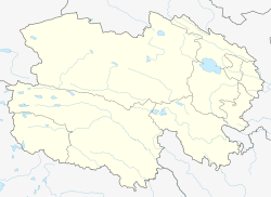
 Dulan County (light red) within Haixi Prefecture (yellow) and Qinghai | |
 Dulan Location of the county seat in Qinghai | |
| Coordinates: 36°18′N98°05′E / 36.300°N 98.083°E | |
| Country | China |
| Province | Qinghai |
| Autonomous prefecture | Haixi |
| County seat | Qagan Us |
| Area | |
| • Total | 45,270 km2 (17,480 sq mi) |
| Elevation | 3,194 m (10,479 ft) |
| Population (2020) | |
| • Total | 68,273 |
| • Density | 1.5/km2 (3.9/sq mi) |
| [1] | |
| Time zone | UTC+8 (China Standard) |
| Postal code | 816100 |
| Website | www |
- ↑ "海西州第七次全国人口普查公报(第二号)——各市县、行委常住人口情况" (in Chinese). Government of Haixi Prefecture. 2021-07-02.
- ↑ 中国气象数据网 – WeatherBk Data (in Simplified Chinese). China Meteorological Administration . Retrieved 27 August 2023.
- ↑ 中国气象数据网 (in Simplified Chinese). China Meteorological Administration . Retrieved 27 August 2023.
- ↑ 中国地面国际交换站气候标准值月值数据集(1971-2000年). China Meteorological Administration. Archived from the original on 2013-09-21. Retrieved 2010-05-25.
- ↑ 中国气象数据网 – WeatherBk Data (in Simplified Chinese). China Meteorological Administration . Retrieved 27 September 2023.
- ↑ 中国气象数据网 (in Simplified Chinese). China Meteorological Administration . Retrieved 27 September 2023.
External links
| Dulan County | |||||||||||
|---|---|---|---|---|---|---|---|---|---|---|---|
| Chinese name | |||||||||||
| Simplified Chinese | 都兰县 | ||||||||||
| Traditional Chinese | 都蘭縣 | ||||||||||
| |||||||||||
| Prefecture-level cities | |||||||||||||
|---|---|---|---|---|---|---|---|---|---|---|---|---|---|
| Autonomous prefectures |
| ||||||||||||
| |||||||||||||