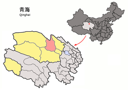
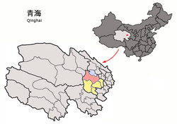
List of township-level divisions of Qinghai

Last updated

A list of township-level divisions of Qinghai , China (PRC): [1] After province, prefecture, and county-level divisions, township-level divisions constitute the formal fourth-level administrative divisions of the PRC. The townships of Qinghai are divided into subdistricts, towns, townships, and ethnic townships.

Contents

Xining

Location of Xining Districts in the Qinghai Location of Xining Districts within Qinghai (China).png
Location of Xining Districts in the Qinghai

Chengzhong District

Subdistricts:

Town:

Chengdong District

Subdistricts:

Towns:

Chengxi District

Subdistricts:

Town:

Chengbei District

Subdistricts:

Towns:

Huangyuan County

Towns:

Townships:

Ethnic Township:

Huangzhong County

Subdistricts: Kangchuan Subdistrict (康川街道) and Ganhe Industrial Park (甘河工业园)

Towns:

Townships:

Ethnic Townships:

Datong County

Towns:

Townships:

Ethnic Townships:

Haidong

Location of Ping'an District in Qinghai (city in pink, rest of administrative area in yellow) Location of Ping'an within Qinghai (China).png
Location of Ping'an District in Qinghai (city in pink, rest of administrative area in yellow)

Ping'an District

Towns:

Township:

Ethnic Townships: Hongshuiquan Hui Ethnic Township (洪水泉回族乡), Shihuiyao Hui Ethnic Township (石灰窑回族乡), Gucheng Hui Ethnic Township (古城回族乡), Shagou Hui Ethnic Township (沙沟回族乡), Bazanggou Hui Ethnic Township (巴藏沟回族乡)

Ledu District

Towns:

Townships:

Ethnic Townships:

Minhe County

Towns:

Townships:

Ethnic Township:

Huzhu County

Towns:

Townships:

Ethnic Townships:

Hualong County

Towns:

Townships:

Ethnic Townships:

Xunhua County

Towns:

Townships:

Ethnic Townships:

Haibei

Location of Haiyan County in Qinghai (city in pink, rest of administrative area in yellow) Location of Haiyan within Qinghai (China).png
Location of Haiyan County in Qinghai (city in pink, rest of administrative area in yellow)

Haiyan County

Towns:

Townships:

Ethnic Township:

Qilian County

Towns:

Townships:

Gangca County

Towns:

Townships:

Menyuan County

Towns:

Townships:

Ethnic Township:

Haixi

Location of Delingha in Qinghai (city in pink, rest of administrative area in yellow) Location of Delingha within Qinghai (China).png
Location of Delingha in Qinghai (city in pink, rest of administrative area in yellow)

Delingha City

Subdistricts:

Towns:

Township:

Golmud City

Subdistricts: [2] [3] [4]

Towns:

Townships:

Mangnai

Towns: Mangnai (茫崖镇), Huatugou (花土沟镇), Lenghu (冷湖镇)

Ulan County

Towns:

Dulan County

Towns:

Townships:

Tianjun County

Towns:

Townships:

Da Qaidam Administrative Zone

Towns: Qaidam (柴旦镇), Xitieshan (锡铁山镇)

Hainan

Location of Gonghe County in Qinghai (city in pink, rest of administrative area in yellow) Location of Gonghe within Qinghai (China).png
Location of Gonghe County in Qinghai (city in pink, rest of administrative area in yellow)

Gonghe County

Towns:

Townships:

Tongde County

Towns:

Townships:

Guide County

Towns:

Townships:

Ethnic Townships:

Xinghai County

Towns:

Townships:

Guinan County

Towns:

Townships:

Huangnan

Location of Tongren County in Qinghai (city in pink, rest of administrative area in yellow) Location of Tongren within Qinghai (China).png
Location of Tongren County in Qinghai (city in pink, rest of administrative area in yellow)

Tongren County

Towns:

Townships:

Jainca County

Towns:

Townships:

Zêkog County

Towns:

Townships:

Henan County

Towns:

Townships:

Golog

Location of Maqen County in Qinghai (city in pink, rest of administrative area in yellow) Location of Maqen within Qinghai (China).png
Location of Maqên County in Qinghai (city in pink, rest of administrative area in yellow)

Maqên County

Towns:

Townships:

Baima County

Town:

Townships:

Gadê County

Town:

Townships:

Darlag County

Town:

Townships:

Jigzhi County

Town:

Townships:

Madoi County

Towns:

Townships:

Yushu

Location of Yushu City in Qinghai (city in pink, rest of administrative area in yellow) Location of Yushu within Qinghai (China).png
Location of Yushu City in Qinghai (city in pink, rest of administrative area in yellow)

Yushu City

[5] Subdistricts:

Towns:

Townships:

Zadoi County (Zaduo County)

[6] Town:

Townships:

Chindu County (Chenduo County)

[7] Towns:

Townships:

Zhidoi County (Zhiduo County)

[8] Town:

Townships:

Nangchen County (Nangqian County)

[9] Town:

Townships:

Qumarlêb County (Qumalai County)

[10] Town:

Townships:

See also

Related Research Articles

<span class="mw-page-title-main">Golmud</span> City in Qinghai Province, China

Golmud, also known by various other romanizations, is a county-level city in the Haixi Mongol and Tibetan Autonomous Prefecture of Qinghai Province, China. It is now the second-largest city in Qinghai and the third largest in the Tibetan Plateau. The population in 2020 is 221,863.

<span class="mw-page-title-main">Karakax County</span> County in Xinjiang, China

Karakax County, alternatively Moyu County, also transliterated from Uyghur as Qaraqash County, alternately Qaraqash, is a county in the Xinjiang Uyghur Autonomous Region and is located in the southern edge of the Tarim Basin, it is under the administration of the Hotan Prefecture. It contains an area of 25,667 km2 (9,910 sq mi). According to the 2011 census it has a population of 577,000 and 98,1% are Uyghurs. The county is bordered to the north by Awat County in Aksu Prefecture, to the northeast by Lop County, to the southeast by Hotan County, to the northwest by Maralbexi County in Kashgar Prefecture, and to the southwest by Pishan County and Kunyu. Exclaves of Kunyu are located within the county.

<span class="mw-page-title-main">Pishan County</span> County in Xinjiang, China

Pishan County as the official romanized name, also transliterated from Uyghur as Guma County, is a county within the Xinjiang Uyghur Autonomous Region and is under the administration of the Hotan Prefecture. It contains an area of 39,412 km2 (15,217 sq mi). According to the 2002 census, it has a population of 220,000. The county borders Maralbexi County and Makit County to the north, Karakax County, Hotan County and Kunyu to the east and Kargilik County to the west. The county includes lands near the Karakoram Pass which are part of the Aksai Chin area that is disputed between China and India.

<span class="mw-page-title-main">Huzhu Tu Autonomous County</span> Autonomous County in Qinghai, China

Huzhu Tu Autonomous County, or in short Huzhu County (互助县), is an autonomous county under the jurisdiction of the prefecture-level city of Haidong, in the east of Qinghai province, China, bordering Gansu province to the northeast. It has an area of 3,321 km2 (1,282 sq mi) and approximately 370,000 inhabitants (2004). Its seat is the town of Weiyuan.

<span class="mw-page-title-main">Huangzhong, Xining</span> District in Qinghai, China

Huangzhong District is a district of Xining, Qinghai Province, China. It is located about 80 km (50 mi) east of Qinghai Lake and about 10 km (6.2 mi) southwest of downtown Xining. In 2020 the district had a population of 463,900, of which 153,000 belonging to minorities. The Kumbum Monastery is located in the district.

Hualong Hui Autonomous County is a county in the east of Qinghai Province, China. It is under the administration of Haidong City. Its area is 2,790 square kilometers and has a population of 203,317 in 2010.

<span class="mw-page-title-main">Hanchuan</span> County-level city in Hubei, Peoples Republic of China

Hanchuan is a county-level city in east-central Hubei province, People's Republic of China. It is under the administration of Xiaogan prefecture-level city. The city's urban area is located on the left bank of the Han River a few tens of kilometres upstream from Wuhan. However, the county-level city as an administrative unit also includes some land on the right bank of the river as well. The city has been served by the Hanchuan railway station on the Wuhan–Yichang railway. Hanchuan is a sister city of Martinez, California, United States.

Muji is a town in Pishan/Guma County, Hotan Prefecture, Xinjiang, China.

References

  1. "名称" (in Chinese). National Bureau of Statistics of China. Retrieved 23 May 2014.
  2. 格尔木市历史沿革 [Goldmud City Historical Development] (in Chinese). XZQH. 10 December 2013. Retrieved 27 November 2018. 2000年第五次人口普查,格尔木市总人口135897人,其中:昆仑路街道38214人,金峰路街道26567人,河西街道27417人,郭勒木德乡15771人,大格勒乡2106人,乌图美仁乡1808人,唐古拉山乡1880人,格尔木铁路12249人,格尔木农场9883人。{...}2005年,格尔木市调整乡镇行政区划:撤销郭勒木德乡,设立郭勒木德镇,镇政府驻地和镇区行政区划范围不变,实行镇管村体制。2、撤销唐古拉山乡,设立唐古拉山镇,镇政府驻地和镇区行政区划范围不变,实行镇管村体制。
  3. 2017年统计用区划代码和城乡划分代码:格尔木市 [2017 Statistical Area Numbers and Rural-Urban Area Numbers: Golmud City] (in Chinese). National Bureau of Statistics of the People's Republic of China. 2017. Retrieved 27 November 2018. 统计用区划代码 名称 632801001000 昆仑路街道办事处 632801002000 黄河路街道办事处 632801003000 金峰路街道办事处 632801004000 河西街道办事处 632801005000 西藏路街道办事处 632801100000 郭勒木德镇 632801101000 唐古拉镇 632801200000 大格勒乡 632801201000 乌图美仁乡 632801400000 察尔汗工行委 632801401000 格尔木农垦有限公司
  4. 世界盐湖城—青海格尔木市门户网站 概览 [World Salt Lake City - Qinghai Golmud City Web Portal Overview] (in Chinese). 格尔木市电子政务办公室. Retrieved 27 November 2018. 昆仑经济开发区 东城区工行委 西城区工行委 察尔汗工行委 乌图美仁乡 大格勒乡 郭勒木德镇 唐古拉山镇 昆仑路街道办事处 黄河路街道办事处 河西办事处 金锋路办事处 西藏路办事处
  5. "统计用区划代码 www.stats.gov.cn" (in Chinese). XZQH. Retrieved 2020-12-27.
  6. "统计用区划代码 www.stats.gov.cn" (in Chinese). XZQH. Retrieved 2020-12-27.
  7. "统计用区划代码 www.stats.gov.cn" (in Chinese). XZQH. Retrieved 2020-12-27.
  8. "统计用区划代码 www.stats.gov.cn" (in Chinese). XZQH. Retrieved 2020-12-27.
  9. "统计用区划代码 www.stats.gov.cn" (in Chinese). XZQH. Retrieved 2020-12-27.
  10. "统计用区划代码 www.stats.gov.cn" (in Chinese). XZQH. Retrieved 2020-12-27.