List of township-level divisions of Hubei

Last updated

Location of Hubei province in China China Hubei.svg
Location of Hubei province in China

This is a list of township-level divisions of the province of Hubei, People's Republic of China (PRC). After province, prefecture, and county-level divisions, township-level divisions constitute the formal fourth-level administrative divisions of the PRC. As of late 2016, there were over 1,000 such divisions in Hubei, including 307 subdistricts, 759 towns, and 168 townships. [1] After changes, as of late 2017, there were 308 subdistricts, 761 towns, and 165 townships [2] (including 19 ethnic townships)[ citation needed ]. This list is divided first into the prefecture-level then the county-level divisions.

Contents

Wuhan

Location of Wuhan in the province Location of Wuhan Prefecture within Hubei (China).png
Location of Wuhan in the province

Caidian District

Subdistricts: [3] [4]

Towns:

The only township is Xiaosi Township (消泗乡)

Dongxihu District

Subdistricts: [5] [6]

Hannan District

Subdistricts: [8] [9] [10] [11]

Hanyang District

Subdistricts: [12] [13]

Areas:

Hongshan District

Nine subdistricts: [14] [15]

The only township is Tianxing Township (天兴乡)

Two other areas:

Huangpi District

Subdistricts: [16] [17]

The only town is Sanli (三里镇)

Townships:

Jiang'an District

Subdistricts: [18] [19]

Other Areas:

Jianghan District

Thirteen subdistricts: [22] [23] [24]

Jiangxia District

Subdistricts: [25] [26]

Towns:

The only township is Shu'an Township (舒安乡)

Qiaokou District

Eleven subdistricts: [27] [28]

Qingshan District

Subdistricts: [29] [30]

Other: Beihu Administrative Committee Subdistrict (北湖管委会街道)

Wuchang District

Fifteen subdistricts: [31] [32]

Xinzhou District

Subdistricts: [33] [34] [35]

Towns:

Enshi Tujia and Miao Autonomous Prefecture

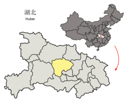
Location of Enshi Tujia and Miao Autonomous Prefecture in the province Location of Enshi Prefecture within Hubei (China).png
Location of Enshi Tujia and Miao Autonomous Prefecture in the province

Enshi City

Three subdistricts: [36] [37] [38]

Five towns:

Eight townships:

Other area:

Lichuan

Two subdistricts: [39] [40] [41]

Seven towns:

Five townships:

Badong County

Ten towns: [42] [43] [44]

Two townships:

Hefeng County

Five towns: [45] [46] [47]

Four townships:

Jianshi County

Seven towns: [48] [49] [50]

Three townships:

Laifeng County

Six towns: [51] [52] [53]

Two townships:

Xianfeng County

Six towns: [54] [55] [56]

Four townships:

One other area:

Xuan'en County

Five towns: [57] [58] [59]

Four townships:

Ezhou

Location of Ezhou in the province Location of Ezhou Prefecture within Hubei (China).png
Location of Ezhou in the province

Echeng District

Three subdistricts: [60] [61] [62]

Nine towns:

The only township is Shawo Township ( 沙窝 )

Other areas:

Huarong District

Three towns: [63] [64]

Two townships:

Liangzihu District

Five towns: [65] [66]

Huanggang

Location of Huanggang in the province Location of Huanggang Prefecture within Hubei (China).png
Location of Huanggang in the province

Huangzhou District

Four subdistricts: [67] [68]

Three towns:

The only township is Taodian Township ( 陶店 ).

One other area:

Macheng

Subdistricts: [69] [70] [71]

Towns:

The only township is Tiemengang ( 铁门岗 ).

One other area: Macheng Economic Development Zone (麻城经济开发区)

Wuxue

Four subdistricts: [72] [73]

Eight towns:

Hong'an County

Towns: [74] [75]

The only township is Xinghua Township (杏花乡)

Other Areas: Huolianfan Tea Farm (火连畈茶场), Tiantaishan Scenic Area (天台山风景区管理处)

Huangmei County

Twelve towns: [76] [77]

Four townships:

Luotian County

Ten towns: [78] [79]

Two townships:

Qichun County

Thirteen towns: [80] [81]

The only township is Xiangqiao Township (向桥乡)

One other area: Balihu (八里湖)

Tuanfeng County

Eight towns: [82] [83]

Two townships:

Xishui County

Twelve towns: [84] [85]

The only township is Lüyang Township (绿杨乡)

Three other areas: Sanjiaoshan Forestry Area (三角山林场), Cehu Breeding Farm (策湖养殖场), Xishui Economic Development Zone (经济开发区)

Yingshan County

Eight towns: [86] [87] [88]

Three townships:

Four other areas:

Huangshi

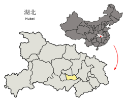
Location of Huangshi in the province Location of Huangshi Prefecture within Hubei (China).png
Location of Huangshi in the province

Huangshigang District

Subdistricts: [89] [90] [91] [92]

Tieshan District

The only administrative direct subdivision is a town-simulating village (区直辖村模拟镇). [93] [94] [95] [96]

Xialu District

The only subdistrict is Tuanchengshan Subdistrict ( 团城山 街道 ) [97] [98] [99] [100]

Xisaishan District

Former Subdistricts: [101] [102] [103] [104]

The only town is Hekou (河口镇)

Daye

Subdistricts: [105] [106] [107] [108]

Towns:

The only township is Mingshan Township (茗山乡)

Other areas: 东风农场管理区, 四顾闸管理处

Yangxin County

Township-level divisions: [109] [110] [111] [112]

Jingmen

Location of Jingmen in the province Location of Jingmen Prefecture within Hubei (China).png
Location of Jingmen in the province

Dongbao District

Two subdistricts: [114] [115] [116]

Six towns:

The only township is Xianju Township ( 仙居 )

Duodao District

Four subdistricts: [117] [118] [119]

Two towns:

Zhongxiang

The only subdistrict is Yingzhong Subdistrict ( 郢中 街道 ) [120] [121] [122]

Towns:

The only township is Jiuli Township ( 九里 )

Jingshan County

Towns: [123]

Shayang County

Towns: [124] [125] [126]

Other Areas:

Jingzhou

Location of Jingzhou in the province Location of Jingzhou Prefecture within Hubei (China).png
Location of Jingzhou in the province

Jingzhou District

Three subdistricts: [127] [128] [129]

Seven towns:

Two other areas:

Shashi District

Five subdistricts: [130] [131] [132]

Four towns:

The only township is Lixin Township ( 立新 )

Honghu

Two subdistricts: [133] [134] [135]

Fourteen towns:

The only township is Laowan Township ( 老湾 )

Three administrative zones:

Shishou

Two subdistricts: [136] [137] [138]

Eleven towns:

The only township is Jiuheyuan Township ( 久合垸 )

The only economic and technological development zone is Tian'ezhou ( 天鹅洲 )

Songzi

Towns: [139] [140] [141] [142]

Townships:

Gong'an County

Fourteen towns: [143] [144] [145]

Two townships:

Jiangling County

Six towns: [146] [147] [148]

Two townships:

Three other areas:

Jianli County

Eighteen towns: [149] [150] [151]

Three townships:

Two other areas:

Qianjiang

Location of Qianjiang in the province Location of Qianjiang within Hubei (China).png
Location of Qianjiang in the province

Six subdistricts: [152] [153]

Ten towns:

Other areas:

Shennongjia

Location of Shennongjia in the province Location of Shennongjia within Hubei (China).png
Location of Shennongjia in the province

Six towns: [154] [155] [156]

Two townships:

Shiyan

Location of Shiyan in the province Location of Shiyan Prefecture within Hubei (China).png
Location of Shiyan in the province

Maojian District

Subdistricts: [157] [158] [159]

The only town is Dachuan ( 大川 )

Townships:

Zhangwan District

Four subdistricts: [160] [161] [162] [163]

Two towns:

Two townships:

Four other areas:

Danjiangkou

Subdistricts: [164] [165] [166]

Towns:

Other areas:

Fang County

Towns: [167] [168] [169]

Townships:

Yunyang District

Towns: [170] [171] [172]

Townships:

Other area:

Yunxi County

Nine towns: [173] [174] [175]

Seven townships:

Two other areas:

Zhushan County

Nine towns: [179] [180] [181]

Eight townships:

Zhuxi County

Eleven towns: [182] [183] [184]

Four townships:

Other areas:

Suizhou

Location of Suizhou in the province Location of Suizhou Prefecture within Hubei (China).png
Location of Suizhou in the province

Zengdu District

Four subdistricts: [185] [186] [187]

Five towns:

Other areas:

Guangshui

Four subdistricts: [188] [189] [190] [191]

Thirteen towns:

Other areas:

Sui County

Nineteen towns: [192] [193] [194]

Tianmen

Location of Tianmen in the province Location of Tianmen within Hubei (China).png
Location of Tianmen in the province

Subdistricts: [195] [196]

Towns:

The only township is Jingtan Township (净潭乡)

Other Areas:

Xiangyang

Location of Xiangyang in the province Location of Xiangfan Prefecture within Hubei (China).png
Location of Xiangyang in the province

Fancheng District

Subdistricts: [197] [198] [199]

Towns:

Xiangcheng District

Six subdistricts: [201] [202] [203]

Two towns:

The only township is Yinji Township ( 尹集 )

Xiangzhou District

Subdistricts: [204] [205] [206]

Towns:

Laohekou

Two subdistricts: [207] [208] [209]

Seven towns:

The only township is Yuanchong Township ( 袁冲 )

Other areas:

Yicheng

Two subdistricts: [210] [211] [212]

Eight towns:

Three other areas:

Zaoyang

Three subdistricts: [213] [214] [215]

Twelve towns:

Other areas:

Baokang County

Ten towns: [216] [217] [218]

The only township is Liangyu Township ( 两峪 )

Gucheng County

Nine towns: [219] [220] [221]

The only township is Zhaowan Township ( 赵湾 )

Other areas:

Nanzhang County

Ten towns: [223] [224] [225]

One other area:

Xianning

Location of Xianning in the province Location of Xianning Prefecture within Hubei (China).png
Location of Xianning in the province

Xian'an District

Subdistricts: [226] [227] [228] [229] [230]

Towns:

The only township is Damu Township (大幕乡)

Other Area: Xiangyanghu Dairy Farm (向阳湖奶牛良种场)

Xianning Advanced Technology Industry Area

Chibi City

Three subdistricts: [233] [234]

Ten towns:

The only township is Yujiaqiao Township ( 余家桥 )

Other areas:

Chongyang County

Eight towns: [236] [237]

Four townships:

One other area:

Jiayu County

Towns: [238]

Tongcheng County

Nine towns: [239]

Two townships:

Tongshan County

Eight towns: [240] [241]

Four townships:

One other area:

Xiantao

Location of Xiantao in the province Location of Xiantao within Hubei (China).png
Location of Xiantao in the province

Subdistricts: [242] [243]

Towns:

Other Areas:

Xiaogan

Location of Xiaogan in the province Location of Xiaogan Prefecture within Hubei (China).png
Location of Xiaogan in the province

Xiaonan District

Subdistricts: [244]

Towns:

Townships:

Other areas:

Anlu

Two subdistricts: [245] [246] [247]

Nine towns:

Four townships:

One other area:

Hanchuan

Two subdistricts: [248] [249] [250] [251]

Fourteen towns:

Six townships:

Five other areas:

Yingcheng

Five subdistricts: [252] [253] [254]

Ten towns:

Two other areas:

Dawu County

Towns: [255] [256] [257]

Towns:

Townships:

Other areas:

Xiaochang County

Eight towns: [258] [259] [260]

Four townships:

Three other areas:

Yunmeng County

Towns: [261] [262] [263] [264]

Townships:

Other area:

Yichang

Location of Yichang in the province Location of Yichang Prefecture within Hubei (China).png
Location of Yichang in the province

Dianjun District

[265] [266] [267]

The only subdistrict is Dianjun Subdistrict ( 点军 街道 )

Two towns:

Two townships:

Wujiagang District

Four subdistricts: [268] [269] [270]

The only township is Wujia Township ( 伍家 )

Xiling District

Subdistricts: [271] [272] [273]

The only township is Yaowan Township ( 窑湾 )

Other area:

Xiaoting District

Three subdistricts: [274] [275] [276]

Yiling District

Subdistricts: [277] [278] [279]

Towns:

Townships:

Dangyang

Three subdistricts: [280] [281] [282]

Seven towns:

Yidu

[283] [284] [285]

The only subdistrict is Lucheng Subdistrict ( 陆城 街道 )

Towns:

Townships:

Zhijiang

One subdistrict: [286] [287] [288]

Eight towns:

Changyang Tujia Autonomous County

Eight towns: [289] [290] [291]

Three townships:

Wufeng Tujia Autonomous County

Five towns: [292] [293] [294]

Three townships:

Xingshan County

Six towns: [295] [296] [297]

Two townships:

Yuan'an County

Six towns: [298] [299] [300]

The only township is Hekou Township ( 河口 )

Zigui County

Eight towns: [301] [302] [303]

Four townships:

Related Research Articles

<span class="mw-page-title-main">Dangyang</span> County-level city in Hubei, Peoples Republic of China

Dangyang is a city in western Hubei province, People's Republic of China, lying 70 kilometres (43 mi) east of the Gezhouba Dam on the Yangtze River. During the Western Han Dynasty. Emperor Jing of Han established an administration in Dangyang on an area of 2,000 square kilometres (770 sq mi). In 1988 the State Council of the People's Republic of China elevated this from a county to a county-level city, and is currently under the administration of the prefecture-level city of Yichang.

<span class="mw-page-title-main">Fancheng, Xiangyang</span> District in Hubei, Peoples Republic of China

Fancheng is a district of the city of Xiangyang, Hubei, People's Republic of China.

Xiangcheng District is a district and the seat of the city of Xiangyang, Hubei province, China.

<span class="mw-page-title-main">Macheng</span> County-level city in Hubei, Peoples Republic of China

Macheng is a city in northeastern Hubei province, People's Republic of China, bordering the provinces of Henan to the north and Anhui to the northeast. It is a county-level city under the administration of Huanggang City and abuts the south side of the Dabie Mountains. The city's administrative area covers about 3,747 square kilometres (1,447 sq mi), and includes some 704 villages and small towns. Total population was 849,092 at the 2010 census.

<span class="mw-page-title-main">Chibi, Hubei</span> County-level city in Hubei, Peoples Republic of China

Chibi is a county-level city in southeastern Hubei province, China. Neighboring Wuhan in the north and Yueyang in the south, Chibi is called the "South Gate of Hubei". It is under the administration of Xianning prefecture-level city. Chibi was called Puqi until 11 June 1998, when the State Council approved its renaming to "Chibi" since it was the site of the famous Battle of Chibi that took place in the winter of 208/9 CE.

Guangshui is a city located in northeastern Hubei province, People's Republic of China, near the border with Henan province. Administratively, it is a county-level city of Suizhou City. Guangshui was known as Yingshan County before December 1988.

<span class="mw-page-title-main">Kaizhou, Chongqing</span> District in Chongqing, Peoples Republic of China

Kaizhou District, formerly known as Kai County, Kaixian or Kaihsien is a district under the jurisdiction of Chongqing Municipality, in southwestern China, bordering Sichuan province to the west. It has an area of 3,959 square km. As of the end of 2009, it had a population of 1.62 million. It is located 330 kilometers from the urban centre of Chongqing proper.

<span class="mw-page-title-main">Yiling, Yichang</span> District in Hubei, Peoples Republic of China

Yiling District is a district of the prefecture-level city of Yichang, Hubei province, People's Republic of China. Created on July 30, 2001, the district includes most of the former Yichang County, with the exception of Yichang center city and certain southern and western suburbs.

<span class="mw-page-title-main">Caidian, Wuhan</span> District in Hubei, Peoples Republic of China

Caidian District is one of 13 urban districts that constitute the prefecture-level city of Wuhan, the capital of Hubei Province, China, forming part of the city's southwestern suburbs and situated on the northwestern (left) bank of the Yangtze River. On the left bank it borders the districts of Dongxihu to the north, Hanyang to the northeast, and Hannan to the south; on the opposite bank, Jiangxia and Hongshan. It also borders Xiaogan to the northwest and Xiantao to the southwest.

<span class="mw-page-title-main">Dongbao, Jingmen</span> District in Hubei, China

Dongbao District is a district of the city of Jingmen, Hubei, China.

<span class="mw-page-title-main">Hanchuan</span> County-level city in Hubei, Peoples Republic of China

Hanchuan is a county-level city in east-central Hubei province, People's Republic of China. It is under the administration of Xiaogan prefecture-level city. The city's urban area is located on the left bank of the Han River a few tens of kilometres upstream from Wuhan. However, the county-level city as an administrative unit also includes some land on the right bank of the river as well. The city has been served by the Hanchuan railway station on the Wuhan–Yichang railway. Hanchuan is a sister city of Martinez, California, United States.

<span class="mw-page-title-main">Jingzhou, Jingzhou</span> District in Hubei, Peoples Republic of China

Jingzhou District is a district of the city of Jingzhou, Hubei, Central China.

<span class="mw-page-title-main">Wujiagang, Yichang</span> District in Hubei, Peoples Republic of China

Wujiagang District is a district of the city of Yichang, Hubei, People's Republic of China. Established in 1986, the territory of the whole area is 84.03 square kilometers. There are 33 community neighborhood committees in 4 Street offices and 16 village committees in 1 townships, with a total population of 214194 at the end of 2010. Wujiagang district is the old industrial district of Yichang City, with a large quantity of high quality industrial stock. There are more than 300 enterprises, enterprises and enterprises in the District, and the industrial output value accounts for more than 70% of the total industrial output value of the city's urban areas. By the end of 2013 has formed the Jinshan building materials, non-staple food, vegetables and fruits, Hengchang bridge Ding Xin auto parts, automobile trade city, Three Gorges building materials City, home-run supermarket market clusters, various professional markets reached 32, the business area of more than 16 square meters.

Mulan is a township of Huangpi District in northeastern Hubei province, China.

References

  1. "2016年湖北行政区划调整" (in Chinese). 湖北省民政厅. 6 January 2017. Archived from the original on 24 October 2018. Retrieved 23 March 2018. 湖北省行政区划一览表 (资料截止2016年底) 行政单位 合计 街道办事处 镇 乡 全省总计 1234 307 759 168
  2. "2017年版湖北省行政区划落定" (in Chinese). 湖北省民政厅. 29 December 2017. Retrieved 23 March 2018. 截止2017年底,全省共有{...}308个街道办事处、761个镇、165个乡。
  3. "行政区划 (translation: Administrative Divisions)" (in Chinese). 武汉市蔡甸区信息中心 (translation: Caidian District, Wuhan Information Center). Archived from the original on 24 December 2017. Retrieved 18 December 2017. "蔡甸区辖蔡甸、奓山、永安、侏儒、大集、张湾、索河、玉贤8个行政街,洪北农业示范区管委会、成功管委会2个管委会和消泗乡及桐湖农场。" (translation: Caidian District administers Caidian, Zhashan, Yong'an, Zhuru, Daji, Zhangwan, Suohe and Yuxian, in all eight administrative subdistricts; Hongbei Agricultural Model Administrative Committee and Chenggong Administrative Committee, in all two administrative committees; as well as Xiaosi Township and Tonghu Farm.)
  4. "蔡甸区历史沿革 (translation: The Historical Development of Caidian District)" (in Chinese). 行政区划网站 (translation: Administrative Divisions Website). 26 December 2014. Retrieved 18 December 2017. "2010年第六次人口普查,蔡甸区常住总人口618994人,其中:蔡甸街道146138人,奓山街道46008人,永安街道26989人,侏儒街道47326人,大集街道29532人,张湾街道28674人,沌口街道181575人,军山街道26531人,索河镇21544人,玉贤镇15417人,消泗乡13251人,桐湖办事处2314人,洪北管委会3585人;(蔡甸经济开发区)沌口办事处13139人,常福办事处6966人,文岭办事处827人,姚家山办事处9178人。" (abbreviated translation: In 2010{...}, Caidian District{...} Caidian Subdistrict{...}, Zhashan Subdistrict{...}, Yong'an Subdistrict{...}, Zhuru Subdistrict{...}, Daji Subdistrict{...}, Zhangwan Subdistrict{...}, Zhuankou Subdistrict{...}, Junshan Subdistrict{...}, Suohe Town{...}, Yuxian Town{...}, Xiaosi Township{...}, Tonghu Office{...}, Hongbei Administrative Committee, (Caidian Economic Development District) Zhuankou Office{...}, Changfu Office{...}, Wenling Office{...} and Yaojiashan Office{...}.)
  5. "区划简码 (translation: Administrative Division Codes)" (PDF) (in Chinese). Dongxihu District government website. 30 November 2017. Retrieved 19 December 2017. "{...}吴家山街{...}柏泉{...}将军路{...}慈惠{...}走马岭{...}径河{...}长青{...}新沟镇{...}辛安渡{...}东山{...}金银湖{...}常青花园{...}" (translation: {...}Wujiashan Subdistrict{...}Boquan{...}Jiangjunlu{...}Cihui{...}Zoumaling{...}Jinghe{...}Changqing (长青){...}Xingouzhen{...}Xin'andu{...}Dongshan{...}Jinyinhu{...}Changqinghuayuan{...}.)
  6. "东西湖区历史沿革 (translation: The Historical Development of Dongxihu District)" (in Chinese). 行政区划网站 (translation: Administrative Divisions Website). 6 August 2014. Retrieved 19 December 2017. "2010年第六次人口普查,东西湖区常住总人口452053人,其中:吴家山街道115067人,柏泉办事处9402人,将军路街道42259人,慈惠街道16373人,走马岭街道26744人,径河街道36937人,长青街道41648人,辛安渡办事处12620人,东山办事处14446人,新沟镇街道17839人,金银湖街道58891人,常青花园新区管委会55353人,台商工业园区管委会4474人。" (abbreviated translation: In 2010{...}, Dongxihu District{...} including: Wujiashan Subdistrict{...}, Boquan Office{...}, Jiangjunlu Subdistrict{...}, Cihui Subdistrict{...}, Zoumaling Subdistrict{...}, Jinghe Subdistrict{...}, Changqing (长青) Subdistrict{...}, Xin'an Office{...}, Dongshan Office{...}, Xingouzhen Subdistrict{...}, Jinyinhu Subdistrict{...}, Changqinghuayuan (常青花园) New Area Administrative Committee{...}, Taishang Industrial Park Administrative Committee{...}.)
  7. 认识武汉②[Learning About Wuhan] (in Simplified Chinese and English). 中共东西湖区委宣传部 Publicity Department of the CPC in Dongxihu District, 武汉新港空港综合保税区(空港) Wuhan New Port Airport Free Trade Zone, 长江日报传播研究院 Institute of Communication Studies of Changjiang Daily. 2018. pp. 10–11. 柏泉古井中数仞清泉,散发千年韵味悠长{...}Crystal-clear springs in the Boquan Ancient Well have captured the imagination for a 1,000 years,{...}
  8. "邓南街巧做"三个加法" 奏响现代农业发展新强音 (translation: Three smart "additions" of Dengnan Subdistrict ring in a new strong sound on modern agricultural development)" (in Chinese). Nanhan government website. 1 March 2017. Archived from the original on 12 June 2018. Retrieved 17 December 2017. "汉南地区4个街道" (translation: Hannan administers four subdistricts)
  9. "汉南区历史沿革 (translation: The Historical Development of Hannan District)" (in Chinese). 行政区划网站 (translation: Administrative Divisions Website). 8 August 2014. Retrieved 17 December 2017. "2006年,撤销邓南镇,设立邓南街道。调整后,全区辖4个街道:纱帽街道、东荆街道、湘口街道、邓南街道。" (translation: In 2006, Dengnan Town was disestablished and Dengnan Subdistrict was created. After this change, the district in all administered four subdistricts: Shamao Subdistrict, Dongjing Subdistrict, Xiangkou Subdistrict and Dengnan Subdistrict)
  10. "汉南区地区概况-市县招商网 - 中国政府招商引资第一平台". Archived from the original on 2020-08-08. Retrieved 2017-12-24.
  11. 2017年统计用区划代码和城乡划分代码:汉南区 [2017 Statistical Area Numbers and Rural-Urban Area Numbers: Hannan District] (in Simplified Chinese). National Bureau of Statistics of the People's Republic of China. 2017. Retrieved 21 January 2019. 统计用区划代码 名称 420113001000 纱帽街道办事处 420113002000 邓南街道办事处 420113003000 东荆街道办事处 420113004000 湘口街道办事处
  12. "人口区划 (translation: Population and Administrative Divisions)" (in Chinese). 武汉市汉阳区人民政府 (translation: People's Government of Hanyang District, Wuhan City). 6 December 2016. Archived from the original on 9 October 2018. Retrieved 23 December 2017. "【行政区划】 2016 年,汉阳区下辖晴川街、龙阳街、建桥街、鹦鹉街、洲头街、四新街、五里墩街、琴断口街、江汉二桥街、永丰街、江堤街等 11 个街道和汉阳经济开发区、四新地区,共有 118 个社区居民委员会。" (translation: Administrative Divisions As of 2016, Hanyang District administers Qingchuan Subdistrict, Longyang Subdistrict, Jianqiao Subdistrict, Yingwu Subdistrict, Zhoutou Subdistrict, Sixin Subdistrict, Wulidun Subdistrict, Qinduankou Subdistrict, Jianghan'erqiao Subdistrict and Jiangdi Subdistrict in all eleven subdistricts as well as Hanyang Economic Development Zone and Sixin Zone including in all 118 community residential committees.)
  13. "汉阳区历史沿革 (translation: The Historical Development of Hanyang District)" (in Chinese). 行政区划网站 (translation: Administrative Divisions Website). 7 July 2014. Retrieved 23 December 2017. 2010年第六次人口普查,汉阳区常住总人口584098人,其中:翠微街道44529人,建桥街道46960人,月湖街道20944人,晴川街道17138人,鹦鹉街道51945人,洲头街道38888人,五里墩街道87346人,琴断口街道66908人,江汉二桥街道76001人,永丰街道106482人,江堤街道24496人,四新地区管委会2461人。2011年末,全区总面积111.54平方千米,户籍总人口420529人,其中农业人口10361人。辖11个街道、1个经济开发区、1个管理地区,131个社区、6个行政村。(武汉年鉴2012数据
  14. "洪山年鉴2016" (PDF) (in Chinese). Hongshan District government website. p. 22. Archived from the original (PDF) on 6 December 2017. Retrieved 5 December 2017. 截至2011年4月,洪山区辖珞南、关山、狮子山、梨园、和平、洪山、张家湾、青菱、卓刀泉9个街道和1个乡天兴乡。
  15. "2016年统计用区划代码和城乡划分代码:洪山区" (in Chinese). 中华人民共和国国家统计局 National Bureau of Statistics of the People's Republic of China. 2016. Retrieved 7 February 2018. 统计用区划代码 名称 420111001000 珞南街道 420111002000 关山街道 420111003000 狮子山街道 420111004000 张家湾街道 420111005000 梨园街道 420111006000 卓刀泉街道 420111007000 洪山街道办事处 420111008000 和平街道办事处 420111009000 青菱街道 420111061000 八吉府街办事处 420111080000 关东街道办事处 420111081000 花山街道办事处 420111082000 左岭街道办事处 420111083000 九峰街道办事处 420111205000 天兴乡 420111460000 清谭湖办事处 420111491000 东湖风景区街道(洪山)
  16. "黄陂区行政区划图 (translation: Map of the Boundaries of the Administrative Districts of Huangpi)" (in Chinese). 黄陂区电子政务网络中心 (translation: Huangpi District Digital Governing Affairs Internet Center). 19 November 2011. Archived from the original on 24 March 2020. Retrieved 20 December 2017. (from north to south) "蔡店乡 姚集镇 长岭镇 木兰乡 木兰山 李集镇 王河镇 罗汉街 蔡榨镇 祁家湾街 前川街 六指镇 横店街 天河街 三里镇 滠口街 武湖农场 盘龙城经济开发区" (translation: Caidian Township Yaoji Town Changling Town Mulan Township Mulan Mountain Liji Town Wanghe Town Luohan Subdistrict Caizha Subdistrict Qijiawan Subdistrict Qianchuan Subdistrict Liuzhi Town Hengdian Subdistrict Tianhe Subdistrict Sanli Town Shekou Subdistrict Wuhu Farm Panlongcheng Economic Development Zone)
  17. "黄陂区历史沿革 (translation: The Historical Development of Huangpi District" (in Chinese). 行政区划网站 (translation: Administrative Divisions Website). 6 August 2014. Retrieved 20 December 2017. 2010年第六次人口普查,黄陂区常住总人口874938人(包括团山部队924人),其中:前川街道190978人,祁家湾街道64228人,横店街道52988人,罗汉寺街道49793人,滠口街道42985人,六指街道62508人,天河街道25758人,王家河街道45220人,长轩岭街道32159人,李家集街道70197人,姚家集街道33669人,蔡家榨街道26228人,武湖街道35631人,三里镇15731人,蔡店乡32765人,木兰乡30039人,木兰山风景区1564人,大潭办事处3290人,盘龙城经济开发区59207人。2011年末,全区总面积2261平方千米,户籍总人口112.98万人。辖13个街道、1个镇、2个乡,65个社区、589个行政村。(武汉年鉴2012数据)2013年,撤销三里镇、蔡店乡,设立三里桥街道、蔡店街道,办事处驻地分别为银湖大道49号、蔡店西街22号。至此,全区辖15个街道、1个乡。
  18. "江岸区政府门户网站" (in Chinese). 武汉市江岸区人民政府 江岸区大数据中心承办. Archived from the original on 11 October 2007. Retrieved 25 December 2017. 街道专栏 大智街道办事处 一元街道办事处 车站街道办事处 四唯街道办事处 永清街道办事处 球场街道办事处 西马街道办事处 台北街道办事处 劳动街道办事处 花桥街道办事处 二七街道办事处 新村街道办事处 丹水池街道办事处 谌家矶街道办事处 后湖街办事处 塔子湖街办事处
  19. "江岸区历史沿革 (translation: The Historical Development of Jiang'an District)" (in Chinese). 行政区划网站 (translation: Administrative Divisions Website). Retrieved 25 December 2017. 2010年第六次人口普查,江岸区常住总人口895957人,其中:上海街道25425人,大智街道35087人,一元街道24827人,车站街道25069人,四唯街道32234人,永清街道18545人,西马街道61595人,球场街道26139人,劳动街道71910人,二七街道81312人,新村街道68916人,丹水池街道57768人,台北街道38531人,花桥街道131229人,谌家矶街道16197人,后湖街道137279人,百步亭花园43894人。2011年,撤销上海街道,将其管辖区域并入一元街道,办事处驻地为岳飞街7号;以武汉大道(金桥大道段)为界,在原后湖街道辖区内设立塔子湖和后湖两个街道,办事处驻地分别为兴业路145号、金桥大道24号。(武民政[2011]117号)2011年末,全区总面积64.24平方千米,户籍总人口683528人,其中农业人口1635人。辖16个街道,147个社区、14个行政村。(武汉年鉴2012数据)
  20. "谌(諶) Shèn 名 姓。另见162页 chén。")現代漢語詞典(第七版). Contemporary Chinese Dictionary (Seventh Edition). 商務印書舘. The Commercial Press. 1 September 2016. p. 1165. ISBN   978-7-100-12450-8.
  21. "谌家矶路 (Shenjiaji Rd)" (in Chinese).
  22. "江汉概况" (in Chinese). 区委宣传部、区政府办公室. 11 January 2016. Archived from the original on 26 December 2017. Retrieved 26 December 2017. 截至2016年底,江汉区下辖民族、民权、花楼、水塔、满春、前进、民意、新华、万松、北湖、唐家墩、常青、汉兴13个街道办事处,108个社区居民委员会。
  23. "江汉区历史沿革 (translation: The Historical Development of Jianghan District)" (in Chinese). 行政区划网站 (translation: Administrative Divisions Website). 8 July 2014. Retrieved 26 December 2017. 2010年第六次人口普查,江汉区常住总人口685699人,其中:民族街道32213人,花楼街道2354人,水塔街道19426人,民权街道36387人,满春街道23878人,民意街道35693人,新华街道40765人,万松街道83040人,唐家墩街道107612人,北湖街道37768人,前进街道29010人,常青街道86882人,汉兴街道150671人。
  24. 2018年统计用区划代码和城乡划分代码:木鱼镇 [2018 Statistical Area Numbers and Rural-Urban Area Numbers: Jianghan District] (in Simplified Chinese). National Bureau of Statistics of the People's Republic of China. 2018. Retrieved 31 January 2019. 统计用区划代码 名称 420103001000 民族街办事处 420103002000 花楼街办事处 420103003000 水塔街办事处 420103004000 民权街办事处 420103005000 满春街办事处 420103006000 民意街办事处 420103007000 新华街办事处 420103008000 万松街办事处 420103009000 唐家墩街办事处 420103010000 北湖街办事处 420103011000 前进街办事处 420103012000 常青街办事处 420103013000 汉兴街办事处 420103400000 江汉经济开发区 420103401000 武汉中央商务区管理委员会
  25. "武汉市江夏区人民政府 乡镇街(办事处)" (in Chinese). Jiangxia District Government office. Archived from the original on 24 March 2020. Retrieved 22 December 2017. 1 文明城市建设有"奇招" 2 大桥新区简介 3 法泗街简介 4 纸坊街道办 5 金口街道办 6 乌龙泉街道办 7 法泗镇 8 安山镇 9 湖泗镇 10 五里界街道办 11 山坡乡 12 舒安乡 13 金水办事处 14 庙山办事处 15 藏龙岛办事处 16 大桥新区
  26. "江夏区历史沿革 (translation: The Historical Development of Jiangxia District" (in Chinese). 行政区划网站 (translation: Administrative Divisions Website). 6 August 2014. Retrieved 22 December 2017. 2010年第六次人口普查,江夏区常住总人口790117人,其中:纸坊街道189290人,金口街道52560人,乌龙泉街道31535人,郑店街道36969人,五里界街道25773人,金水办事处5437人,法泗镇16982人,安山镇13303人,湖泗镇13669人,山坡乡29148人,舒安乡8909人;(东湖开发区)佛祖岭办事处94290人,豹澥办事处24592人,流芳街道14336人,大屋陈办事处12064人;(江夏经济开发区)庙山办事处53920人,藏龙岛办事处97474人,大桥新区办事处66087人,梁子湖风景区办事处3779人。2011年1月,撤销安山镇,设立安山街道,办事处驻马安路36号。2011年7月,撤销豹澥镇,设立豹澥街道,办事处驻桥南路特1号;同时新设立关东、佛祖岭、滨湖3个街道,办事处分别驻南湖大道81号、流芳老街6号、中屋田街特1号。2011年8月,撤销山坡乡,设立山坡街道,办事处驻山坡新街49号。2011年末,将金口街道部分区域划出设立金港新区。2011年末,全区总面积2008.98平方千米,户籍总人口585480人(包括山坡机场203人),其中非农业人口214145人。辖7个街道、2个镇、1个乡,1个办事处、4个开发区管委会,52个社区、268个行政村,2688个村民小组。(武汉年鉴2012数据)2012年3月,撤销法泗镇,设立法泗街道,办事处驻法泗洲76号。2012年7月,撤销湖泗镇,设立湖泗街道,办事处驻南墩街49号。2012年12月,撤销舒安乡,设立舒安街道,办事处驻梁湖路89号。2013年10月,流芳街道更名为龙泉街道。
  27. "硚口概述" (in Chinese). 武汉市硚口区电子政务管理中心. 4 January 2017. Archived from the original on 22 February 2019. Retrieved 24 December 2017. 全区土地面积41.46平方千米,下辖易家、古田、长丰、韩家墩、宗关、汉水桥、宝丰、荣华、汉中、六角亭、汉正等11个行政街道,130个社区居民委员会和1个村民委员会,常住人口86.49万人。
  28. "硚口区历史沿革 (translation: The Historical Development of Qiaokou District)" (in Chinese). 行政区划网站 (translation: Administrative Divisions Website). 7 July 2014. Retrieved 24 December 2017. 2010年第六次人口普查,硚口区常住总人口829665人,其中:易家墩街道86627人,韩家墩街道94340人,宗关街道64649人,汉水桥街道71776人,宝丰街道56647人,荣华街道50592人,崇仁街道36025人,汉中街道29597人,汉正街道113975人,六角亭街道46285人,长丰街道179152人。
  29. "行政区划 (translation: Administrative Districts)" (in Chinese). 青山区城市数字化中心 (translation: Qingshan District Digital City Center). 14 December 2016. Retrieved 16 December 2017. "2015年,青山区辖10个行政街道、1个管理委员会、1个经济开发区,{...}1个管理委员会是钢都花园{...}红钢城街道{...}新沟桥街道{...}红卫路街道{...}冶金街道{...}钢花村街道{...}工人村街道{...}青山镇街道{...}厂前街道{...}武东街道{...}白玉山街道{...}钢都管委会{...}青山区经济开发区(北湖园区办){...}" (translation: As of 2015, Qingshan District administers 10 administrative subdistricts, one administrative committee and one special economic zone,{...}one administrative committee: Gangdu Huayuan{...}Honggangcheng Subdistrict{...}Xingouqiao Subdistrict{...}Hongweilu Subdistrict{...}Yejin Subdistrict{...}Ganghuacun Subdistrict{...}Gongrencun Subdistrict{...}Qingshanzhen Subdistrict{...}Changqian Subdistrict{...}Wudong Subdistrict{...}Baiyushan Subdistrict{...}Gangdu Administrative Committee{...}Qingshan District Economic Development Zone (Beihuyuan District Office){...})
  30. "青山区历史沿革 (translation: The Historical Development of Qingshan District)" (in Chinese). 行政区划网站 (translation: Administrative Divisions Website). 7 July 2014. Retrieved 16 December 2017. "2010年第六次人口普查,青山区常住总人口485607人,其中:红卫路街道82337人,冶金街道78887人,新沟桥街道54932人,红钢城街道37992人,工人村街道14141人,青山镇街道20791人,厂前街道9961人,武东街道25254人,白玉山街道37703人,钢花村街道77222人,武钢厂区281人,钢都花园管委会39919人,北湖管委会6187人。" (translation: In Sixth Census of China in 2010, there were 485607 residents in Qingshan District: 82337 residents in Hongweilu Subdistrict, 78887 residents in Yejin Subdistrict, 54932 residents in Xingouqiao Subdistrict, 37992 residents in Honggangcheng Subdistrict, 14141 residents in Gongrencun Subdistrict, 20791 residents in Qingshanzhen Subdistrict, 9961 residents in Changqian Subdistrict, 25254 residents in Wudong Subdistrict, 37703 residents in Baiyushan Subdistrict, 77222 residents in Ganghuacun Subdistrict, 281 residents in Wugangchang District, 39919 residents in Gangdu Huayuan Administrative Committee, 6187 residents in Beihu Administrative Committee.)
  31. "武汉市武昌区区属部门预决算及"三公"经费预决算信息" (in Chinese). 武汉市武昌区人民政府办公室. Archived from the original on 10 February 2020. Retrieved 27 December 2017. 石洞街 杨园街 徐家棚街 积玉桥街 中华路街 粮道街 黄鹤楼街 紫阳街 白沙洲街 首义路街 中南路街 水果湖街 珞珈山街 南湖街
  32. "武昌区历史沿革 (translation: The Historical Development of Wuchang District)" (in Chinese). 行政区划网站 (translation: Administrative Divisions Website). 7 July 2014. Retrieved 27 December 2017. 2010年第六次人口普查,武昌区常住总人口1214287人,其中:积玉桥街道60323人,杨园街道109485人,徐家棚街道123918人,粮道街道64704人,中华路街道44262人,黄鹤楼街道60909人,紫阳街道61135人,白沙洲街道76226人,首义路街道69562人,中南路街道216216人,水果湖街道178628人,珞珈山街道75128人,石洞街道6664人,南湖街道52596人,东湖风景区街道(武昌)14531人。
  33. "新洲区行政区划" (in Chinese). 武汉市新洲区电子政务网络中心. 19 April 2017. Archived from the original on 24 March 2020. Retrieved 21 December 2017. 邾城街 阳逻街 仓埠街 汪集街 李集街 三店街 潘塘街 旧街街 双柳街 涨渡湖 辛冲街 徐古街 凤凰镇
  34. "新洲区历史沿革 (translation: The Historical Development of Xinzhou District" (in Chinese). 行政区划网站 (translation: Administrative Divisions Website). 28 May 2015. Retrieved 21 December 2017. 2015年,撤销辛冲镇,设立辛冲街道(鄂民政函[2015]157号,武民政[2015]39号);撤销徐古镇,设立徐古街道(鄂民政函[2015]156号,武民政[2015]40号)。调整后,全区辖12个街道、1个镇:邾城街道、阳逻街道、仓埠街道、汪集街道、李集街道、三店街道、潘塘街道、旧街街道、双柳街道、涨渡湖街道、辛冲街道、徐古街道、凤凰镇,以及道观河风景旅游管理处、阳逻开发区。
  35. 2016年统计用区划代码和城乡划分代码:新洲区 [2016 Statistical Area Numbers and Rural-Urban Area Numbers: Xinzhou District]. National Bureau of Statistics of the People's Republic of China. 2016. Retrieved 21 June 2018. 统计用区划代码 名称 420117001000 邾城街道办事处 420117002000 阳逻街道办事处 420117003000 仓埠街道办事处 420117004000 汪集街道办事处 420117005000 李集街道办事处 420117006000 三店街道办事处 420117007000 潘塘街道办事处 420117008000 旧街街道办事处 420117009000 双柳街道办事处 420117010000 涨渡湖街道办事处 420117011000 辛冲街道办事处 420117012000 徐古街道办事处 420117102000 凤凰镇 420117400000 道观河风景旅游管理处 420117406000 新洲原种场
  36. 恩施市情简介 [Enshi City Overview]. 恩施市政府公众信息网:恩施市政府门户网(中国·湖北·恩施) (in Simplified Chinese). Archived from the original on 4 September 2018. Retrieved 14 January 2019. 辖13个乡镇、4个办事处、
  37. 恩施市历史沿革 [Enshi City Historical Development] (in Simplified Chinese). XZQH.org. 6 August 2014. Retrieved 14 January 2019. 2013年,经省政府批准,省民政厅(鄂民政发[2013]22号)同意恩施市白杨坪乡撤乡建镇。调整后,全市辖3个街道、4个镇、9个乡:舞阳坝街道、六角亭街道、小渡船街道、龙凤镇、崔家坝镇、板桥镇、白杨坪镇、三岔乡、新塘乡、红土乡、沙地乡、太阳河乡、屯堡乡、白果乡、芭蕉侗族乡、盛家坝乡。
  38. 2017年统计用区划代码和城乡划分代码:恩施市 [2017 Statistical Area Numbers and Rural-Urban Area Numbers: Enshi City] (in Simplified Chinese). National Bureau of Statistics of the People's Republic of China. 2017. Retrieved 14 January 2019. 统计用区划代码 名称 422801001000 舞阳坝街道办事处 422801002000 六角亭街道办事处 422801003000 小渡船街道办事处 422801100000 龙凤镇 422801101000 崔坝镇 422801102000 板桥镇 422801103000 白杨坪镇 422801104000 三岔镇 422801201000 新塘乡 422801202000 红土乡 422801203000 沙地乡 422801204000 太阳河乡 422801205000 屯堡乡 422801206000 白果乡 422801207000 芭蕉侗族乡 422801208000 盛家坝乡 422801400000 沐抚办事处
  39. 利川市历史沿革 [Lichuan City Historical Development] (in Simplified Chinese). XZQH.org. 6 August 2014. Retrieved 6 January 2019. 2013年,撤销毛坝乡,设立毛坝镇(鄂民政发[2013]6号)。调整后,全市辖2个街道、7个镇、5个乡:都亭街道、东城街道、谋道镇、柏杨坝镇、汪营镇、建南镇、忠路镇、团堡镇、毛坝镇、凉雾乡、元堡乡、南坪乡、文斗乡、沙溪乡。
  40. 利川概况 [Lichuan Overview]. 利川市人民政府网 (in Simplified Chinese). Retrieved 6 January 2019. 辖2街道、7镇、5乡。[ permanent dead link ]
  41. 2017年统计用区划代码和城乡划分代码:利川市 [2017 Statistical Area Numbers and Rural-Urban Area Numbers: Lichuan City] (in Simplified Chinese). National Bureau of Statistics of the People's Republic of China. 2017. Retrieved 6 January 2019. 统计用区划代码 名称 422802001000 都亭街道办事处 422802002000 东城街道办事处 422802100000 谋道镇 422802101000 柏杨坝镇 422802102000 汪营镇 422802103000 建南镇 422802104000 忠路镇 422802105000 团堡镇 422802106000 毛坝镇 422802200000 凉雾乡 422802201000 元堡乡 422802202000 南坪乡 422802203000 文斗乡 422802205000 沙溪乡 422802400000 佛宝山生态综合开发区
  42. 巴东县历史沿革 [Badong County Historical Development] (in Simplified Chinese). XZQH.org. 6 August 2014. Retrieved 24 January 2019. 2010年第六次人口普查,巴东县常住总人口420840人,其中:信陵镇60831人,东壤[sic]口镇22771人,沿渡河镇39607人,官渡口镇44157人,茶店子镇26510人,绿葱坡镇22533人,大支坪镇16901人,野三关镇61233人,水布垭镇39011人,清太坪镇31645人,溪丘湾乡36477人,金果坪乡19164人。
  43. 行政区划 [Administrative Divisions]. 巴东县人民政府网 (in Simplified Chinese). Retrieved 24 January 2019. 1.官渡口镇{...}2.水布垭镇{...}3.绿葱坡镇{...}4.金果坪乡{...}5.茶店子镇{...}6.野三关镇{...}7.溪丘湾乡{...}8.信陵镇{...}9.清太坪镇{...}10.沿渡河镇{...}11.东瀼口镇{...}12.大支坪镇{...}
  44. 2017年统计用区划代码和城乡划分代码:巴东县 [2017 Statistical Area Numbers and Rural-Urban Area Numbers: Badong County] (in Simplified Chinese). National Bureau of Statistics of the People's Republic of China. 2017. Retrieved 24 January 2019. 统计用区划代码 名称 422823100000 信陵镇 422823101000 东瀼口镇 422823102000 沿渡河镇 422823103000 官渡口镇 422823104000 茶店子镇 422823105000 绿葱坡镇 422823106000 大支坪镇 422823107000 野三关镇 422823108000 水布垭镇 422823109000 清太坪镇 422823200000 溪丘湾乡 422823201000 金果坪乡
  45. 鹤峰概况 [Hefeng Overview]. 鹤峰县人民政府 (in Simplified Chinese). Retrieved 18 January 2019. 鹤峰县位于恩施州东南部,{...}辖5镇4乡1个经济开发区
  46. 鹤峰县历史沿革 [Hefeng County Historical Development] (in Simplified Chinese). XZQH.org. 6 August 2014. Retrieved 18 January 2019. 2013年,撤销太平乡,设立太平镇(鄂民政发[2013]7号);撤销燕子乡,设立燕子镇(鄂民政发[2013]52号);撤销中营乡,设立中营镇(鄂民政发[2013]72号)。调整后,全县辖5个镇、4个乡(其中1个民族乡):容美镇、走马镇、太平镇、燕子镇、中营镇、铁炉白族乡、五里乡、下坪乡、邬阳乡。
  47. 2017年统计用区划代码和城乡划分代码:鹤峰县 [2017 Statistical Area Numbers and Rural-Urban Area Numbers: Hefeng County] (in Simplified Chinese). National Bureau of Statistics of the People's Republic of China. 2017. Retrieved 18 January 2019. 统计用区划代码 名称 422828100000 走马镇 422828101000 容美镇 422828102000 太平镇 422828103000 燕子镇 422828104000 中营镇 422828200000 铁炉乡 422828201000 五里乡 422828203000 下坪乡 422828204000 邬阳乡
  48. 建始县历史沿革 [Jianshi County Historical Development] (in Simplified Chinese). XZQH.org. 6 August 2014. Retrieved 21 January 2019. 2011年,花坪乡撤乡设镇。调整后,全县辖6个镇、4个乡:业州镇、高坪镇、红岩寺镇、景阳镇、官店镇、花坪镇、长梁乡、茅田乡、龙坪乡、三里乡。
  49. 行政区划 [Administrative Divisions]. 建始县人民政府网 (in Simplified Chinese). 2016. Retrieved 21 January 2019. 到2016年,全县设4乡(长梁乡、茅田乡、龙坪乡、三里乡)、6镇(业州镇、红岩镇、高坪镇、花坪镇、景阳镇、官店镇)[ permanent dead link ]
  50. 2017年统计用区划代码和城乡划分代码:建始县 [2017 Statistical Area Numbers and Rural-Urban Area Numbers: Jianshi County] (in Simplified Chinese). National Bureau of Statistics of the People's Republic of China. 2017. Retrieved 21 January 2019. 统计用区划代码 名称 422822100000 业州镇 422822101000 高坪镇 422822102000 红岩寺镇 422822103000 景阳镇 422822104000 官店镇 422822105000 花坪镇 422822106000 长梁镇 422822201000 茅田乡 422822202000 龙坪乡 422822203000 三里乡
  51. 来凤县历史沿革 [Laifeng County Historical Development] (in Simplified Chinese). XZQH.org. 6 August 2014. Retrieved 30 December 2018. 2010年第六次人口普查,来凤县常住总人口242870人,其中:翔凤镇94270人,百福司镇16731人,大河镇37231人,绿水乡17325人,漫水乡17365人,旧司乡32050人,革勒车乡10042人,三胡乡17856人。 2011年11月13日,绿水乡正式撤乡设镇。2013年1月3日,旧司乡正式撤乡设镇。2013年,撤销革勒车乡,设立革勒车镇(鄂民政发[2013]66号)。调整后,全县辖6个镇、2个乡:翔凤镇、百福司镇、大河镇、绿水镇、旧司镇、革勒车镇、漫水乡、三胡乡。
  52. 中国·来凤--来凤县人民政府门户网站-来凤县人民政府网- [Laifeng China Laifeng County People's Government Web Portal Laifeng County People's Government Web] (in Simplified Chinese). Archived from the original on 2 January 2019. Retrieved 30 December 2018. 乡镇频道 经济开发区 翔凤镇 绿水镇 漫水乡 百福司镇 三胡乡 旧司镇 大河镇 革勒车镇
  53. 2017年统计用区划代码和城乡划分代码:来凤县 [2017 Statistical Area Numbers and Rural-Urban Area Numbers: Laifeng County] (in Simplified Chinese). National Bureau of Statistics of the People's Republic of China. 2017. Retrieved 30 December 2018. 统计用区划代码 名称 422827100000 翔凤镇 422827101000 百福司镇 422827102000 大河镇 422827103000 绿水镇 422827104000 旧司镇 422827105000 革勒车镇 422827200000 漫水乡 422827202000 三胡乡
  54. 咸丰县历史沿革 [Xianfeng County Historical Development] (in Simplified Chinese). XZQH.org. 6 August 2014. Retrieved 3 January 2019. 面积2550平方千米,{...}2010年第六次人口普查,咸丰县常住总人口300618人,其中:高乐山镇81220人,忠堡镇10804人,甲马池镇43615人,朝阳寺镇10701人,清坪镇33268人,丁寨乡21103人,尖山乡29042人,活龙坪乡29982人,小村乡17159人,黄金洞乡16419人,大路坝区7305人。 2012年9月11日,省政府批准将甲马池镇更名为坪坝营镇(11月5日实施)。调整后,全县辖5个镇、5个乡:高乐山镇、忠堡镇、坪坝营镇、朝阳寺镇、清坪镇、丁寨乡、尖山乡、活龙坪乡、小村乡、黄金洞乡。
  55. 咸丰县情 - 咸丰新闻网 [Xianfeng County Overview - Xianfeng News]. 咸丰县人民政府网站 (in Simplified Chinese). Archived from the original on 21 January 2019. Retrieved 3 January 2019. ·高乐山镇·忠堡镇·坪坝营镇·丁寨乡·朝阳寺镇·黄金洞乡·清坪镇·小村乡·唐崖镇·活龙坪乡·大路坝区工委
  56. 2017年统计用区划代码和城乡划分代码:咸丰县 [2017 Statistical Area Numbers and Rural-Urban Area Numbers: Xianfeng County] (in Simplified Chinese). National Bureau of Statistics of the People's Republic of China. 2017. Retrieved 3 January 2019. 统计用区划代码 名称 422826100000 高乐山镇 422826101000 忠堡镇 422826102000 坪坝营镇 422826103000 朝阳寺镇 422826104000 清坪镇 422826105000 唐崖镇 422826200000 丁寨乡 422826202000 活龙坪乡 422826203000 小村乡 422826204000 黄金洞乡 422826400000 大路坝区
  57. 宣恩县历史沿革 [Xuan'en County Historical Development] (in Simplified Chinese). XZQH.org. 6 August 2014. Retrieved 11 January 2019. 2013年,撤销李家河乡,设立李家河镇(鄂民政发[2013]71号)。调整后,全县辖4个镇、5个乡(其中1个民族乡):珠山镇、椒园镇、沙道沟镇、李家河镇、万寨乡、长潭河侗族乡、晓关侗族乡、高罗乡、椿木营乡。
  58. 历史沿革 [Historical Development]. 宣恩县人民政府 (in Simplified Chinese). 3 January 2017. Archived from the original on 19 December 2018. Retrieved 11 January 2019. 2013年11月25日,经省人民政府批准撤销李家河乡,设立李家河镇,以原李家河乡的行政区域为李家河镇的行政区域,镇人民政府驻凤山。至此,全县辖万寨、高罗、椿木营3个乡,晓关、长潭河2个侗族乡,珠山、椒园、沙道沟、李家河镇4个镇。
  59. 2017年统计用区划代码和城乡划分代码:宣恩县 [2017 Statistical Area Numbers and Rural-Urban Area Numbers: Xuan'en County] (in Simplified Chinese). National Bureau of Statistics of the People's Republic of China. 2017. Retrieved 11 January 2019. 统计用区划代码 名称 422825100000 珠山镇 422825101000 椒园镇 422825102000 沙道沟镇 422825103000 李家河镇 422825104000 高罗镇 422825200000 万寨乡 422825201000 长潭河侗族乡 422825203000 晓关侗族乡 422825205000 椿木营乡
  60. "鄂城区志目录" (in Chinese). 鄂城区人民政府办公室. 10 May 2017. Archived from the original on 31 December 2017. Retrieved 31 December 2017. 第八篇 乡、镇、街道概览 第一章 长港镇 第二章 杜山镇 第三章 泽林镇 第四章 碧石渡镇 第五章 汀祖镇 第六章 花湖镇 第七章 杨叶镇 第八章 燕矶镇 第九章 沙窝乡 第十章 新庙镇 第十一章 凤凰街道 第十二章 古楼街道 第十三章 西山街道 第十四章 樊口街道。
  61. "鄂城区历史沿革 (translation: The Historical Development of Echeng District)" (in Chinese). 行政区划网站 (translation: Administrative Divisions Website). 6 August 2014. Retrieved 31 December 2017. 2010年第六次人口普查,鄂城区常住总人口其中:{樊口街道}668727人,凤凰街道138032人,古楼街道127600人,西山街道68767人,泽林镇50200人,杜山镇18981人,新庙镇20133人,碧石镇24979人,汀祖镇51381人,燕矶镇40286人,杨叶镇22606人,花湖镇34634人,长港镇13273人,沙窝乡26842人,鄂州经济开发区31013人。
  62. 2018年统计用区划代码和城乡划分代码:鄂城区 [2018 Statistical Area Numbers and Rural-Urban Area Numbers: Echeng District]. National Bureau of Statistics of the People's Republic of China. 2018. Retrieved 26 May 2019. 统计用区划代码 名称 420704001000 凤凰街道 420704002000 古楼街道 420704003000 西山街道 420704100000 泽林镇 420704101000 杜山镇 420704102000 新庙镇 420704103000 碧石镇 420704104000 汀祖镇 420704105000 燕矶镇 420704106000 杨叶镇 420704107000 花湖镇 420704108000 长港镇 420704200000 沙窝乡 420704400000 鄂州经济开发区
  63. "华容区情概况" (in Chinese). 华容区政府信息中心. 6 December 2017. Archived from the original on 31 December 2017. Retrieved 1 January 2018. 1.2行政区划 华容区辖华容、段店、庙岭三镇和蒲团、临江二乡。全区共有77个村民委员会,5个居民委员会,1028个村民小组。
  64. "华容区历史沿革 (translation: The Historical Development of Huarong District)" (in Chinese). 行政区划网站 (translation: Administrative Divisions Website). 6 August 2014. Retrieved 1 January 2018. 2010年第六次人口普查,华容区常住总人口237333人,其中:华蓉镇58401人,葛店镇62173人,庙岭镇30090人,段店镇34601人,临江乡30056人,蒲团乡19451人,葛店开发区2561人。
  65. "魅力梁子湖---梁子湖政府网" (in Chinese). 梁子湖区新闻信息中心. Archived from the original on 1 July 2019. Retrieved 3 January 2018. 截至2013年, 梁子湖区辖太和、东沟、沼山、梁子和涂家垴5个镇,
  66. "梁子湖区历史沿革 [The Historical Development of Liangzihu District]" (in Chinese). 行政区划网站 [Administrative Divisions Website]. 6 August 2014. Retrieved 3 January 2018. 2010年第六次人口普查,梁子湖区常住总人口其中:142608人,太和镇45473人,东沟镇20860人,梁子镇16044人,涂家垴镇26376人,沼山镇33855人。
  67. "行政区划" (in Chinese). 黄州区人民政府办公室. 28 May 2015. Archived from the original on 5 January 2018. Retrieved 5 January 2018. 2014年,黄州区辖3镇1乡4个街道办事处1 个火车站经济开发区,116个行政村、24个社区。
  68. ""黄冈市乡镇(街道)名录" [Huanggang City Township-level Divisions List]" (in Chinese). 行政区划网站 [Administrative Divisions Website]. 15 August 2014. Retrieved 5 January 2018. 黄州区辖4个街道、3个镇、1个乡:赤壁街道、东湖街道、禹王街道、南湖街道、路口镇、堵城镇、陈策楼镇、陶店乡。区政府驻赤壁街道。
  69. "行政区划" (in Chinese). 麻城市广电局. Archived from the original on 18 November 2018. Retrieved 6 January 2018. 2015年,辖鼓楼、南湖、龙池桥3个街道办事处,阎家河、三河口、木子店、张家畈、龟山、盐田河、夫子河、白果、歧亭、宋埠、中馆驿、顺河、乘马岗、黄土岗、福田河15个镇,铁门岗1个乡,麻城经济开发区1个省级经济开发区等共有20个乡级行政机构;
  70. ""黄冈市乡镇(街道)名录" [Huanggang City Township-level Divisions List]" (in Chinese). 行政区划网站 [Administrative Divisions Website]. 15 August 2014. Retrieved 6 January 2018. 麻城市辖3个街道、15个镇、1个乡:龙池桥街道、鼓楼街道、南湖街道、中馆驿镇、宋埠镇、歧亭镇、白果镇、夫子河镇、阎家河镇、龟山镇、盐田河镇、张家畈镇、木子店镇、三河口镇、黄土岗镇、福田河镇、乘马岗镇、顺河集镇、铁门岗乡。
  71. 2017年统计用区划代码和城乡划分代码:麻城市 [2017 Statistical Area Numbers and Rural-Urban Area Numbers: Macheng City]. National Bureau of Statistics of the People's Republic of China. 2017. Retrieved 7 August 2018. 统计用区划代码 名称 421181001000 龙池办事处 421181002000 鼓楼办事处 421181003000 南湖办事处 421181100000 中馆驿镇 421181101000 宋埠镇 421181102000 歧亭镇 421181103000 白果镇 421181104000 夫子河镇 421181105000 阎家河镇 421181106000 龟山镇 421181107000 盐田河镇 421181108000 张家畈镇 421181109000 木子店镇 421181110000 三河口镇 421181111000 黄土岗镇 421181112000 福田河镇 421181113000 乘马岗镇 421181114000 顺河镇 421181200000 铁门岗乡 421181401000 宋埠良种场 421181402000 麻城明山水库 421181403000 麻城三河水库 421181404000 狮子峰林场 421181405000 麻城林店茶场 421181471000 湖北省麻城开发区 421181472000 龟山风景区管理处 421181473000 湖北浮桥河国家湿地公园管理处 421181500000 五脑山林场
  72. "行政区划" (in Chinese). 武穴市人民政府电子政务办公室. 29 November 2016. Archived from the original on 7 January 2018. Retrieved 7 January 2018. 全市行政区划调整为3街道办事处、8镇(包含1个农场)。分别是武穴街道办事处、刊江街道办事处、田家镇街道办事处、梅川镇、余川镇、花桥镇、大金镇、四望镇、石佛寺镇、大法寺镇、龙坪镇(包含国营万丈湖农场区域)。2004年11月,经省人民政府批准,设立万丈湖街道办事处,其行政区域为原国营万丈湖农场辖区,驻地新港,同时经市人民政府批准,设立黄湖村、太泊村、万丈湖村和新港社区居委会。至2005年,全市行政区划为4街道办事处、8镇。
  73. ""黄冈市乡镇(街道)名录" [Huanggang City Township-level Divisions List]" (in Chinese). 行政区划网站 [Administrative Divisions Website]. 15 August 2014. Retrieved 7 January 2018. 武穴市辖4个街道、8个镇:武穴街道、刊江街道、田镇街道、万丈湖街道、梅川镇、余川镇、花桥镇、大金镇、石佛寺镇、四望镇、大法寺镇、龙坪镇。
  74. "红安简介" (in Chinese). 红安县人民政府办公室. Archived from the original on 9 January 2018. Retrieved 9 January 2018. 行政区划:红安辖13个乡镇(场),分别为城关镇(面积117.94平方公里)(面积为平方公里,下同),杏花乡(面积166.41)、七里坪镇(面积351.33),华家河镇(面积167.25)、二程镇(面积129.25)、上新集镇(面积85.7)、高桥镇(面积150.06)、觅儿寺镇(面积89.64)、八里湾镇(面积100.6)、太平桥镇(面积75.15)、永佳河镇(面积225.81)、火连畈茶场(面积13.79)、天台山风景区管理处。村委会396个,村民小组3814个。
  75. ""黄冈市乡镇(街道)名录" [Huanggang City Township-level Divisions List]" (in Chinese). 行政区划网站 [Administrative Divisions Website]. 15 August 2014. Retrieved 9 January 2018. 红安县辖10个镇、1个乡:城关镇、七里坪镇、华家河镇、二程镇、上新集镇、高桥镇、觅儿寺镇、八里湾镇、太平桥镇、永佳河镇、杏花乡。县政府驻城关镇。
  76. "黄梅简介" (in Chinese). 黄梅县人民政府电政办. Archived from the original on 24 October 2017. Retrieved 12 January 2018. 现设黄梅、孔垅、小池、濯港、新开、蔡山、五祖、停前、下新、大河、分路、独山12个镇,杉木、柳林、苦竹、刘佐4个乡
  77. ""黄冈市乡镇(街道)名录" [Huanggang City Township-level Divisions List]" (in Chinese). 行政区划网站 [Administrative Divisions Website]. 15 August 2014. Archived from the original on 24 October 2017. Retrieved 12 January 2018. 黄梅县辖12个镇、4个乡:黄梅镇、孔垄镇、小池镇、下新镇、大河镇、停前镇、五祖镇、濯港镇、蔡山镇、新开镇、独山镇、分路镇、柳林乡、杉木乡、苦竹乡、刘佐乡。
  78. "行政区划" (in Chinese). 罗田县广播电影电视局. Archived from the original on 2018-01-13. Retrieved 13 January 2018. 河铺镇简介 [ 2017-10-16 ] 白莲河乡简介 [ 2017-10-16 ] 平湖乡简介 [ 2017-10-13 ] 骆驼坳镇概况 [ 2017-10-13 ] 三里畈镇简介 [ 2017-09-21 ] 胜利镇概况 [ 2017-09-21 ] 九资河镇简介 [ 2017-09-21 ] 白庙河镇概况 [ 2017-09-21 ] 大河岸镇简介 [ 2017-09-21 ] 大崎镇简介 [ 2017-09-20 ] 匡河镇简介 [ 2011-06-15 ] 凤山镇简介 [ 2011-06-15 ]
  79. ""黄冈市乡镇(街道)名录" [Huanggang City Township-level Divisions List]" (in Chinese). 行政区划网站 [Administrative Divisions Website]. 15 August 2014. Archived from the original on 24 October 2017. Retrieved 13 January 2018. 罗田县辖10个镇、2个乡:凤山镇、骆驼坳镇、大河岸镇、九资河镇、胜利镇、河铺镇、三里畈镇、匡河镇、白庙河镇、大崎镇、白莲河乡、平湖乡。
  80. "行政区划" (in Chinese). 蕲春县政府信息中心. Archived from the original on 11 January 2018. Retrieved 11 January 2018. 2014年末,全县总人口102.1万,辖15个乡镇办、2个省级园区(开发区)和1个国家级湿地公园。全县有567个村委会(居委会、社区)。漕河镇:赤东镇:蕲州镇:管窑镇:横车镇:彭思镇:株林镇:刘河镇:狮子镇:青石镇:张榜镇[sic]:檀林镇:大同镇:向桥乡:八里湖:
  81. ""黄冈市乡镇(街道)名录" [Huanggang City Township-level Divisions List]" (in Chinese). 行政区划网站 [Administrative Divisions Website]. 15 August 2014. Retrieved 11 January 2018. 蕲春县辖13个镇、1个乡:漕河镇、赤东镇、蕲州镇、管窑镇、彭思镇、横车镇、株林镇、刘河镇、狮子镇、青石镇、张塝镇、大同镇、檀林镇、向桥乡。县政府驻漕河镇。
  82. "行政区划" (in Chinese). 团风县信息中心. Archived from the original on 8 January 2018. Retrieved 8 January 2018. 1996年5月18日,黄冈地区撤地区建地级市,黄冈市暨黄州区团风县成立大会隆重举行,团风县正式诞生。现辖团风镇、淋山河镇、方高坪镇、回龙山镇、马曹庙镇、上巴河镇、总路咀镇、但店镇、贾庙乡、杜皮乡共8镇2乡,共293个行政村(社区)。
  83. ""黄冈市乡镇(街道)名录" [Huanggang City Township-level Divisions List]" (in Chinese). 行政区划网站 [Administrative Divisions Website]. 15 August 2014. Retrieved 8 January 2018. 团风县辖8个镇、2个乡:团风镇、淋山河镇、方高坪镇、回龙山镇、马曹庙镇、上巴河镇、总路嘴镇、但店镇、贾庙乡、杜皮乡。县政府驻团风镇。
  84. "浠水县行政区划" (in Chinese). 浠水县信息中心. Archived from the original on 10 January 2018. Retrieved 10 January 2018. 行政区划 (2016年6月资料更新)全县完成乡镇区划撤并工作,共撤并巴驿、马垅2个镇,麻桥、余堰、三店、西河、六神、朱店、松山、华桂、胡河、堰桥11个乡,现辖清泉、巴河、兰溪、散花、竹瓦、汪岗、团陂、白莲、蔡河、洗马、丁司当[sic]、关口12镇,绿杨1个乡,共649个行政村、15个城区社区。另全县设有非行政区划单位有3个:三角山林场、策湖养殖场、经济开发区(省级)。
  85. ""黄冈市乡镇(街道)名录" [Huanggang City Township-level Divisions List]" (in Chinese). 行政区划网站 [Administrative Divisions Website]. 15 August 2014. Retrieved 10 January 2018. 浠水县辖12个镇、1个乡:清泉镇、巴河镇、竹瓦镇、汪岗镇、团陂镇、关口镇、白莲镇、蔡河镇、洗马镇、丁司垱镇、散花镇、兰溪镇、绿杨乡。县政府驻清泉镇。
  86. "乡镇之窗" (in Chinese). 英山县电子政务中心. Archived from the original on 14 January 2018. Retrieved 14 January 2018. 雷家店镇 陶家河乡 孔家坊 方家咀乡 温泉镇 南河镇 石头咀镇 金家铺镇 红山镇 杨柳湾镇 草盘地镇
  87. ""黄冈市乡镇(街道)名录" [Huanggang City Township-level Divisions List]" (in Chinese). 行政区划网站 [Administrative Divisions Website]. 15 August 2014. Retrieved 13 January 2018. 英山县辖8个镇、3个乡:温泉镇、南河镇、红山镇、金家铺镇、石头嘴镇、草盘地镇、雷家店镇、杨柳湾镇、方家嘴乡、孔家坊乡、陶家河乡。
  88. 2016年统计用区划代码和城乡划分代码:英山县. 中华人民共和国国家统计局. 2016. 统计用区划代码 名称 421124100000 温泉镇 421124101000 南河镇 421124102000 红山镇 421124103000 金家铺镇 421124104000 石头咀镇 421124105000 草盘地镇 421124106000 雷家店镇 421124107000 杨柳湾镇 421124200000 方家咀乡 421124201000 孔家坊乡 421124202000 陶家河乡 421124400000 桃花冲林场 421124401000 吴家山林场 421124402000 五峰山林场 421124403000 英山县经济开发区
  89. "2016年统计用区划代码和城乡划分代码:黄石港区" (in Chinese). 中华人民共和国国家统计局 National Bureau of Statistics of the People's Republic of China. 2016. Retrieved 13 February 2018. 统计用区划代码 名称 420202070000 花湖街道办事处 420202400000 江北管理区 420202402000 黄石港区环磁湖片区工作委员会 420202403000 黄石港区黄石港片区工作委员会 420202404000 黄石港区胜阳港片区工作委员会
  90. "黄石港区行政区划" (in Chinese). 黄石日报集团新媒体中心. 16 April 2017. Archived from the original on 13 February 2018. Retrieved 13 February 2018. 黄石港区辖5个街道:沈家营街道、黄石港街道、红旗桥街道、胜阳港街道、花湖街道。
  91. "黄石港区历史沿革" (in Chinese). 行政区划网站 [Administrative Divisions Website]. 6 August 2014. Retrieved 13 February 2018. 2010年第六次人口普查,黄石港区常住总人口224314人,其中:沈家营街道46405人,黄石港街道55831人,红旗桥街道40619人,胜阳港街道46649人,花湖街道31214人,江北管理区3596人。 2012年3月13日,黄石港区撤销沈家营、黄石港、红旗桥、胜阳港四个街道办事处。
  92. "湖北黄石市黄石港区" (in Chinese). 博雅地名网. Retrieved 13 February 2018.
  93. "城区概况" (in Chinese). 黄石市铁山区人民政府. Retrieved 22 February 2018. 铁山区{...}现辖14个社区居委会
  94. "铁山区历史沿革" (in Chinese). 行政区划网站www.xzqh.org. 6 August 2014. Retrieved 22 February 2018. 2009年3月17日,铁山区首开全国先河,撤销铁山和鹿獐山两个街道办事处,实现区政府直管社区(一说,2009年1月正式撤销2个街道)。
  95. "2016年统计用区划代码和城乡划分代码:铁山区" (in Chinese). 中华人民共和国国家统计局 National Bureau of Statistics of the People's Republic of China. 2016. Retrieved 22 February 2018. 统计用区划代码 名称 420205198000 区直辖村模拟镇
  96. "湖北黄石市铁山区" (in Chinese). 博雅地名网. Retrieved 22 February 2018.
  97. "下陆区情简介(2016年版)" (in Chinese). 东楚网·黄石新闻网. Archived from the original on 19 February 2018. Retrieved 19 February 2018. 辖1个国家4A级旅游景区——东方山风景区,1个省级经济开发区——长乐山工业园区,1个街道办事处——团城山街道办事处。
  98. "下陆区历史沿革" (in Chinese). 行政区划网站www.xzqh.org. 6 August 2014. Retrieved 19 February 2018. 2010年第六次人口普查,下陆区常住总人口176614人,其中:新下陆街道57914人,老下陆街道38256人,东方山街道14755人,团城山街道65689人。 2011年5月,下陆区撤销新下陆、老下陆、东方山三个街道办事处。
  99. "2016年统计用区划代码和城乡划分代码:下陆区" (in Chinese). 中华人民共和国国家统计局 National Bureau of Statistics of the People's Republic of China. 2016. Retrieved 19 February 2018. 统计用区划代码 名称 420204070000 团城山街道办事处 420204400000 社区事务管理委员会 420204401000 长乐山工业园管理委员会 420204402000 东方山风景区服务处
  100. "湖北黄石市下陆区" (in Chinese). 博雅地名网. Retrieved 19 February 2018.
  101. "行政区划-黄石市西塞山区人民政府" (in Chinese). 西塞山区新闻信息办公室. Archived from the original on 16 February 2018. Retrieved 16 February 2018. 2012年大部制改革后,辖一个省级开发区和21个社区、15个行政村。
  102. "西塞山区历史沿革" (in Chinese). 行政区划网站www.xzqh.org. 6 August 2014. Retrieved 16 February 2018. 2012年4月19日,西塞山区撤销临江、澄月、陈家湾、八泉、黄思湾五个街道办事处。
  103. "2016年统计用区划代码和城乡划分代码:西塞山区区" (in Chinese). 中华人民共和国国家统计局 National Bureau of Statistics of the People's Republic of China. 2016. Retrieved 16 February 2018. 统计用区划代码 名称 420203007000 章山街道办事处 420203400000 冶钢农场 420203401000 社区工作管理委员会 420203402000 西塞山工业园区管委会
  104. "湖北黄石市西塞山区" (in Chinese). 博雅地名网. Retrieved 16 February 2018.
  105. "大冶市情简介" (in Chinese). 黄石市东楚传媒网络科技有限公司. 21 September 2017. Archived from the original on 28 February 2018. Retrieved 28 February 2018. 辖10个乡镇、4个城区街道办事处、1个省级高新区和1个国有农场,
  106. "大冶市历史沿革" (in Chinese). 行政区划网站www.xzqh.org. 6 August 2014. Retrieved 28 February 2018. 全市现辖5个街道、10个镇、1个乡:东岳路街道、东风路街道、金湖街道、罗家桥街道、金山街道、金牛镇、保安镇、灵乡镇、金山店镇、还地桥镇、殷祖镇、刘仁八镇、陈贵镇、大箕铺镇、汪仁镇、名山乡。
  107. "2016年统计用区划代码和城乡划分代码:大冶市" (in Chinese). 中华人民共和国国家统计局 National Bureau of Statistics of the People's Republic of China. 2016. Retrieved 28 February 2018. 统计用区划代码 名称 420281001000 东岳路街道办事处 420281002000 东风路街道办事处 420281003000 金湖街道办事处 420281004000 罗家桥街道办事处 420281070000 金山街道办事处 420281100000 金牛镇 420281101000 保安镇 420281102000 灵乡镇 420281103000 金山店镇 420281104000 还地桥镇 420281105000 殷祖镇 420281107000 刘仁八镇 420281108000 陈贵镇 420281109000 大箕铺镇 420281170000 汪仁镇 420281200000 茗山乡 420281401000 东风农场管理区 420281402000 四顾闸管理处
  108. "湖北黄石市大冶市" (in Chinese). 博雅地名网. Retrieved 28 February 2018.
  109. "行政区划" (in Chinese). 阳新县人民政府. Archived from the original on 25 February 2018. Retrieved 25 February 2018. 阳新县现辖22个镇(区),即兴国镇、富池镇、黄颡口镇、韦源口镇、陶港镇、白沙镇、浮屠镇、三溪镇、王英镇、龙港镇、洋港镇、排市镇、木港镇、枫林镇、太子镇、大王镇,阳新经济开发区、城东新区(综合管理区)、率洲管理区、半壁山管理区、荆头山管理区、金海开发区。
  110. "阳新县历史沿革" (in Chinese). 行政区划网站www.xzqh.org. 6 August 2014. Retrieved 25 February 2018. 2013年5月,阳新县的太子镇、大王镇交由黄石经济开发区代管。 2010年第六次人口普查,阳新县常住总人口827631人,其中:兴国镇137412人,富池镇32821人,黄颡口镇32898人,韦源口镇27430人,太子镇36606人,大王镇39500人,陶港镇28052人,白沙镇84882人,浮屠镇73213人,三溪镇37787人,龙港镇79743人,洋港镇31164人,排市镇33780人,木港镇42448人,枫林镇36878人,王英镇35105人,综合农场10373人,率洲农场10129人,半壁山农场3669人,荆头山农场4162人,阳新原种场1022人,金海开发区8557人。
  111. "2018年统计用区划代码和城乡划分代码:阳新县" (in Chinese). 中华人民共和国国家统计局 National Bureau of Statistics of the People's Republic of China. 2016. Retrieved 29 May 2019. 统计用区划代码 名称 420222100000 兴国镇 420222101000 富池镇 420222102000 黄颡口镇 420222103000 韦源口镇 420222104000 太子镇 420222105000 大王镇 420222106000 陶港镇 420222107000 白沙镇 420222108000 浮屠镇 420222109000 三溪镇 420222110000 龙港镇 420222111000 洋港镇 420222112000 排市镇 420222113000 木港镇 420222114000 枫林镇 420222115000 王英镇 420222451000 率洲农场 420222452000 半壁山农场 420222453000 荆头山农场 420222455000 金海开发区 420222456000 城东新区
  112. "湖北黄石市阳新县" (in Chinese). 博雅地名网. Retrieved 25 February 2018.
  113. 𣲗源口 (Wéiyuánkǒu) 现代汉语词典(第七版). A Dictionary of Current Chinese (Seventh Edition). 北京. Beijing: 商务印书馆. The Commercial Press. 1 September 2016. p. 1361. ISBN   978-7-100-12450-8.
  114. 东宝区历史沿革 [Dongbao District Historical Development]. 行政区划网站 www.xzqh.org (in Chinese). 行政区划网站/区划地名网站 (Administrative Divisions Web/District Geographic Names Web). 6 August 2014. Retrieved 4 August 2018. 2010年第六次人口普查,东宝区常住总人口360984人,其中:龙泉街道办92280人,泉口街道办98912人,栗溪镇17779人,子陵镇40537人,漳河镇34355人,马河镇8579人,石桥驿镇28015人,牌楼镇20121人,仙居乡20406人。
  115. 人口区划 [Population & Administrative Divisions]. 东宝区公众信息网 (in Chinese). 中共监利县委 监利县人民政府东宝区人民政府办公室东宝区电子政务办公室. Archived from the original on 6 August 2018. Retrieved 4 August 2018. 东宝区辖6镇(栗溪、马河、漳河、子陵铺、石桥驿、牌楼)1乡(仙居)2个街道办事处(龙泉、泉口)。
  116. 2017年统计用区划代码和城乡划分代码:东宝区 [2017 Statistical Area Numbers and Rural-Urban Area Numbers: Dongbao District]. National Bureau of Statistics of the People's Republic of China. 2017. Retrieved 4 August 2018. 统计用区划代码 名称 420802001000 龙泉街道办 420802002000 泉口街道办 420802100000 栗溪镇 420802101000 子陵镇 420802102000 漳河镇 420802103000 马河镇 420802104000 石桥驿镇 420802105000 牌楼镇 420802200000 仙居乡 420802400000 东宝工业园区
  117. 掇刀区历史沿革 [Duodao District Historical Development]. 行政区划网站 www.xzqh.org (in Chinese). 行政区划网站/区划地名网站 (Administrative Divisions Web/District Geographic Names Web). 6 August 2014. Retrieved 7 August 2018. 2010年第六次人口普查,掇刀区常住总人口其中:271970人,掇刀石街道119288人,白庙街道87602人,团林铺镇41572人,麻城镇23508人。
  118. 区情简介 [Overview of the District]. 荆门高新区•掇刀区 (in Chinese). 中共掇刀区委办公室掇刀区人民政府办公室. 13 June 2018. Archived from the original on 4 December 2018. Retrieved 7 August 2018. 现辖团林铺、麻城2个镇和白庙、掇刀石、兴隆、双喜等4个街道,其中双喜街道委托漳河新区管理。
  119. 2017年统计用区划代码和城乡划分代码:掇刀区 [2017 Statistical Area Numbers and Rural-Urban Area Numbers: Duodao District]. National Bureau of Statistics of the People's Republic of China. 2017. Retrieved 7 August 2018. 统计用区划代码 名称 420804001000 掇刀街道办事处 420804002000 白庙街道办事处 420804003000 兴隆街道办事处 420804004000 双喜街道办事处 420804100000 团林铺镇 420804101000 麻城镇
  120. 张林 (21 November 2016). 行政区划 [Administrative Divisions]. 钟祥市人民政府门户网站 (in Chinese). 钟祥市人民政府办公室. Archived from the original on 27 October 2018. Retrieved 10 August 2018. 街道办事处镇、乡名 称 合 计 郢中街道办事处 洋梓镇 长寿镇 丰乐镇 胡集镇 双河镇 磷矿镇 文集镇 冷水镇 石牌镇 旧口镇 柴湖镇 长滩镇 东桥镇 客店镇 张集镇 九里乡 其它(场、库)
  121. 钟祥市历史沿革 [Zhongxiang City Historical Development]. 行政区划网站 www.xzqh.org (in Chinese). 行政区划网站/区划地名网站 (Administrative Divisions Web/District Geographic Names Web). 6 August 2014. Retrieved 10 August 2018. 2010年第六次人口普查,钟祥市常住总人口1022514人,其中:郢中街道190147人,洋梓镇52466人,长寿镇28033人,丰乐镇64531人,胡集镇127586人,双河镇38159人,磷矿镇41410人,文集镇40286人,冷水镇45373人,石牌镇84301人,旧口镇96356人,柴湖镇95169人,长滩镇18311人,东桥镇24293人,客店镇13263人,张集镇22034人,九里乡17163人,钟祥市官庄湖管理区12689人,南湖原种场7253人,罗汉寺种畜场2304人,温峡水库1015人,石门水库255人,黄坡水库117人。
  122. 2017年统计用区划代码和城乡划分代码:钟祥市 [2017 Statistical Area Numbers and Rural-Urban Area Numbers: Zhongxiang City]. National Bureau of Statistics of the People's Republic of China. 2017. Retrieved 10 August 2018. 统计用区划代码 名称 420881001000 郢中街道办事处 420881100000 洋梓镇 420881101000 长寿镇 420881102000 丰乐镇 420881103000 胡集镇 420881104000 双河镇 420881105000 磷矿镇 420881106000 文集镇 420881107000 冷水镇 420881108000 石牌镇 420881109000 旧口镇 420881110000 柴湖镇 420881111000 长滩镇 420881112000 东桥镇 420881113000 客店镇 420881114000 张集镇 420881200000 九里乡 420881400000 湖北钟祥经济开发区 420881450000 钟祥市官庄湖管理区 420881451000 南湖原种场 420881452000 罗汉寺种畜场 420881453000 双桥原种场 420881454000 东岳种畜场 420881455000 康桥湖农场 420881456000 大口林场 420881457000 盘石岭林场 420881458000 温峡水库 420881459000 石门水库 420881460000 黄坡水库 420881461000 湖北钟祥胡集经济技术开发区
  123. "京山县行政区划" (in Chinese). Jingshan County government website. Archived from the original on 13 August 2018. Retrieved 5 December 2017. 【行政区划】京山县辖新市、永兴、曹武、罗店[、]宋河、坪坝、三阳、绿林、杨集、孙桥、石龙、永隆[sic]、雁门口、钱场等14个镇和京山经济开发区、京山温泉新区,356个村民委员会,2343个村民小组,30个社区居民委员会。
  124. "综述". 沙洋县人民政府门户网站 www.shayang.gov.cn (in Chinese). 沙洋县新闻中心. Archived from the original on 5 April 2018. Retrieved 3 April 2018. 现辖13个镇2个新区和1个省级经济开发区,其中:13个镇分别为五里铺、十里铺、纪山、拾迴桥、后港、毛李、官垱、李市、马良、高阳、沈集、曾集、沙洋镇,2个新区分别为滨江新区和新港区,1个省级经济开发区为沙洋经济开发区。全县现有249个村31个社区居委会。县人民政府驻沙洋镇。
  125. "2016年统计用区划代码和城乡划分代码:沙洋县". 中华人民共和国国家统计局信息网 (in Chinese). 中华人民共和国国家统计局 National Bureau of Statistics of the People's Republic of China. 2016. Retrieved 3 April 2018. 统计用区划代码 名称 420822100000 沙洋镇 420822101000 五里铺镇 420822102000 十里铺镇 420822103000 纪山镇 420822104000 拾回桥镇 420822105000 后港镇 420822106000 毛李镇 420822107000 官当镇 420822108000 李市镇 420822109000 马良镇 420822110000 高阳镇 420822111000 沈集镇 420822112000 曾集镇 420822450000 沙洋监狱管理局
  126. "沙洋县历史沿革". 行政区划网站www.xzqh.org (in Chinese). 6 August 2014. Retrieved 3 April 2018. {...}官垱镇{...}2010年第六次人口普查,沙洋县常住总人口581443人,其中:沙洋镇59158人,五里铺镇43825人,十里铺镇34162人,纪山镇23543人,拾回桥镇41035人,后港镇69968人,毛李镇36830人,官当镇34813人,李市镇37237人,马良镇34910人,高阳镇39137人,沈集镇33647人,曾集镇44627人,沙洋监狱管理局48551人。
  127. 荆州市乡镇(街道)名录 [Jingzhou City Township-level Divisions Name List]. 行政区划网站 www.xzqh.org (in Chinese). 行政区划网站/区划地名网站 (Administrative Divisions Web/District Geographic Names Web). 6 August 2014. Retrieved 17 June 2018. 荆州区辖3个街道、7个镇:西城街道、东城街道、城南街道、纪南镇、川店镇、马山镇、八岭山镇、李埠镇、弥市镇、郢城镇,以及太湖港、菱角湖2个农场。区政府驻西城街道。
  128. 2016年统计用区划代码和城乡划分代码:荆州区 [2016 Statistical Area Numbers and Rural-Urban Area Numbers: Jingzhou District]. National Bureau of Statistics of the People's Republic of China. 2016. Retrieved 17 June 2018. 统计用区划代码 名称 421003001000 西城街道办事处 421003002000 东城街道办事处 421003003000 城南街道办事处 421003100000 纪南镇 421003101000 川店镇 421003102000 马山镇 421003103000 八岭山镇 421003104000 李埠镇 421003105000 弥市镇 421003106000 郢城镇 421003450000 太湖港管理区 421003451000 菱角湖管理区
  129. 古城·荆州 魅力荆州 [Ancient City Jingzhou Charming Jingzhou]. 荆州市荆州区人民政府信息网 (in Chinese). 荆州市荆州区人民政府信息中心. Archived from the original on 8 October 2019. Retrieved 17 June 2018. 目前,全区辖川店、马山、纪南、八岭山、李埠、弥市、郢城7个镇,东城、西城2个街道办事处,太湖港、菱角湖2个农场管理区以及湖北省荆州城南经济开发区。
  130. 沙市区历史沿革 [Shashi District Historical Development]. 行政区划网站 www.xzqh.org (in Chinese). 行政区划网站/区划地名网站 (Administrative Divisions Web/District Geographic Names Web). 6 August 2014. Retrieved 19 June 2018. 2000年第五次人口普查,沙市区总人口591572人,其中:中山路街道59924人,崇文街街道49746人,解放路街道101798人,胜利街街道75314人,朝阳路街道111735人,锣场镇10715人,岑河镇51480人,观音垱镇46943人,立新乡18583人,关咀乡15846人,西湖管理区7238人,沙市农场14027人,荆州高新技术产业开发区28223人。{...}2010年第六次人口普查,沙市区常住总人口600330人,其中:中山街道57566人,崇文街道51208人,解放街道85584人,胜利街道75002人,朝阳街道58834人,联合街道88308人,锣场镇9927人,岑河镇47121人,观音当镇34010人,关沮镇15841人,立新乡55505人,岑河原种场7928人,沙市农场13496人。
  131. 2016年统计用区划代码和城乡划分代码:沙市区 [2016 Statistical Area Numbers and Rural-Urban Area Numbers: Shashi District]. National Bureau of Statistics of the People's Republic of China. 2016. Retrieved 19 June 2018. 统计用区划代码 名称 421002001000 中山街道办事处 421002002000 崇文街道办事处 421002003000 解放街道办事处 421002004000 胜利街道办事处 421002005000 朝阳街道办事处 421002100000 锣场镇 421002101000 岑河镇 421002102000 观音当镇 421002103000 关沮镇 421002200000 立新乡
  132. 行政区划 [Administrative Divisions]. 荆州市沙市区人民政府 (in Chinese). 沙市区人民政府办公室沙市区新闻和信息中心. Archived from the original on 15 August 2018. Retrieved 19 June 2018. 2016年,沙市区辖立新乡、关沮镇、锣场镇、观音垱镇、岑河镇等5个乡镇和解放路街道办事处、崇文街街道办事处、中山路街道办事处、胜利街街道办事处、朝阳路街道办事处等5个办事处,
  133. 洪湖市历史沿革 [Honghu City Historical Development]. 行政区划网站 www.xzqh.org (in Chinese). 行政区划网站/区划地名网站 (Administrative Divisions Web/District Geographic Names Web). 6 August 2014. Retrieved 8 July 2018. 2010年第六次人口普查,洪湖市常住总人口819446人,其中:新堤街道128039人,滨湖街道24020人,螺山镇34410人,乌林镇45901人,龙口镇41425人,燕窝镇33999人,新滩镇35496人,峰口镇79078人,曹市镇49428人,府场镇16380人,戴家场镇47172人,瞿家湾镇14047人,沙口镇43997人,万全镇63023人,汊河镇47253人,黄家口镇33468人,老湾乡11011人,小港管理区11906人,大同湖管理区27678人,大沙湖管理区31715人。
  134. 2016年统计用区划代码和城乡划分代码:洪湖市 [2016 Statistical Area Numbers and Rural-Urban Area Numbers: Honghu City]. National Bureau of Statistics of the People's Republic of China. 2016. Retrieved 8 July 2018. 统计用区划代码 名称 421083001000 新堤街道办事处 421083002000 滨湖街道办事处 421083100000 螺山镇 421083101000 乌林镇 421083102000 龙口镇 421083103000 燕窝镇 421083104000 新滩镇 421083105000 峰口镇 421083106000 曹市镇 421083107000 府场镇 421083108000 戴家场镇 421083109000 瞿家湾镇 421083110000 沙口镇 421083111000 万全镇 421083112000 汊河镇 421083113000 黄家口镇 421083200000 老湾乡 421083450000 小港管理区 421083451000 大同湖管理区 421083452000 大沙湖管理区
  135. 行政区划 [Administrative Divisions]. 洪湖市人民政府门户网 (in Chinese). 洪湖市人民政府荆州新闻网. 21 June 2017. Retrieved 8 July 2018. 洪湖市现辖新堤、滨湖两个街道办事处,螺山、乌林、龙口、燕窝、新滩、峰口、曹市、府场、戴家场、瞿家湾、沙口、万全、汊河、黄家口14个镇,老湾回族乡1个乡,大同湖、大沙湖、小港3个管理区(农场)共20个乡镇办区和洪湖经济开发区(托管7村),下辖37个居民委员会、411个村民委员会;201个居民小组、2902个村民小组。
  136. 石首市历史沿革 [Shishou City Historical Development]. 行政区划网站 www.xzqh.org (in Chinese). 行政区划网站/区划地名网站 (Administrative Divisions Web/District Geographic Names Web). 6 August 2014. Retrieved 2 July 2018. 2010年第六次人口普查,石首市常住总人口577022人,其中:绣林街道75395人,笔架山街道83068人,新厂镇36342人,横沟市镇36051人,大垸镇49320人,小河口镇27278人,桃花山镇21848人,调关镇38901人,东升镇53184人,高基庙镇35237人,南口镇27252人,高陵镇29776人,团山寺镇29045人,久合垸乡24708人,天鹅洲开发区9617人。
  137. 2016年统计用区划代码和城乡划分代码:石首市 [2016 Statistical Area Numbers and Rural-Urban Area Numbers: Shishou City]. National Bureau of Statistics of the People's Republic of China. 2016. Retrieved 2 July 2018. 统计用区划代码 名称 421081001000 绣林街道办事处 421081002000 笔架山街道办事处 421081100000 新厂镇 421081101000 横沟市镇 421081102000 大垸镇 421081103000 小河口镇 421081104000 桃花山镇 421081105000 调关镇 421081106000 东升镇 421081107000 高基庙镇 421081108000 南口镇 421081109000 高陵镇 421081110000 团山寺镇 421081200000 久合垸乡 421081500000 天鹅洲开发区
  138. 行政区划 [Administrative Divisions]. 石首门户网 (in Chinese). 中共石首市委石首市人民政府石首市委宣传部石首市新闻中心. 9 November 2014. Archived from the original on 4 July 2018. Retrieved 4 July 2018. 1986年,石首撤县建市,版土面积1427平方公里,辖国家级麋鹿自然保护区、国家级白鳍豚保护区2个正县级事业单位,1个省管天鹅洲生态旅游经济开发区副县级行政单位,石首经济开发区、荆州机电职业技术学院2个副县级事业单位和14个乡、镇、办事处,总人口63万。大垸镇、新厂镇、横沟市镇、小河口镇、天鹅洲经济开发区位于江北片,面积和人口分别占全市总量的三分之一;桃花山镇、调关镇、东升镇位于东南片,南口镇、高陵镇、高基庙镇、团山寺镇、久合垸乡位于西南片,绣林、笔架山两个街道办事处位于中心城区。
  139. "松滋市历史沿革_区划地名网".
  140. "2016年统计用区划代码".
  141. "行政区划 - 松滋市人民政府网". Archived from the original on 2018-06-28. Retrieved 2018-06-28.
  142. "行政区划 - 松滋市人民政府网". Archived from the original on 2018-06-28. Retrieved 2018-06-28.
  143. 公安县历史沿革 [Gong'an County Historical Development]. 行政区划网站 www.xzqh.org (in Chinese). 行政区划网站/区划地名网站 (Administrative Divisions Web/District Geographic Names Web). 6 August 2014. Retrieved 19 July 2018. 2010年第六次人口普查,公安县常住总人口881128人,其中:埠河镇81365人,斗湖堤镇146148人,夹竹园镇40224人,闸口镇45945人,杨家厂镇43568人,麻豪口镇55232人,藕池镇38776人,黄山头镇34105人,孟家溪镇37006人,南平镇45517人,章庄铺镇57236人,狮子口镇54366人,斑竹垱镇63061人,毛家港镇60745人,甘家厂乡37294人,章田寺乡40540人。
  144. 2016年统计用区划代码和城乡划分代码:公安县 [2016 Statistical Area Numbers and Rural-Urban Area Numbers: Gong'an County]. National Bureau of Statistics of the People's Republic of China. 2016. Retrieved 19 July 2018. 统计用区划代码 名称 421022100000 埠河镇 421022101000 斗湖堤镇 421022102000 夹竹园镇 421022103000 闸口镇 421022104000 杨家厂镇 421022105000 麻豪口镇 421022106000 藕池镇 421022107000 黄山头镇 421022108000 孟家溪镇 421022109000 南平镇 421022110000 章庄铺镇 421022111000 狮子口镇 421022112000 斑竹垱镇 421022113000 毛家港镇 421022200000 甘家厂乡 421022201000 章田寺乡
  145. 行政区划 [Administrative Divisions]. 公安县人民政府 (in Chinese). 公安县人民政府公安县人民政府信息中心. Archived from the original on 5 December 2018. Retrieved 19 July 2018. 2014年末,公安县辖斗湖堤、埠河、夹竹园、闸口、杨家厂、麻豪口、藕池、黄山头、孟家溪、南平、章庄铺、狮子口、斑竹垱、毛家港14个镇和甘家厂、章田寺2个乡;领导59个居民委员会、321个村民委员会;下设3337个村民小组。
  146. 江陵县历史沿革 [Jiangling County Historical Development]. 行政区划网站 www.xzqh.org (in Chinese). 行政区划网站/区划地名网站 (Administrative Divisions Web/District Geographic Names Web). 6 August 2014. Retrieved 13 July 2018. 2010年第六次人口普查,江陵县常住总人口331344人,其中:资市镇22261人,滩桥镇21788人,熊河镇38689人,白马寺镇41470人,沙岗镇40336人,普济镇31729人,郝穴镇44100人,马家寨乡35400人,秦市乡23067人,江北监狱11369人,三湖管理区12457人,六合垸管理区8678人。
  147. 2016年统计用区划代码和城乡划分代码:江陵县 [2016 Statistical Area Numbers and Rural-Urban Area Numbers: Jiangling County]. National Bureau of Statistics of the People's Republic of China. 2016. Retrieved 13 July 2018. 统计用区划代码 名称 421024100000 资市镇 421024102000 熊河镇 421024103000 白马寺镇 421024104000 沙岗镇 421024105000 普济镇 421024106000 郝穴镇 421024200000 马家寨乡 421024201000 秦市乡 421024450000 江北监狱 421024500000 三湖管理区 421024501000 六合垸管理区
  148. 行政区划 [Administrative Divisions]. 江陵县人民政府网站 (in Chinese). 江陵县人民政府办公室江陵县电子政务管理办公室江陵县政务公开管理办公室. Archived from the original on 13 July 2018. Retrieved 13 July 2018. 以原江陵县资市、滩桥、熊河、白马寺、沙岗、普济、郝穴7镇和马家寨、秦市2乡以及江北监狱、三湖农场、六合垸农场所辖国土面积为江陵区版图范围。
  149. 监利县历史沿革 [Jianli County Historical Development]. 行政区划网站 www.xzqh.org (in Chinese). 行政区划网站/区划地名网站 (Administrative Divisions Web/District Geographic Names Web). 6 August 2014. Retrieved 23 July 2018. 2010年第六次人口普查,监利县常住总人口1162770人,其中:容城镇146031人,朱河镇76486人,新沟镇72679人,龚场镇32758人,周老嘴镇54212人,黄歇口镇54489人,汪桥镇57487人,程集镇37723人,分盐镇44536人,毛市镇44214人,福田寺镇33768人,上车湾镇30460人,汴河镇46400人,尺八镇55217人,白螺镇42749人,网市镇39050人,三洲镇25619人,桥市镇45541人,红城乡81298人,棋盘乡30256人,柘木乡59068人,人民大垸管理区34069人,荒湖管理区18660人。
  150. 2017年统计用区划代码和城乡划分代码:监利县 [2017 Statistical Area Numbers and Rural-Urban Area Numbers: Gong'an County]. National Bureau of Statistics of the People's Republic of China. 2017. Retrieved 23 July 2018. 统计用区划代码 名称 421023100000 容城镇 421023101000 朱河镇 421023102000 新沟镇 421023103000 龚场镇 421023104000 周老嘴镇 421023105000 黄歇口镇 421023106000 汪桥镇 421023107000 程集镇 421023108000 分盐镇 421023109000 毛市镇 421023110000 福田寺镇 421023111000 上车湾镇 421023112000 汴河镇 421023113000 尺八镇 421023114000 白螺镇 421023115000 网市镇 421023116000 三洲镇 421023117000 桥市镇 421023200000 红城乡 421023201000 棋盘乡 421023202000 柘木乡 421023450000 人民大垸农场管理区 421023451000 荒湖农场管理区
  151. 行政区划 [Administrative Divisions]. 监利县人民政府门户网 (in Chinese). 中共监利县委 监利县人民政府监利县新闻中心监利县电视台. Archived from the original on 23 July 2018. Retrieved 23 July 2018. 监利县辖21个乡镇、2个农场管理区,657个行政村,总人口155.1万。 名称 人口 面积 容城镇 152358人 85平方千米 朱河镇 112146人 124平方千米 新沟镇 103571人 150平方千米 尺八镇 86658人 152平方千米 白螺镇 52687人 157平方千米 上车湾镇 42567人 120平方千米 汴河镇 70278人 221平方千米 周老嘴镇 68754人 155平方千米 龚场镇 56768人 115平方千米 分盐镇 54696人 172平方千米 毛市镇 59948人 138平方千米 福田寺镇 42254人 104平方千米 黄歇口镇 61075人 175平方千米 网市镇 52984人 114平方千米 汪桥镇 78325人 145平方千米 程集镇 58458人 146平方千米 三洲镇 42478人 193平方千米 桥市镇 60357人 150平方千米 红城乡 133544人 254平方千米 棋盘乡 45685人 124.5平方千米 柘木乡 49802人 202平方千米 大垸农场 40920人 146平方千米 荒湖农场 23878人 58平方千米
  152. "行政区划" (in Chinese). 潜江市人民政府信息中心. 4 May 2016. Archived from the original on 30 December 2017. Retrieved 30 December 2017. 潜江辖6个办事处、10个镇、6个管理区(农场)、1 个省级经济开发区。 街道办事处:园林办事处、广华办事处、杨市办事处、周矶办事处、泰丰办事处、高场办事处 乡镇:熊口镇、竹根滩镇、高石碑镇、老新镇、王场镇、渔洋镇、龙湾镇、浩口镇、积玉口镇、张金镇 管理区:白鹭湖管理区、总口管理区、熊口农场管理区、运粮湖管理区、后湖管理区、周矶管理区 省级经济开发区:潜江开发区 经省人民政府批准,省民政厅正式发文,潜江市棉花原种场改设为潜江市泰丰办事处,杨市办事处莫市等九个村和园林办事处小南门社区同时划归泰丰办事处,该处成为该市第十六个乡镇办事行政机关。
  153. "潜江市历史沿革 (translation: The Historical Development of Qianjiang City)" (in Chinese). 行政区划网站 (translation: Administrative Divisions Website). 8 July 2014. Retrieved 26 December 2017. 2010年第六次人口普查,潜江市常住总人口946277人,其中:园林街道139393人,杨市街道43365人,周矶街道38937人,广华街道7687人,竹根滩镇61372人,渔洋镇49116人,王场镇42370人,高石碑镇40784人,熊口镇44443人,老新镇53600人,浩口镇57015人,积玉口镇34966人,张金镇58560人,龙湾镇39258人,江汉石油管理局86439人,潜江经济开发区21797人,周矶管理区10462人,后湖管理区24651人,熊口管理区13024人,总口管理区34879人,西大垸管理区12907人,运粮湖管理区13153人,高场原种场7206人,浩口原种场2647人,棉花原种场8246人。 全市现辖7个街道、10个镇:园林街道、杨市街道、周矶街道、广华街道、泰丰街道、高场街道、泽口街道(潜江经济开发区)、竹根滩镇、渔洋镇、王场镇、高石碑镇、熊口镇、老新镇、浩口镇、积玉口镇、张金镇、龙湾镇。
  154. 神农概况 [Shennong Overview]. 神农架林区人民政府门户网站 (in Simplified Chinese). Archived from the original on 10 April 2019. Retrieved 26 January 2019. 下辖6镇2乡(松柏镇、木鱼镇、阳日镇、红坪镇、新华镇、九湖镇、宋洛乡、下谷乡)和三个正县级单位(林业管理局、国家级自然保护区管理局、国家湿地公园管理局)以及2个副县级单位(木鱼省级旅游度假区、盘水生态产业园区)
  155. 神农架林区历史沿革 [Shennongjia Forestry District Historical Development] (in Simplified Chinese). XZQH.org. 6 August 2014. Retrieved 26 January 2019. 神农架林区现辖6个镇、2个乡:松柏镇、阳日镇、红坪镇、木鱼镇、新华镇、九湖镇、宋洛乡、下谷平土家族乡。
  156. 2017年统计用区划代码和城乡划分代码:神农架林区 [2017 Statistical Area Numbers and Rural-Urban Area Numbers: Shennongjia Forestry District] (in Simplified Chinese). National Bureau of Statistics of the People's Republic of China. 2017. Retrieved 26 January 2019. 统计用区划代码 名称 429021100000 松柏镇 429021101000 阳日镇 429021102000 木鱼镇 429021103000 红坪镇 429021104000 新华镇 429021105000 九湖镇 429021200000 宋洛乡 429021202000 下谷坪土家族乡
  157. 茅箭区历史沿革 [Maojian District Historical Development]. 行政区划网 (in Chinese). XZQH. 22 July 2014. Retrieved 19 November 2018. 2010年第六次人口普查,茅箭区常住总人口399449人,其中:武当路街道47476人,二堰街道122898人,五堰街道136909人,白浪开发区白浪街道50561人,大川镇2920人,茅塔乡3874人,鸳鸯乡33410人,小川乡1401人。
  158. 行政区划 [Administrative Divisions]. 茅箭区人民政府 (in Chinese). 茅箭区人民政府, 茅箭区政府办. 11 May 2018. Retrieved 19 November 2018. 茅箭区下辖五堰街道、二堰街道、武当街道3个街道办事处,大川镇、茅塔乡、鸳鸯乡3个乡镇,一个省管经济开发区即十堰东城经济开发区(2003年与鸳鸯乡合署办公),1个国家级自然保护区即赛武当风景区。
  159. 2017年统计用区划代码和城乡划分代码:茅箭区 [2017 Statistical Area Numbers and Rural-Urban Area Numbers: Maojian District] (in Chinese). National Bureau of Statistics of the People's Republic of China. 2017. Retrieved 19 November 2018. 统计用区划代码 名称 420302001000 武当路街道办事处 420302002000 二堰街道办事处 420302003000 五堰街道办事处 420302004000 白浪开发区白浪街道办事处 420302100000 大川镇人民政府 420302200000 小川乡 420302201000 茅塔乡 420302202000 鸳鸯乡
  160. 张湾区情概况 [Zhangwan District Overview]. 十堰市张湾区政府 (in Chinese). 中共张湾区委, 张湾区人民政府, 张湾区政府办. 12 July 2016. Retrieved 22 November 2018. 2015年底,张湾区辖2乡2镇4个街道1个省管经济开发区(十堰市西城经济开发区),{...}行政区{...}车城路街道{...}汉江路街道{...}红卫街道{...}花果街道{...}柏林镇{...}黄龙镇{...}西沟乡{...}方滩乡{...}西城经济开发区
  161. 工业新区 [Industrial New Area]. 十堰市张湾区政府 (in Chinese). 中共张湾区委, 张湾区人民政府, 张湾区政府办. 26 December 2017. Archived from the original on 6 December 2018. Retrieved 22 November 2018.
  162. 张湾区历史沿革 [Zhangwan District Historical Development]. 行政区划网 (in Chinese). XZQH. 22 July 2014. Retrieved 22 November 2018. 2010年第六次人口普查,张湾区常住总人口368471人,其中:花果街道49027人,红卫街道85628人,车城路街道121907人,汉江路街道77559人,黄龙镇14291人,柏林镇8689人,方滩乡3442人,西沟乡3345人,西城开发区4090人,秦家坪林场229人,凤凰山茶场264人。
  163. 2017年统计用区划代码和城乡划分代码:张湾区 [2017 Statistical Area Numbers and Rural-Urban Area Numbers: Zhangwan District] (in Chinese). National Bureau of Statistics of the People's Republic of China. 2017. Retrieved 22 November 2018. 统计用区划代码 名称 420303001000 花果街道 420303002000 红卫街道 420303003000 车城路街道 420303004000 汉江路街道 420303100000 黄龙镇 420303101000 柏林镇 420303200000 方滩乡 420303201000 西沟乡 420303400000 西城开发区 420303401000 十堰工业新区 420303500000 秦家坪林场 420303501000 凤凰山茶场
  164. 丹江口市历史沿革 [Danjiangkou City Historical Development]. 行政区划网 [www.xzqh.org] (in Simplified Chinese). 6 August 2014. Retrieved 11 December 2018. 2010年第六次人口普查,丹江口市常住总人口443755人,其中:均州路街道55248人,大坝路街道48225人,丹赵路街道39091人,三宫[sic]殿街道21346人,土关垭镇10408人,浪河镇14147人,丁家营镇13530人,六里坪镇47148人,盐池河镇6552人,均县镇19916人,习家店镇29896人,蒿坪镇9067人,石鼓镇9049人,凉水河镇19547人,官山镇10693人,土台乡9176人,新港经济开发管理处12876人,牛河林业开发管理区5624人,白杨坪林业开发管理区1909人,大沟林业开发管理区5136人,武当山特区55171人。 全市辖5个街道、12个镇:均州路街道、大坝街道、丹赵路街道、三官殿街道、武当山街道(实际由武当山特区管理)、土关垭镇、浪河镇、丁家营镇、六里坪镇、盐池河镇、均县镇、习家店镇、蒿坪镇、石鼓镇、凉水河镇、官山镇、龙山镇。
  165. 区划人口 [Administrative Divisions & Population]. 丹江口市人民政府 [Danjiangkou City People's Government] (in Simplified Chinese). 30 September 2018. Archived from the original on 28 July 2020. Retrieved 11 December 2018. 【区划】截至2016年,丹江口市下辖4个街道办事处,12个镇,及武当山旅游经济特区(即湖北省武当山风景区),共有41个社区(居委会)、223个村。即习家店镇、蒿坪镇、均县镇、六里坪镇、土关垭镇、凉水河镇、石鼓镇、浪河镇、丁家营镇、盐池河镇、官山镇、龙山镇、三官殿办事处、丹赵路办事处、大坝办事处、均州路办事处、大沟林业开发管理区、牛河林业开发管理区、白杨坪林业开发管理区、新港经济开发管理处、武当山旅游经济特区。
  166. 2017年统计用区划代码和城乡划分代码:丹江口市 [2017 Statistical Area Numbers and Rural-Urban Area Numbers: Danjiangkou City] (in Simplified Chinese). National Bureau of Statistics of the People's Republic of China. 2017. Retrieved 11 December 2018. 统计用区划代码 名称 420381001000 均州路街道办事处 420381002000 大坝路街道办事处 420381003000 丹赵路街道办事处 420381005000 三官殿街道办事处 420381100000 土关垭镇 420381101000 浪河镇 420381102000 丁家营镇 420381103000 六里坪镇 420381104000 盐池河镇 420381105000 均县镇 420381106000 习家店镇 420381107000 蒿坪镇 420381108000 石鼓镇 420381109000 凉水河镇 420381110000 官山镇 420381111000 龙山镇 420381400000 新港经济开发管理处 420381401000 牛河林业开发管理区 420381402000 白杨坪林业开发管理区 420381403000 大沟林业开发管理区 420381450000 武当山特区
  167. 房县历史沿革 [Fang County Historical Development]. 行政区划网 [www.xzqh.org] (in Simplified Chinese). 22 July 2014. Retrieved 13 December 2018. 2010年第六次人口普查,房县常住总人口390991人,其中:城关镇89898人,军店镇32346人,化龙堰镇20163人,土城镇16404人,大木厂镇26828人,青峰镇27231人,门古寺镇26488人,白鹤镇28435人,野人谷镇9638人,红塔乡31367人,窑淮乡10763人,姚坪乡13008人,榔口乡7261人,沙河乡7197人,万峪河乡6917人,上龛乡8712人,中坝乡7130人,九道乡8675人,回龙乡3022人,国营五台山林业总场3268人,国营杨岔山林场1474人,国营九口山林场944人,国营毛家山林场125人,国营代东河林场319人,房县西蒿漆场151人,房县园艺场1963人,谭家湾水库管养所437人,温泉风景区316人,房县旱粮粮种场511人。 2012年3月,经省政府批准,房县撤销榔口乡,设立尹吉甫镇,以原榔口乡的行政区域为尹吉甫镇行政区域,镇政府驻榔口村。 全县现辖12个镇、8个乡:城关镇、军店镇、化龙堰镇、土城镇、大木厂镇、青峰镇、门古寺镇、白鹤镇、野人谷镇、红塔镇、窑淮镇、尹吉甫镇、姚坪乡、沙河乡、万峪河乡、上龛乡、中坝乡、九道乡、回龙乡、五台乡。
  168. 房县行政区划 [Fang County Administrative Divisions]. 房县政府网 [Fang County Government Web] (in Simplified Chinese). 29 May 2018. Retrieved 13 December 2018. 城关镇{...}军店镇{...}化龙堰镇{...}门古寺镇{...}大木厂镇{...}青峰镇{...}土城镇{...}窑淮镇{...}尹吉甫镇{...}红塔镇{...}白鹤镇{...}野人谷镇{...}沙河乡{...}万峪河乡{...}九道乡{...}上龛乡{...}中坝乡{...}姚坪乡{...}五台乡{...}黑獐沟{...}九口山{...}杨岔山{...}温泉{...}旱粮场{...}毛家山{...}潭家湾{...}西蒿{...}代东河{...}
  169. 2017年统计用区划代码和城乡划分代码:房县 [2017 Statistical Area Numbers and Rural-Urban Area Numbers: Fang County] (in Simplified Chinese). National Bureau of Statistics of the People's Republic of China. 2017. Retrieved 13 December 2018. 统计用区划代码 名称 420325100000 城关镇 420325101000 军店镇 420325102000 化龙堰镇 420325103000 土城镇 420325104000 大木厂镇 420325105000 青峰镇 420325106000 门古寺镇 420325107000 白鹤镇 420325108000 野人谷镇 420325109000 红塔镇 420325110000 窑淮镇 420325111000 尹吉甫镇 420325203000 姚坪乡 420325205000 沙河乡 420325206000 万峪河乡 420325208000 上龛乡 420325209000 中坝乡 420325210000 九道乡 420325211000 回龙乡 420325212000 五台乡
  170. 郧阳区情简介 [Yunyang District Overview]. 郧阳区人民政府网 (in Chinese). Retrieved 30 November 2018. 郧阳区{...}辖19个乡镇(场)和1个经济开发区,
  171. 郧阳区历史沿革 [Yunyang District Historical Development]. 行政区划网 (in Chinese). XZQH. 25 September 2014. Retrieved 30 November 2018. 2010年第六次人口普查,郧县常住总人口558355人,其中:城关镇133014人,安阳镇23239人,杨溪铺镇16039人,青曲镇24115人,白桑关镇24932人,南化塘镇46315人,白浪镇10097人,刘洞镇14818人,谭山镇29923人,梅铺镇27126人,青山镇11753人,茶店镇27022人,柳陂镇56729人,鲍峡镇27592人,胡家营镇18281人,谭家湾镇23010人,大柳乡11762人,五峰乡22333人,叶大乡9569人,红岩背林场686人。
  172. 2017年统计用区划代码和城乡划分代码:郧阳区 [2017 Statistical Area Numbers and Rural-Urban Area Numbers: Yunyang District] (in Chinese). National Bureau of Statistics of the People's Republic of China. 2017. Retrieved 30 November 2018. 统计用区划代码 名称 420304101000 安阳镇 420304102000 杨溪铺镇 420304103000 青曲镇 420304104000 白桑关镇 420304105000 南化塘镇 420304106000 白浪镇 420304107000 刘洞镇 420304108000 谭山镇 420304109000 梅铺镇 420304110000 青山镇 420304111000 郧县经济开发区(茶店镇) 420304112000 柳陂镇 420304113000 鲍峡镇 420304114000 胡家营镇 420304115000 谭家湾镇 420304117000 郧县城关镇 420304200000 大柳乡 420304201000 五峰乡 420304202000 叶大乡 420304400000 红岩背林场
  173. 郧西县历史沿革 [Yunxi County Historical Development]. 行政区划网 [www.xzqh.org] (in Simplified Chinese). 22 July 2014. Retrieved 8 December 2018. 马安镇{...}2010年第六次人口普查,郧西县常住总人口447482人,其中:城关镇93805人,土门镇24150人,上津镇28813人,店子镇24327人,夹河镇30246人,羊尾镇19118人,观音镇32135人,马鞍镇23776人,河夹镇25261人,香口乡22532人,关防乡16882人,湖北口回族乡21425人,景阳乡28423人,六郎乡25590人,涧池乡14509人,安家乡9712人,槐树林乡4250人,三官洞乡2528人。
  174. 行政规划 [Administrative Divisions]. 郧西县人民政府门户网站 [Yunxi County People's Government Web Portal] (in Simplified Chinese). Retrieved 8 December 2018. 关防乡{...} 马安镇{...} 六郎乡{...} 羊尾镇{...} 香口乡{...} 土门镇{...} 上津镇{...} 三官洞{...} 景阳乡{...} 涧池乡{...} 湖北口回族乡{...} 夹河镇{...} 河夹镇{...} 观音镇{...} 店子镇{...}
  175. 2017年统计用区划代码和城乡划分代码:郧阳区 [2017 Statistical Area Numbers and Rural-Urban Area Numbers: Yunxi County] (in Simplified Chinese). National Bureau of Statistics of the People's Republic of China. 2017. Retrieved 8 December 2018. 统计用区划代码 名称 420322100000 城关镇 420322101000 土门镇 420322102000 上津镇 420322103000 店子镇 420322104000 夹河镇 420322105000 羊尾镇 420322106000 观音镇 420322107000 马鞍镇 420322108000 河夹镇 420322200000 香口乡 420322201000 关防乡 420322202000 湖北口回族乡 420322203000 景阳乡 420322204000 六郎乡 420322205000 涧池乡 420322206000 安家乡 420322400000 槐树林特场管委会 420322401000 三官洞林区 420322402000 工业园区
  176. 羊尾镇简介 [Yangyi Town Overview]. 郧西县人民政府门户网站 [Yunxi County People's Government Web Portal] (in Simplified Chinese). 20 August 2018. Archived from the original on 9 December 2018. Retrieved 8 December 2018. 羊尾镇因镜内羊尾山,即历史名山钖义山而得名,
  177. 马安镇简介 [Ma'an Town Overview]. 郧西县人民政府门户网站 [Yunxi County People's Government Web Portal] (in Simplified Chinese). 14 August 2018. Retrieved 8 December 2018. 1999年12月经省人民政府批准改为马鞍镇。{...}现更名为马安镇。
  178. 三官洞简介 [Sanguandong Overview]. 郧西县人民政府门户网站 [Yunxi County People's Government Web Portal] (in Simplified Chinese). 20 August 2018. Archived from the original on 9 December 2018. Retrieved 8 December 2018. 三官洞天然林保护区
  179. 竹山县历史沿革 [Zhushan County Historical Development]. 行政区划网 [www.xzqh.org] (in Simplified Chinese). 22 July 2014. Retrieved 22 December 2018. 2010年第六次人口普查,竹山县常住总人口417079人,其中:城关镇64251人,溢水镇31298人,麻家渡镇28655人,宝丰镇55401人,擂鼓镇25034人,秦古镇23500人,得胜镇24723人,上庸镇14884人,官渡镇15200人,潘口乡17789人,竹坪乡24730人,大庙乡12028人,双台乡16108人,楼台乡24249人,文峰乡14021人,深河乡10987人,柳林乡13391人,九华林场830人。
  180. 李永芳. 竹山行政区划 [Zhushan Administrative Divisions]. 中国竹山政府网 [Zhushan County, China Government Web] (in Simplified Chinese). Retrieved 25 December 2018. 合计9镇8乡 分别为:城关镇{...}潘口乡{...}溢水镇{...}麻家渡镇{...}宝丰镇{...}擂鼓镇{...}秦古镇{...}竹坪乡{...}大庙乡{...}得胜镇{...}双台乡{...}楼台乡{...}文峰乡{...}深河乡{...}上庸镇{...}官渡镇{...}柳林乡{...}
  181. 2017年统计用区划代码和城乡划分代码:竹山县 [2017 Statistical Area Numbers and Rural-Urban Area Numbers: Zhushan County] (in Simplified Chinese). National Bureau of Statistics of the People's Republic of China. 2017. Retrieved 22 December 2018. 统计用区划代码 名称 420323100000 城关镇 420323101000 溢水镇 420323102000 麻家渡镇 420323103000 宝丰镇 420323104000 擂鼓镇 420323105000 秦古镇 420323106000 得胜镇 420323107000 上庸镇 420323108000 官渡镇 420323200000 潘口乡 420323201000 竹坪乡 420323202000 大庙乡 420323203000 双台乡 420323204000 楼台乡 420323205000 文峰乡 420323206000 深河乡 420323207000 柳林乡
  182. 竹溪县历史沿革 [Zhuxi County Historical Development]. 行政区划网 [www.xzqh.org] (in Simplified Chinese). 1 August 2014. Retrieved 25 December 2018. 2010年第六次人口普查,竹溪县常住总人口315259人,其中:城关镇65559人,蒋家堰镇32879人,中峰镇31306人,水坪镇46559人,县河镇17624人,泉溪镇10502人,丰溪镇11191人,龙坝乡16085人,新洲乡19184人,兵营乡9632人,鄂坪乡7023人,汇湾乡13541人,天宝乡14547人,桃源乡6259人,向坝乡7076人,龙王垭茶场163人,国营竹溪综合农场554人,原种场393人,渔种场23人,种畜场71人,标湖林场207人,双竹林场794人,八卦山林场243人,源茂林场1116人,岱王沟林场116人,望府座林场163人,天池垭林场143人,九里岗林场59人,竹溪县十八里长峡管理局2247人。 2013年,撤销兵营乡,设立兵营镇(鄂民政发[2013]67号);撤销汇湾乡,设立汇湾镇(鄂民政发[2013]70号)。调整后,全县辖10个镇、5个乡:城关镇、蒋家堰镇、中峰镇、水坪镇、县河镇、泉溪镇、丰溪镇、龙坝镇、兵营镇、汇湾镇、新洲乡、鄂坪乡、天宝乡、桃源乡、向坝乡。
  183. 信息发布上月排行(2018年11月) [Information Publication Rankings for the Preceding Month (November 2018)]. 竹溪县委县政府门户网站 [Zhuxi County Committee County Government Web Portal] (in Simplified Chinese). 1 May 2017. Retrieved 22 December 2018. 天宝乡{...}蒋家堰镇{...}城关镇{...}龙坝镇{...}新洲镇{...}汇湾镇{...}泉溪镇{...}中峰镇{...}丰溪镇{...}水坪镇{...}桃源乡{...}县综合农场{...}向坝乡{...}十八里长峡管理局{...}鄂坪乡{...}县河镇{...}兵营镇{...}
  184. 2017年统计用区划代码和城乡划分代码:竹溪县 [2017 Statistical Area Numbers and Rural-Urban Area Numbers: Zhuxi County] (in Simplified Chinese). National Bureau of Statistics of the People's Republic of China. 2017. Retrieved 25 December 2018. 统计用区划代码 名称 420324100000 城关镇 420324101000 蒋家堰镇 420324102000 中峰镇 420324103000 水坪镇 420324104000 县河镇 420324105000 泉溪镇 420324106000 丰溪镇 420324107000 龙坝镇 420324108000 兵营镇 420324109000 汇湾镇 420324110000 新洲镇 420324203000 鄂坪乡 420324205000 天宝乡 420324206000 桃源乡 420324207000 向坝乡 420324500000 龙王垭茶场 420324501000 国营竹溪综合农场 420324502000 原种场 420324503000 渔种场 420324504000 种畜场 420324505000 王家山茶场 420324506000 标湖林场 420324507000 双竹林场 420324508000 八卦山林场 420324509000 源茂林场 420324510000 岱王沟林场 420324511000 望府座林场 420324512000 天池垭林场 420324513000 九里岗林场 420324514000 竹溪县十八里长峡管理局
  185. 曾都区历史沿革 [Zengdu District Historical Development]. 行政区划网站 www.xzqh.org (in Chinese). 行政区划网站/区划地名网站 (Administrative Divisions Web/District Geographic Names Web). 6 August 2014. Retrieved 3 June 2018. 2010年第六次人口普查,曾都区常住总人口618582人,其中:西城街道68012人,东城街道101334人,南郊街道64161人,北郊街道63175人,城南新区管委会14217人,万店镇42586人,何店镇41831人,洛阳镇31481人,府河镇43950人,淅河镇108089人,曾都区经济开发区17227人,随州市经济开发区22519人。
  186. 2016年统计用区划代码和城乡划分代码:曾都区 [2016 Statistical Area Numbers and Rural-Urban Area Numbers: Zengdu District]. 中华人民共和国国家统计局信息网 (in Chinese). 中华人民共和国国家统计局 National Bureau of Statistics of the People's Republic of China. 2016. Retrieved 3 June 2018. 统计用区划代码 名称 421303001000 西城街道(办事处) 421303002000 东城街道(办事处) 421303003000 南郊街道(办事处) 421303004000 北郊街道(办事处) 421303005000 城南新区办事处 421303101000 万店镇 421303102000 何店镇 421303103000 洛阳镇 421303104000 府河镇 421303187000 淅河镇 421303499000 曾都区新型工业基地 421303587000 随州市经济开发区
  187. 随州市行政区划 [Suizhou City Administrative Divisions]. 随州市人民政府门户网站 (in Chinese). 随州市人民政府办公室随州日报社. 22 January 2016. Archived from the original on 12 April 2018. Retrieved 3 June 2018. 曾都区共有5个乡镇、4办事处、2个管委会和1个经济开发区分别是: 淅河镇 万店镇 何店镇 洛阳镇 府河镇 东城街道办事处 西城街道办事处 南郊街道办事处 北郊街道办事处 随州城南新区管委会 随州铁东新区管委会 曾都区经济开发区
  188. 广水市历史沿革 [Guangshui City Historical Development]. 行政区划网站 www.xzqh.org (in Chinese). 行政区划网站/区划地名网站 (Administrative Divisions Web/District Geographic Names Web). 6 August 2014. Retrieved 6 June 2018. 2010年第六次人口普查,广水市常住总人口755910人,其中:应山街道98587人,十里街道46666人,广水街道75111人,武胜关镇37010人,杨寨镇36701人,陈巷镇39236人,长岭镇66685人,马坪镇31221人,关庙镇43906人,余店镇49973人,吴店镇22383人,郝店镇26816人,蔡河镇37773人,城郊乡49269人,李店乡30862人,太平乡26629人,骆店乡36236人,中华山林场128人,三潭风景区718人。 2014年,撤销太平乡,设立太平镇(鄂民政函[2014]33号);撤销李店乡,设立李店镇(鄂民政函[2014]34号)。调整后,全市辖3个街道、12个镇、2个乡:应山街道、十里街道、广水街道、武胜关镇、杨寨镇、陈巷镇、长岭镇、马坪镇、余店镇、关庙镇、吴店镇、郝店镇、蔡河镇、太平镇、李店镇、城郊乡、骆店乡。
  189. 2016年统计用区划代码和城乡划分代码:广水市 [2016 Statistical Area Numbers and Rural-Urban Area Numbers: Guangshui City]. 中华人民共和国国家统计局信息网 (in Chinese). 中华人民共和国国家统计局 National Bureau of Statistics of the People's Republic of China. 2016. Retrieved 6 June 2018. 统计用区划代码 名称 421381001000 应山街道办事处 421381002000 十里街道办事处 421381003000 广水街道办事处 421381004000 城郊街道办事处 421381100000 武胜关镇 421381101000 杨寨镇 421381102000 陈巷镇 421381103000 长岭镇 421381104000 马坪镇 421381105000 关庙镇 421381106000 余店镇 421381107000 吴店镇 421381108000 郝店镇 421381109000 蔡河镇 421381110000 李店镇 421381111000 太平镇 421381112000 骆店镇 421381400000 中华山林场 421381401000 三潭风景区
  190. 随州市行政区划 [Suizhou City Administrative Divisions]. 随州市人民政府门户网站 (in Chinese). 随州市人民政府办公室随州日报社. 22 January 2016. Archived from the original on 12 April 2018. Retrieved 6 June 2018. 广水市共有4个街道办事处、13个镇,分别是: 应山街道办事处 十里街道办事处 广水街道办事处 城郊街道办事处 李店镇 太平镇 骆店镇 杨寨镇 陈巷镇 长岭镇 马坪镇 余店镇 蔡河镇 郝店镇 吴店镇 关庙镇 武胜关镇
  191. 行政区划 [Administrative Divisions]. 广水市人民政府门户网站 (in Chinese). 广水市人民政府办公室广水市网络信息管理中心. Archived from the original on 12 June 2018. Retrieved 6 June 2018. 辖一个省级经济技术开发区,4个街道办事处、13个镇,市政府驻应山街道。
  192. "随县历史沿革" [Sui County Historical Development]. 行政区划网站 www.xzqh.org (in Chinese). 行政区划网站/区划地名网站 (Administrative Divisions Web/District Geographic Names Web). 6 August 2014. Retrieved 31 May 2018. 2010年第六次人口普查,随县常住总人口787730人,其中:厉山镇60825人,高城镇23137人,殷店镇55011人,草店镇24053人,小林镇27664人,淮河镇24327人,万和镇59487人,尚市镇42169人,唐县镇78538人,吴山镇27000人,新街镇36106人,安居镇54693人,环潭镇53878人,洪山镇65219人,长岗镇16960人,三里岗镇37188人,柳林镇21229人,均川镇54367人,万福店镇25879人。
  193. "2016年统计用区划代码和城乡划分代码:随县" [2016 Statistical Area Numbers and Rural-Urban Area Numbers: Sui County]. 中华人民共和国国家统计局信息网 (in Chinese). 中华人民共和国国家统计局 National Bureau of Statistics of the People's Republic of China. 2016. Retrieved 31 May 2018. 统计用区划代码 名称 421321101000 厉山镇 421321102000 高城镇 421321103000 殷店镇 421321104000 草店镇 421321105000 小林镇 421321106000 淮河镇 421321107000 万和镇 421321108000 尚市镇 421321109000 唐县镇 421321110000 吴山镇 421321111000 新街镇 421321112000 安居镇 421321113000 澴潭镇 421321114000 洪山镇 421321115000 长岗镇 421321116000 三里岗镇 421321117000 柳林镇 421321118000 均川镇 421321119000 万福店镇
  194. "随州市行政区划" [Suizhou City Administrative Divisions]. 随州市人民政府门户网站 (in Chinese). 随州市人民政府办公室随州日报社. 22 January 2016. Archived from the original on 12 April 2018. Retrieved 31 May 2018. 随县共有19个乡镇,分别是: 厉山镇 洪山镇 柳林镇 三里岗镇 均川镇 澴潭镇 安居镇 万福镇 新街镇 高城镇 殷店镇 长岗镇 草店镇 小林镇 淮河镇 万和镇 尚市镇 唐县镇 吴山镇
  195. "天门市行政区划分布图" (in Chinese). 天门市政府电子政务办公室(天门市政府信息中心). Retrieved 29 December 2017. (from west to east) "多宝镇 拖市镇 张港镇 蒋湖 蒋场镇 渔薪镇 佛子山镇 汪场镇 黄潭镇 岳口镇 石家河镇 天门高新[区?] 彭市镇 竟陵街道办 横林镇 小板镇 杨林街道办 九真镇 麻洋镇 皂市镇 马湾镇 卢市镇 {blank} 天门工业园 胡市镇 干驿镇 净潭乡"
  196. "天门市历史沿革 (translation: The Historical Development of Tianmen City" (in Chinese). 行政区划网站 (translation: Administrative Divisions Website). 6 August 2014. Retrieved 29 December 2017. 2010年第六次人口普查,天门市常住总人口1418913人,其中:竟陵街道169734人,天门经济开发区管委会33768人,杨林街道28208人,多宝镇71908人,拖市镇58347人,张港镇76305人,蒋场镇39989人,汪场镇39225人,渔薪镇56915人,黄潭镇50754人,岳口镇88095人,横林镇63621人,彭市镇52070人,麻洋镇48023人,多祥镇62396人,干驿镇46601人,马湾镇36632人,卢市镇55895人,小板镇32630人,九真镇72608人,皂市镇68272人,胡市镇30211人,石河镇50171人,佛子山镇33154人,净潭乡27855人,蒋湖农场18827人,白茅湖农场6515人,沉湖管委会184人。 全市现辖3个街道、21个镇、1个乡:竟陵街道、侨乡街道、杨林街道、多宝镇、拖市镇、张港镇、蒋场镇、汪场镇、渔薪镇、黄潭镇、岳口镇、横林镇、彭市镇、麻洋镇、多祥镇、干驿镇、马湾镇、卢市镇、小板镇、九真镇、皂市镇、胡市镇、石河镇、佛子山镇、净潭乡。
  197. 樊城区历史沿革 [Fancheng District Historical Development]. 行政区划网站 www.xzqh.org (in Chinese). 行政区划网站/区划地名网站 (Administrative Divisions Web/District Geographic Names Web). 6 August 2014. Retrieved 30 September 2018. 2010年第六次人口普查,樊城区常住总人口其中:821531人,汉江街道74514人,王寨街道75392人,中原街道97025人,定中门街道25167人,清河口街道46821人,屏襄门街道66354人,米公街道83034人,柿铺街道28413人,襄樊高新区紫贞街道23517人,襄樊高新区七里河街道30176人,牛首镇74166人,太平店镇61614人,襄樊高新区团山镇50066人,襄樊高新区米庄镇39096人,樊城区经济开发区15184人,襄樊高新区东风公司襄樊基地18259人,襄樊鱼梁洲开发区12733。
  198. 行政区划 [Administrative Divisions]. 樊城区政府网站 (in Chinese). 樊城区人民政府. 29 June 2012. Retrieved 30 September 2018. 2009年,樊城区辖太平店镇、牛首镇、和柿铺[sic]、清河口、屏襄门、定中门、中原、王寨、汉江、米公等8个街道办事处。[ permanent dead link ]
  199. 2017年统计用区划代码和城乡划分代码:樊城区 [2017 Statistical Area Numbers and Rural-Urban Area Numbers: Fancheng District]. National Bureau of Statistics of the People's Republic of China. 2017. Retrieved 30 September 2018. 统计用区划代码 名称 420606001000 汉江街道办事处 420606002000 王寨街道办事处 420606003000 中原街道办事处 420606004000 定中门街道办事处 420606005000 清河口街道办事处 420606006000 屏襄门街道办事处 420606007000 米公街道办事处 420606008000 柿铺街道办事处 420606070000 高新区紫贞街道办事处 420606071000 高新区七里河街道办事处 420606072000 高新区东风办事处 420606100000 牛首镇 420606101000 太平店镇 420606170000 高新区团山镇 420606171000 高新区米庄镇 420606400000 经济开发区 420606480000 鱼梁洲开发区 420606570000 高新区汽车工业园 420606571000 高新区高新技术产业园 420606572000 高新区高新技术创业服务中心
  200. 1 2 3 4 5 Part of the New High Technologies District (高新区) located in Fancheng District
  201. 襄城区历史沿革 [Xiangcheng City Historical Development]. 行政区划网站 www.xzqh.org (in Chinese). 行政区划网站/区划地名网站 (Administrative Divisions Web/District Geographic Names Web). 6 August 2014. Retrieved 15 September 2018. (襄政函[2013]168号)。2014年1月12日正式实施。调整后,全区辖6个街道、2个镇、1个乡:古城街道、真武山街道、庞公街道、檀溪街道、隆中街道、余家湖街道、卧龙镇、欧庙镇、尹集乡。
  202. 襄城区概况 [Overview of Xiangcheng District]. 襄城区人民政府 (in Chinese). 襄城区人民政府, 襄城区人民政府办公室, 襄城区新闻中心. 4 June 2013. Retrieved 15 September 2018. 现辖区 1 个乡、2 个镇、6 个街道办事处, 1 个省级经济开发区和 2 个市政府派出托管机构(襄阳古城管理委员会、岘山文化旅游区管理局){...}尹集乡{...}卧龙镇{...}欧庙镇{...}余家湖街道办事处{...}隆中街道办事处{...}庞公街道办事处{...}真武山街道办事处{...}古城街道办事处{...}檀溪街道办事处{...}鱼梁洲经济开发区
  203. 2017年统计用区划代码和城乡划分代码:襄城区 [2017 Statistical Area Numbers and Rural-Urban Area Numbers: Xiangcheng City]. National Bureau of Statistics of the People's Republic of China. 2017. Retrieved 15 September 2018. 统计用区划代码 名称 420602001000 真武山街道办事处 420602002000 古城街道办事处 420602003000 庞公街道办事处 420602004000 檀溪街道办事处 420602005000 隆中街道办事处 420602006000 余家湖街道办事处 420602100000 欧庙镇 420602101000 卧龙镇 420602200000 尹集乡
  204. 襄州区历史沿革 [Xiangzhou District Historical Development]. 行政区划网站 www.xzqh.org (in Chinese). 行政区划网站/区划地名网站 (Administrative Divisions Web/District Geographic Names Web). 6 August 2014. Retrieved 17 September 2018. 2010年第六次人口普查,襄阳区常住总人口904957人,其中:张湾镇156631人,龙王镇53636人,石桥镇70131人,黄集镇69289人,伙牌镇50976人,古驿镇63950人,朱集镇63164人,程河镇56993人,双沟镇84352人,张家集镇50366人,黄龙镇41111人,峪山镇48570人,东津镇95788人。
  205. 襄州概况 [Overview of Xiangzhou]. 襄州区人民政府门户网站 (in Chinese). 中共襄阳市襄州区委员会, 襄阳市襄州区人民政府, 襄州区新闻中心, 区政府电子政务信息管理中心. 1 June 2017. Archived from the original on 18 September 2018. Retrieved 17 September 2018. 2016年末,辖肖湾街道、六两河街道、张湾街道、刘集街道、龙王镇、石桥镇、伙牌镇、黄集镇、古驿镇、朱集镇、程河镇、双沟镇、张家集镇、黄龙镇、峪山镇、东津镇、米庄镇。
  206. 2017年统计用区划代码和城乡划分代码:襄州区 [2017 Statistical Area Numbers and Rural-Urban Area Numbers: Xiangzhou District]. National Bureau of Statistics of the People's Republic of China. 2017. Retrieved 17 September 2018. 统计用区划代码 名称 420607001000 张湾办事处 420607002000 刘集办事处 420607003000 肖湾办事处 420607004000 六两河街道办事处 420607100000 龙王镇 420607101000 石桥镇 420607102000 黄集镇 420607103000 伙牌镇 420607104000 古驿镇 420607105000 朱集镇 420607106000 程河镇 420607107000 双沟镇 420607108000 张家集镇 420607109000 黄龙镇 420607110000 峪山镇 420607111000 东津镇 420607402000 鹿门风景名胜区 420607500000 襄北农场 420607570000 深圳工业园
  207. 老河口市历史沿革 [Laohekou City Historical Development]. 行政区划网站 www.xzqh.org (in Chinese). 行政区划网站/区划地名网站 (Administrative Divisions Web/District Geographic Names Web). 6 August 2014. Retrieved 3 September 2018. 1996年,老河口市面积1032平方千米,{...}2010年第六次人口普查,老河口市常住总人口其中:471482人,光化街道67317人,酂阳街道97148人,孟楼镇31968人,竹林桥镇35022人,薛集镇42538人,张集镇41215人,仙人渡镇36042人,洪山嘴镇50677人,李楼镇37453人,袁冲乡32102人。
  208. 老河口概况--【行政建制】 [Laohekou Overview - Administrative Structure]. 老河口网 (in Chinese). 中共老河口市委, 老河口市人民政府, 老河口市政务信息管理(新闻). 1 February 2016. Archived from the original on 5 December 2018. Retrieved 3 September 2018. 老河口市辖1乡:袁冲乡;7镇:仙人渡镇、张集镇、竹林桥镇、薛集镇、孟楼镇、李楼镇、洪山嘴镇;2个街道办事处:酂阳街道办事处、光化街道办事处。
  209. 2017年统计用区划代码和城乡划分代码:老河口市 [2017 Statistical Area Numbers and Rural-Urban Area Numbers: Laohekou City]. National Bureau of Statistics of the People's Republic of China. 2017. Retrieved 1 September 2018. 统计用区划代码 名称 420682001000 光化街道办事处 420682002000 酂阳街道办事处 420682100000 孟楼镇 420682101000 竹林桥镇 420682102000 薛集镇 420682103000 张集镇 420682104000 仙人渡镇 420682105000 洪山嘴镇 420682106000 李楼镇 420682200000 袁冲乡 420682501000 蔬菜原种场 420682502000 百花山林场 420682503000 林茂山林场 420682504000 二房营原种场
  210. 宜城市历史沿革 [Yicheng City Historical Development]. 行政区划网站 www.xzqh.org (in Chinese). 行政区划网站/区划地名网站 (Administrative Divisions Web/District Geographic Names Web). 6 August 2014. Retrieved 12 September 2018. 1995年,宜城市面积2115平方千米,{...}2010年第六次人口普查,宜城市常住总人口其中:512530人,鄢城街道133877人,南营街道42060人,郑集镇69169人,小河镇50922人,刘猴镇31807人,孔湾镇19514人,流水镇49832人,板桥镇40391人,王集镇34258人,雷河镇36498人,大雁工业园区4202人。
  211. 行政区划 [Administrative Divisions]. 宜城市人民政府门户网站 (in Chinese). 中共宜城市委市政府, 宜城市网络新闻信息中心. 13 April 2017. Archived from the original on 12 September 2018. Retrieved 12 September 2018. 宜城市现辖8个镇、2个街道办事处,1个经济开发区,1个工业园区。小河镇、郑集镇、孔湾镇、刘猴镇、雷河镇、王集镇、板桥店镇、流水镇、鄢城街道办事处、南营街道办事处、宜城经济开发区、大雁工业园区。
  212. 2017年统计用区划代码和城乡划分代码:宜城市 [2017 Statistical Area Numbers and Rural-Urban Area Numbers: Yicheng City]. National Bureau of Statistics of the People's Republic of China. 2017. Retrieved 12 September 2018. 统计用区划代码 名称 420684001000 鄢城街道办事处 420684002000 南营街道办事处 420684102000 郑集镇 420684103000 小河镇 420684104000 刘猴镇 420684105000 孔湾镇 420684106000 流水镇 420684107000 板桥镇 420684108000 王集镇 420684109000 雷河镇 420684400000 襄南监狱 420684401000 劳教所 420684450000 大雁工业园区 420684452000 宜城经济开发区
  213. 枣阳市历史沿革 [Zaoyang City Historical Development]. 行政区划网站 www.xzqh.org (in Chinese). 行政区划网站/区划地名网站 (Administrative Divisions Web/District Geographic Names Web). 6 August 2014. Retrieved 8 September 2018. 1996年,枣阳市面积3272平方千米,{...}杨垱镇{...}2010年第六次人口普查,枣阳市常住总人口其中:1004741人,北城街道74143人,南城街道137934人,环城街道51994人,琚湾镇66773人,七方镇85860人,杨当镇65941人,太平镇81251人,新市镇48362人,鹿头镇55667人,刘升镇34045人,兴隆镇54837人,王城镇40964人,吴店镇80714人,熊集镇41802人,平林镇25163人,枣阳经济开发区44146人,随阳农场6883人,车河农场8262人。
  214. 行政区划 [Administrative Divisions]. 中国•枣阳政务网 (in Chinese). 中共枣阳市委, 枣阳市人民政府, 枣阳市新媒体中心. Archived from the original on 2018-09-20. Retrieved 8 September 2018. 航天英雄聂海胜的家乡──枣阳,是湖北省西北部一颗璀璨的明珠,连鄂豫望江淮,处 于我国南北过渡带上。版图面积3277平方公里,总人口110万,辖12个镇(鹿头、新市、太平、杨垱、七方、琚湾、熊集、吴店、平林、王城、兴隆、刘 升)、3个办事处(南城、北城、环城)、1个省级经济技术开发区(西城开发区)、2个农场管理区(车河、随阳)。
  215. 2017年统计用区划代码和城乡划分代码:枣阳市 [2017 Statistical Area Numbers and Rural-Urban Area Numbers: Zaoyang City]. National Bureau of Statistics of the People's Republic of China. 2017. Retrieved 8 September 2018. 统计用区划代码 名称 420683001000 北城街道办事处 420683002000 南城街道办事处 420683003000 环城街道办事处 420683100000 琚湾镇 420683101000 七方镇 420683102000 杨当镇 420683103000 太平镇 420683104000 新市镇 420683105000 鹿头镇 420683106000 刘升镇 420683107000 兴隆镇 420683108000 王城镇 420683109000 吴店镇 420683110000 熊集镇 420683111000 平林镇 420683402000 枣阳经济开发区 420683500000 随阳农场 420683501000 车河农场
  216. 保康县历史沿革 [Baokang County Historical Development]. 行政区划网站 www.xzqh.org (in Chinese). 行政区划网站/区划地名网站 (Administrative Divisions Web/District Geographic Names Web). 6 August 2014. Retrieved 28 August 2018. 2010年第六次人口普查,保康县常住总人口其中:254596人,城关镇55047人,黄堡镇21649人,后坪镇9868人,龙坪镇8888人,店垭镇14271人,马良镇30986人,歇马镇42752人,马桥镇28034人,寺坪镇24539人,过渡湾镇9498人,两峪乡9064人。
  217. 行政区划 [Administrative Divisions]. 保康县人民政府 (in Chinese). 保康县人民政府, 保康县政府办公室, 县政府政务公开办公室. 29 August 2018. Retrieved 3 April 2019. 保康县辖城关、黄堡、后坪、龙坪、马良、店垭、歇马、马桥、寺坪、过渡湾10个镇和1个两峪乡[ permanent dead link ]
  218. 2018年统计用区划代码和城乡划分代码:保康县 [2018 Statistical Area Numbers and Rural-Urban Area Numbers: Baokang County]. National Bureau of Statistics of the People's Republic of China. 2018. Retrieved 3 April 2019. 统计用区划代码 名称 420626100000 城关镇 420626101000 黄堡镇 420626102000 后坪镇 420626103000 龙坪镇 420626104000 店垭镇 420626105000 马良镇 420626106000 歇马镇 420626107000 马桥镇 420626108000 寺坪镇 420626109000 过渡湾镇 420626200000 两峪乡 420626400000 湖北保康经济开发区管理委员会
  219. 谷城县历史沿革 [Gucheng County Historical Development]. 行政区划网站 www.xzqh.org (in Chinese). 行政区划网站/区划地名网站 (Administrative Divisions Web/District Geographic Names Web). 6 August 2014. Retrieved 6 September 2018. 1996年,谷城县面积2553平方千米,{...}2010年第六次人口普查,谷城县常住总人口其中:523607人,城关镇178990人,石花镇108753人,盛土康镇56582人,庙滩镇42184人,五山镇26932人,茨河镇16550人,南河镇17447人,紫金镇17527人,冷集镇47288人,赵湾乡9567人,薤山林场1787人。
  220. 行政区划 [Administrative Divisions]. 谷城县人民政府 (in Chinese). 中共谷城县委, 谷城县人民政府, 谷城县广播电视台网络新闻中心. 27 December 2017. Retrieved 6 September 2018. 2016年,谷城县辖城关、冷集、石花、五山、紫金、南河、盛康、庙滩、茨河9个镇和赵湾乡,设谷城经济开发区和薤山旅游度假区,242个行政村、48个社区居民委员会。[ permanent dead link ]
  221. 2017年统计用区划代码和城乡划分代码:谷城县 [2017 Statistical Area Numbers and Rural-Urban Area Numbers: Gucheng County]. National Bureau of Statistics of the People's Republic of China. 2017. Retrieved 6 September 2018. 统计用区划代码 名称 420625100000 城关镇 420625101000 石花镇 420625102000 盛康镇 420625103000 庙滩镇 420625104000 五山镇 420625105000 茨河镇 420625106000 南河镇 420625107000 紫金镇 420625108000 冷集镇 420625200000 赵湾乡 420625500000 薤山林场
  222. 现代汉语词典(第七版)[ A Dictionary of Current Chinese ] (in Chinese) (Seventh ed.). Beijing: 商务印书馆. The Commercial Press. 1 September 2016. p. 731. ISBN   978-7-100-12450-8. 𡐓 kāng 盛𡐓镇(Shèngkāng Zhèn),地名,在湖北。
  223. 赵晨; 张兴江 (eds.). 南漳简介 [Nanzhang Overview]. 南漳县人民政府门户网站 (in Chinese). 南漳县人民政府. Archived from the original on 28 August 2018. Retrieved 25 August 2018. 行政区划 南漳县辖11个镇(区):城关镇、武安镇、九集镇、肖堰镇、东巩镇、巡检镇、板桥镇、薛坪镇、长坪镇、李庙镇、清河区。
  224. 南漳县历史沿革 [Nanzhang County Historical Development]. 行政区划网站 www.xzqh.org (in Chinese). 行政区划网站 / 区划地名网站 (Administrative Divisions Web/District Geographic Names Web). 25 August 2014. Retrieved 25 August 2018. 2010年第六次人口普查,南漳县常住总人口其中:533661人,城关镇157183人,武安镇101101人,九集镇83743人,李庙镇24980人,长坪镇16425人,薛坪镇29151人,板桥镇17851人,巡检镇29306人,东巩镇33055人,肖堰镇28152人,清河管理区12714人。
  225. 2017年统计用区划代码和城乡划分代码:南漳县 [2017 Statistical Area Numbers and Rural-Urban Area Numbers: Nanzhang County]. National Bureau of Statistics of the People's Republic of China. 2017. Retrieved 25 August 2018. 统计用区划代码 名称 420624100000 城关镇 420624101000 武安镇 420624102000 九集镇 420624103000 李庙镇 420624104000 长坪镇 420624105000 薛坪镇 420624106000 板桥镇 420624107000 巡检镇 420624108000 东巩镇 420624109000 肖堰镇 420624500000 清河管理区
  226. "咸安区人民政府" (in Chinese). 咸安区政府电子政务办. Retrieved 6 March 2018. 咸安区辖9镇1乡3个街道办事处和1个奶牛场,138个建制村,29个城市社区,12个集镇社区。{...}【咸宁高新区托管咸安区横沟桥镇】2015年11月26日,咸宁高新区管委会和咸安区政府举行签约仪式,正式托管咸安区横沟桥镇。
  227. "咸宁市行政区划" (in Chinese). 咸宁新闻网. Archived from the original on 12 June 2018. Retrieved 6 March 2018. 其中,咸安区辖汀泗桥、官埠桥、双溪桥、马桥、高桥、贺胜桥、向阳湖、桂花8个镇,浮山、永安、温泉3个街道办事处和大幕1个乡;咸宁高新技术产业园区下辖横沟桥镇;
  228. "咸安区历史沿革" (in Chinese). 行政区划网站www.xzqh.org. 6 August 2014. Retrieved 6 March 2018. 2010年第六次人口普查,咸安区常住总人口其中:512517人,温泉办事处120156人,浮山办事处47776人,永安办事处91500人,汀泗桥镇22368人,向阳湖镇20828人,官埠桥镇31657人,横沟桥镇33874人,贺胜桥镇14275人,双溪桥镇33276人,马桥镇24357人,桂花镇25746人,高桥镇15982人,大幕乡25606人,向阳湖奶牛良种场2859人,咸宁经济开发区833人,咸安经济开发区1424人。
  229. "2016年统计用区划代码和城乡划分代码:咸安区" (in Chinese). 中华人民共和国国家统计局 National Bureau of Statistics of the People's Republic of China. 2016. Retrieved 6 March 2018. 统计用区划代码 名称 421202001000 温泉办事处 421202002000 浮山办事处 421202003000 永安办事处 421202100000 汀泗桥镇 421202101000 向阳湖镇 421202102000 官埠桥镇 421202103000 横沟桥镇 421202104000 贺胜桥镇 421202105000 双溪桥镇 421202106000 马桥镇 421202107000 桂花镇 421202108000 高桥镇 421202200000 大幕乡 421202450000 向阳湖奶牛良种场 421202570000 咸宁市经济技术开发区 421202571000 湖北咸安经济开发区
  230. "湖北咸宁市咸安区" (in Chinese). 博雅地名网. Retrieved 6 March 2018.
  231. "咸宁市行政区划" (in Chinese). 咸宁新闻网. Retrieved 3 March 2018. 咸宁市辖{...}和一个高新技术产业园区,{...}咸宁高新技术产业园区下辖横沟桥镇;
  232. "咸安区人民政府" (in Chinese). 咸安区政府电子政务办. Archived from the original on 12 June 2018. Retrieved 6 March 2018. 【咸宁高新区托管咸安区横沟桥镇】2015年11月26日,咸宁高新区管委会和咸安区政府举行签约仪式,正式托管咸安区横沟桥镇。
  233. "行政区划 (Administrative Divisions)" (in Chinese). 赤壁广播电视台. 31 October 2010. Archived from the original on 24 October 2018. Retrieved 23 March 2018. 现辖9个镇、1个乡、3个办事处、1个农业开发区、3个国有农、林、茶、场,152个村民委员会,1682个村民小组。
  234. "2016年统计用区划代码和城乡划分代码:赤壁市" (in Chinese). 中华人民共和国国家统计局 National Bureau of Statistics of the People's Republic of China. 2016. Retrieved 3 March 2018. 统计用区划代码 名称 421281001000 蒲圻街道办事处 421281002000 赤马港街道办事处 421281003000 陆水湖街道办事处 421281100000 新店镇 421281101000 赵李桥镇 421281102000 茶庵岭镇 421281103000 车埠镇 421281104000 赤壁镇 421281105000 柳山湖镇 421281106000 神山镇 421281107000 中伙铺镇 421281108000 官塘驿镇 421281109000 黄盖湖镇 421281200000 余家桥乡 421281400000 蒲纺工业园 421281401000 官塘驿林场 421281402000 羊楼洞茶场 421281403000 沧湖开发区 421281404000 赤壁市经济开发区
  235. 2005年7月12日,湖北省民政厅《关于赤壁市设立周郎嘴回族镇的批复》(鄂民政发[2005]47号)
  236. "行政区划" (in Chinese). 崇阳县新闻宣传中心. Archived from the original on 2018-12-04.
  237. "2016年统计用区划代码和城乡划分代码:崇阳县" (in Chinese). 中华人民共和国国家统计局 National Bureau of Statistics of the People's Republic of China. 2016. Retrieved 20 March 2018. 统计用区划代码 名称 421223100000 天城镇 421223101000 沙坪镇 421223102000 石城镇 421223103000 桂花泉镇 421223104000 白霓镇 421223105000 路口镇 421223106000 金塘镇 421223107000 青山镇 421223200000 肖岭乡 421223201000 铜钟乡 421223202000 港口乡 421223203000 高枧乡 421223570000 崇阳县工业园区
  238. "嘉鱼县历史沿革_区划地名网".
  239. "通城县行政区划" (in Chinese). 通城县网络信息管理办公室. 1 July 2015. Retrieved 18 March 2018. 通城县辖隽水、麦市、塘湖、关刀、五里、北港、石南、沙堆、马港9镇,大坪、四庄乡。
  240. "通山县-行政区划" (in Chinese). 湖北通山县广播电视台. 30 September 2015. Retrieved 9 March 2018. 截至目臆,通山县辖8个镇、4个乡、1个管委会。{...}九宫山名胜风景区管委会{...}通羊镇{...}南林桥镇{...}厦铺镇{...}闯王镇{...}九宫山镇{...}洪港镇{...}大畈镇{...}黄沙铺镇{...}大路乡{...}杨芳林乡{...}燕厦乡{...}慈口乡{...}
  241. "2016年统计用区划代码和城乡划分代码:通山县" [2016 Statistical Area Numbers and Rural-Urban Area Numbers: Tongshan County]. 中华人民共和国国家统计局信息网 (in Chinese). 中华人民共和国国家统计局 National Bureau of Statistics of the People's Republic of China. 2016. Retrieved 15 April 2018. 统计用区划代码 名称 421224100000 通羊镇 421224101000 南林桥镇 421224102000 黄沙铺镇 421224103000 厦铺镇 421224104000 九宫山镇 421224105000 闯王镇 421224106000 洪港镇 421224107000 大畈镇 421224200000 大路乡 421224201000 杨芳林乡 421224202000 燕厦乡 421224203000 慈口乡 421224450000 九宫山自然保护管理局 421224570000 开发区
  242. "仙桃市人大信息网--人事任免" (in Chinese). 仙桃市人大常委会办公室. Retrieved 27 December 2017. 郑场 毛嘴 剅河 三伏潭 胡场 长埫口 西流河 彭场 沙湖 杨林尾 张沟 郭河 沔城 通海口 陈场 干河 龙华山 沙嘴 工业园 高新区 沙原 九合垸 排湖风景区
  243. "仙桃市历史沿革 (translation: The Historical Development of Xiaotao City)" (in Chinese). 行政区划网站 (translation: Administrative Divisions Website). 6 August 2014. Retrieved 27 December 2017. 2010年第六次人口普查,仙桃市常住总人口1175085人,其中:沙嘴街道72590人,干河街道147528人,龙华山办事处104160人,郑场镇45198人,毛嘴镇57563人,剅河镇61822人,三伏潭镇52571人,胡场镇54476人,长倘口镇74671人,西流河镇72471人,沙湖镇32465人,杨林尾镇57492人,彭场镇82724人,张沟镇58965人,郭河镇46312人,沔城回族镇17140人,通海口镇44935人,陈场镇55041人,仙桃工业园20070人,九合垸原种场3922人,沙湖原种场6784人,排湖渔场1748人,五湖渔场2049人,赵西垸林场429人,刘家垸林场1027人,畜禽良种场932人。
  244. 统计用区划代码 名称 420902001000 孝南区书院街办事处 420902002000 孝南区新华街办事处 420902003000 孝南区广场街办事处 420902004000 孝南区车站街道办事处 420902100000 孝南区新铺镇 420902101000 孝南区西河镇 420902102000 孝南区杨店镇 420902103000 孝南区陡岗镇 420902104000 孝南区肖港镇 420902105000 孝南区毛陈镇 420902106000 孝南区三汊镇 420902107000 孝南区祝站镇 420902200000 孝南区朋兴乡 420902201000 孝南区卧龙乡 420902202000 孝南区闵集乡 420902400000 孝南区经济开发区 420902450000 孝南区朱湖办事处 420902500000 孝南区东山头办事处 420902570000 孝感开发区丹阳办事处 420902571000 孝感开发区孝天办事处 420902572000 孝感开发区槐荫办事处
  245. "安陆市历史沿革" [Anlu City Historical Evolution]. 行政区划网站www.xzqh.org (in Chinese). 6 August 2014. Retrieved 16 April 2018. 洑水镇{...}2010年第六次人口普查,安陆市常住总人口568590人,其中:府城街道132486人,南城街道21735人,赵棚镇29411人,李店镇22166人,巡店镇40338人,棠棣镇25578人,雷公镇30400人,王义贞镇25927人,烟店镇36269人,孛畈镇24765人,狀水镇29112人,陈店乡28808人,辛榨乡28791人,木梓乡19661人,接官乡22057人,安陆市开发区51086人。
  246. "中国安陆网" [Anlu, China Website]. 中国安陆网 (in Chinese). 中共安陆市委 安陆市人民政府 中共安陆市委宣传部 安陆市互联网信息中心. Archived from the original on 16 April 2018. Retrieved 16 April 2018. 乡镇 赵棚镇 陈店乡 李店镇 巡店镇 辛榨乡 棠棣镇 木梓乡 雷公镇 王义贞镇 烟店镇 孛畈镇 洑水镇 接官乡 南城街道 府城街道 开发区
  247. "2016年统计用区划代码和城乡划分代码:安陆市" [2016 Statistical Area Numbers and Rural-Urban Area Numbers: Anlu City]. 中华人民共和国国家统计局信息网 (in Chinese). 中华人民共和国国家统计局 National Bureau of Statistics of the People's Republic of China. 2016. Retrieved 16 April 2018. 统计用区划代码 名称 420982001000 府城街道办事处 420982002000 南城街道办事处 420982100000 赵棚镇 420982101000 李店镇 420982102000 巡店镇 420982103000 棠棣镇 420982104000 雷公镇 420982105000 王义贞镇 420982106000 烟店镇 420982107000 孛畈镇 420982108000 伏水镇 420982200000 陈店乡 420982201000 辛榨乡 420982202000 木梓乡 420982203000 接官乡 420982400000 开发区
  248. "汉川市历史沿革" [Hanchuan City Historical Development]. 行政区划网站www.xzqh.org (in Chinese). 6 August 2014. Retrieved 28 April 2018. 垌塚镇{...}国营中洲农场13219人,华严农场11368人,汈东棉花原种场9012人,三星垸原种场3978人,汈汊湖养殖场9809人,汉川市经济技术开发区7647人,沉湖基地开发总公司16人。 全市现辖2个街道、14个镇、6个乡:仙女山街道、汈东街道、马口镇、脉旺镇、城隍镇、分水镇、沉湖镇、田二河镇、回龙镇、新堰镇、垌冢镇、麻河镇、刘家隔镇、新河镇、庙头镇、杨林沟镇、西江乡、湾潭乡、南河乡、马鞍乡、里潭乡、韩集乡。
  249. "2016年统计用区划代码和城乡划分代码:汉川市" [2016 Statistical Area Numbers and Rural-Urban Area Numbers: Hanchuan City]. 中华人民共和国国家统计局信息网 (in Chinese). 中华人民共和国国家统计局 National Bureau of Statistics of the People's Republic of China. 2016. Retrieved 28 April 2018. 统计用区划代码 名称 420984001000 仙女山街道办事处 420984002000 汈东街道办事处 420984100000 马口镇 420984101000 脉旺镇 420984102000 城隍镇 420984103000 分水镇 420984104000 沉湖镇 420984105000 田二河镇 420984106000 回龙镇 420984107000 新堰镇 420984108000 垌塚镇 420984109000 麻河镇 420984110000 刘家隔镇 420984111000 新河镇 420984112000 庙头镇 420984113000 杨林沟镇 420984200000 西江乡 420984201000 湾潭乡 420984202000 南河乡 420984203000 马鞍乡 420984204000 里潭乡 420984205000 韩集乡 420984450000 国营中洲农场 420984500000 华严农场 420984502000 三星垸原种场 420984503000 汈汊湖养殖场 420984504000 汉川市经济技术开发区
  250. "行政区划" [Administrative Divisions]. 中国·汉川-魅力汉川 (in Chinese). 湖北省汉川市人民政府 汉川市电子政务中心. 26 April 2015. Archived from the original on 3 October 2018. Retrieved 28 April 2018. 行政区划,汉川市辖2个街道、14个镇、6个乡、4个农场: 仙女山街道办事处、汈东街道办事处、马口镇、城隍镇、分水镇、杨林沟镇 脉旺镇、田二河镇、沉湖镇、垌塚镇、新堰镇、庙头镇 刘家隔镇、麻河镇、新河镇、回龙镇、马鞍乡、里潭乡 西江乡、南河乡、湾潭乡、韩集乡、汈汊湖养殖场、华严农场、三星垸农场、中洲农场
  251. "Hanchuan Makou Town Maiwang Town Fenshui Town Huilong Town Xinyan Town Dongzhong[sic] Town Mahe Town Miaotou Town Xijiang Town Nanhe Town Ma'an Town Litan Town Hanji Town".
  252. 应城市历史沿革 [Yingcheng City Historical Development]. 行政区划网站 www.xzqh.org (in Chinese). 行政区划网站/区划地名网站 (Administrative Divisions Web/District Geographic Names Web). 6 August 2014. Retrieved 1 August 2018. 2010年第六次人口普查,应城市常住总人口593812人,其中:城中街道134010人,城北街道43785人,四里棚街道24438人,东马坊街道40684人,长江埠街道23504人,田店镇14570人,杨河镇37398人,三合镇28568人,郎君镇50520人,黄滩镇45325人,天鹅镇26812人,义和镇18922人,陈河镇43200人,杨岭镇27861人,汤池镇13354人,应城市经济技术开发区17204人,南垸良种场3657人。
  253. 2017年统计用区划代码和城乡划分代码:应城市 [2017 Statistical Area Numbers and Rural-Urban Area Numbers: Yingcheng City]. National Bureau of Statistics of the People's Republic of China. 2017. Retrieved 1 August 2018. 统计用区划代码 名称 420981001000 城中街道办事处 420981002000 城北街道办事处 420981003000 四里棚街道办事处 420981004000 东马坊街道办事处 420981005000 长江埠街道办事处 420981100000 田店镇 420981101000 杨河镇 420981102000 三合镇 420981103000 郎君镇 420981104000 黄滩镇 420981105000 天鹅镇 420981106000 义和镇 420981107000 陈河镇 420981108000 杨岭镇 420981109000 汤池镇 420981400000 经济技术开发区 420981500000 南垸良种场
  254. 行政区划 [Administrative Divisions]. 应城市委市政府门户网站 (in Chinese). 中共湖北省应城市委, 应城市人民政府, 中共应城市委应城市人民政府新闻办公室. Archived from the original on 2 August 2018. Retrieved 1 August 2018. 2014年,应城有5个街道办事处、10个镇、1个良种场、1个省级经济开发区(省管)
  255. "大悟县概况". 孝感市门户网 (in Chinese). 孝感市门户网站管理中心. Archived from the original on 30 March 2018. Retrieved 29 March 2018. 县辖城关镇、高店乡、阳平镇、芳畈镇、新城镇、彭店乡、夏店镇、刘集镇、河口镇、四姑镇、吕王镇、黄站镇、宣化店镇、丰店镇、大新镇、三里城镇、东新乡3乡14镇和经济开发区、高铁新区。
  256. "2016年统计用区划代码和城乡划分代码:大悟县". 中华人民共和国国家统计局信息网 (in Chinese). 中华人民共和国国家统计局 National Bureau of Statistics of the People's Republic of China. 2016. Retrieved 29 March 2018. 统计用区划代码 名称 420922100000 城关镇 420922101000 阳平镇 420922102000 芳畈镇 420922103000 新城镇 420922104000 夏店镇 420922105000 刘集镇 420922106000 河口镇 420922107000 四姑镇 420922108000 吕王镇 420922109000 黄站镇 420922110000 宣化店镇 420922111000 丰店镇 420922112000 大新镇 420922113000 三里镇 420922200000 高店乡 420922201000 彭店乡 420922202000 东新乡
  257. "大悟县历史沿革". 行政区划网站www.xzqh.org (in Chinese). 6 August 2014. Retrieved 29 March 2018. 2010年第六次人口普查,大悟县常住总人口614902人,其中:城关镇133788人,阳平镇19828人,芳畈镇32899人,新城镇44031人,夏店镇29459人,刘集镇26582人,河口镇23993人,四姑镇22858人,吕王镇26319人,黄站镇15134人,宣化店镇55113人,丰店镇30259人,大新镇32148人,三里镇23173人,高店乡36754人,彭店乡32013人,东新乡30551人。
  258. "孝昌县历史沿革" [Xiaochang County Historical Evolution]. 行政区划网站www.xzqh.org (in Chinese). 6 August 2014. Retrieved 10 April 2018. 2010年第六次人口普查,孝昌县常住总人口588666人,其中:花园镇107709人,丰山镇23100人,周巷镇54161人,小河镇38981人,王店镇39985人,卫店镇27584人,白沙镇43094人,邹岗镇58155人,小悟乡16023人,季店乡44994人,花西乡42493人,陡山乡48179人,孝昌县开发区22225人,观音湖生态文化旅游度假区13060人,双峰山旅游度假区8923人。
  259. "行政区划" [Administrative Divisions]. 中国·孝昌人民政府网 (in Chinese). 孝昌县政府门户网站管理中心. Retrieved 10 April 2018. 孝昌县现辖花园镇、邹岗镇、小河镇、白沙镇、王店镇、卫店镇、周巷镇、丰山镇、陡山乡、季店乡、花西乡、小悟乡共12个乡镇和1个省管经济开发区、1个国家4A级生态旅游区,
  260. "2016年统计用区划代码和城乡划分代码:孝昌县" [2016 Statistical Area Numbers and Rural-Urban Area Numbers: Xiaochang County]. 中华人民共和国国家统计局信息网 (in Chinese). 中华人民共和国国家统计局 National Bureau of Statistics of the People's Republic of China. 2016. Retrieved 10 April 2018. 统计用区划代码 名称 420921100000 花园镇 420921101000 丰山镇 420921102000 周巷镇 420921103000 小河镇 420921104000 王店镇 420921105000 卫店镇 420921106000 白沙镇 420921107000 邹岗镇 420921200000 小悟乡 420921201000 季店乡 420921202000 花西乡 420921203000 陡山乡 420921400000 开发区 420921450000 观音湖生态文化旅游渡假区 420921500000 双峰山旅游渡假区
  261. "云梦县历史沿革" [Yunmeng County Historical Development]. 行政区划网站www.xzqh.org (in Chinese). 6 August 2014. Retrieved 25 April 2018. 2010年第六次人口普查,云梦县常住总人口524799人,其中:城关镇137873人,义堂镇40180人,曾店镇31059人,吴铺镇28399人,伍洛镇35006人,下辛店镇47870人,道桥镇21978人,隔蒲潭镇51137人,胡金店镇27439人,倒店乡27222人,沙河乡31241人,清明河乡24697人,云梦县经济开发区20698人。
  262. "2016年统计用区划代码和城乡划分代码:云梦县" [2016 Statistical Area Numbers and Rural-Urban Area Numbers: Yungmen County]. 中华人民共和国国家统计局信息网 (in Chinese). 中华人民共和国国家统计局 National Bureau of Statistics of the People's Republic of China. 2016. Retrieved 25 April 2018. 统计用区划代码 名称 420923100000 城关镇 420923101000 义堂镇 420923102000 曾店镇 420923103000 吴铺镇 420923104000 伍洛镇 420923105000 下辛店镇 420923106000 道桥镇 420923107000 隔蒲潭镇 420923108000 胡金店镇 420923200000 倒店乡 420923201000 沙河乡 420923202000 清明河乡 420923450000 县经济开发区
  263. "乡镇动态" [Status of Township-level Divisions]. 云梦网 (in Chinese). 中共湖北省云梦县委 云梦县人民政府 中共云梦县委宣传部. Retrieved 25 April 2018. 开发区 城关镇 吴铺镇 伍洛镇 沙河乡 下辛店镇 道桥镇 隔蒲潭镇 清明河乡 胡金店镇 义堂镇 倒店乡 曾店镇
  264. Yitang Town Zengdian Town Wupu Town Wuluo Town Daoqiao Town Geputan Town Hujindian Town Qingminghe Town
  265. 点军区历史沿革 [Dianjun District Historical Development]. 行政区划网站 www.xzqh.org (in Chinese). 行政区划网站/区划地名网站 (Administrative Divisions Web/District Geographic Names Web). 14 July 2014. Retrieved 20 October 2018. 2010年第六次人口普查,点军区常住总人口103696人,其中:点军街道34111人,艾家镇8348人,桥边镇26332人,联棚乡13949人,土城乡20956人。
  266. 2017年统计用区划代码和城乡划分代码:点军区 [2017 Statistical Area Numbers and Rural-Urban Area Numbers: Dianjun District]. National Bureau of Statistics of the People's Republic of China. 2017. Retrieved 20 October 2018. 统计用区划代码 名称 420504001000 点军街道办事处 420504101000 艾家镇 420504102000 桥边镇 420504201000 联棚乡 420504202000 土城乡
  267. 点军简介 [Dianjun Overview]. "宜昌点军网"门户网站 (in Chinese). 中共点军区委, 点军区人民政府, 宜昌市点军区人民政府办公室. Archived from the original on 20 October 2018. Retrieved 20 October 2018. 至此,点军区下辖联棚乡、土城乡、桥边镇、艾家镇、点军街道等4个乡镇和1个街道,
  268. 伍家岗区历史沿革 [Wujiagang District Historical Development]. 行政区划网站 www.xzqh.org (in Chinese). 行政区划网站/区划地名网站 (Administrative Divisions Web/District Geographic Names Web). 14 July 2014. Retrieved 25 October 2018. 2010年第六次人口普查,伍家岗区常住总人口214194人,其中:大公桥街道37473人,万寿桥街道42873人,宝塔河街道41114人,伍家岗街道44953人,伍家乡47781人。
  269. 行政区划 [Administrative Divisions]. "宜昌市伍家岗区人民政府"网站 (in Chinese). 中共伍家岗区委, 伍家岗区人民政府, 伍家岗政府办公室. Archived from the original on 5 December 2018. Retrieved 25 October 2018. 2015年,伍家岗区辖四个街道办事处、一个乡。大公桥街道办事处辖胜利二路、北山坡、八宝塔、大公桥、力行街、隆康路、胜利四路、金家台8个社区;万寿桥街道办事处辖杨岔路、胜利一路、港务、建设、航运、红港、汉宜路、张家店8个社区;宝塔河街道办事处辖张家坡、宝联、韩家坝、古塔、合益路、艾家嘴、中南路、碧翠园8个社区;伍家岗街道办事处辖伍家岗、伍临路、白沙脑、白马山、王家河、花艳、小洋坝、李家湖、沈家店、龙盘湖、临江溪、江山、八一路、桔城路14个社区居委会。伍家乡辖共前、共勤、共联、共谊、共升、共同、共和、共强、火光、合益、旭光、联丰、前坪、灵宝、南湾、汉宜16个村。
  270. 2017年统计用区划代码和城乡划分代码:猇亭区 [2017 Statistical Area Numbers and Rural-Urban Area Numbers: Xiaoting District]. National Bureau of Statistics of the People's Republic of China. 2017. Retrieved 22 October 2018. 统计用区划代码 名称 420503001000 大公桥街道办事处 420503002000 万寿桥街道办事处 420503003000 宝塔河街道办事处 420503004000 伍家岗街道办事处 420503201000 伍家乡
  271. 西陵区简介 [Xiling District Overview]. 宜昌市西陵区人民政府 (in Chinese). 中共宜昌市西陵区委, 宜昌市西陵区人民政府, 宜昌市西陵区人民政府办公室, 宜昌市西陵区电子政务办公室. 17 November 2017. Retrieved 27 October 2018. 总面积89.9平方公里,常住人口54万。辖学院、云集、西陵、西坝、葛洲坝、夜明珠、窑湾等7个街道以及西陵经济开发区和解放路步行街。
  272. 西陵区历史沿革 [Xiling District Historical Development]. 行政区划网站 www.xzqh.org (in Chinese). 行政区划网站/区划地名网站 (Administrative Divisions Web/District Geographic Names Web). 14 July 2014. Retrieved 27 October 2018. 全区现辖9个街道、1个乡:西陵街道、学院街道、云集街道、西坝街道、葛洲坝街道、夜明珠街道、东苑街道、南苑街道、北苑街道、窑湾乡。
  273. 2017年统计用区划代码和城乡划分代码:西陵区 [2017 Statistical Area Numbers and Rural-Urban Area Numbers: Xiling District]. National Bureau of Statistics of the People's Republic of China. 2017. Retrieved 27 October 2018. 统计用区划代码 名称 420502001000 西陵街道 420502002000 学院街道 420502003000 云集街道 420502004000 西坝街道 420502005000 葛洲坝街道 420502006000 夜明珠街道 420502007000 东苑街道办事处 420502008000 南苑街道办事处 420502009000 北苑街道办事处 420502201000 窑湾乡 420502401000 峡口风景区
  274. 历史沿革 [Historical Development]. "宜昌·猇亭"门户网站 (in Chinese). 中共宜昌市猇亭区委宣传部, 宜昌市猇亭区人民政府办公室. 11 July 2018. Retrieved 22 October 2018. 2017年,猇亭区辖古老背、云池、虎牙3个街道办事处,
  275. 猇亭区历史沿革 [Xiaoting District Historical Development]. 行政区划网站 www.xzqh.org (in Chinese). 行政区划网站/区划地名网站 (Administrative Divisions Web/District Geographic Names Web). 14 July 2014. Retrieved 22 October 2018. 2010年第六次人口普查,猇亭区常住总人口61230人,其中:古老背街道32273人,虎牙街道13390人,云池街道15567人。
  276. 2017年统计用区划代码和城乡划分代码:猇亭区 [2017 Statistical Area Numbers and Rural-Urban Area Numbers: Xiaoting District]. National Bureau of Statistics of the People's Republic of China. 2017. Retrieved 22 October 2018. 统计用区划代码 名称 420505001000 古老背街道办事处 420505002000 虎牙街道办事处 420505003000 云池街道办事处
  277. 夷陵区历史沿革 [Yiling District Historical Development]. 行政区划网站 www.xzqh.org (in Chinese). 行政区划网站/区划地名网站 (Administrative Divisions Web/District Geographic Names Web). 14 July 2014. Retrieved 17 October 2018. 全区现辖1个街道、9个镇、2个乡:小溪塔街道、樟村坪镇、雾渡河镇、分乡镇、太平溪镇、三斗坪镇、乐天溪镇、龙泉镇、鸦鹊岭镇、黄花镇、下堡坪乡、邓村乡。
  278. 2017年统计用区划代码和城乡划分代码:夷陵区 [2017 Statistical Area Numbers and Rural-Urban Area Numbers: Yiling District]. National Bureau of Statistics of the People's Republic of China. 2017. Retrieved 17 October 2018. 统计用区划代码 名称 420506001000 小溪塔街道办 420506002000 夷陵经济开发区办事处 420506101000 樟村坪镇 420506102000 雾渡河镇 420506103000 分乡镇 420506104000 太平溪镇 420506105000 三斗坪镇 420506106000 乐天溪镇 420506107000 龙泉镇 420506108000 鸦鹊岭镇 420506109000 黄花镇 420506201000 下堡坪乡 420506202000 邓村乡 420506401000 三峡坝区
  279. 行政区划 [Administrative Divisions]. 宜昌市夷陵区人民政府网站 (in Chinese). 宜昌市夷陵区人民政府, 宜昌市夷陵区智慧城市建设办公室. Retrieved 17 October 2018. [From West to East:] 太平溪 邓村 三斗坪 乐天溪 下堡坪 雾渡河 樟村坪 小溪塔 黄花 泉龙 分乡 鸦鹊岭
  280. 当阳市历史沿革 [Dangyang City Historical Development]. 行政区划网站 www.xzqh.org (in Chinese). 行政区划网站/区划地名网站 (Administrative Divisions Web/District Geographic Names Web). 14 July 2014. Retrieved 11 October 2018. {...}淯溪镇、{...}2010年第六次人口普查,当阳市常住总人口468293人,其中:玉阳街道104568人,坝陵街道54384人,玉泉街道45390人,两河镇32412人,河溶镇51339人,育溪镇50205人,庙前镇36917人,王店镇39481人,半月镇32749人,草埠湖镇20848人。
  281. 2017年统计用区划代码和城乡划分代码:当阳市 [2017 Statistical Area Numbers and Rural-Urban Area Numbers: Dangyang City]. National Bureau of Statistics of the People's Republic of China. 2017. Retrieved 11 October 2018. 统计用区划代码 名称 420582001000 当阳市玉阳街道办事处 420582002000 当阳市坝陵街道办事处 420582003000 当阳市玉泉街道办事处 420582101000 当阳市两河镇 420582102000 当阳市河溶镇 420582103000 当阳市淯溪镇 420582104000 当阳市庙前镇 420582105000 当阳市王店镇 420582106000 当阳市半月镇 420582107000 当阳市草埠湖镇
  282. 行政区划 [Administrative Divisions]. "当阳市人民政府"网站 (in Chinese). 当阳市人民政府, 中国宜昌网站群运维服务中心. Archived from the original on 11 October 2018. Retrieved 11 October 2018. 全市辖7个建制镇,3个城区办事处。7个镇是两河、河溶、淯溪、庙前、王店、半月、草埠湖,3个办事处是玉阳、坝陵、玉泉。
  283. 宜都市历史沿革 [Yidu City Historical Development]. 行政区划网站 www.xzqh.org (in Chinese). 行政区划网站/区划地名网站 (Administrative Divisions Web/District Geographic Names Web). 1 August 2014. Retrieved 30 October 2018. 1996年,枝城市面积1357平方千米,{...}2010年第六次人口普查,宜都市常住总人口384598人,{...}2013年,撤销王家畈乡,设立王家畈镇(鄂民政发[2013]53号)。调整后,全市辖1个街道、8个镇、1个民族乡:陆城街道、红花套镇、高坝洲镇、聂家河镇、松木坪镇、枝城镇、姚家店镇、五眼泉镇、王家畈镇、潘家湾土家族乡。
  284. 宜都市行政区域图 [Yidu City Administrative Divisions Map]. 宜都市人民政府网 (in Chinese). 宜都市人民政府办公室. Archived from the original on 6 December 2018. Retrieved 30 October 2018. 红花套 高坝洲 陆城 姚家店 五眼泉 聂家河 潘家湾 枝城 王家畈 松木坪
  285. 2017年统计用区划代码和城乡划分代码:宜都市 [2017 Statistical Area Numbers and Rural-Urban Area Numbers: Yidu City]. National Bureau of Statistics of the People's Republic of China. 2017. Retrieved 30 October 2018. 统计用区划代码 名称 420581001000 陆城街道办事处 420581100000 红花套镇 420581101000 高坝洲镇 420581102000 聂家河镇 420581103000 松木坪镇 420581104000 枝城镇 420581105000 姚家店镇 420581106000 五眼泉镇 420581107000 王家畈镇 420581200000 潘家湾土家族乡 420581400000 松宜矿区管理委员会
  286. 枝江市历史沿革 [Zhijiang City Historical Development]. 行政区划网站 www.xzqh.org (in Chinese). 行政区划网站/区划地名网站 (Administrative Divisions Web/District Geographic Names Web). 14 July 2014. Retrieved 8 October 2018. 2010年第六次人口普查,枝江市常住总人口495995人,其中:马家店街道132746人,安福寺镇52784人,白洋镇37444人,顾家店镇26303人,董市镇54730人,仙女镇32174人,问安镇41213人,七星台镇43478人,百里洲镇75123人。
  287. 2017年统计用区划代码和城乡划分代码:枝江市 [2017 Statistical Area Numbers and Rural-Urban Area Numbers: Zhijiang City]. National Bureau of Statistics of the People's Republic of China. 2017. Retrieved 8 October 2018. 统计用区划代码 名称 420583001000 马家店街道 420583101000 安福寺镇 420583102000 白洋镇 420583103000 顾家店镇 420583104000 董市镇 420583105000 仙女镇 420583106000 问安镇 420583107000 七星台镇 420583108000 百里洲镇
  288. 行政区划 [Administrative Divisions]. 枝江人民政府网站 (in Chinese). 枝江市委、市人民政府, 枝江市电子政务办公室. Retrieved 8 October 2018. Map (west to east):白洋镇, 顾家店, 安福寺镇, 董市镇, 仙女镇, 马家店街道办事处, 百里洲镇, 问安镇, 七星台镇
  289. 长阳土家族自治县历史沿革 [Changyang Tujia Autonomous County Historical Development]. 行政区划网站 www.xzqh.org (in Chinese). 行政区划网站/区划地名网站 (Administrative Divisions Web/District Geographic Names Web). 14 July 2014. Retrieved 10 November 2018. 1996年,长阳土家族自治县面积3430平方千米,{...}2010年第六次人口普查,长阳土家族自治县常住总人口388228人,其中:龙舟坪镇89679人,高家堰镇20590人,磨市镇29832人,都镇湾镇49755人,资丘镇37651人,渔峡口镇33524人,榔坪镇39348人,贺家坪镇27170人,大堰乡32839人,鸭子口乡20087人,火烧坪乡7753人。
  290. 2017年统计用区划代码和城乡划分代码:长阳土家族自治县 [2017 Statistical Area Numbers and Rural-Urban Area Numbers: Changyang Tujia Autonomous County]. National Bureau of Statistics of the People's Republic of China. 2017. Retrieved 10 November 2018. 统计用区划代码 名称 420528101000 龙舟坪镇 420528102000 高家堰镇 420528103000 磨市镇 420528104000 都镇湾镇 420528105000 资丘镇 420528106000 渔峡口镇 420528107000 榔坪镇 420528108000 贺家坪镇 420528201000 大堰乡 420528202000 鸭子口乡 420528203000 火烧坪乡
  291. 历史沿革 [Historical Development]. "中国 • 长阳"政府门户网 (in Chinese). 长阳土家族自治县人民政府, 长阳县电子政务办公室. 15 September 2017. Archived from the original on 4 December 2018. Retrieved 10 November 2018. 现辖8镇(龙舟坪、磨市、都镇湾、资丘、渔峡口、榔坪、贺家坪、高家堰)3乡(大堰、鸭子口、火烧坪)、154个行政村和8个社区。
  292. 五峰土家族自治县历史沿革 [Wufeng Tujia Autonomous County Historical Development] (in Chinese). XZQH. 14 July 2014. Retrieved 13 November 2018. 2010年第六次人口普查,五峰土家族自治县常住总人口188923人,其中:五峰镇37746人,长乐坪镇22500人,渔洋关镇46145人,仁和坪镇18879人,湾潭镇16743人,付家堰乡15567人,牛庄乡7496人,采花乡23847人。
  293. 2017年统计用区划代码和城乡划分代码:五峰土家族自治县 [2017 Statistical Area Numbers and Rural-Urban Area Numbers: Wufeng Tujia Autonomous County] (in Chinese). National Bureau of Statistics of the People's Republic of China. 2017. Retrieved 13 November 2018. 统计用区划代码 名称 420529111000 渔洋关镇 420529112000 仁和坪镇 420529113000 长乐坪镇 420529114000 五峰镇 420529115000 湾潭镇 420529201000 付家堰乡 420529202000 牛庄乡 420529203000 采花乡
  294. 行政区划 [Administrative Divisions] (in Chinese). 五峰土家族自治县人民政府. Retrieved 13 November 2018. 将原16个乡镇撤并为五峰镇、长乐坪镇、渔洋关镇、仁和坪镇、湾潭镇和采花、傅家堰、牛庄3个乡,
  295. 兴山县历史沿革 [Xingshan County Historical Development]. 行政区划网站 www.xzqh.org (in Chinese). 行政区划网站/区划地名网站 (Administrative Divisions Web/District Geographic Names Web). 14 July 2014. Retrieved 5 November 2018. 1996年,兴山县面积2316平方千米,{...}2010年第六次人口普查,兴山县常住总人口170630人,其中:古夫镇42425人,昭君镇22809人,峡口镇24582人,南阳镇11195人,黄粮镇21864人,水月寺镇22187人,高桥乡14568人,榛子乡11000人。
  296. 2017年统计用区划代码和城乡划分代码:兴山县 [2017 Statistical Area Numbers and Rural-Urban Area Numbers: Xingshan County]. National Bureau of Statistics of the People's Republic of China. 2017. Retrieved 5 November 2018. 统计用区划代码 名称 420526101000 古夫镇 420526102000 昭君镇 420526103000 峡口镇 420526104000 南阳镇 420526105000 黄粮镇 420526106000 水月寺镇 420526201000 高桥乡 420526202000 榛子乡
  297. 部门列表 [Department Listing]. "湖北·兴山"门户网站 (in Chinese). 兴山县人民政府, 中国宜昌网站群运维服务中心. Retrieved 5 November 2018. 兴山高桥乡 兴山黄粮镇 兴山县国土局 兴山县教育局 兴山水月寺镇 兴山峡口镇 兴山古夫镇 兴山县林业局 兴山榛子 乡
  298. 远安县历史沿革 [Yuan'an County Historical Development]. 行政区划网站 www.xzqh.org (in Chinese). 行政区划网站/区划地名网站 (Administrative Divisions Web/District Geographic Names Web). 14 July 2014. Retrieved 14 October 2018. 2010年第六次人口普查,远安县常住总人口184532人,其中:鸣凤镇55838人,花林寺镇14402人,旧县镇20865人,洋坪镇29722人,茅坪场镇24797人,荷花镇25250人,河口乡13658人。
  299. 2017年统计用区划代码和城乡划分代码:远安县 [2017 Statistical Area Numbers and Rural-Urban Area Numbers: Yuan'an County]. National Bureau of Statistics of the People's Republic of China. 2017. Retrieved 14 October 2018. 统计用区划代码 名称 420525101000 鸣凤镇 420525102000 花林寺镇 420525103000 旧县镇 420525104000 洋坪镇 420525105000 茅坪场镇 420525106000 荷花镇 420525201000 河口乡
  300. 行政区划 [Administrative Divisions]. "湖北 • 远安"政府门户网站 (in Chinese). 远安县人民政府主办. 26 August 2018. Retrieved 14 October 2018. 6镇1乡即:鸣凤镇、花林寺镇、洋坪镇、旧县镇、茅坪场镇、荷花镇、河口乡。
  301. 秭归县历史沿革 [Zigui County Historical Development]. 行政区划网站 www.xzqh.org (in Chinese). 行政区划网站/区划地名网站 (Administrative Divisions Web/District Geographic Names Web). 14 July 2014. Retrieved 8 November 2018. 2010年第六次人口普查,秭归县常住总人口367107人,其中:茅坪镇101620人,归州镇26155人,屈原镇16839人,沙镇溪镇30996人,两河口镇23649人,郭家坝镇46708人,杨林桥镇26082人,九畹溪镇22657人,水田坝乡31180人,泄滩乡12586人,梅家河乡17267人,磨坪乡11368人。
  302. 2017年统计用区划代码和城乡划分代码:秭归县 [2017 Statistical Area Numbers and Rural-Urban Area Numbers: Zigui County]. National Bureau of Statistics of the People's Republic of China. 2017. Retrieved 8 November 2018. 统计用区划代码 名称 420527101000 茅坪镇 420527102000 归州镇 420527103000 屈原镇 420527104000 沙镇溪镇 420527105000 两河口镇 420527106000 郭家坝镇 420527107000 杨林桥镇 420527108000 九畹溪镇 420527201000 水田坝乡 420527202000 泄滩乡 420527203000 梅家河乡 420527204000 磨坪乡
  303. 乡镇风采 列表页 [View of the Township-level divisions]. 三峡秭归在线 (in Chinese). 中共秭归县委, 中共秭归县委宣传部. Retrieved 8 November 2018. {...}茅坪镇{...}屈原镇{...}归州镇{...}沙镇溪镇{...}水田坝乡{...}磨坪乡{...}梅家河乡{...}两河口镇{...}九畹溪镇{...}郭家坝镇{...}泄滩乡{...}杨林桥镇{...}