
Chiayi County is a county in southwestern Taiwan surrounding but not including Chiayi City. It is the sixth largest county in Taiwan.
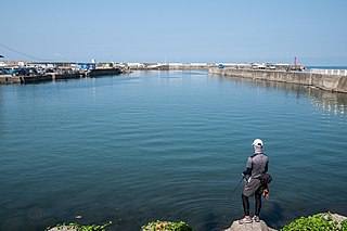
Fangliao Township is a rural township in Pingtung County, Taiwan.

Chuxiong Yi Autonomous Prefecture is an autonomous prefecture located in central Yunnan Province, China. Chuxiong has an area of 29,256 km2 (11,296 sq mi). The capital of the prefecture is Chuxiong City.

Zhaoyuan is a county-level city within the prefecture-level city of Yantai, Shandong Province, China, located on the Bohai Sea. Zhaoyuan is well known for its abundant gold deposit and production, and is occasionally nicknamed "China's gold capital".

Kaiyuan is a county-level city within the jurisdiction of Honghe Hani and Yi Autonomous Prefecture in the southeast of Yunnan province, China.
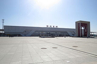
Qingyuan is a district of the city of Baoding, in the central part of Hebei province, China, covering part of the southern and eastern suburbs of Baoding. As of 2006, it has a total population of 620,000 residing in an area of 953 km2 (368 sq mi).

Mingjian Township is a rural township in western Nantou County, Taiwan. It is the second smallest township in the county, after Jiji Township.

Wuqi District is a coastal suburban district in southern Taichung, Taiwan. The Port of Taichung is located in Wuqi District.
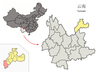
Qiaojia County is a county in the northeast of Yunnan province, China, bordering Sichuan province to the north and west. The population was 625,000 in 2019, 33,200 of whom belonged to ethnic minorities. It is both the southernmost and westernmost county-level division of Zhaotong City and located entirely on the right bank of the Jinsha River. The river valleys of Qiaojia are some of the lowest points in Yunnan province, at around 900 meters. The name of the county literally means 'City of industrious artisans'.
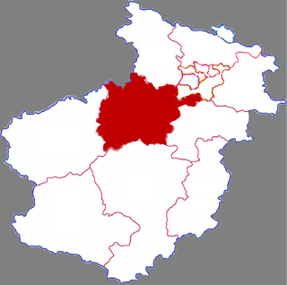
Yiyang is a county under the administration of the prefecture-level city of Luoyang city, Henan province, China, historically called Shou'an County. Fuchang County of the Tang and Song dynasties was located in Yiyang. In 1072 Fuchang was merged into Shou'an, and in 1186 Shou'an was renamed as Yiyang.
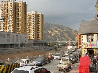
Minhe Hui and Tu Autonomous County is the easternmost county in Qinghai Province, China. It is under the administration of Haidong Region. "Hui" refers to the Chinese Muslims, whereas "Tu" refers to the ethnic group known as “Monguor” in the West and as "Tu Zu" in China. It borders the Honggu District of Gansu on the east, demarcated by the Datong River, a tributary to the Huangshui River, which eventually flows into the Yellow River.

Yinan is a county in the south of Shandong province, China. It is under the administration of the prefecture-level city of Linyi.

Houlong Township is an urban township in western Miaoli County, Taiwan. It is bordered by the Taiwan Strait on the west and Zaoqiao Township on the east. It lies at the mouth of the Houlong River.

Xizhou Township is a rural township in Changhua County, Taiwan. It has a population total of 30,753 and an area of 75.83 square kilometres (29.28 sq mi). It is the third largest township in Changhua County after Erlin and Fangyuan.

Erlun Township is a rural township in Yunlin County, Taiwan. It has a population total of 27,255 and an area of 59.5625 square kilometres.

Morin Dawa Daur Autonomous Banner, often abbreviated in official documents as Mo Banner, is one of three autonomous banners in Inner Mongolia, China, created for the Daur people. It lies on the Nen River, borders Heilongjiang province to the east, south and southwest and is under the administration of Hulunbuir City. The autonomous banner spans an area of approximately 10,400 square kilometres (4,000 sq mi), and has a total population of 316,398 as of 2019.
Dàzhuāng (大庄) could refer to the following locations in China:

Dazhuang is a community located in Tungli Village, Fuli Township in Hualien County, Taiwan. Dazhuang used to be an old community of Amis, until 1845 when some plain indigenous people started to migrate from Southern Taiwan to here. It was the most populous community in Fuli between Qin dynasty and Japanese occupation period, and so called the name Tuā-tsng, which means "a big village" in Taiwanese.

Shangba Tujia Ethnic Township is a township in Daozhen Gelao and Miao Autonomous County, Guizhou, China. As of the 2016 census it had a population of 18,000 and an area of 99.67-square-kilometre (38.48 sq mi).

Dazhuang Haotian Temple is a temple located in Dazhuang, Wuqi District, Taichung, Taiwan. The temple is dedicated to the sea goddess Mazu, who is the deified form of Lin Moniang.


