Heilongjiang[a] is a province in northeast China. It is the northernmost and easternmost province of the country and contains China's northernmost point (in Mohe City along the Amur) and easternmost point (at the confluence of the Amur and Ussuri rivers).
Ancient Chinese records and other sources state that Heilongjiang was inhabited by people such as the Sushen, Buyeo, the Mohe, and the Khitan. MongolicDonghu people lived in Inner Mongolia and the western part of Heilongjiang.[7] Some names are Manchu or Mongolian.[8] The eastern portion of Heilongjiang was ruled by the Bohai Kingdom between the 7th and 10th centuries, followed by the Khitan Liao dynasty. The Jurchen Jin dynasty (1115–1234) that subsequently ruled much of north China arose within the borders of modern Heilongjiang.
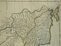
Heilongjiang and Jilin Provinces on a French map dated to 1734
Heilongjiang as an administrative entity was created in 1683, during the Kangxi era of the ManchuQing dynasty, from the northwestern part of the Jilin province.[9] This Heilongjiang Province only included the western part of today's Heilongjiang Province, and was under the supervision of the General of Heilongjiang (Sahaliyan Ula i Jiyanggiyūn) (the title is also translated as the Military Governor of Heilongjiang; jiyanggiyūn is the Manchu reading of the Chinese word 將軍jiāngjūn; "military leader, general" and is cognate with Japaneseshōgun), whose power extended, according to the Treaty of Nerchinsk, as far north as the Stanovoy Mountains. The eastern part of what's today Heilongjiang remained under the supervision of the General of Jilin (Girin i Jiyanggiyūn), whose power reached the Sea of Japan. These areas deep in Manchuria were closed off to Han Chinese migration.
Seal of the Guard General of Heilongjiang at the Heilongjiang General Mansion
The original seat of the Military Governor of Heilongjiang, as established in 1683, was in Heilongjiang City (also known as Aigun or Heihe, or, in Manchu, Saghalien Ula), located on the Amur river. However, already in 1690 the seat of the governor was transferred to Nenjiang (Mergen) on the Nen River, and, in 1699, further south to Qiqihar. According to modern historians, the moves may have been driven by supply considerations: Nenjiang and Qiqihar are connected by a convenient waterway (Nen River) with southern Manchuria, whereas accessing Aigun (Heihe) would require either sailing all the way down the Sungari River until its confluence with the Amur and then up the Amur to Heihe, or using a portage over the Lesser Xing'an Mountains between the Nen River valley and the Amur valley. An additional advantage of Qiqihar may have been its location at the junction of a northbound road (to Nenjiang) and a westbound one (to Mongolia), enabling its garrison to defend both against the Russians and the Ölöt Mongols.[10]
Little Qing Military presence existed north of Aigun. According to the 18th- and early-20th-century European sources and the reports of the Russians in the 1850s, the farthest Qing "advance guard" post was at Ulusu-Modon (Ulussu-Mudan) (Chinese:乌鲁苏穆丹Wūlǔsūmùdān), near the Amur river's famous S-shaped meander. (The post was on the left (north) bank of the river, lost to the Russians in 1860.)
In 1858 and 1860, the Qing government was forced to give up all land beyond the Amur and Ussuri rivers to the Russian Empire, cutting off the Qing Empire from the Sea of Japan and giving Heilongjiang its present northern and eastern borders. At the same time, Manchuria was opened to Han Chinese migration by the Qing government. By the early twentieth century, due to the Chuang Guandong, the Han Chinese had become the dominant ethnic group in the region.[11]
In 1931, Japanese forces invaded Heilongjiang. In 1932, the Japanese completed their conquest of the province, which became part of the Japanesepuppet state of Manchukuo.
In 1945, Japanese forces in Manchuria were defeated by the Soviet Army. During the Chinese Civil War, Soviet forces aided the Chinese communists. Heilongjiang became the first province to be completely controlled by the communists and Harbin the first major city to be controlled by them.
At the beginning of communist rule, Heilongjiang included only the western portion of the present-day province, and had its capital at Qiqihar. The remaining area was the province of Songjiang; its capital was Harbin. In 1954, these two provinces were merged into present-day Heilongjiang. During the Cultural Revolution, Heilongjiang was also expanded to include Hulunbuir League and some other areas previously in Inner Mongolia; this has since mostly been reversed.
Heilongjiang is a land of varied topographies. Much of the province is dominated by mountain ranges such as the Greater Khingan Range and Lesser Khingan Range, Zhangguangcai Mountains, Laoye Mountains, and Wanda Mountains. The highest peak is Datudingzi Mountain at 1,690 metres (5,540ft), located on the border with Jilin province.[12] The Greater Khingan Range contains China's largest remaining virgin forest and is an important area for China's forestry industry.
Koppen Classification map of Heilonjiang, based on its climate from 1991 to 2020Winter in Heilongjiang
A humid continental climate (KöppenDwa or Dwb) predominates in the province, though areas in the far north are subarctic (Köppen Dwc).[13] Winters are long and bitter, with an average of −31 to −15°C (−24 to 5°F) in January, and summers are short and warm to very warm with an average of 18 to 23°C (64 to 73°F) in July. The annual average rainfall is 400 to 700 millimetres (16 to 28in), concentrated heavily in summer. Clear weather is prevalent throughout the year, and in the spring, the Songnen Plain and the Sanjiang Plain provide abundant sources of wind energy.[citation needed]
Heilongjiang boasts an extensive road network, As of October 2020. it has 165,989km (103,141mi) of expressways,[14] highways and other roads. The Beijing – Harbin Expressway is the most significant expressway corridor to the province, which begins at the Heilongjiang – Jilin border and ends within the Harbin Ring Expressway. The Harbin – Tongjiang Expressway runs northeast and it links far-flung counties within the jurisdiction of Harbin, Jiamusi and other major counties in Northeast Heilongjiang. Near the end of Harbin – Tongjiang Expressway, Jiansanjiang–Heixiazi Island Expressway branches off the main expressway at Jiansanjiang and connects many state-owned farms at the far east of the province before ending near the Sino-Russian border. The Suifenhe – Manzhouli Expressway is another major corridor it runs southeast to northwest and connects some of the most significant population centers of the province, including Mudanjiang, Harbin, Daqing and Qiqihar, before ending at the Heilongjiang – Inner Mongolia border. The Hegang – Dalian Expressway, another major expressway that facilitates the transportation of lumber and coal, runs between Hegang and the Heilongjiang – Jilin border in East Heilongjiang.
Railways
There are 60 railway lines of around 5,300 kilometres (3,300 miles) including a section of the Eurasian Land Bridge. The Harbin–Dalian high-speed railway, completed in 2012, stretches from Harbin, Heilongjiang's capital, to Dalian in Liaoning province via Changchun and Shenyang comprising 23 stops. It is expected to transport 37 million passengers per year by 2020 and 51 million by 2030.
The Chinese portion of the bridge was finished in July 2016.[16] In December 2016, work began on the Russian portion of the bridge. Completion of structural link between the two sides of the bridge was completed in March 2019.[17][18] Opening to rail traffic has been repeatedly delayed, with the December 2019 estimate being "the end of 2020",[19] and then 3rd quarter of 2021.[20]
* – including Ethnic districts ** – administrative districts not registered under the Ministry of Civil Affairs (not included in the total Districts' count) ≈ – not including territories within Inner Mongolia (if included: 82,928.80km2 or 32,018.99sqmi)
From left to right: Qiqihar, Mudanjiang, Daqing, Jixi
Administrative divisions in Chinese and varieties of romanizations
↑New district established after 2010 census: Shuangcheng (Shuangcheng CLC). The new district not included in the urban area count of the pre-expanded city.
12The stats does not reflect the Yichun PLC reorganization in 2019 after 2010 census.
↑Nenjiang County is currently known as Nenjiang CLC after 2010 census.
↑Jiagedaqi Administrative Zone is a special urban area jurisdiction that is de jure part of Hulunbuir, Inner Mongolia but, currently de facto under Daxing'anling Prefecture control.
↑Dongning County is currently known as Dongning CLC after 2010 census.
↑Fuyuan County is currently known as Fuyuan CLC after 2010 census.
↑Mohe County is currently known as Mohe CLC after 2010 census.
↑Xinlin Administrative Zone is a special urban area jurisdiction that is de jure part of Huma County.
↑Huzhong Administrative Zone is a special urban area jurisdiction that is de jure part of Huma County.
↑Songling Administrative Zone is a special urban area jurisdiction that is de jure part of Hulunbuir, Inner Mongolia but, currently de facto under Daxing'anling Prefecture control.
In 2022, Heilongjiang's GDP was 1.59 trillion RMB ($236 billion in GDP nominal), with a per capita GDP of CN¥51,906 (US$7,717 in nominal).[3] Its primary, secondary, and tertiary industries contributed ¥360 billion (22.7%), ¥465 billion (29.2%), and ¥764 billion (48%) to GDP, respectively.[3]
Heilongjiang's GDP has been rising steadily since 2003, growing 37% from 2003 to 2007.[citation needed] The value of the private economy reached RMB234 billion in 2006 and accounted for 37.6 percent of the GDP. In that year, the tax revenue from private enterprises hit RMB20.5 billion.[citation needed]
Private enterprises in Heilongjiang led the overall economic growth of the province. Many leading private enterprises have begun to emerge.
Agriculture
Heilongjiang is home to China's largest plantations of rice, corn and soybeans, with a total of 14.37millionha (35.5million acres) of grain plantation area, including 4millionha (9.9million acres) of rice plantation and 5.5millionha (14million acres) of corn.[29][30] Heilongjiang has vast tracts of black soil (chernozem), one of the most fertile soil types.[31][32] Since the early 20th century, cultivation in the black soil belt has expanded by almost 100-fold, and after the 1960s agriculture in the region transformed to modern agriculture with heavy mechanization and an increase of fertilizer use.[31] Heilongjiang is one of the Asia's leading production areas for japonica rice, known for high quality brand rice varieties.[33][34] The introduction of cold-resistant varieties, favorable policies and climate change have all contributed to a significant increase in rice production in recent years.[35] Commercial crops grown include beets, flax, sunflowers.[34]
Herding in Heilongjiang is centered upon horses and cattle; the province has the largest number of milk cows and the highest production of milk among all the province-level divisions of China.[citation needed]
Industry
Heilongjiang is part of northeast China, the country's traditional industrial base. Industry is focused upon coal, petroleum, lumber, machinery, and food.[citation needed] Due to its location, Heilongjiang is also an important gateway for trade with Russia. Since a wave of privatization led to the closure of uncompetitive factories in the 1990s, Manchuria has suffered from stagnation.[citation needed] As a result, the government has started the Revitalize Northeast China campaign to deal with this problem, promoting the private sectors as the preferred method of the reform and opening up.[citation needed]
Daqing New & Hi-Tech Industrial Development Zone was constructed in April 1992 and was then approved as a national high-tech zone by the State Council later that year. Its initial zone area is 208.54km2 (80.52sqmi), and it recently expanded the area by 32.45km2 (12.53sqmi).[38]
Harbin High-tech Zone was set up in 1988 and was approved by the State Council as a national development zone in 1991. It has a total area of 34km2 (13sqmi) in the centralized parks, subdivided into Nangang, Haping Road and Yingbin Road Centralized Parks. The Nangang Centralized Park is designated for the incubation of high-tech projects and research and development base of enterprises as well as tertiary industries such as finance, insurance, services, catering, tourism, culture, recreation and entertainment, where the headquarters of major well-known companies and their branches in Harbin are located; the Haping Road Centralized Park is a comprehensive industrial basis for the investment projects of automobile and automobile parts manufacturing, medicines, foodstuffs, electronics, textile; the Yingbin Road Centralized Park is mainly for high-tech incubation projects and high-tech industrial development.[39]
Sino-Russia Dongning-Piurtaphca Trade Zone
Sino-Russia Dongning-Piurtaphca Trade Zone was approved by the State Council in 2000 and was completed in 2005. The zone has a planned area of 275.4 hectares. The Chinese part of the zone has a 22-hectare trade center with four subsidiary areas, A, B, C, and D, in which more than 6,000 stalls are already set up, mainly dealing with clothes, household appliances, food, construction materials, etc.[40]
Suifenhe Border Economic Cooperation District (Suifenhe BECD) is located in the north of Suifenhe City, and borders Russia to the east. Suifenhe BECD is the largest among the three state-level border-trade zones of Heilongjiang, in terms of investor numbers. Suifenhe BECD has a convenient transport network. The Binzhou-Suifenhe Railway, which connects the Russian Far East Railway, is an important port for export. The railway distance between Suifenhe and Harbin is 548km (341mi). Buguranikinai, the corresponding Russian port city, is 21km (13mi) away.[41]
Established in 1923; dissolved in 1932 and incorporated into Manchukuo / Heilongjiang Province (present). Harbin part of Heilongjiang Province until 1947–1949 and 1953–1954. Dongsheng SAR dissolved in 1932 and incorporated into Manchukuo / Heilongjiang Province (present). Songjiang Province dissolved in 1955 and incorporated into Heilongjiang Province. Hejiang Province dissolved in 1949 and incorporated into Songjiang Province / Heilongjiang Province (present). Nenjiang Province dissolved in 1949 and incorporated into Heilongjiang Province.
By the end of 2022, Heilongjiang Province had a permanent resident population of 30.99 million.[52] This represented a decrease of 260,000 from the previous year. The urban population was 20.52 million, and the rural population was 10.47 million. The urbanization rate reached 66.2%, up 0.5 percentage points from the previous year. The age composition was as follows:
Ages 0–14: 9.3% of the total population
Ages 65 and above: 17.8% of the total population
According to the 2021 Statistical Bulletin, the province’s total permanent population was 31.25 million, a decrease of 460,000 compared with 2020.[53]
Based on the Seventh National Population Census (2020), the total permanent population of Heilongjiang was 31,850,088.[54] Compared with the Sixth Census (2010) figure of 38,313,991, the province’s population declined by 6,463,903 over ten years (−16.87%), with an average annual growth rate of −1.83%.
Breakdown by gender and age:
Males: 15,952,468 (50.09%)
Females: 15,897,620 (49.91%)
Sex ratio (females = 100): 100.35
Ages 0–14: 3,286,466 (10.32%)
Ages 15–59: 21,167,932 (66.46%)
Ages 60 and above: 7,395,690 (23.22%), including 4,972,868 aged 65+ (15.61%)
Urban residents: 20,897,694 (65.61%)
Rural residents: 10,952,394 (34.39%)
In 2020, the birth rate was 3.35‰, the death rate was 8.23‰, and the natural growth rate was −4.48‰.[55] Heilongjiang's demographic profile is characterized by a low birth rate, low death rate, and a high level of population aging. In addition, out-migration has contributed to a continuous population decline since 2014.[56][57]
In Heilongjiang Province, the Han Chinese constitute an overwhelming majority, many of whom are descendants of immigrants from Shandong and Hebei during the Qing dynasty. Ten indigenous ethnic minorities are officially recognized: the Manchu, Korean, Mongol, Hui, Daur, Xibe, Hezhen, Oroqen, Evenki, and Kyrgyz peoples.[58] Among these, the Hezhen are unique to Heilongjiang Province.[59] Within the province, there is the Dorbod Mongol Autonomous County, the Meilisi Daur District in Qiqihar, as well as several ethnic townships.
Among the province’s permanent residents, the Han population numbers 30,728,612, accounting for 96.48% of the total; all ethnic minorities together total 1,121,476, or 3.52%. Compared with the 2010 Sixth National Population Census, the Han population decreased by 6,210,569 people (−16.81%) but their proportion rose by 0.07 percentage points. Minority populations decreased by 253,334 (−18.43%), and their proportion declined by 0.07 percentage points. Specifically:
The Manchu population decreased by 164,213 (−21.95%), down 0.12 percentage points in proportion.
The Korean Chinese population decreased by 57,683 (−17.6%), down 0.01 percentage points.
The Mongol population decreased by 13,273 (−10.58%), but their proportion rose by 0.02 percentage points.
The Hui population decreased by 26,285 (−25.83%), down 0.03 percentage points.
The Daur population decreased by 6,607 (−16.4%), with no change in proportion.
The Xibe population decreased by 1,349 (−17.73%), with no change in proportion.
The Hezhen population increased by 192 (+5.31%), with no change in proportion.
Ethnic composition of Heilongjiang Province (Seventh National Population Census, 2020)[60]
Heilongjiang's culture is part of a culture of Northeast China that is relatively homogeneous across this region, known in Mandarin Chinese as "Dongbei" (the northeast).
Harbin, the provincial capital, is a city of contrasts, with Chinese, Russian, and eclectic worldwide influences clearly apparent. Bukui Mosque, a national heritage site, is the largest glazed-tile building in the province.[61]Eastern Orthodox, Roman Catholic, and Protestant churches as well as synagogues dot the city.[62]
The long, cold winter is the backdrop for its famed ice sculpture exhibitions. In 2007 already the 8th Ice and Snow World opened to visitors in Harbin. More than 2,000 ice sculptures were on display at the annual event.[63]
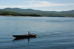
Wudalianchi Lakes are a series of five lakes formed between 1719 and 1721 when volcanic eruption shaped one section of a tributary of the Amur into five interconnected lakes. The second lake in particular is renowned for its irregular geological sights. Lake Jingbo, in Ning'an County, is a section of the Mudan River that has been narrowed and shaped by volcanic eruption into a series of sights, including the Diaoshuilou Falls.
Heilongjiang is in the forefront of promoting winter sports and winter-featured sports industry in China.[65] For example, it is promoting bandy as an Olympic sport.[66]
↑浅谈黑龙江省地名的特点. iqh.net.cn (in Chinese (China)). Archived from the original on 23 July 2011. Retrieved 16 January 2011.
↑Edmonds, Richard Louis (1985). Northern Frontiers of Qing China and Tokugawa Japan: A Comparative Study of Frontier Policy. University of Chicago, Department of Geography; Research Paper No. 213. p.6. ISBN0-89065-118-3.
↑Patrick Fuliang Shan, "Taming China's Wilderness: Immigration, Settlement, and the Shaping of the Heilongjiang Frontier, 1900–1931", Ashgate, 2014, ISBN978-1-4094-6389-4
↑Census Office of the State Council of the People's Republic of China; Population and Employment Statistics Division of the National Bureau of Statistics of the People's Republic of China (2012). 中国2010人口普查分乡、镇、街道资料 (1ed.). Beijing: China Statistics Print. ISBN978-7-5037-6660-2.
↑Lawrence, Susan; Martin, Michael (20 March 2013). "Understanding China's Political System"(PDF). Federation of American Scientists. Congressional Research Service. Archived(PDF) from the original on 8 January 2012. Retrieved 28 September 2019.
↑党委书记权力究竟有多大?[How much power does a Party Secretary really have?]. 人民论坛 (in Chinese (China)). People's Daily Press. 23 January 2007. Archived from the original on 2 July 2018. Retrieved 29 April 2018.
↑Office of the Leading Group for the Seventh National Population Census of the State Council. "China Population Census Yearbook – 2020". Archived from the original on 12 May 2023. Retrieved 28 July 2023.
This page is based on this Wikipedia article Text is available under the CC BY-SA 4.0 license; additional terms may apply. Images, videos and audio are available under their respective licenses.


