Hulunbuir | |
|---|---|
| Name transcription(s) | |
| • Chinese | 呼伦贝尔市 |
| • Mongolian | ᠬᠥᠯᠥᠨ ᠪᠤᠶᠢᠷ ᠬᠣᠲᠠ |
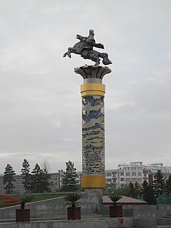
 Hulunbuir steppes | |
 Location of Hulunbuir City jurisdiction in Inner Mongolia | |
 Hulunbuir Location of the city centre (Hailar) in Inner Mongolia | |
| Coordinates(Hulunbuir municipal government): 49°12′26″N119°46′16″E / 49.2072°N 119.7711°E | |
| Country | People's Republic of China |
| Region | Inner Mongolia |
| Municipal seat | Hailar District |
| Area | |
| 263,953 km2 (101,913 sq mi) | |
| • Urban (2017) [1] | 252.00 km2 (97.30 sq mi) |
| • Districts [1] | 1,518.9 km2 (586.5 sq mi) |
| Population (2010) | |
| 2,549,278 | |
| • Density | 9.65808/km2 (25.0143/sq mi) |
| • Urban (2017) [1] | 349,400 |
| • Urban density | 1,387/km2 (3,591/sq mi) |
| • Districts [1] | 356,000 |
| • Major nationalities | Han: 81.85% Mongols: 8.6% Manchu: 4.13% |
| GDP [2] | |
| • Prefecture-level city | CN¥ 159.6 billion US$ 25.6 billion |
| • Per capita | CN¥ 63,133 US$ 10,136 |
| Time zone | UTC+8 (China Standard) |
| Postal code | 021000 |
| Area code | 0470 |
| ISO 3166 code | CN-NM-07 |
| Website | www |
| Hulunbuir | |||||||||
|---|---|---|---|---|---|---|---|---|---|
| Chinese name | |||||||||
| Simplified Chinese | 呼伦贝尔 | ||||||||
| Traditional Chinese | 呼倫貝爾 | ||||||||
| |||||||||
| Mongolian name | |||||||||
| Mongolian Cyrillic | Хөлөнбуйрхот | ||||||||
| Mongolian script | ᠬᠥᠯᠥᠨᠪᠤᠶᠢᠷᠬᠣᠲᠠ | ||||||||
| |||||||||
Hulunbuir or Hulun Buir [a] is a prefecture-level city in northeastern Inner Mongolia,China. Its administrative center is located at Hailar District,its largest urban area. Major scenic features are the high steppes of the Hulun Buir grasslands,the Hulun and Buir lakes (the latter partially in Mongolia),and the Khingan range. Hulun Buir borders Russia to the north and west,Mongolia to the south and west,Heilongjiang province to the east and Hinggan League to the direct south. Hulunbuir is a linguistically diverse area:next to Mandarin Chinese,Mongolian dialects such as Khorchin and Buryat,the Mongolic language Daur,and some Tungusic languages,including Oroqen and Solon,are spoken there.