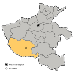
Nanyang is a prefecture-level city in the southwest of Henan province, China. The city with the largest administrative area in Henan, Nanyang borders Xinyang to the southeast, Zhumadian to the east, Pingdingshan to the northeast, Luoyang to the north, Sanmenxia to the northwest, the province of Shaanxi to the west, and the province of Hubei to the south.
Nanyang was the home of various important figures in Chinese history. It nurtured the "sage of science" Zhang Heng, "sage of medicine" Zhang Zhongjing, "sage of commerce" Fan Li, and "sage of intelligence" Zhuge Liang. It has also been home to contemporary celebrities such as philosopher Feng Youlan, military strategist Peng Xuefeng, novelist Yao Xueyin, inventor Wang Yongmin, and writer Er Yuehe.[5]
Names
In the name "Nanyang" (simplified Chinese:南阳; traditional Chinese:南陽; pinyin:Nányáng), Nan (南) means south, and Yang (阳/陽) means sun—the south side of a mountain, or the north side of a river, in Chinese is called Yang. The name came from Nanyang Commandery, a commandery established in the region during the Warring States period. Before the name "Nanyang" became associated with the city itself, it was referred to as "Wan" (宛).Nanyang, also known as Wan, Nandu, and Dixiang.[5]
History
550,000 years ago, Nanzhao Man inhabited near Xinghuashan, Nanzhao.[6] Between 5,000 BCE and 3,000 BCE, a substantial Neolithic settlement thrived in Huangshan, situated north of Nanyang. Excavations of the Huangshan ruins have uncovered remnants of jade workshops, high-level tombs, wharves, and granaries.[7] The Huangshan Archeological Site provided insight into the formation of Chinese civilization. The Baliqiao site in Fangcheng County is a core settlement of the Erlitou culture. It served as an important hub for the transfer and control of resources.[8] Nanyang was the capital of the state of Shen in the first millennium BCE. After the unification of the six states by Qin, the "relocation of unruly people to Nanyang" brought together the wealthy and skilled merchants and artisans of the six states, promoting the development of Nanyang's economy, especially the iron smelting industry, which became one of the national iron smelting centers.[9] It became commercially important under the Han dynasty, as it had many iron foundries and other manufacturing sites, and also fell at the convergence of routes between major cities. It's an important city of the Silk Road.[10][11]Emperor Gengshi's enthronement took place on the banks of the Bai River in Nanyang. Later, with the help of the 28 generals of the Cloud Terrace and the financial support of Nanyang, Liu Xiu successfully ascended to power and established the Eastern Han dynasty. Nanyang became the southern capital, ranking as the second largest city after Luoyang, the capital. During that time, Nanyang was home to numerous influential families. Nanyang subsequently declined somewhat in importance, but remained a political and cultural center of southwestern Henan province and a hub for trade.[12]
Geography
Nanyang is located in southwestern Henan, bordering Hubei (Xiangyang, Shiyan, and Suizhou) to the south, Shaanxi (Shangluo) to the west and the following prefecture-level cities in Henan:
Zhumadian (E)
Xinyang (SE)
Sanmenxia (NW)
Luoyang (N)
Pingdingshan (NE)
The latitude of the entire prefecture ranges from 32° 17' to 33° 48' N, while the longitude ranges from 110° 58' to 113° 49' E, and the prefecture spans 26,600 square kilometres (10,300sqmi). The city lies within the Nanyang Basin, which is part of a region in Central China that lies in the gap between the eastern end of the Qin Mountains and the source of the Huai River. Thus, using those two geographic features as the standard dividing line, it is difficult to classify the city into northern or southern China.
To the north of Nanyang city proper, there is a mountain called Mount Du, which is famous for the Dushan jade, one of the four famous jades of China, now a rarity. To the southwest is Neixiang County with the newly developing Baotianman Biosphere Reserve—an area of high biodiversity, with 65 rare and endangered species.
Satellite view of the area, showing the Nanyang Basin in the centre. The city proper of Nanyang is located in the north-central part of this picture.
Climate
The climate is generally moderate and is a four-season humid subtropical climate (KöppenCwa), with strong monsoon influences: winters are cool but dry, and summers are hot and humid. Spring and autumn provide transitions of reasonable length. The monthly daily average temperature in January is 1.6°C (34.9°F) and in July it is 27.0°C (80.6°F); the annual mean is 15.2°C (59.4°F). More than half the annual rainfall occurs from June to August.Winter lasts for 110–135 days, followed by summer for 110–120 days, and spring and autumn for 55–70 days.[13]
Climate data for Nanyang, elevation 181m (594ft), (1991–2020 normals, extremes 1971–present)
The whole city area has a population over 10.26 million, which is the twelfth prefecture-level city in China now. The built-up area has over 1.8 million people, which is the fifth largest city in Henan Province. About 1 million commute from the city, mainly to Zhengzhou, Guangdong province, Beijing and Shanghai. The majority of the province is Han; among the minority nationalities are the Hui people and Man people.
Population
As of the 2020 Chinese census, Nanyang was home to 9,713,112 people, ranking nineteenth in China, and its built-up (or metro) area made of Wolong and Wancheng Districts was home to 2,085,680 people.
Ethnic groups
In 2022, Nanyang City has 49 ethnic minority groups with a population of 288000. The distribution of ethnic minorities shows the characteristics of "large dispersion and small mixed residence", among which the Hui ethnic group has 163800 people, distributed in Wancheng District, Dengzhou City, Zhenping County and other places; There are 72600 Mongolian people, distributed in Zhenping County, Neixiang County and other places; There are 28600 Manchu people, distributed in Nanzhao County, Xichuan County and other places.[18]
Health
This section is empty. You can help by adding to it. (April 2019)
Education
Nanyang higher education already has a good foundation for development. Nanyang is a great city of education. It has a fine tradition of respecting teachers and teaching and educating students. It has taken the lead in proposing a strategy of science and education in the country. In particular, in recent years, the municipal party committee and the municipal government have attached great importance to education. The education industry in our city has developed vigorously and the face of higher education has undergone tremendous changes. There are 6 colleges and universities in the city, with nearly 90,000 students. All colleges and universities adhere to the Party's education policy, implement the fundamental tasks of Lide Shuren, and have achieved unprecedented achievements in personnel training, scientific research, social services, cultural heritage innovation and international exchanges and cooperation, which not only promotes the city's science and technology. Innovation, social progress and improvement of people's livelihood have also laid a good foundation for achieving a higher level of development at a new starting point.
Nanyang has a developing cattle industry, as well as a tobacco factory.
The Bai River flows through Nanyang and provides it with an abundant supply of fish.
Nanyang produces two kinds of quality wine: Shedianlaojiu and Wolongyuye.
Nanyang oil field is the second largest oil field in Henan Province.
Agriculture plays an important role in its economy.
There is a large optical component production community in the area comprising several factories.
At present, the Nanyang Municipal Government has set the development goal of "building the city with industry and strengthening the city with industry", prioritizing the acceleration of the construction of a characteristic advanced manufacturing center city and making every effort to create a new highland for innovative development in the manufacturing industry.[25]
Sports
Nanyang has three main sports centers.[26] Among them, the Nanyang First Sports and Fitness Center is the home of the Henan Golden Elephants.
Nanyang has three major railway stations: Nanyang railway station, Nanyang East railway station, and Nanyang West railway station. There are also several other small stations serving suburban areas. Direct train service is available to Beijing, Shenyang, and Harbin to the north; Shanghai, Nanjing, and Hangzhou to the east; Xining, Lanzhou, and Ürümqi to the west; and Guangzhou, Xiamen, Nanning, and Kunming to the south.
Highways and expressways
As of 2023, Nanyang has 898km expressway, ranking the longest in Henan Province. The expressway is an important part of Nanyang's "One cross, three rings, and six radiations" plan.[27]
Tanghe to Madian waterway is under construction; the project is expected to be completed by the end of 2024.
Public transit
Nanyang Public Transportation Corporation has 1,005 buses (97.8% are clean energy buses), 44 bus lines (859.8km), and 1,050 stations.[28]
As of 2023, a total of 1,500 taxis were in operation in Nanyang; all of them run on natural gas.[29] In addition, there are more than 1,790 app-taxis and 35.98% of them are powered by renewable energy.[30]
Dockless app based bikeshares such as DiDi Bike and Hellobike are also available.[31]
Nanyang has planned six light rail lines with a total track mileage of 134km.
Culture
The Nanyang Xu Zhongjing Memorial Hall
The official language of Nanyang is Mandarin Chinese, but most locals speak the Henan dialect, with its easily identifiable features; this local dialect is known as Nanyang Hua (南阳话), and is spoken by about 15 million people in the area.[citation needed]
There are mainly Chu culture series, Han culture series, Three Kingdoms culture series, and various ancient architectural development and utilization series. The rare treasures unearthed from the Spring and Autumn tombs in Danyang, the capital of Chu, are well-known and the Chu Great Wall site, known as the "father of the Great Wall of China," has attracted attention. The Han cultural relics in Nanyang, represented by the "Three Wonders of Nanyang Han Culture" such as portrait stones, portrait bricks, and pottery dogs, rank first in the country in terms of quantity, scale, content, research, and tourism value discovered; There are also the largest ancient iron smelting workshop in the country - the Wafangzhuang site, the sizable Han Wancheng site, the medical saint temple where the famous Han Dynasty great medical expert Zhang Zhongjing's ancestral tomb is located, and the famous tomb of the Eastern Han Dynasty scientist and writer Zhang Heng at home and abroad. The historical influence of the Three Kingdoms period is profound, and the remaining relics mainly include the Wuhou Temple, Weigong Bridge, Fengchu Terrace, as well as the ancient battlefield of Huoshao Bowang in Fangcheng and the council stage in Xinye.
↑Etler, Dennis (1996). "The Fossil Evidence for Human Evolution in Asia". Annual Review of Anthropology. 25 (1): 281. doi:10.1146/annurev.anthro.25.1.275.
↑Xu, Siwen; Qiao, Baotong; Yang, Yimin (2022). "The rise of the Maritime Silk Road about 2000 years ago: Insights from Indo-Pacific beads in Nanyang, Central China". Journal of Archaeological Science: Reports. 42 103383. Bibcode:2022JArSR..42j3383X. doi:10.1016/j.jasrep.2022.103383. ISSN2352-409X.
↑刘, 先琴; 董, 一鸣 (2009-07-05). "河南南阳方城是丝绸之路源头之一". 光明日报 (in Chinese). Archived from the original on 2024-01-16.
This page is based on this Wikipedia article Text is available under the CC BY-SA 4.0 license; additional terms may apply. Images, videos and audio are available under their respective licenses.