
Yingtan is a prefecture-level city in the east of Jiangxi province, People's Republic of China, bordering Fujian to the southeast. Its location near the trisection of Jiangxi, Fujian, and Zhejiang has made it a strategically important city for centuries. Today, it continues to be a major rail transport hub. It is best known as the Capital of Copper, and located here is Jiangxi Copper and its smelting factory.
Hepu, alternately romanized as Hoppo, Hopu or Hop'u, is a county under the administration of Beihai City in southeastern Guangxi, China. It borders Lianjiang (Guangdong) to the southeast, Bobai County to the northeast, the Gulf of Tonkin to the south, Qinzhou to the west, and Pubei County to the north. Then-Premier Li Peng called this place "the Southern Pearl County" (南珠之乡) in November 1992. The county was once known as Lianzhou. It has an area of 2,380 km2 (920 sq mi) and a population of 930,914 as of 2003.
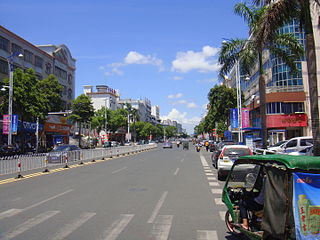
Wanning, or in local Hainanese dialect as Ban Ning, is a county-level city in the southeast of Hainan Province, China. Although called a "city", Wanning refers to both the county seat and to the entire county as a whole. The county-wide area has an estimated population of 65,871 (2006).

Dongfang is one of the seven county-level cities of Hainan province, China. Although called a "city", Dongfang refers to a large land area in Hainan - an area which was once a county. Within this area is the main city, Dongfang City. It is located on the western coast of Hainan Island facing Vietnam across the Gulf of Tonkin, and in 2004 had a population of 435,000.
Qimen County is a county in the southeast of Anhui Province, China, bordering Jiangxi Province to the southwest. It is the westernmost county-level division of the prefecture-level city of Huangshan City. It has a population of 190,000 and an area of 2,257 square kilometres (871 sq mi). The government of Qimen County is located in Qishan Town.

Qianshan is a county-level city in the southwest of Anhui Province, China; it is under the jurisdiction of the prefecture-level city of Anqing. It has a population of 570,000 and an area of 1,686 square kilometres (651 sq mi). The government of Qianshan County is located in Meicheng Town. The well-known Wan Mountain, or Tianzhu Mountain, is located within the borders of the County.

Yiwu County as the official romanized name, also transliterated from Uyghur as Aratürük County, is a county in the northeast of the Xinjiang Uyghur Autonomous Region and is under the administration of the Hami City. It contains an area of 19,511 km2 (7,533 sq mi). According to the 2002 census, it has a population of 20,000.
Ürümqi County is a county of Xinjiang Uyghur Autonomous Region, Northwest China, it is under the administration of the prefecture-level city of Ürümqi, the capital of Xinjiang. It contains an area of 4,601 km² and according to the 2002 census has a population of 80,000.

Lushui is a county-level city in and the seat of Nujiang Prefecture, western Yunnan Province, China. It borders Myanmar's Kachin State to the west and occupies the southern fifth of Nujiang Prefecture.
Língāo County is an administrative district in Hainan province, China. It is one of the 4 counties of Hainan. Its postal code is 571800, and in 1999, its population was 399,057 people.

Dìng'ān is an administrative district in Hainan, People's Republic of China. It is one of 4 counties of Hainan. In 1999, its population was 304,522 people.

Tunchang County is a county of Hainan Province, People's Republic of China. Its postal code is 571600, and in 1999 its population was 250,059 people. The administrative seat lies at Tuncheng.

Qionghai is one of the seven county-level cities of Hainan province, China. Although called a "city", Qionghai refers to a large land area in Hainan - an area which was once a county. Within this area is the main city, Qionghai City. It is located in the east of the island at the mouth of the Wanquan River, 86 kilometres (53 mi) from the provincial capital of Haikou. It has an area of 1,692 square kilometres (653 sq mi) and in 2010, it had a population of 483,217 people.

Baisha Li Autonomous County, p Báishā Lízú Zìzhìxiàn) is one of 6 autonomous counties of Hainan, China. In 1999 its population was 176,377 people, largely made up of the Li people.

Qiongzhong Li and Miao Autonomous County is an autonomous county in Hainan, China. It is one of 6 autonomous counties of the upper highlands of Hainan. Its postal code is 572900, and in 1999, its population was 196,581 people, largely made up of the Li people and the Miao people.
Ledong Li Autonomous County is an autonomous county in Hainan province, China. It is one of six autonomous counties of Hainan. Its postal code is 572500, and in 1999, its population was 468,834 people, largely made up of the Li people.

Xinghai County is a county under the jurisdiction of Hainan Tibetan Autonomous Prefecture, in the east-central part of Qinghai Province, China.

Maqên or Maqin County is a county of Qinghai Province, China. It is under the administration of Golog Tibetan Autonomous Prefecture.

Qinglong Manchu Autonomous County is a Manchu autonomous county in northeastern Hebei province, China, bordering Liaoning Province to the north and east and located in the eastern part of the Yan Mountains. It is under the administration of the prefecture-level city of Qinhuangdao, and, as of 2004, had a population of 520,000 residing in an area of 3,309 km2 (1,278 sq mi). Bordering county-level divisions are: Lingyuan and Jianchang County (Liaoning) to the north, Liaoning's Suizhong County and Qinhuangdao city proper to the east, Qian'an and Lulong County to the south, and Kuancheng Manchu Autonomous County and Qianxi County to the west.
Guanyun County is under the administration of Lianyungang, Jiangsu province, China. It borders the prefecture-level city of Suqian to the southwest and the Yellow Sea to the east. Guanyun County has an area of 1,538 km2 (594 sq mi) and a population of about 1,026,000 as of 2020.


