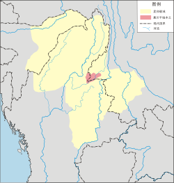
The Dehong Dai and Jingpo Autonomous Prefecture[a] is an autonomous prefecture in western Yunnan province,China. It is bordered by Baoshan to the east and Myanmar's Kachin State to the west. Its eponymous ethnic minorities are the Dai and Jingpo,who make up 28 and 11 percent of the prefecture's population,respectively.By the end of 2024,the resident population of the whole state is 1,337,000,of which the urban population is 687,000.[8]
Tai Nuea is the origin language of the word "Dehong",in Tai Le script (the script used to write the Tai Nüa language by the Tai Nua people) is written as "ᥖᥬᥳᥑᥨᥒᥰ",transliterated to Latin as Taue Xoong. Dehong means the lower reaches of the Nu River.[9]:38
The Chinese characters for Dehong are "德宏". These two characters are a compound of 德,"moral" or "value";and 宏,"magnificent" or "great".
History
Early history
Dianyue and Ailao were the ancient countries recorded in Chinese literature in the Dehong area,and Guozhanbi (Kawsampi) was an ancient country established by the Dai people and recorded in Dai legends.
Dianyue
In the history book Records of the Grand Historian written by Sima Qian during the Han dynasty,a paragraph in volume 123 describes Dianyue as when Zhang Qian visited Daxia in Central Asia,he found some merchandise that was produced in Sichuan. And the Daxia merchant said it was purchased from Yuandu (India). There was a trade route,Shu-Yuandu Road (蜀身毒道),between Yuandu and Sichuan. The road passed a kingdom named "Dianyue" (滇越).[10] The country is also called "Dianyue Chengxiang" (滇越乘象国) in modern books.[6]:37Chinese historians generally said Tengyue was the center of Dianyue Chengxiang,and the territory included the Dehong area. However,some historians disagree with this opinion. Lou Zichang believes Dianyue Chengxiang was not a country in western Yunnan,nor was it a country established by the Dai people.[11]
Ailao
Ai Lao (哀牢) was an ancient tribal alliance country in the west of Yunnan from the Spring and Autumn to the Eastern Han periods,and modern historians say the area included Dehong. In Chronicles of Huayang,the record of Ailao mentions its territory "3,000 li from west to east,and 4,600 li from south to north",[12] approximately equal to 1,300km west to east and 1,994km south to north in modern units.[13] It includes the southwest of Yunnan and most of Myanmar,and in modern research,it is called the generalized area of Ailao.[13]
In the Han period,Ailao was an influential tribal country with a population of 20,000.[13]Baoshan historian Xiao Zhengwei believes the kingdom of Dianyue was a powerful tribe under Ailao.[14]
In 69 AD,Liu Mao (柳貌),the king of Ailao,led the tribal alliance to surrender to the Han dynasty,and Han set "Ailao County" here.[15] During the Southern dynastyQi period,the name was changed to "Xicheng County" (西城县).[16]:1950 During the end of the Liang dynasty,Xicheng County was abolished.[16]:933
Guozhanbi
Between 568 BC and 424 BC,during the Eastern Zhou dynasty in China,the ancestors of the Dai people had settled in the Shweli River valley area and entered the tribal period. In 364 BC,grand chief Gelaba (葛拉叭) unified the tribes in the Shweli basin. He became the chief of the tribal alliance and set the capital at Hansa (喊萨,in modern Ruili). It was the early stage of the "Guozhanbi"(果占璧) Kingdom,also called "Kawsampi" (憍赏弥).
In 364 AD,a descendant of Gelaba named Zhaowuding (召武定) inherited the throne. He became a famous deity,sovereign,and culture hero of the Dai people.[17]:5 In the 7th century,the Dai area was in chaos,and the descendants of Zhaowuding could not effectively control the area. At the same time,the kingdom of Nanzhao was rising and conquered the Dehong area. Piluoge,the king of Nanzhao,canonized another Dai tribe chief named Hundeng (混等) to be the "King of Mong Mao" and managed the whole Dai area in 762.[18]:28–29
In 1995,Dehong historian Yang Yongsheng published research on the ancient Dai civilization. He put forward a new opinion during the Dai legend research —The "Kingdom of Daguang" (达光) is the first country of the Dai people which was established in 424 BC,and the country "Dianyue Chengxiang" is another name for "Daguang". In 233 BC,the capital of Daguang moved to Pagan,and finally perished in 586 AD.[19] The research was countered by He Ping,a history professor at Yunnan University. He Ping says that the Kingdom of Daguang is the legendary kingdom of Tagaung in Burmese history and there was no kingdom of "Daguang" in the ancient Dai civilization. The Dai legend of Daguang is the story of pre-period of the Pyu city-states. The story of the Pyu city-states spread to the Dehong Dai area,localized to a Dai legend,and was recorded in Dai literature.[20]
In Yang Yongsheng's research,the kingdom of "Guozhanbi" was the second kingdom established by the Dai people after Daguang. Dai language literatures were his sources of research. He said the kingdom of Guozhanbi was in existence from 567 to 1488. According to the research of He Ping,"Guozhanbi" is the ancient state "Kawsampi" or Kosambi. There are many legends about Kawsampi in Thai-Shan folklore. The origin of the legend was a story in Buddhist texts. Therefore,He Ping thought the Kingdom of "Guozhanbi" or "Kawsampi" is an untrustworthy history.[21]
Medieval
Whether or not the early history of Dehong is controversial,it can be determined that Dehong belonged to Nanzhao and Dali in the medieval period of Yunnan. In Nanzhao,it was divided into "Yongchang Jiedu" (永昌节度,south of Dehong) and "Lishui Jiedu" (丽水节度,north of Dehong).[4]:10 In Dali,it was under the division of "Zhenxi Zhen" (镇西镇).[22]:115
In 1253,Kublai Khan conquered the Dali Kingdom,and the Dehong Dai people capitulated to the Mongol Empire. The Mongols set up an administrative division called "Jinchi Anfu Si" (金齿安抚司) to manage the west of Yunnan. In 1276,during the Yuan dynasty,the Anfu Si was upgraded to "Jinchi Xuanfu Si" (金齿宣抚司),and established the agency "6 Lu governor Fu" (六路总管府) to manage the Dehong area. The 6 Lu were:Luchuan Lu (麓川路,modern Ruili and Longchuan),Pingmian Lu (平缅路,modern southern Lianghe and northern Longchuan),Zhenxi Lu (镇西路,modern Yingjiang),Zhenkang Lu (镇康路,modern Zhenkang,out of Dehong),Mangshi Lu (茫施路,modern Mangshi),and Rouyuan Lu (柔远路,modern Lujiang,out of Dehong). In addition,the special divisions named "Nan Dan" (南赕) and Nandian Fu (南甸府,modern Lianghe) were established. The scope of "6 Lu general manager Fu" was close to the modern Dehong territory.[4]:11
During the 13th and 14th centuries,the Dehong Dai people immigrated to modern Assam in India and built up the kingdom of Ahom. They formed the latter-day Ahom people.[25]
The territory of Möng Mao in the heyday of the Si Kefa period
The local Dai chief was the leader of Luchuan Lu, and they were the successors of "Guozhanbi". "Luchuan" is the name denoted by Yuan, and "Möng Mao" is a self-claimed name.[26]
Si Kefa enthroned the chieftain of Luchuan Lu in 1340[27] and sent troops to the surrounding states such Hsenwi, Möng Yang, and Möng Mit. After that, he attacked Mangshi, Zhenxi, Pingmian, and Nandian. The Yuan dynasty initiated wars in 1342, 1345, 1346, and 1347 to counterattack Luchuan, but all the attempts failed. Luchuan conquered the surrounding states successively. In 1355, Si Kefa asked the Yuan dynasty to canonize him. The Yuan central government admitted his local regime and canonized Si Kefa to be the first Möng Mao Tusi. The central government set a division of "Pingmian Xuanwei Si" (平缅宣慰司) at Möng Mao to legalize the regime, and Möng Mao Tusi was the leader of Xuanwei Si.[17]:9–10
In 1382, the Ming dynasty military arrived at the Möng Mao Tusi and Si Lunfa surrendered. Ming granted him the title "Xuanwei Commissioner of Luchuan Pingmian" (麓川平缅宣慰使) and changed the division name "Luchuan Pingmian Xuanwei Si". In 1385, the leader of Jingdong renegaded the Möng Mao regime, and Si Lunfa sent troops to attack Jingdong.[28] However, Mu Ying, the general of Yunnan, was protecting the Jingdong leader.
The wars between the Möng Mao regime and the Yunnan local government occurred in 1387 and 1388. Finally, Möng Mao failed. In order to maintain the relationship with Ming, Si Lunfa sent a mission to Kunming to make peace. Möng Mao consented to compensate for the losses, and peace was restored.
After Si Lunfa died in 1399, a minister of Möng Mao launched a rebellion. The Ming government felt threatened and separated 14 Tusi regions from the Luchuan territory.[17]:11–13 During Si Xingfa's rule in the 1410s, the Möng Mao territory decreased to include only modern Ruili, Mangshi, and Namhkam.[29]
After Si Xingfa, Si Renfa was enthroned in 1413, and he tried to restore the kingdom to its former glory. In 1439, a conflict between Möng Mao and Ming reoccurred. This was the beginning of the Luchuan–Pingmian campaigns. In 1441, Ming sent troops to Möng Mao, and Si Renfa fled to Möng Yang. Several wars occurred between 1443 and 1449, and finally, Möng Mao lost Dehong. The imperial family continued to live in Möng Yang until they were attacked in 1604 by the Toungoo dynasty.[17]:13–16
Ming and Qing dynasties
Fang Zhengde (放正德), the 21st Mangshih TusiManyun Customs
After the Mong Mao kingdom declined, the Chinese central government gained efficient control in the Dehong area. During the Ming and Qing dynasties, the central government canonized 10 Tusi in Dehong:[17]
China–Myanmar border Dehong section, the solid line is the modern borderline, and the dotted lines are the outline of the areas which were incorporated into Burma in 1897. The red region is the "Namwan Assigned Tract".
During the Ming dynasty, two Sino-Burmese wars occurred in Dehong.[4]:18–19 In 1594, Yunnan grand coordinator Chen Yongbin (陈用宾) built up 8 border defense military checkpoints to guard the international border between Dehong and the Burmese Toungoo dynasty; these checkpoints formed the early border between China and Myanmar.[35]
In 1658, the last emperor of the Southern Ming dynasty, Zhu Youlang, passed the Nandian and Ganya Tusi and fled to Myanmar. He granted Ganya Tusi a marquess title. Ganya Tusi helped Youlang to flee but was completely annihilated in the tussle. Thereafter, all the Tusi in Dehong surrendered to the Qing dynasty in 1659. The war between the Qing and Konbaung dynasties from 1765 to 1769 also extended to the Dehong area.[4]:19–21
In 1894, during a Britain-China border convention,[b] certain sections of the China–Myanmar border to the south of the "High Conical Peak" (尖高山) were delimited,[36]:192 and an agreement was reached that the Qing dynasty would open two border ports between Burma and China: Manyun (蛮允) and Zhanxi (盏西).[37]:578[4]:23
In 1897, another agreement was signed[c] and three parts of the area around Dehong were incorporated into Burma, although the convention in 1894 had determined they were part of China,[36]:190 and four of the border checkpoints which were established by Chen Yongbin in the Ming dynasty were also incorporated into Burma.[4]:23 Under this agreement, the British government leased the "Namwan Assigned Tract" in the southwest of Dehong with the rent of 1,000 Rupees a year.[36]:194 Finally, China didn't get this region back and used it to exchange another area in the west of Cangyuan in 1960.[38]
After the Qing dynasty
After the Wuchang Uprising occurred in October 1911, Ganya Tusi Dao Anren (刀安仁) launched an uprising at Tengyue on 27 October 1911. Under the Republic of China, the Yunnan government tried to eliminate the Tusi system and replace Tusi with state-appointed officials, but the Tusi officials opposed the change. Therefore, special administrative divisions were formed to support the period of transition. The administrative titles included Suppress Committee (弹压委员) and Deputy County (县佐) between 1911 and 1917, District and Deputy County between 1917 and 1932, and Administrative Bureau (设治局) after 1932.
The Tusi system existed until the land reform movement in 1955. The administrative bureaus after 1932 included Luxi, Ruili, Longchuan, Yingjiang, Lianshan, and Lianghe — they were the predecessors of future counties.[4]:24–25
During World War II, Dehong was an important strategic location for China. By 1938, the Burma Road was built, and it was an important international transit channel after the Japanese army blocked the eastern coast of China.[39] In 1939, the Central Aircraft Manufacturing Company moved to Loiwing in the south-west corner of Ruili, and it was the biggest aircraft manufacturing plant in China at that time.[40]
After World War II
The area was declared an autonomous region in 1953. In May 1956, it became an autonomous prefecture. In 1960, when inter-provincial migration took place, many farmers came to Yunnan to farm bananas. This was during the "Great Leap Forward" when a biologist working for Mao Zedong wrote an article about the weather in Yunnan being very suitable for bananas to be planted. Before this, many Chinese were scared of going there because of an illness that lurked about. It was later discovered that this was an identifiable tropical disease. The farmers helped to get rid of the disease. They made clearings, roads, and space for fields and plantations.[citation needed]
Demographics
Among the resident population, the Han population is 629,147, accounting for 51.93% of the total population; the ethnic minorities population is 582,293, accounting for 48.07% of the total population.
Most of the Dai people in Dehong Prefecture and nearby counties and cities belong to Tai Nua and speak Tai Nua Language.
Ethnic Composition of Dehong Dai and Jingpo Autonomous Prefecture (November 2010)[41]
Dehong is one of the 3 primary regions for coffee cultivation in Yunnan.[42] The main coffee planter and processor is Hogood Coffee, which operates a contracting scheme with local farmers. Hogood contracts farm land from smallholders on which it plants seedlings, and then re-contracts with farmers to purchase the coffee beans at harvest.[citation needed]
Further reading
Luo, Yongxian. A Grammar of Dehong, Southwest China. Canberra, ACT: Pacific Linguistics, Research School of Pacific and Asian Studies, Australian National University, 1999. ISBN0-85883-496-0
Jingpo: Sakhkung Sam Jinghpo Amyu Madu Uphkang Mungdo
↑The convention in the English language named Convention between China and Great Britain giving effect to Article III of the Convention of 24 July 1886 relative to Burmah and Thibet, and in the Chinese language named 《续议滇缅界、商务条款》
↑The agreement in the English language was called the Agreement between China and Great Britain Modifying the Convention of 1 March 1894 relative to Burmah and Thibet, and in the Chinese language it was called 《续议缅甸条约附款》
References
↑卫岗 简历[Curriculum vitae of Wei Gang]. people.com.cn (in Chinese). People's Daily Online, local government leader database. Archived from the original on 2020-12-08. Retrieved 2018-08-16.
↑王俊强 简历[Curriculum vitae of Wang Junqiang]. people.com.cn (in Chinese). People's Daily Online, local government leader database. Archived from the original on 2020-10-29. Retrieved 2018-08-16.
↑Li Cheng (李赪) (2012). 《云南统计年鉴2017》[Statistical Yearbook of Yunnan 2017] (in Simplified Chinese). Beijing: China Statistics Press. ISBN978-7-5037-8267-1.
123456789101112德宏傣族景颇族自治州志编纂委员会 (1994). 《德宏州志·综合卷》[Annals of Dehong Prefecture · Integrated Volume] (in Simplified Chinese). Mangshi: Dehong Nationalities Publishing House. ISBN7-80525-248-3.
12Luo Jinzhong (罗进忠) (2012). 《云南省2010年人口普查资料》[People Census Reference of Yunnan 2010] (in Simplified Chinese). Beijing: China Statistics Press. ISBN978-7-5037-6548-3.
123德宏傣族景颇族自治州志编纂委员会 (2017). Tian Qiyun (田启云) (ed.). 《德宏年鉴2017》[Yearbook of Dehong 2017] (in Simplified Chinese). Mangshi: Dehong Nationalities Publishing House. ISBN978-7-5558-0726-1.
↑Niu Ruchen (牛汝辰) (2016). 《中国地名掌故词典》[Dictionary of etymology of Chinese places name] (in Simplified Chinese). Beijing: China Social Publisher. ISBN978-7-5087-5238-9.
↑Lou, Zichang (2006). 论古代滇越并非腾越——兼论滇越国不是傣族先民建立的国家[The Ancient Dianyue Kingdom neither Tengyue Kingdom nor Found by the Dai People——The Ancient Dianyue Kingdom was not Founded by the Dai People]. Journal of Wenshan Teachers College (in Simplified Chinese). 19 (3): 40–44. doi:10.3969/j.issn.1674-9200.2006.03.009.
123Lou, Zichang (2007). 古代哀牢国的疆域范围和民族构成再探[Further Study on the Border and Constitute of Ancient Ailao Country]. Journal of Wenshan Teachers College (in Simplified Chinese). 20 (1): 38–43. doi:10.3969/j.issn.1674-9200.2007.01.007.
↑Xiao, Zhengwei (2010). 哀牢国与滇国、滇越国之辨析[Ailao Country, Dian Country and Dianye Country]. Journal of Baoshan University (in Simplified Chinese) (1): 18–23. doi:10.3969/j.issn.1674-9340.2010.01.004.
12Shi Weile (史为乐) (2005). 《中国历史地名大辞典》[Dictionary of Chinese history places name] (in Simplified Chinese). Beijing: China Social Science Press. ISBN7-5004-4929-1.
12345678德宏州政协文史和学习委 (1997). 《德宏州文史资料选辑 第十辑(德宏土司专辑)》[Compilation of History Reference of Dehong Prefecture – 10th volume (Dehong Tusi volume)] (in Simplified Chinese). Mangshi: Dehong Nationalities Publishing House. ISBN7-80525-340-4.
↑瑞丽市委宣传部 (2007). 《勐卯弄王国》[Kingdom of Mong Mao] (in Simplified Chinese). Mangshi: Dehong Nationalities Publishing House. ISBN978-7-80750-070-4.
↑Yang, Yongsheng (1995). "乘象国滇越"考[Research of "Dianyue Chengxiang"]. The Ideological Front (in Chinese) (1): 88–91.
↑He, Ping (2007). 傣族历史上并没有一个"达光王国"——与杨永生先生商榷[There was not a Kingdom of Daguang in the History of the Dai Nationality: A Discussion with Mr. Yang Yongsheng]. Ethno-National Studies (in Chinese) (6): 79–88, 109. doi:10.3969/j.issn.0256-1891.2007.06.011.
↑He, Ping (2005). 傣族历史上并没有一个"果占璧王国"[There Existed no "Guozhanbi Kingdom" in Dai History]. Thinking (in Simplified Chinese). 31 (6): 54–57. doi:10.3969/j.issn.1001-778X.2005.06.011.
↑Duan Yuming (段玉明) (2003). 《大理国史》[History of Dali Kingdom] (in Simplified Chinese). Kunming: Yunnan Nationalities Publishing House. ISBN7-5367-2480-2.
↑He, Ping (2004). 德宏傣族的西迁与印度阿洪姆人的形成[The Westward Immigration of Dai People from Dehong and the Coming-into-Being of the Ahoms in Northeastern India]. Social Sciences in Yunnan (in Simplified Chinese) (2): 76–81. doi:10.3969/j.issn.1000-8691.2004.02.019.
↑Gao, Jinhe (2014). 麓川思氏王国的历史兴衰[The Rise and Fall of Luchuan Kingdom during the Sis' Reign]. Journal of Lincang Teachers' College (in Simplified Chinese). 23 (3): 19–23, 35.
↑Lu, Ren (2008). 元代西南边疆与麓川势力兴起的地缘政治[The Yuan Dynasty's Southwest Frontier and The Geopolitics of the Rise of Luchuan Power]. China's Borderland History and Geography Studies (in Simplified Chinese). 18 (3): 55–65, 149.
↑Bi, Aonan (2005). 洪武年间明朝与麓川王国关系考察[A Review on the Relationship between Ming Dynasty and Luchuan Kingdom in the Hongwu Period]. China's Borderland History and Geography Studies (in Simplified Chinese). 15 (2): 102–111, 148–149. doi:10.3969/j.issn.1002-6800.2005.02.012.
↑Li, Zhengting (2008). "析麓川地"与明代西南边疆变迁关系析评[The Review of Relation of "Separated the Area of Luchuan" and the Changed of Southwest Borderland of Ming Dynasty]. Thinking (in Simplified Chinese). 34 (1): 125–126. doi:10.3969/j.issn.1001-778X.2008.01.028.
↑云南省瑞丽市志编纂委员会 (1996). 《瑞丽市志》[Annals of Ruili City] (in Simplified Chinese). Chengdu: Sichuan Lexicographical Press. ISBN7-80543-518-9.
↑云南省陇川县志编纂委员会 (2005). 《陇川县志》[Annals of Longchuan County] (in Simplified Chinese). Kunming: Yunnan Nationalities Publishing House. ISBN7-5367-3082-9.
↑云南省梁河县志编纂委员会 (1993). 《梁河县志》[Annals of Lianghe County] (in Simplified Chinese). Kunming: Yunnan people's Publishing House. ISBN7-222-01147-1.
↑盈江县志编纂委员会 (1997). 《盈江县志》[Annals of Yingjiang County] (in Simplified Chinese). Kunming: Yunnan Nationalities Publishing House. ISBN7-5367-1492-0.
123云南省潞西县志编纂委员会 (1993). 《潞西县志》[Annals of Luxi County] (in Simplified Chinese). Kunming: Yunnan Education Publishing House. ISBN7-5415-0685-0.
↑Zhu, Zhaohua (2004). 薛福成与滇缅边界谈判再研究[A Reappraisal of Xue Fucheng and the Negotiations of the Boundary of China's Yunnan Province and Burma]. China's Borderland History and Geography Studies (in Simplified Chinese). 14 (1): 43–51. doi:10.3969/j.issn.1002-6800.2004.01.005.
↑Wang Tieya (1993). 《中外舊約章彙編》[Compilation of China-Foreign Countries Former Treaty] (in Simplified Chinese). Beijing: SDX Joint Publishing Company.
↑Feng, Yue (2014). 中缅边界问题解决的历史过程(1954-1961)[Historical Process of Settling the Sino-Myanmar Boundary Issue]. Southeast Asian Affairs (in Simplified Chinese) (3): 23–40. doi:10.3969/j.issn.1003-9856.2014.03.004.
↑Jia Guoxiong (贾国雄) (2000). 抗战时期滇缅公路的修建及运输述论[On Construction and Employment of Yunnan-Burma Road During the Anti-Japanese War]. Journal of Sichuan Normal University(Social Sciences Edition) (in Simplified Chinese). 27 (2): 100–105. doi:10.3969/j.issn.1000-5315.2000.02.017.
↑Ma Xiangdong (马向东) (1996). 中央垒允飞机制造厂始末[The Beginning and End of Central Loiwing Aircraft Manufacturing Company]. The Journal of Studies of China's Resistance War Against Japan (in Simplified Chinese) (2): 95–102.
↑Yunnan Provincial Census Office, Yunnan Provincial Bureau of Statistics (September 2012). "Yunnan Provincial Census Data in 2010". China Statistics Press. ISBN978-7-5037-6548-3.
This page is based on this Wikipedia article Text is available under the CC BY-SA 4.0 license; additional terms may apply. Images, videos and audio are available under their respective licenses.