Dongfang is one of the seven county-level cities of Hainan province, China. Although called a "city", Dongfang refers to a large land area in Hainan - an area which was once a county. Within this area is the main city, Dongfang City. It is located on the western coast of Hainan Island facing Vietnam across the Gulf of Tonkin, and in 2004 had a population of 435,000.

Danzhou is a prefecture-level city in the northwest of the Chinese island province of Hainan. The administrative seat and urban center of Danzhou is Nada Town. Danzhou was upgraded from a county-level city into a prefecture-level city in February 2015.

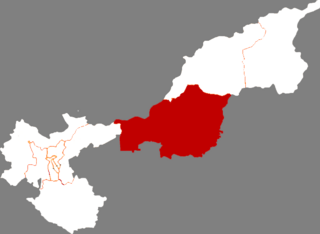
The Zhangjiachuan Hui Autonomous County is an autonomous county in the east of Gansu Province of the People's Republic of China, bordering Shaanxi Province to the east. It is under the administration of the prefecture-level city of Tianshui. Its postal code is 741500, and in 1999 its population was 299,277 people.

Shandan County is a county in Gansu Province, China, bordering Inner Mongolia to the north. It is under the administration of the prefecture-level city of Zhangye. It is an important site located on the ancient Silk Road. Its postal code is 734100, and in 1999 its population was 194,901 people. It is known for horses and pastures. Ancient Han people called the horses as 'heavenly western horses'. The region's lakes provide water to the animals on the pastures.
Língāo County is an administrative district in Hainan province, China. It is one of the 4 counties of Hainan. Its postal code is 571800, and in 1999, its population was 399,057 people.

Chengmai County is a county in Hainan, China. It is one of four counties of Hainan. Its postal code is 571900. In 2002, its population was 490,800.

Dìng'ān is an administrative district in Hainan, People's Republic of China. It is one of 4 counties of Hainan. In 1999, its population was 304,522 people.

Baisha Li Autonomous County, p Báishā Lízú Zìzhìxiàn) is one of 6 autonomous counties of Hainan, China. In 1999 its population was 176,377 people, largely made up of the Li people.

Qiongzhong Li and Miao Autonomous County is an autonomous county in Hainan, China. It is one of 6 autonomous counties of the upper highlands of Hainan. Its postal code is 572900, and in 1999, its population was 196,581 people, largely made up of the Li people and the Miao people.
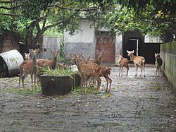
Ledong Li Autonomous County is an autonomous county in Hainan province, China. It is one of six autonomous counties of Hainan. Its postal code is 572500, and in 1999, its population was 468,834 people, largely made up of the Li people.

Xingan County is a county in the central part of Jiangxi province, People's Republic of China. It is the northernmost county-level division of the prefecture-level city of Ji'an, with a total area of 1,245 km2 (481 sq mi). Its population was 329,830 at the 2010 census.
Fujin is a county-level city in the east of Heilongjiang province, People's Republic of China. It is under the jurisdiction of the prefecture-level city of Jiamusi.
Guan County is a county of western Shandong province, People's Republic of China, bordered by Hebei province to the west. It is administered by Liaocheng City.

Gonghe County, also known as Kungho, is a county of Qinghai Province, China under the administration of Hainan Prefecture. The seat of Gonghe County is in the town of Qabqa.

Tongde County is a county of Qinghai province, China. It is under the administration of Hainan Tibetan Autonomous Prefecture.
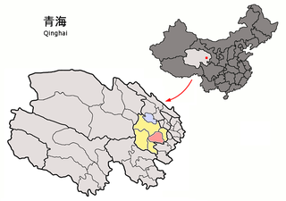
Guinan County is a county in the east of Qinghai Province, China. It is under the administration of Hainan Tibetan Autonomous Prefecture. The seat of Guinan County is in the Town of Mangqu.
Huaiji County is a county of western Guangdong province, People's Republic of China. It is under the administration of Zhaoqing City.

Huiyang District (postal: Waiyeung; simplified Chinese: 惠阳区; traditional Chinese: 惠陽區; pinyin: Huìyáng Qū; Jyutping: wai6joeng4 keoi1 is a district of Huizhou, Guangdong province, People's Republic of China. It was renamed in 2003 amid the restructuring of districts and counties in Huizhou. Formerly named Huiyang city, its size shrank after the restructuring with several towns incorporated into the Huicheng district of Huizhou. Huiyang is the southern urban center of Huizhou along with Huicheng as the northern urban center.
Dongming County in Heze Prefecture is the westernmost county of Shandong Province in the People's Republic of China. It borders Henan Province to the west across the Yellow River. Dongming County had a population of 677,563 in 1999.

Alxa Left Banner is a banner in the southwest of Inner Mongolia, China. It borders Mongolia's Ömnögovi Province to the north, the autonomous region of Ningxia to the southeast, and Gansu province to the southwest. The town of Bayanhot, situated in the banner, is the seat of government of the greater Alxa League, of which Alxa Left Banner is a part.