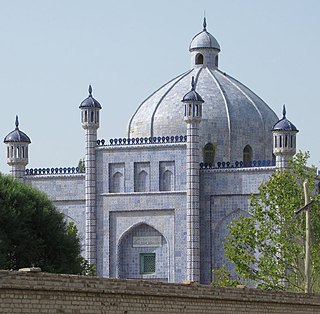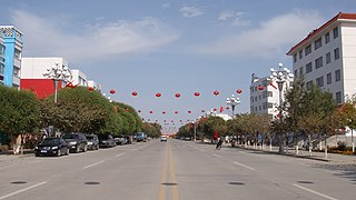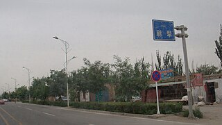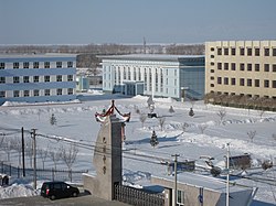
Ili Kazakh Autonomous Prefecture is an autonomous prefecture in northern Xinjiang,China. Its capital is Yining,also known as Ghulja or Kulja.

Aksu is a city in and the seat of Aksu Prefecture,Xinjiang,lying at the northern edge of the Tarim Basin. The name Aksu literally means "white water" and is used for both the oasis town and the Aksu River.

Tacheng,as the official romanized name,also transliterated from Mongolian as Qoqak,is a county-level city and the administrative seat of Tacheng Prefecture,in northern Ili Kazakh Autonomous Prefecture,Xinjiang.

Artux or Artush is a county-level city and the capital of Kizilsu Kyrgyz Autonomous Prefecture in Xinjiang,China. The government seat is in Guangminglu Subdistrict. As of 2018,it has a population of 285,507 people,81.4 per cent of whom are Uyghurs.

Fuhai County is a county under the jurisdiction of the Altay Region of the Xinjiang Uygur Autonomous Region of the People's Republic of China,located in the lower reaches of the Ulungu River in northern Xinjiang.

Qinggil County (Uyghur),also Chinggil County,Qinghe County,is a county of Altay Prefecture in northeastern Xinjiang,China,bordering Bayan-Ölgii Province and Khovd Province in Mongolia to the east. It has an area of 15,722 km2 (6,070 sq mi) with a population of 60,000. Qinghe was the site of a meteorite impact in 1898 and a Mongolian–Chinese border clash in the spring of 1944.

Kalpin County is a county in the Xinjiang Uyghur Autonomous Region and is under the administration of the Aksu Prefecture. The overwhelmingly Uyghur population of the county lives on oases at the base of the Tian Shan mountains and on the edge of the Taklamakan Desert.

Yuli County as the official Romanized name,also transliterated from Mongolian as Lopnur County,is a county in the Xinjiang Uyghur Autonomous Region and is under the administration of the Bayin'gholin Mongol Autonomous Prefecture. It contains an area of 59,399 km2 (22,934 sq mi). According to the 2002 census,it has a population of 100,000.

Qira County,alternatively Chira or Cele,is a county in Hotan Prefecture,Xinjiang Uyghur Autonomous Region,China. Almost all the residents of the county are Uyghurs and live around oases situated between the desolate Taklamakan Desert and Kunlun Mountains. The county is bordered to the north by Aksu Prefecture,to the east by Yutian / Keriya County,to the northwest by Lop County,to the southwest by Hotan County including the China-India disputed Aksai Chin area and to the south by Rutog County,Ngari Prefecture in Tibet.

Hotan County is a county in the southwest of the Xinjiang Uyghur Autonomous Region and is under the administration of the Hotan Prefecture. Almost all the residents of the county are Uyghurs and live around oases situated between the desolate Taklamakan Desert and Kunlun Mountains. Hotan County is the southernmost county-level division of Xinjiang. The county borders Karakax/Moyu County to the northwest,Hotan City and Lop County to the northeast,Qira County to the east,Pishan County to the west,and Rutog County,Tibet to the southeast. Hotan County administers most of Aksai Chin,an area disputed between China and India. The Line of Actual Control divides the India-controlled part of Ladakh union territory from the Aksai Chin area administered as part of southwest Hotan County.

Hoboksar,sometimes referred with the historic name Hefeng County,is an autonomous county for Mongol people in the middle north of Xinjiang Uyghur Autonomous Region,Western China,it is under the administration of Tacheng Prefecture. The county has an area of 28,784 km2 (11,114 sq mi) with a population of 62,100. It has eight towns and townships and seven farms,Hoboksar Town is its county seat.

Altay Xuedu Airport is an airport serving Altay City,Ili Kazakh Autonomous Prefecture,Xinjiang,China.
The Kuytun–Beitun railway or Kuibei railway is a single-track railway in Xinjiang,China between Kuytun and Beitun. The railway branches from the Northern Xinjiang railway at Kuytun and heads north across the Junggar Basin to Beitun,near Altay,passing through Karamay,Urho,and Fuhai (Burultoqay). The railway is 468.5 km in length The railway opened to freight traffic on December 29,2009,and passenger traffic on June 1,2011.

The University Days of a Dog is a 2010 Chinese comedy film. The director is Lu Zhengyu (卢正雨),and the lead actor is Joker Xue. The run time is 96 minutes. It was produced by the Beijing Shengshi Bang Wei Culture Media Co.,LTD.

The Kuytun–Altay Expressway,commonly referred to as the Kui'a Expressway,is an expressway that connects the cities of Kuytun and Altay in Xinjiang,China. The expressway is 527 kilometres (327 mi) in length,with a 135-kilometre long (84 mi) section between Kuytun and Karamay that is concurrent with the G3015 Kuytun–Tacheng Expressway. The entire expressway is part of Asian Highway 67.
Kunyu is a county-level city in Xinjiang Uyghur Autonomous Region,China. It is geographically located in Hotan Prefecture of Southern Xinjiang,but is de jure directly administered by the Xinjiang regional government.
Jiya is a township in the northeastern part of Hotan City in Hotan Prefecture,Xinjiang,China in an oasis area on the eastern bank of the White Jade River in the southwestern part of the Taklamakan Desert. To the north and east,Jiya borders Lop County,the county which Jiya was a part of until 2006,and to the south and west,Jiya borders the rest of Hotan city.


