The area of Hotan is originally known as and has been historically referred to as Godana (Godaniya),a Sanskrit name meaning "Land of the cows". In Chinese,the same name is written as Yu-t'ien. It is referred to as Gosthana by local Tibetans,which also means the same in Sanskrit.[10]
History
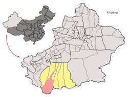
Map including northern Hotan County and surrounding region (USATC,1971)Map including Hotan County area and surrounding region (DMA,1980)
On 12 April 1969,during the Cultural Revolution,the Hotan County People's Government became the Hotan County Revolutionary Committee. In December 1979,the Hotan County Revolutionary Committee was disestablished and the Hotan County People's Government re-established.[11]
In 1983 / 4,the urban area of Hotan was administratively split from the larger Hotan County,and from then on governed as a county-level city.[3][13]
On 9 September 1995,Vice Premier Zhu Rongji visited Buzhake Township.[14]
On 11 July 2006,the township of Tusalla (Tushala),then part of Hotan County,was transferred to Hotan City.[2][13]
In 2012,Hanerik (Han'airike) was changed from a township into a town and Uzunsho (Wuzongxiao) township was established.[2]
On 28 July 2013,an incident involving Muslim protesters and local police in Hanerik (Han'airike / Hanairke) occurred.[15][16] Chinese state media said no one died during the confrontation. There were reports of protester deaths,as many as over 100.[17]
Major lakes administered as part of Hotan County include the soda lakesAksai Chin Lake and Surigh Yilganing Kol (Surigh-yilganing Köl;萨利吉勒干南库勒湖),[18] both part of the disputed Aksai Chin. A Chinese military outpost called Tianshuihai[19] which is named for another lake,Tianshuihai (甜水海[18]),is also in the Hotan County administered part of the disputed Aksai Chin region. The Hotan County-administered part of Aksai Chin includes Tianwendian,[18] site of a Chinese military post.
Climate
Hotan County has a cool arid climate (Köppen climate classificationBWk). The average annual temperature in Hotan is 13.0°C (55.4°F). The average annual rainfall is 44.1mm (1.74in) with July as the wettest month. The temperatures are highest on average in June,at around 25.8°C (78.4°F),and lowest in January,at around −3.9°C (25.0°F).
Climate data for Hotan (1981−2010 normals,extremes 1981−2010)
The county is known for Hotan Silk,Hotan Jade and Hotan Carpets. The county's agricultural products include wheat,rice,corn,melons,cotton,and silkworm cocoons.[3]
1 2 3 4 和田县史志办 (3 April 2019). 和田县简介[Hotan County Overview]. 和田县政府门户网站 (in Simplified Chinese). Archived from the original on 18 January 2020. Retrieved 23 December 2019. 和田县位于新疆西南部,昆仑山北麓,塔克拉玛干沙漠南缘,处于玉龙喀什河和喀拉喀什河之间;国土总面积4.03万平方公里,其中,山区占95%,沙漠占3.7%,绿洲仅占1.3%;全县辖10乡2镇206个行政村,总人口36万人,其中维吾尔族占99%。
1 2 1997年和田县行政区划[1997 Hotan County Administrative Divisions]. XZQH.org. 6 January 2011. Archived from the original on 30 October 2019. Retrieved 3 April 2020. 面积约40808.6平方千米,人口23.9万,有维吾尔、汉、回等民族。其中维吾尔族占99%,辖1镇11乡。
1 2 3 4 历史沿革. 和田县政府门户网站 (in Simplified Chinese). 22 March 2019. Retrieved 23 December 2019. 民国二年(1913)1月18日,撤销和阗直隶州建制,改称和阗县。民国九年(1920)设和阗道,民国十八年(1929)改为和阗行政区,设行政长公署,和阗县属和阗行政长公署管辖。1933年穆罕默德·伊敏等煽动组织民族分裂势力暴乱,成立"和阗伊斯兰共和国",1934年为马虎山部所破。1937年盛世才省军进驻和阗。民国三十二年(1943)设行政督察专员公署,和田县属专员公署管辖。1949年12月22日中国人民解放军十五轩进驻和阗,1950年6月,成立和阗县人民政府。1969年4月12日和田县人民政府改为和田县革命委员会。1979年12月,撤销和田县革命委员会,建立和田县人民政府。
↑ Calvin, James Barnard (April 1984). "The China-India Border War". Marine Corps Command and Staff College. Archived from the original on 11 November 2011. Retrieved 15 October 2011. On October 24th, four days after the outbreak of heavy fighting in NEFA and Aksai Chin
1 2 和田市历史沿革[Hotan City Historical Development] (in Simplified Chinese). XZQH.org. 2 December 2014. Retrieved 20 December 2019. 1984年和田县析置和田市。{...}2006年7月11日,洛浦县吉亚乡、玉龙喀什镇与和田县吐沙拉乡正式划归和田市管辖。
↑ Andrew Jacobs (26 August 2013). "Over News of Clash, a Shroud of Silence in Xinjiang". New York Times. Archived from the original on 30 December 2019. Retrieved 23 December 2019. Although the state media said that no one died during the confrontation between villagers and armed police officers, numerous sources say that dozens were shot dead on the highway that connects Hanerik to Hotan, which the Chinese call Hetian. Exile groups say the death toll may exceed 100.
1 2 3 地貌气候. 和田县政府门户网站 (in Simplified Chinese). 29 April 2019. Retrieved 23 December 2019. 和田县境内有主要湖泊5处:阿克赛钦湖,距县城200千米,面积158平方米,湖面高程 4 963米;萨利吉勒干南库勒湖,距县城260千米,湖面高程5 200米;列腾格湖,距县城260千米,湖水面积9.3平方千米;甜水海;长千湖,湖水面积8平方千米。{...}海拔5 000米以上的天文点、空喀山口一带,
↑ Robert Kerry; John Vincent Bellezza, eds. (February 2008). Tibet. Lonely Planet (7ed.). p.2, 339. ISBN9781741045697– via Internet Archive. Tianshuihai{...}From here the road turns south, and climbs to the Khitai Pass (kilometre marker 535; 5150m), past the military base of Tianshuihai.
↑ 中国地面气候标准值月值(1981-2010) (in Chinese (China)). China Meteorological Data Service Center. Retrieved 16 January 2023.
↑ 2018年统计用区划代码和城乡划分代码:和田县[2018 Statistical Area Numbers and Rural-Urban Area Numbers: Hotan County] (in Simplified Chinese). National Bureau of Statistics of the People's Republic of China. 2018. Archived from the original on 22 December 2019. Retrieved 23 December 2019. 统计用区划代码 名称 653221100000 巴格其镇 653221102000 罕艾日克镇 653221202000 英阿瓦提乡 653221203000 英艾日克乡 653221204000 布扎克乡 653221205000 拉依喀乡 653221206000 朗如乡 653221207000 塔瓦库勒乡 653221208000 伊斯拉木阿瓦提乡 653221209000 色格孜库勒乡 653221210000 喀什塔什乡 653221211000 吾宗肖乡 653221401000 和田县经济新区
↑ huaxia, ed. (17 September 2020). "Full Text: Employment and Labor Rights in Xinjiang". Xinhua News Agency. Retrieved 20 September 2020. In 2019, a survey in three villages of Baghchi Town, Hotan County, Hotan Prefecture counted a total population of 5,307, with 1,699 people capable of work, of whom, 1,493, or 88 percent, were keen to work outside their home villages. Of the remainder, 180 preferred to work locally in township enterprises, village factories, or poverty-relief cooperatives offering an average monthly salary of RMB3,000; the other 26 wished to start businesses locally, engaging in transport and logistics, property management and household services, construction, hairdressing, catering or retail stores.
↑ 3-7 各地、州、市、县(市)分民族人口数 (in Simplified Chinese). شىنجاڭ ئۇيغۇر ئاپتونوم رايونى新疆维吾尔自治区统计局 Statistic Bureau of Xinjiang Uygur Autonomous Region. 15 March 2017. Archived from the original on 11 October 2017. Retrieved 3 September 2017.
Wikimedia Commons has media related to Hotan County.
This page is based on this Wikipedia article Text is available under the CC BY-SA 4.0 license; additional terms may apply. Images, videos and audio are available under their respective licenses.