K2, at 8,611 metres (28,251 ft) above sea level, is the second-highest mountain on Earth, after Mount Everest at 8,849 metres (29,032 ft). It lies in the Karakoram range, partially in the Gilgit-Baltistan region of Pakistan-administered Kashmir and partially in the China-administered Trans-Karakoram Tract in the Taxkorgan Tajik Autonomous County of Xinjiang.

Lenin Peak or Ibn Sina (Avicenna) Peak, rises to 7,134 metres (23,406 ft) in Gorno-Badakhshan (GBAO) on the Kyrgyzstan–Tajikistan border, and is the second-highest point of both countries. It is considered one of the less technical 7,000 m peaks in the world to climb and it has by far the most ascents of any 7,000 m or higher peak on Earth, with every year seeing hundreds of mountaineers make their way to the summit. Lenin Peak is the highest mountain in the Trans-Alay Range of Central Asia, and in the Pamir Mountains in Tajikistan it is exceeded only by Ismoil Somoni Peak. It was thought to be the highest point in the Pamirs in Tajikistan until 1933, when Ismoil Somoni Peak was climbed and found to be more than 300 metres higher. Two mountains in the Pamirs in China, Kongur Tagh and Muztagh Ata, are higher than the Tajik summits.

Muztagh Tower, also Mustagh Tower; Muztagh: icy mountain), is a mountain situated in Baltoro Muztagh, which is a segment of the Karakoram range. It straddles the border of the Gilgit–Baltistan region of Pakistan and the Xinjiang Uyghur Autonomous Region of China. Muztagh Tower is located between the basins of the Baltoro and Sarpo Laggo glaciers.
Peter Boardman was an English mountaineer and author. He is best known for a series of bold and lightweight expeditions to the Himalayas, often in partnership with Joe Tasker, and for his contribution to mountain literature. Boardman and Tasker died on the North East Ridge of Mount Everest in 1982. The Boardman Tasker Prize for Mountain Literature was established in their memory.
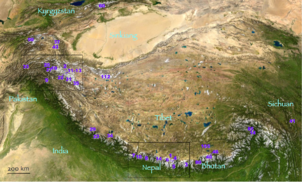
The Pamir Mountains are a range of mountains between Central Asia and South Asia. They are located at a junction with other notable mountains, namely the Tian Shan, Karakoram, Kunlun, Hindu Kush and the Himalaya mountain ranges. They are among the world's highest mountains.
The Kunlun Mountains constitute one of the longest mountain chains in Asia, extending for more than 3,000 kilometres (1,900 mi). In the broadest sense, the chain forms the northern edge of the Tibetan Plateau south of the Tarim Basin. Located in Western China, the Kunlun Mountains have been known as the "Forefather of Mountains" in China.

Saser Kangri is a mountain in India. It is the highest peak in the Saser Muztagh, the easternmost subrange of the Karakoram range. Sasir Kangri is located within Ladakh.

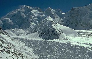
The Kongur Tagh is the highest peak in the Pamir Mountains, and also the highest mountain wholly within the Xinjiang Uyghur Autonomous Region, China. With an elevation of 7,649 metres (25,095 ft), it is also the highest mountain outside of the Hindu Kush/Karakoram and Himalaya ranges.

Mount Gongga, also known as Minya Konka and colloquially as "The King of Sichuan Mountains", is the highest mountain in Sichuan province, China. It has an elevation of 7,556 m (24,790 ft) above sea level. This makes it the third highest peak in the world outside of the Himalaya/Karakoram range, after Tirich Mir and Kongur Tagh, and the easternmost and most isolated 7,000-metre (23,000 ft) peak in the world. It is situated in the Daxue Shan mountain range, between Dadu River and Yalong River, and is part of the Hengduan mountainous region. From it comes the Hailuogou glacier.

The Karakul or Karakuli, is a lake located 196 km southwest of Kashgar, Xinjiang Uyghur Autonomous Region of China. It is located in Akto County, Kizilsu Kirgiz Autonomous Prefecture on the Karakoram Highway, before reaching Tashkurgan, the Khunjerab Pass on the China - Pakistan border and Sost in Pakistan.
Bolor-Tagh is an old name for the longitudinal range in eastern Pamir Mountains extending from Kunlun Mountains in the south to the east extremity of the Trans-Alay Range in the north. Highest peaks Kongur Tagh (7649 m) and Muztagh Ata. Bolor-Tagh lies entirely in the Xinjiang province of western China. Marco Polo visited the area in 1271 during his travel to China, describing it under the name of ‘Belor’.

Altyn-Tagh is a mountain range in Northwestern China that separates the Eastern Tarim Basin from the Tibetan Plateau. The western third is in Xinjiang while the eastern part forms the border between Qinghai to the south and Xinjiang and Gansu to the north.

Batura Sar, also referred to as Batura I, is the 25th-highest mountain on Earth and the 10th-highest in Pakistan. It is the highest peak of the Batura Muztagh, which is the westernmost subrange of the Karakoram range. It forms the apex of the Batura Wall, a continuously high part of the backbone of the Batura Muztagh.
Peak Ozodi, is the third highest peak in the Pamir Mountains of Tajikistan. It is one of the five "Snow Leopard Peaks" in the territory of the former Soviet Union. It is named after Evgenia Korzhenevskaya, the wife of Russian geographer Nikolai L. Korzhenevskiy, who discovered the peak in August 1910.

Alam-Kūh or Mount Alam is a mountain in Alborz mountain range in northern Iran, Mazandaran Province, forming a peak of Takht-e Suleyman Massif. It is located in Kelardasht District of Mazandaran Province. With an elevation of 4,828 meters, it is the second-highest peak in Iran after Mount Damavand.
Skyang Kangri, or Staircase Peak, is a high mountain peak of the Baltoro Muztagh, a subrange of the Karakoram range. It lies on the Pakistan–China border, about 7 kilometres (4.3 mi) northeast of K2, the world's second-highest mountain. The name "Staircase Peak" refers to the East Ridge, which resembles a giant staircase with five steps.
Ulugh Muztagh or Ulugh Muztag and Muztag Feng, is an extremely remote mountain group on the northern Qinghai-Tibetan Plateau. Located on the border between the Tibetan Autonomous Region and Xinjiang Uyghur Autonomous Region, it is part of the main range of the Kunlun Mountains of East-Central Asia.

Akto County is a county in Kizilsu Kyrgyz Autonomous Prefecture, Xinjiang Uygur Autonomous Region, China. The county borders Tajikistan and Kyrgyzstan and has two towns, 11 townships, four state-owned farms and a plant nursery under its jurisdiction. The county seat is Akto Town. The county has an area of 24,555 km2 (9,481 sq mi). In 2015 its population was 221,526; in 2017 it was 231,756.
Chakragil is a major mountain in Xinjiang, China. It is located about 100 kilometres (60 mi) southwest of Kashgar, about 60 kilometres (40 mi) due north of Muztagh Ata, and 37 kilometres (23 mi) northwest of Kongur Tagh. It is in the subrange known as the Kingata Shan, generally included in the "Eastern Pamirs" as it are separated by the major Yarkand River valley from the extreme northwest end of the Kunlun Mountains, near the Pamir Mountains. The Gez River flows just south of the mountain.

Kongur Tagh, which means "a brown mountain" in Uyghur language, has a significant subpeak known as Kongur Tiube, 38°36′57″N75°11′44″E; elevation = 7,530 metres (24,700 ft).Ranked 46th It is moderately independent, with a topographic prominence of 840 m (2,760 ft). It was first climbed in 1956.