This article includes a list of general references, but it lacks sufficient corresponding inline citations .(July 2018) |
Kottiyam | |
|---|---|
Town | |
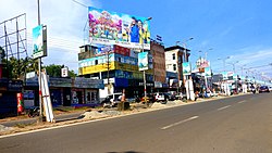 Kottiyam Town | |
 Interactive map of Kottiyam | |
| Coordinates: 8°51′44″N76°40′12″E / 8.86222°N 76.67000°E | |
| Country | India |
| State | Kerala |
| District | Kollam |
| Government | |
| • Type | Panchayath |
| • Body | Adichanalloor, Mayyanad |
| Languages | |
| • Official | Malayalam, English |
| Time zone | UTC+5:30 (IST) |
| PIN | 691571 |
| Telephone code | 0474 |
| Vehicle registration | KL-02 |
| Nearest city | Kollam (Quilon) |
| Lok Sabha constituency | Kollam |

Kottiyam is a suburban town located at the southern end of Kollam city in Kollam district, Kerala, India. The town is home to many popular educational institutions, hospitals, restaurants, hotels, and retail stores. Kottiyam is strategically located and therefore a regular stopover for long-distance travellers wishing to freshen up during their journeys.

