Chakkuvarakkal

Last updated

Chakkuvarakkal
village
India Kerala location map.svg
Red pog.svg
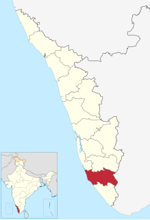
Chakkuvarakkal
Location in Kerala, India
India location map.svg
Red pog.svg
Chakkuvarakkal
Chakkuvarakkal (India)
Coordinates: 8°59′0″N76°51′0″E / 8.98333°N 76.85000°E / 8.98333; 76.85000 Coordinates: 8°59′0″N76°51′0″E / 8.98333°N 76.85000°E / 8.98333; 76.85000
CountryFlag of India.svg  India
State Kerala
District Kollam
Population
 (2001)
  Total17,580
Languages
  Official Malayalam, English
Time zone UTC+5:30 (IST)
Vehicle registration KL-

Chakkuvarakkal is a village in Kollam district in the state of Kerala, India. [1]

Kollam district District in Kerala, India

Kollam district is one of 14 districts of the state of Kerala, India. The district has a cross-section of Kerala's natural attributes; it is endowed with a long coastline, a major Laccadive Sea seaport and an inland lake. The district has many waterbodies. Kallada river is one among them, and the east side land of river is EastKallada and the west side land is WestKallada. Kallada Boat race is one among the famous festival events of district. Even though it is a competition between two land sides of the river, many boat clubs from various place,s even beyond the district participate in the event. Kollam is the capital of Kerala's cashew industry. Plains, mountains, lakes, lagoons and backwaters, forests, farmland and rivers make up the topography of the district. The area had trading relationships with Phoenicia and Ancient Rome.

Kerala State in southern India

Kerala is a state on the southwestern Malabar Coast of India. It was formed on 1 November 1956, following passage of the States Reorganisation Act, by combining Malayalam-speaking regions. Spread over 38,863 km2 (15,005 sq mi), Kerala is the twenty-third largest Indian state by area. It is bordered by Karnataka to the north and northeast, Tamil Nadu to the east and south, and the Lakshadweep Sea to the west. With 33,387,677 inhabitants as per the 2011 Census, Kerala is the thirteenth-largest Indian state by population. It is divided into 14 districts with the capital being Thiruvananthapuram. Malayalam is the most widely spoken language and is also the official language of the state.

India Country in South Asia

India is a country in South Asia. It is the seventh-largest country by area, the second-most populous country, and the most populous democracy in the world. Bounded by the Indian Ocean on the south, the Arabian Sea on the southwest, and the Bay of Bengal on the southeast, it shares land borders with Pakistan to the west; China, Nepal, and Bhutan to the north; and Bangladesh and Myanmar to the east. In the Indian Ocean, India is in the vicinity of Sri Lanka and the Maldives; its Andaman and Nicobar Islands share a maritime border with Thailand and Indonesia.

Demographics

As of 2001 India census, Chakkuvarakkal had a population of 17,580 with 8465 males and 9115 females. [1]

Census Acquiring and recording information about the members of a given population

A census is the procedure of systematically acquiring and recording information about the members of a given population. This term is used mostly in connection with national population and housing censuses; other common censuses include traditional culture, business, supplies, and traffic censuses. The United Nations defines the essential features of population and housing censuses as "individual enumeration, universality within a defined territory, simultaneity and defined periodicity", and recommends that population censuses be taken at least every 10 years. United Nations recommendations also cover census topics to be collected, official definitions, classifications and other useful information to co-ordinate international practices.

Around 13 km from Kottarakkara and almost same from Punalur.

Related Research Articles

Vettikkavala village in Kerala, India

Vettikkavala is a village in Kollam district in the state of Kerala, India. It is famous for the famous Shiva-Vishnu temple situated there with a special deity called Vathukkal Njaali Kunju for whom there's an annual offering of Pongala.

Belagali village in Karnataka, India

Belagali is a panchayat village in the southern state of Karnataka, India. It is located in the Mudhol taluka of Bagalkot district in Karnataka, about 4 km east of the town of Mahalingpur.

Aigali village in Karnataka, India

Aigali is a village in the southern state of Karnataka, India. It is located in the Athani taluk of Belgaum district in Karnataka.

Alakhanur village in Karnataka, India

Alakhanur is a village in the southern state of Karnataka, India. It is located in the Raybag taluk of Belgaum district in Karnataka.

Bekkeri village in Karnataka, India

Bekkeri is a village in the southern state of Karnataka, India. It is located in the Raybag taluk of Belgaum district in Karnataka.

Benachinamaradi village in Karnataka, India

Benachinamaradi is a village in the southern state of Karnataka, India. It is located in the Gokak taluk of Belgaum district in Karnataka.

Honaga village in Karnataka, India

Honaga is a village in the southern state of Karnataka, India. It is located in the Belgaum taluk of Belgaum district in Karnataka.

Jatrat village in Karnataka, India

Jatrat is a village in the southern state of Karnataka, India. It is located in the Chikodi taluk of Belgaum district in Karnataka.

Kanagale village in Karnataka, India

Kanagale is a village in the southern state of Karnataka, India. It is located in the Hukeri taluk of Belgaum district in Karnataka.

Kanvi Karvinakoppa village in Karnataka, India

Kanvi Karvinakoppa is a village in the southern state of Karnataka, India. It is located in the Belgaum taluk of Belgaum district in Karnataka.

Karadaga village in Karnataka, India

Karadaga is a village in the southern state of Karnataka, India. It is located in the Chikodi taluk of Belgaum district in Karnataka.

Karlakatti village in Karnataka, India

Karlakatti is a village in the southern state of Karnataka, India. It is located in the Saundatti taluk of Belgaum district in Karnataka.

Koganoli village in Karnataka, India

Koganoli is a village in the southern state of Karnataka, India. It is located in the Chikodi taluk of Belgaum district in Karnataka.

Kokatnoor village in Karnataka, India

Kokatnur

Koujalgi village in Karnataka, India

Koujalgi is a village in the southern state of Karnataka, India. It is located in the Gokak taluk of Belgaum district in Karnataka.

Kurni village in Karnataka, India

Kurni is a village in the southern state of Karnataka, India. It is located in the Hukeri taluk of Belgaum district in Karnataka.

M.K.Hubli Town Municipal in Karnataka, India

M. K. Hubli is a village in the southern state of Karnataka, India. It is located in the Kittur taluk of Belgaum district in Karnataka. M K Hubballi's full form is Mugut Khan Hubballi

Manakapur village in Karnataka, India

Manakapur is a village in the southern state of Karnataka, India. It is located in the Chikodi taluk of Belgaum district in Karnataka.

Mangutti village in Karnataka, India

Mangutti is a village in the southern state of Karnataka, India. It is located in the Hukeri taluk of Belgaum district in Karnataka.

Karajagi Village in Karnataka, India

Karajagi is a village in jath, in the state of Maharashtra]], India. It is located in the [jath]] taluk of sangli district.

References

  1. 1 2 "Census of India : Villages with population 5000 & above". Registrar General & Census Commissioner, India. Archived from the original on 8 December 2008. Retrieved 10 December 2008.