
Kollam, is an ancient seaport and the fourth largest city in the Indian state of Kerala. Located on the southern tip of the Malabar Coast of the Arabian Sea, the city is on the banks of Ashtamudi Lake and is 71 kilometers northwest of the state capital, Thiruvanathapuram (Trivandrum). Kollam is one of India's oldest continuously inhabited cities, with evidence of habitation stretching back to the megalithic; the city has also been a maritime entrepôt millennia, the earliest attestation of which dates back to the Phoenicians and Romans. It is the southern gateway to the Backwaters of Kerala, and is known for its cashew processing, coir manufacturing, and tourism industries.
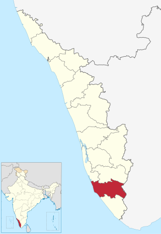
Kollam district, is one of 14 districts of the state of Kerala, India. The district has a cross-section of Kerala's natural attributes; it is endowed with a long coastline, a major Laccadive Sea seaport and an inland lake. The district has many water bodies. Kallada River is one among them, and land on the east bank of the river is East Kallada and that on the west bank is West Kallada.

Pathanamthitta, is a municipality situated in the Southern Kerala, India, spread over an area of 23.50 km2. It is the administrative capital of Pathanamthitta district. The town has a population of 37,538. The Hindu pilgrim centre Sabarimala is situated in the Pathanamthitta district; as the main transport hub to Sabarimala, the town is known as the 'Pilgrim Capital of Kerala'. Pathanamthitta District, the thirteenth revenue district of the State of Kerala, was formed with effect from 1 November 1982, with headquarters at Pathanamthitta. Forest covers more than half of the total area of the District. Pathanamthitta District ranks the 7th in area in the State. The district has its borders with Allepey, Kottayam, Kollam and Idukki districts of Kerala and Tamil Nadu. Nearest town is Thiruvalla, located at a distance of 30 km. Thiruvalla railway station is 30 km via Thiruvalla-Kumbazha highway. Buses ply every 5 Minutes from Thiruvalla To Pathanamthitta & vice versa.
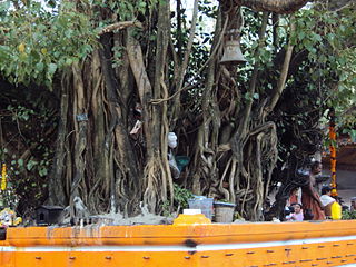
Oachira Temple is an ancient temple located in Oachira in Kollam district in the South Indian state of Kerala. According to the Puranas, this temple is one of the famous sacred places of Kerala and India. Oachira is on the border of Kollam and Allappuzha districts, next to the National Highway 66. This temple is known "DakshinaKashi"(SouthaKashi).This very ancient pilgrimage center is centered on the ParaBrahma temple, and covers thirty-six acres of land.
Padanilam is a town located in Onattukara region of Alappuzha district, Kerala. The word Padanilam means "land of battles". It is located on the banks of river Achankovil. The Padanilam temple is one of the important centres of worship in Kerala. Nooranad is named as the Nandikesha Paithruka Gramam by the Government of Kerala due to its importance in kettukala construction, which is an icon of Onattukara region.
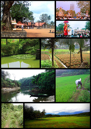
Pattazhy, also Pattazhi is a village located in Pathanapuram taluk in the eastern part of the Kollam District, Kerala state, India. It is best known as the site of an ancient Bhagavathy temple, Pattazhy Devi Temple.
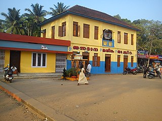
Oachira or Ochira is an ancient temple town located 36 km away from Kollam city in Karunagappally taluk, Oachira is on the border of Kollam and Allappuzha Districts,Kollam district in Kerala, India.

Kulathupuzha is a town in the eastern part of Kollam district of Kerala, India. It is one of the important pilgrim spots linked with the legend of Sabarimala. It is the birthplace of the Malayalam music composer Raveendran. Kulathupuzha is the source of the Kallada river, Thenmala Dam (KIP) is located on this river. As declared by the Governor Arif Mohammad Khan, Kulathupuzha panchayat is the first in India to have achieved Constitution-literacy.

The Vilwadrinatha Temple is a Hindu temple in Thiruvilwamala, a town in the city of Thrissur, Kerala, India. The principal deities are Rama, the seventh incarnation of the god Vishnu, and his brother, Lakshmana. It figures among the Abhimana Kshetrams in Vaishnavite traditions. This is one of the four major Rama temples in Kerala — the other three are in Thriprayar, Kadavallur, and Thiruvangad. The temple houses an idol of Lakshmana, which is rare in India. Vilwadrinatha Temple is located in the centre of the community of Thiruvilwamala, atop a 100-foot-high hillock. Visible from the temple is Bharathappuzha, the second-largest river in Kerala, which flows past the temple's northern side from around 3 kilometres away.
Karunagappally is a municipality in the Kollam district of Kerala, India. It is 24 km north of Kollam and 60 km (37 mi) south of Alappuzha. Karunagappally taluk consists of Alappad, Ochira, Adinad, Karunagappally, Thazhava, Pavumba, Thodiyoor, Kallalibhagom, Thevalakkara, Chavara, Neendakara, Clappana, Kulasekharapuram, Thekkumbhagam, Ayanivelikulangara, Panmana, Ponmana and Vadakumthala. The taluk is bound on the north by Kayamkulam, on the east by Kunnathur taluk, on the south by Kollam and on the west by the Arabian Sea. It is one of the fastest developing towns in Kerala and is part of Kollam metropolitan area.
Kandalloor is a village in Alappuzha district in the Indian state of Kerala.

Nooranad is a developing town in Mavelikkara taluk of Alappuzha district in the Indian state of Kerala. It is located at a distance of 8 Km south-west of Pandalam, in Kayamkulam route. Padanilam is the cultural centre of Nooranad region. The Padanilam Parabrahma Temple, known for the biggest Shivarathri Kettukazhcha in Kerala, is situated in Nooranad. Nooranad is declared by the Government of Kerala as the Nandikesha Paithruka Gramam due to its importance in Kettukala making, which is an icon of Onattukara region of Central Travancore. Nooranad is also known as Pakshi Gramam of kerala.
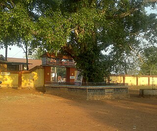
Kizhakkekallada, also known as East Kallada, is a large village in the Kollam district in the state of Kerala, India. It is located about 20 kilometres (12 mi) northeast of Kollam.
Vettikkavala is a village located in the Kollam district in the state of Kerala, India. The village is famous for Shiva-Vishnu temples which hosts a special deity called Vathukkal Njaali Kunju. An annual celebration of Pongala is held at the temple. The village is also well known for temple arts and a palace constructed by Sree Moolam Thirunal.

Edava is a panchayat in Varkala Taluk, which is the northernmost tip of Thiruvananthapuram district in the state of Kerala, India. Edava is located 5km north of Varkala, 21km south of port city Kollam and 44km north of capital city Thiruvananthapuram. Kappil beach is a famous surf location.Surfsupkerala life saving club operates here.

Vilakkupara is a village in Punalur Taluk, Kollam District, Kerala State, India. Vilakkupara lies 58 km (36 mi) to the east of Kollam, the District headquarters, and 12 km (7 mi) to the southeast of Punalur on Kollam-Thirumangalam National Highway (N.H-744). It is 72 km (45 mi) north of Thiruvananthapuram, the State Capital. It belongs to the Yeroor Gram panchayat, Punalur Assembly Constituency, and is a part of the Kollam Lok Sabha constituency.
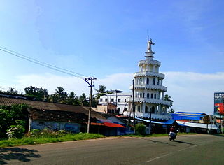
Sakthikulangara is a zone and neighbourhood situated at the coastal area of the city of Kollam in Kerala India. It is one among the 6 zonal headquarters of Kollam Municipal Corporation.

The Kottankulangara Devi Temple is a Hindu temple to the goddess Durga Bhagavathy or Aadi Shakthi, the supreme mother of power, located in the village of Chavara, Kerala, India.

Attuvassery is a village in Kollam district in the state of Kerala in southern India. The Kallada River flows through the village from east and south. On the other side of the river, Attuvassery is in the east and Thekkumchery is in the south, while on the west side are Kadampanadu and North Mannady.

The Asramam Maidanam or Ashramam Maithanam is an urban park, or maidhanam, in the city of Kollam, in Kerala, India. At 72 acres (29 ha), it is the largest open space within Kerala Municipal Corporation limits. The maidan is considered one of the green lungs of the city and regularly hosts the city's main cultural and sports events. It holds an adventure park children's park, picnic village, British Residency and mangrove forests making it an important tourism spot in the city.


