Nedumangad is a town and municipality in Thiruvananthapuram metropolitan area of Thiruvananthapuram district in the Indian state of Kerala, and is the headquarters of Nedumangad tehsil and Nedumangad Revenue Division (RDO). It is a suburb of the extended metropolitan region of Thiruvananthapuram city. It is located around 16 km to the north-east of Thiruvananthapuram city on the Thiruvananthapuram – Shenkottah. It is an important commercial center in the district. It is a growing commercial and educational hub and all important government institutions are situated in the town. Nedumangadu Market is important in South Kerala.

Valapattanam is a Census town in the Kannur district, located in the Indian state of Kerala. It is also the smallest panchayath in Kerala. Its area is 2.04 sqr Km. It is about 7 km north of Kannur. Valapattanam is known for its communal harmony. On one side Kalarivathukkal Temple is located and on the other bank there is "Kakkulangara Mosque".
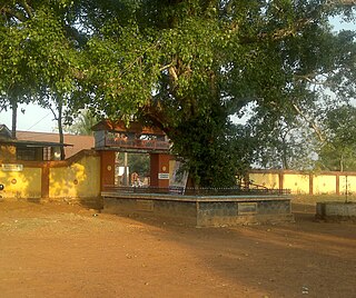
VITHURA is a town VITHURA 36 km from Thiruvananthapuram, capital of the Kerala state in India. Vithura is the crossroads to various tourist, cultural, and religious centres. Surrounded by the Western Ghats (Sahyadri), Vithura is a prime tourist spot. The Village is rich with scenic beauty and good climate. The campus for the Indian Institute of Science Education and Research, Thiruvananthapuram is being constructed here.
Irikkur is a census town in Kannur District of Kerala state, India.
Koyilandy is a municipality in the taluk of the same name in Kozhikode district, Kerala on the Malabar Coast. The town is located between Kozhikode (Calicut) and Vadakara (Badagara) on National Highway 66.. Koyilandy harbour is the largest fishing harbour in the Asia. The northern part of Pulimuttu is 1600 m long and the southern part is 915 m long. The picturesque Kappad beach lies near Koyilandy. India's first mangrove museum is situated in Koyilandy. Koyilandy is well connected to major towns like Kozhikode, Vatakara, Thamarassery, Balussery & Perambra.

Kadungalloor is a census town, just 1km from Aluva Town, It is in Paravur Taluk, Ernakulam district in the Indian state of Kerala. The industrial estate of Muppathadam and Edayar is situated in this panchayat. Pottuvellari is widely cultivated in this panchayat. Panchayat consists of notable peoples in cultural and local arts. Famous personalities include actor Sathar,writer Sethu and award-winning Malayalam novelist Gracy. Recently Kadungallor panchayath, previously in Paravur Taluk joined Aluva Taluk. Muppathadam is the main Commercial Center of Kadungalloor.

Varapuzha is a northern suburb of the city of Kochi. It is a census town in Paravur Taluk, Ernakulam district in the Indian state of Kerala. Situated around 15 km (9 mi) from the city centre and 8 km (5 mi) from Edapally, the areas lies in the NH 66 connecting Vytilla with North Paravur. Its specialty is that considerably large scale paddy cultivating area is situating western part of Varapuzha which is called Devaswompadam, specialised with Pokkali paddy cultivation and interim crop as fish cultivation locally called 'Kettu'. The common work of the natives are fishing and agriculture.

Ramankary is a village in the Kuttanad region of India. It is 9 km away from Changanacherry town and 17 km from Alappuzha city. It is one of the villages in Alapuzha on the bank of the Manimala River with picturesque vast paddy fields.

Pattuvam is a village in Kannur district, Kerala, India. It is bounded by Kuppam river on the north-west-south directions. It shares border with Taliparamba municipality on the east. A joint-less bridge over Kuppam river which connects Pattuvam to Kottakkeel of Ezhome village in northwest direction was inaugurate by Chief Minister of Kerala Pinarayi Vijayan in January 2017.
Kodamthuruth is a village in Alappuzha district in the Indian state of Kerala. It is a panchayat which comes under the Aroor Assembly constituency.

Muthukulam is a backwater village in the Karthikapally Taluk of Alappuzha district in the Indian state of Kerala.

Venmony is a village in Chengannur taluk of Alappuzha district of Central Travancore area in Kerala state, India. Venmoney is 18 km south of Thiruvalla, 11 km east of Mavelikkara and 9 km northwest of Pandalam. 12 km from Chengannur. It is located 55 km towards East from District headquarters Alappuzha. 107 km from State capital Thiruvananthapuram and 138 km from Cochin International Airport. The village is on the border of the Alappuzha District and Pathanamthitta District. The Achenkovil river flows on its southern boundary and is spanned by the Pulakadavu bridge.

Varappetty is a village in Ernakulam district in the Indian state of Kerala. Varappetty is 7 km from Kothamangalam along Kothamangalam-Vazhakulam Road, 6 km from Muvattupuzha along Puthuppady-Oonnukal Road and 12 km from Vazhakulam in Eranakulam District.
Kizhakkekallada is a village in Kollam district in the state of Kerala, India. East Kallada or popularly known as Kizhakkekallada is a village located about 20 km north-east of Kollam.
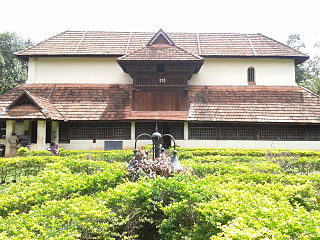
Vettikkavala is a village in Kollam district in the state of Kerala, India. It is famous for the famous Shiva-Vishnu temple situated there with a special deity called Vathukkal Njaali Kunju for whom there's an annual offering of Pongala. The village is famous for temple arts and a palace constructed by Sree Moolam Thirunal.

Trikkalangode is a large Grama Panchayath located in Ernad (Manjeri) Taluk of Malappuram district in Kerala state with total 10415 families residing. The Trikkalangode Grama Panchayath has population of 52090 of which 25140 are males while 26950 are females as per Population Census 2011. In Trikkalangode village population of children with age 0-6 is 7266. Average Sex Ratio of Trikkalangode is 1046 which is lower than Kerala state average of 1084. Child Sex Ratio for the Trikkalangode as per census is 927, lower than Kerala average of 964.

Vazhayur is a census town in Malappuram in the state of Kerala, India. Vazhayur is located in the border of Kozhikkode and Malappuram districts. The Vazhayur Census Town has population of 36,909 of which 18,163 are males while 18,746 are females as per report released by Census India 2011. The 2018 Malayalam film Sudani from Nigeria was shot in Vazhayur.
Polpully is a village and gram panchayat in Palakkad district in the state of Kerala, India. The village is located 10 km from Palghat town, and 5 km from Chittur. The spirit of Polpully is mix of young generation of people and vibrant culture.
Koipuram is a large census village in Tiruvalla, and a pacnhayath in keralaPathanamthitta district in the state of Kerala, India. Kumbanad, Muttumon, Pullad, Poovathoor, are the nodal points. The village has large number of banks and Christian churches. The Koipuram area has a sizeable NRI population, like other parts of Tiruvalla, and this is the main source of economy. Many nationalised and private banks have their branches in Koipuram, especially in the Kumbanad area. This is a well developed region, thanks to the NRI population.
Malayinkeezhu is a suburb of Trivandum, the largest city and capital of the Indian state of Kerala. It is located at the south-eastern side of Thiruvanathapuram Metropolitan Area, and is at a distance of 13 km from the heart of the city. The town is famous for the religious festival named Malayinkeezhu Aarattu. Neyyar Wildlife Sanctuary, one of the major tourist destinations in Thiruvananthapuram district is situated 17 km away from the town. The nearest airport is Trivandrum International Airport and Balaramapuram Railway Station is the nearest Railway Station. The Pincode of Malayinkeezhu Post Office is 695571 which comes under the postal circle of Neyyattinkara region.


