
Changanassery, is a municipality in the Kottayam district of Kerala, India. It is located 17 km (10.6 mi) south of the district headquarters in Kottayam and about 115 km (71.5 mi) north of the state capital Thiruvananthapuram. As per the 2011 Indian census, Changanassery has a population of 47,485 people, and a population density of 3,517/km2 (9,110/sq mi).

Piravom is a municipality in the Ernakulam district of Kerala, India. It is located 22 km (13.7 mi) south of the district collectorate in Thrikkakara and about 162 km (100.7 mi) north of the state capital Thiruvananthapuram. As per the 2011 Indian census, Piravom has a population of 27,229 people, and a population density of 927/km2 (2,400/sq mi).The majority of people living in Piravom are Syrian Christians.

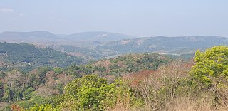
Peralasseri is a census town and Panchayat headquarters in Kannur district in the Indian state of Kerala, situated on the Kannur-Kuthuparamba State Highway 38 (Kerala), 12 km from Kannur city, on the bank of Anjarakandy river.

Thiruvankulam is a census town and revenue village in Thrippunithura municipality, in Ernakulam district, Kerala, India. The area is a part of the Kochi metropolitan area. NH 85 passes through Thiruvankulam. The Karingachira junction is the location of the southern terminus of the Seaport-Airport Road, which connects the Cochin International Airport and the Cochin Port.

Pathanapuram is a Town in Pathanapuram Taluk Kollam district, Kerala, India. Pathanapuram is a part of Grama Panchayat and Block panchayat of same name and part of Kollam District Panchayat.
Ramankary is a village in the Kuttanad region of India. It is 9 km away from Changanacherry town and 17 km from Alappuzha city. It is one of the villages in Alapuzha on the bank of the Manimala River with picturesque vast paddy fields.
Chittar is a village in Pathanamthitta district, located in Kerala state, India. It is a Panchayat and is situated in the Konni Thaluk and in Konni constituency in Pathanamthitta District. Nearest Railway Station Is Thiruvalla,Located At A Distance Of 53 km.It is located 29 km away from Pathanamthitta town at its east. Nearby Panchayats are Seethathodu, Perunad, Vadaserikkara and Thannithodu. Chittar was formerly represented in the Ranni legislative assembly, but now in Konni assembly. Its previous parliament constituency was Idukki. Chittar was given the Nirmal Gram award from former president Pratibha Patil.
Kottappady is a village in Kothamangalam Taluk in Ernakulam district of Kerala State, India. It belongs to Central Kerala Division. It is located 10 km from Kothamangalam. The village came into existence in the year 1953.

Pavithreswaram is a village in Kottarakkara taluk of Kollam district in the state of Kerala, India.
Piravanthoor is a village in Kollam district in the state of Kerala, India. Piravanthoor is a part of Pathanapuram Block Panchayat and Kollam district Panchayat.
Poothakkulam, also known as Bhoothakkulam, is a village in Kollam district in the state of Kerala, India. The village is located 3.9 km away from Paravur, 11.4 km from Varkala and 23 km from Kollam. In 2011, it had a population of 628,451 residents. The village covers an area of 16.56 km2.
Melukavu (Melukavumattom) is a village in the eastern part of Meenachil Taluk in Kottayam District of Kerala state, India.

Kozhinjampara is a town in the Palakkad district, state of Kerala, India. It forms a part of the area administered by the Kozhinjampara gram panchayat.
Enadimangalam is a village in the Pathanamthitta district of the state of Kerala, India. Enadimagalam includes mainly Elamanoor and Maroor. Enadimagalam is often recognised as a Panchayat. Enadimangalam had a population of around 30,000.
Karakulam is a panchayat in Nedumangad Taluk in Thiruvananthapuram District in the state of Kerala, India. It is the most populated panchayat in the district according to 2011 census.
Vellarada is a border village situated in Thiruvananthapuram district in the state of Kerala, India. It is 42 km from Thiruvananthapuram. It is the southernmost part of Kerala state, sharing its border with Tamil Nadu. Vellarada is said to be the threshold to the high-range areas of the eastern part of Thiruvananthapuram district. The southernmost point of Western Ghats in Kerala is near Vellarada.
Vembayam is a village in Thiruvananthapuram district in the state of Kerala, India.

Thuravoor is a Gram Panchayat in Aluva Taluk of Ernakulam District in the South Indian state of Kerala. Thuravoor Grama Panchayath is nearly 5 km from Angamaly Town. The Panchayat covers 12.13 km2 in area. The borders of this panchayat are Mookkannoor and Manjapra Panchayat in the north, Manjapra, Malayattoor-Neeleeswaram Panchayat in the East. Kalady panchayat and Angamaly Municipality in the south, and Karukutty and Mookkannoor Panchayat on the west.
Valakom is a fast growing town located on Kerala State highway One, in the Kollam district of Kerala, India, with a population of 17928. It lies within Kottarakkara municipal town, Ummannoor and edamulackal Panchayat. Valkom is famous for menkari and kapa puzhikiyathu. In the Valakom market, anyone can buy and sell vegetables, fish and meat. The government library is located around 2 km from the place. Valakom consists of many schools, churches and temples.

Meenangadi is an old town situated on the highway NH 766 between Kalpetta and Sulthan Bathery in Wayanad District, in Kerala, India. This place is one among the Provinces where the existence of Dolmens provide an historical evidence of earlier civilisation. Coffee bean, Black pepper, Ginger, Rice and Areca are the major crops cultivated in this area. Meenangadi is famous for its Fish Market and Cattle Market. The nearest railway station is at Kozhikode at 87 km and airport is Kannur International Airport with 94 km from Meenangadi. Meenangadi is surrounded by, Ambalavayal Panchayat, Kalpetta Taluk towards west, Gudalur Taluk towards East, Mananthavady Taluk towards west. Kalpetta, Sultan Bathery, Kozhikode are the nearby Cities and towns to Meenangadi.
Kerala's first carbon neutrality project launched in Meenangadi in June 2016. Upon achieving the goals of the project, Meenangadi will be the first village in India to go completely carbon neutral. Meenangadi has a population of 33450 According to 2011 Census with two Villages Purakkadi and (Part)Krishnagiri.


