
The Kingdom of Travancore, also known as the Kingdom of Thiruvithamkoor or later as Travancore State, was an Indian kingdom that lasted from c. 1729 until 1949. It was ruled by the Travancore Royal Family from Padmanabhapuram, and later Thiruvananthapuram. At its zenith, the kingdom covered most of the south of modern-day Kerala and the southernmost part of modern-day Tamil Nadu with the Thachudaya Kaimal's enclave of Irinjalakuda Koodalmanikyam temple in the neighbouring Kingdom of Cochin. However Tangasseri area of Kollam city and Anchuthengu near Attingal in Thiruvananthapuram were parts of British India.
Mavelikara is a municipality in the Alappuzha district of Kerala, India. It is located 36 km (22.4 mi) south of the district headquarters in Alappuzha and about 95 km (59.0 mi) north of the state capital Thiruvananthapuram. As per the 2011 Indian census, Mavelikkara has a population of 26,421 people, and a population density of 2,088/km2 (5,410/sq mi).
Kollam district, is one of 14 districts of the state of Kerala, India. The district has a cross-section of Kerala's natural attributes; it is endowed with a long coastline, a major Laccadive Sea seaport and an inland lake. The district has many water bodies. Kallada River is one among them, and land on the east bank of the river is East Kallada and that on the west bank is West Kallada.

Kottarakkara, also transliterated as Kottarakara, is a town and municipality in the Kollam district of the Kerala, India. Kottarakkara lies 27 kilometres (17 mi) to the east of Kollam city centre.

Kadakkal is a historic town located in the eastern part of Kollam district, Kerala. It is 44 km away from both Kollam City and Thiruvananthapuram. State highway 64 passes through the town. Kadakkal is well known for the social revolutionary activities held in the pre-independent period of India.The town is an important business centre and is known for its Trade ,Kadakkal Viplavam Kadakkal Riot Case,Festivals ,Religious unity & spice production. Kadakkal is reachable through Nilamel, and is well connected to nearby villages like Anchal, Kilimanoor, Parippally and Madathara. Kadakkal is one of the place which facilitates the easiest roadway access to the neighbouring state Tamil Nadu & is one of the upcoming Municipality in Kollam district. The town is only 50 km away from Tamil Nadu border, Trivandrum central & Kollam city.

Thalavoor is a village located in the district of Kollam in the Kerala state of India. It is 77 km to the north of the State Capital, Thiruvananthapuram, and 28 km to the east of District Capital, Kollam. Thalavoor village is bordered by Pattazhy village to the north, Pidavoor village to the north-east, Vilakkudy village to the south-east, Melila village to the south and Mylom village to the west. Thalavoor is a part of Pathanapuram Block Panchayat

Pathanapuram is a Town in Pathanapuram Taluk Kollam district, Kerala, India. Pathanapuram is a part of Grama Panchayat and Block panchayat of same name and part of Kollam District Panchayat.
The history of Thiruvananthapuram dates back to the 18th century AD. In 1795, the city became the capital of the princely state of Travancore. Several historic landmarks of the city, including the Kowdiar Palace, University of Kerala, and Napier Museum were built during that period. After independence, Thiruvananthapuram was made the capital of the state of Kerala.

Poonjar is a small Indian town located on the eastern side of Kottayam district in Kerala state, India. Before the independence of India, Poonjar had been the part of Travancore princely state. Erattupetta, Teekoy, Bharananganam, and Vagamon are the nearest towns and villages of Poonjar. Taluk Headquarters, Pala is 18 kilometres away from Poonjar and Kanjirapally is 22.6 kilometres away from Poonjar.
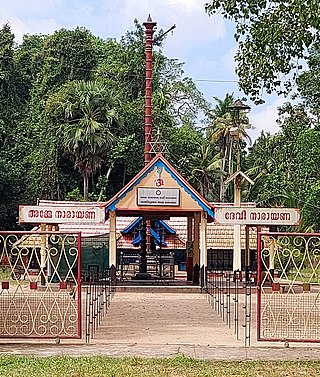
Pattazhy, also Pattazhi is a village located in Pathanapuram taluk in the eastern part of the Kollam District, Kerala state, India. It is best known as the site of an ancient Bhagavathy temple, Pattazhy Devi Temple.

The Travancore royal family was the ruling house of the Kingdom of Travancore.The Travancore royal family signed a treaty with the British in 1788, thereby adopting British dominance. Later, in 1805, they revised the treaty, leading to a diminution of royal authority and the loss of political independence for Travancore. They had to give up their ruling rights over the common people in 1949 when Travancore were forced to merge with Independent India and their political pension privileges were abolished in 1971.
Kudavattoor is a small village of the Kottarakara Taluk in the Kollam district of the Indian state of Kerala. In the local Malayalam language, kuda means "umbrella" and vattor "round". A predominantly rural village, Kudavattoor comes under the administration of the Veliyam Grama Panchayat made up of Maroor, Cherukarakonam and Kudavattoor chandhamukku. The village is situated on the odanavattom kollam road, which provides access to Kollam via Kundara or Nedumankavu as well as to Kottarakara. Kollam, the district headquarters is situated about 25 km from Kudavattoor.
Ezhukone is a village in Kollam district in the state of Kerala, India between Kottarakara and Kundara.
Hinduism, Islam and Christianity are the prominent religions in Kollam district. As per the Census 2011, out of the total population of 2,635,375 persons, 64.42% follow Hinduism, 19.30% follow Islam and 16.00% follow Christianity. Other religions comprise 0.04%, while 0.25% did not state any religion.

Aswathy Thirunal Gowri Lakshmi Bayi is an Indian writer from Kerala and a member of the Travancore Royal Family. She has ten books to her credit. Aswathy Thirunal is the niece of the last King of Travancore, Chithira Thirunal Balarama Varma. She was awarded India's fourth highest civilian award the Padma Shri in 2024.

Kulathupuzha Sastha Temple is a Hindu temple dedicated to Shasta, located in Kulathupuzha in the Kollam district of Kerala, India. It is one of the five important Sastha temples in Kerala, the others being Aryankavu, Achankovil, Sabarimala and Kanthamala. The idol there is believed to have been installed by Parashurama and is made up of eight pieces of stone. The temple is known for the Meenoottu offering. The temple is governed by the Travancore Devaswom Board.
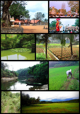
Kollam district, earlier called Quilon district, is one of the 14 districts of Kerala state, India. The district is representative of all the natural attributes of Kerala states, and is endowed with a long coastal region, a major sea port on the Arabian Sea, plains and the mountains, lakes, lagoons and Kerala Backwaters, forests and the farm land, and rivers and streams. The area had mercantile relationship with Phoenicians and the Romans.


