| Purna River | |
|---|---|
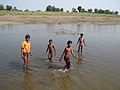
 River Purna at Manegaon | |
 | |
| Etymology | Purna River - Complete river |
| Location | |
| Country | India |
| State | Madhya Pradesh, Maharashtra |
| Region | Vidarbha, Khandesh |
| District | Betul District, Amravati, Akola, Buldhana, Jalgaon |
| Physical characteristics | |
| Source | Pokhrani, Bhainsdehi |
| • location | Satpura Range, Betul District, Gawilgarh ranges, Madhya Pradesh |
| • coordinates | 21°30′N77°46′E / 21.500°N 77.767°E |
| Mouth | Tapti River |
• location | Changdev, Jalgaon, Muktainagar, Maharashtra |
• coordinates | 21°5′45″N76°0′36″E / 21.09583°N 76.01000°E |
| Discharge | |
| • location | Surat, Gujarat |
| Discharge | |
| • location | Changdev, Taluka-Muktainagar, Dist-Jalgaon, State-Maharashtra, India |
| Basin features | |
| Tributaries | |
| • left | Pedhi River, [1] Mūrna River, Mūn River, Dnyanganga River, Vishwaganga River, Nalganaga River |
| • right | Arna River, Bodi River, Chandrabhaga River, Ban River, Shahanur River |
The Purna River is a river of Central and Western India. It is one of the chief[ citation needed ] tributaries of the Tapti River and empties into it at Changdev in Jalgaon, Maharashtra.