
Saurashtra, also known as Kathiawar, is a peninsular region of Gujarat, India, located on the Arabian Sea coast. It covers about a third of Gujarat state, notably 11 districts of Gujarat, including Rajkot District. It was formerly a state of India before it merged with Bombay state. In 1961 it separated from Bombay and joined Gujarat.

The Sabarmati river is one of the major west-flowing rivers in India. It originates in the Aravalli Range of the Udaipur District of Rajasthan and meets the Gulf of Khambhat of Arabian Sea after travelling 371 km (231 mi) in a south-westerly direction across Rajasthan and Gujarat. 48 km (30 mi) of the river length is in Rajasthan, while 323 km (201 mi) is in Gujarat.

Surendranagar is an administrative district in Saurashtra region of Gujarat state in India. It has a population of approximately 1.7 million people. Surendranagar, along with the twin city of Wadhwan, has a total of 400,000 inhabitants, and is known as "Camp".
Wadhwan, also spelled Vadhwan, is a city and a municipality in Surendranagar district in the Indian state of Gujarat. Located on the banks of the Bhogavo River, around 3 km from Surendranagar and 111 km from Ahmedabad, Wadhwan is a known location for its old world royal charm and serene space with a life and culture of its own. It was historically the capital of Wadhwan State.
Botad is a city and district headquarters of Botad district, Gujarat, India. It is about 92 km from Bhavnagar and 133 km From Ahmedabad by road distance.
Surendranagar is Municipal Corporation in Surendranagar district in the Indian state of Gujarat.
Muli is a town located 21 km southwest of the district capital of Surendranagar, Gujarat, India, by the Bhogavo River.
Nayka Dam is an earthen dam on the Bhogavo River located near Surendranagar in the Indian state of Gujarat. Nayka is a major source of water and helps with flood control.

The Bhal region is an area of Gujarat, India. It is spread across the political boundaries of the districts of Bhavnagar, Ahmedabad, and Anand. The Bhal region is situated on the deltas of the Sabarmati, Bhogawo, Bhadar, Lilka and other rivers that flow east and southeast off the Kathiawar peninsula into the Gulf of Cambay. The word Bhaal seems to have been derived from the Sanskrit word भाल which means forehead. Such a name is given to this region probably because it is mostly as flat as a forehead with almost entire region's soil without any stones, pebbles or gravel.

The Narmada Canal is a contour canal in Western India that brings water from the Sardar Sarovar Dam to the state of Gujarat and then into Rajasthan state. The main canal has a length of 532 kilometres (331 mi). It is the second longest canal in India and the largest canal by water carrying capacity. The main canal is connected with 42 branch canals providing irrigation to 2,129,000 hectares farmland. The canal is designed to transfer 9.5 million acre-feet water annually from the Narmada Basin to areas under other river basins in Gujarat and Rajasthan..
Limbdi is one of the 182 Legislative Assembly constituencies of Gujarat state in India. It is part of Surendranagar district.
Bhavnagar railway station is a small railway station in Bhavnagar district, Gujarat. Its code is BVP. It serves Bhavnagar city. The station consists of two platforms. The platforms are not well sheltered. It lacks many facilities including water and sanitation.
Bajana is a village in Dasada Taluka of Surendranagar district, Gujarat, India.
Bhimora is a village and former Rajput-Kathi princely state in Chotila Taluka of Surendranagar district, Gujarat, India.
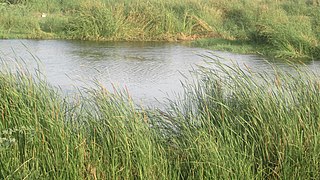
Bhogavo River is a river in Gujarat, India. It is a major right tributary of the Sabarmati River. The city of Surendranagar is on the banks of the Bhogavo. Dholidhaja Dam is located on the river. The film Guide's climax was shot in the town of Limbdi, 90 km from Ahmedabad on the Bhogavo River. The Harappan port city Lothal is located along Bhogava River.
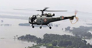
Following heavy rain in July 2017, the Indian state of Gujarat was affected by severe flooding. The floods were reported to have caused total 224 deaths between 1 June and 31 July 2017. 16 people had died in neighbouring Rajasthan state by 31 July.
Dholi Dam across the Madhumati River forms the Dholi Reservoir in Jhagadia city, Gujarat state, India.
Lakhtar railway station is a railway station on the Western Railway network in the state of Gujarat, India. Lakhtar railway station is 21 km far away from Surendranagar railway station. Two Passenger, two Express, and one Superfast trains halt here.
Than railway station is a railway station on the Western Railway network in the state of Gujarat, India. Than railway station is 48 km far away from Surendranagar railway station. Passenger, Express and Superfast trains halt here.

Ranakdevi's Temple is a 9th or 10th century Hindu temple dedicated to Ranakdevi located in Wadhwan in Surendranagar district of Gujarat, India. It is built in post-Maitraka and early Nagara phase of Māru-Gurjara architecture style.


