Nadiad is a city in the state of Gujarat, India and the administrative centre of the Kheda district. The city is managed by the Nadiad Municipal Corporation. It is known for the Santram Mandir, the Mai Mandir, the historic Swaminarayan temple built in 1824, and the Anand and Hari Om Ashram. Nadiad is the place where Shrimad Rajchandra composed Shri Atmasiddhi Shatra, a 142 verse spiritual treatise in 1895. Nadiad is located 90 kilometres (56 mi) away from Gandhinagar, the capital of Gujarat. It has a major railway junction and is a main station on the Ahmedabad-Mumbai route. It is the birthplace of Sardar Vallabhbhai Patel, the first Deputy Prime Minister of India. Nadiad Municipality was Founded in 1866.

The Aravalli Range is a mountain range in Northern-Western India, running approximately 670 km (420 mi) in a south-west direction, starting near Delhi, passing through southern Haryana, Rajasthan, and ending in Ahmedabad Gujarat. The highest peak is Guru Shikhar on Mount Abu at 1,722 m (5,650 ft). The Aravalli Range is one of the oldest geological features on Earth, having its origin in the Proterozoic era.

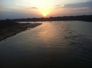
The Sabarmati River is one of the major west-flowing rivers in India. It originates in the Aravalli Range of the Udaipur District of Rajasthan and meets the Gulf of Khambhat of Arabian Sea after travelling 371 km (231 mi) in a south-westerly direction across Rajasthan and Gujarat. 48 km (30 mi) of the river length is in Rajasthan, while 323 km (201 mi) is in Gujarat.

Sabarkantha district is one of the 33 districts of Gujarat state of India, located in the northeastern part of the state. The administrative headquarters of the district are located in Himatnagar.
Kheda is a city and a municipality in the Indian state of Gujarat. It was former administrative capital of Kheda district. India's First Deputy Prime Minister Vallabhbhai Patel Was Born In Kheda District of Gujarat State. Kheda city is famous for tobacco farming. The nearest railway station is Mahemadavad Kheda Road. The nearest airport is Ahmedabad airport. The nearest bus station is Kheda Bus Station.
Modasa is a town and a municipality in Aravalli district in the Indian state of Gujarat.

The Mahi is a river in western India. It rises in Madhya Pradesh and, after flowing through the Vagad region of Rajasthan, enters Gujarat and flows into the Arabian Sea. It is one of the relatively few west-flowing rivers in India, alongside the endorheic Luni River, the Sabarmati River, the Tapi River and the Narmada River. Most peninsular rivers in India flow eastward into the Bay of Bengal or northward into the Ganges River.
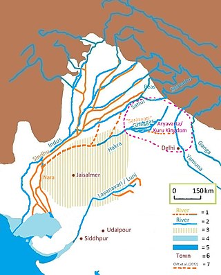
The Luni is the largest river in the Thar Desert in Northwest India. It originates in the Pushkar valley of the Aravalli Range, near Ajmer, passes through the southeastern portion of the Thar Desert, and ends in the marshy lands of Rann of Kutch in Gujarat, after travelling a distance of 495 km (308 mi). It is first known as Sagarmati, then after passing Govindgarh, it meets its tributary Sarasvati, which originates from Pushkar Lake and from then on it is called Luni.
Mahemdavad is a town with municipality in the Kheda district in the Indian state of Gujarat. Mahemdavad is situated on the Vatrak River bank. The nearest city is Kheda. It is 30 km from largest city of Gujarat, Ahmedabad.
Meghraj is a town in the Indian state of Gujarat.
Bhiloda is a taluka headquarters situated in Aravalli District in the state of Gujarat, India. It is situated on the banks of the Hathmati River among the Aravalli Hills.

Aravalli district is a district in the state of Gujarat in India that came into being on August 15, 2013, becoming the 29th district of the state. The district has been carved out of the Sabarkantha district. The district headquarters are at Modasa.
Sarsavani is a village located in the Mahemdavad Taluka of Kheda district, Gujarat, India.It is located is located 28 KM towards East from District head quarters Kheda.

The Ahmedabad–Udaipur Line is a railway route of both the Western and North Western Railway zones of the Indian Railways. It plays an important role in short-connectivity transport, reaching to North India and Eastern India from Gujarat and the coastal areas of Maharashtra, Goa, Karnataka and Kerala.
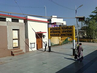
Nadiad Junction is a major railway station in the Kheda district of Gujarat State of India. It serves Nadiad city. It is under Vadodara railway division of Western Railway zone of Indian Railways. It is "A" category railway station of Western Railway Zone of Indian Railways. It has four platforms. Each day five train originate from Nadiad Junction. Nadiad Junction handles more than 100 trains daily. If one wants to travel to Modasa, Kapadvanj, Petlad and Bhadran, they can change the train route from here. Indian Railways has decided to convert Nadiad-Bhadran Narrow Gauge Line to Broad Gauge line and Modasa line to be extended to Shamlaji.
Mahemadavad Kheda Road railway station is a railway station on the Western Railway network in the state of Gujarat, India. Mahemadavad Kheda Road railway station is 18 km far away from Nadiad railway station. Passenger, MEMU and few Express/Superfast trains halt at Mahemadavad Kheda Road railway station. This railway station's nearest city is Kheda.

The Wakal River is a tributary to the Sabarmati River in Rajasthan and Gujarat states of India.
The Vatrak is a tributary of the Sabarmati River which flows for 243 kilometers in Gujarat, India. It originates in the hills of Dungarpur, Rajasthan and enters in Gujarat near village Moydi of Meghraj taluka.
Shamlaji fair is an annual festival held in Gujarat, India. It is held on the day of Karthiki Purnima. The fair is attended by a large number of tribals, who have great faith in Shamlaji . People from different regions of Gujarat as well as the state of Rajasthan also come to this fair.

Vautha fair is one of the important fairs held in Gujarat. Vautha is located on the border of Dholka taluka of Ahmedabad district and Matar taluka of Kheda district. Vautha fair is the largest fair in Ahmedabad district.
