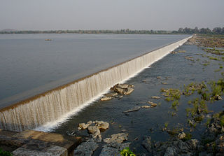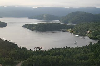
The Krishna River is the fourth-biggest river in terms of water inflows and river basin area in India, after the Ganga, Godavari and Brahmaputra. The river is almost 1,288 kilometres (800 mi) long. The river is also called Krishnaveni. It is one of the major sources of irrigation for Maharashtra, Karnataka, Telangana and Andhra Pradesh.

The Godavari is India's second longest river after the Ganga. Its source is in Triambakeshwar, Maharashtra. It flows east for 1,465 kilometres (910 mi), draining the states of Maharashtra (48.6%), Telangana (18.8%), Andhra Pradesh (4.5%), Chhattisgarh (10.9%) and Odisha (5.7%). The river ultimately empties into the Bay of Bengal through an extensive network of tributaries. Measuring up to 312,812 km2 (120,777 sq mi), it forms one of the largest river basins in the Indian subcontinent, with only the Ganga and Indus rivers having a larger drainage basin. In terms of length, catchment area and discharge, the Godavari is the largest in peninsular India, and had been dubbed as the Dakshina Ganga.

The Upper Rhine is the section of the Rhine in the Upper Rhine Plain between Basel in Switzerland and Bingen in Germany. The river is marked by Rhine-kilometres 170 to 529.

Lake Vyrnwy is a reservoir in Powys, Wales, built in the 1880s for Liverpool Corporation Waterworks to supply Liverpool with fresh water. It flooded the head of the Vyrnwy valley and submerged the village of Llanwddyn.

Ghaghara, also called Karnali is a perennial trans-boundary river originating on the Tibetan Plateau near Lake Manasarovar. It cuts through the Himalayas in Nepal and joins the Sharda River at Brahmaghat in India. Together they form the Ghaghara River, a major left bank tributary of the Ganges. With a length of 507 kilometres (315 mi) it is the longest river in Nepal. The total length of Ghaghara River up to its confluence with the Ganges at Revelganj in Bihar is 1,080 kilometres (670 mi). It is the largest tributary of the Ganges by volume and the second longest tributary of the Ganges by length after Yamuna.

The Daman Ganga also called Dawan River is a river in western India. The river's headwaters are on the western slope of the Western Ghats range, and it flows west into the Arabian Sea. The river flows through Maharashtra and Gujarat states, as well as the Union territory of Dadra and Nagar Haveli and Daman and Diu. The industrial towns of Vapi, Dadra and Silvassa lie on the north bank of the river, and the town of Daman occupies both banks of the river's estuary.

Shahādā is a town in Nandurbar district of the Indian state of Maharashtra. It is a Municipal council.

The Chambal River is a tributary of the Yamuna River in central India, and thus forms part of the greater Gangetic drainage system. The river flows north-northeast through Madhya Pradesh, running for a time through Rajasthan, then forming the boundary between Rajasthan and Madhya Pradesh before turning southeast to join the Yamuna in Uttar Pradesh state.

The Gandhi Sagar Dam is one of the four major dams built on India's Chambal River. The dam is located in the Mandsaur, Neemuch districts of the state of Madhya Pradesh. It is a masonry gravity dam, standing 62.17 metres (204.0 ft) high, with a gross storage capacity of 7.322 billion cubic metres from a catchment area of 22,584 km2 (8,720 sq mi). The dam's foundation stone was laid by Prime Minister of India Pandit Jawaharlal Nehru on 7 March 1954, and construction of the main dam was done by leading contractor Dwarka Das Agrawal & Associates and was completed in 1960. Additional dam structures were completed downstream in the 1970s.

The Ranapratap Sagar Dam is a gravity masonry dam of 53.8 metres (177 ft) height built on the Chambal River at Rawatbhata in Rajasthan in India. It is part of integrated scheme of a cascade development of the river involving four projects starting with the Gandhi Sagar Dam in the upstream reach in Madhya Pradesh and the Jawahar Sagar Dam on the downstream with a terminal structure of the Kota Barrage in Rajasthan for irrigation.
The Jawahar Sagar Dam is the third dam in the series of Chambal Valley Projects on the Chambal River, located 29 km upstream of Kota city and 26 km downstream of Rana Pratap Sagar dam. It is a concrete gravity dam, 45 meters high and 393 meters long, generating 60 MW of power with an installed capacity of 3 units of 33 MW. Its construction was completed in 1972. The total catchment area of the dam is 27,195 km2, of which only 1,496 km2 are in Rajasthan. The free catchment area below Rana Pratap Sagar dam is 2,331 km2. The dam is located after the Gandhi Sagar Dam and Rana Pratap Sagar Dam, but before the Kota Barrage.

Prakasha, popularly known as Dakshin Kashiis a village situated on the bank of Tapi River in taluka Shahada in Nandurbar district, Maharashtra, India.

Pandavleni, also known as Tirthankar Leni, Panch Pandav or Pandav Leni Jain cave, is ancient rock-cut sculptures complex located at Gomai River around 6 kilometer north of Shahada, Maharashtra. These caves were excavated by Jain saints 2,000 years ago.

The Ghab Plain is a fertile depression lying mainly in the Al-Suqaylabiyah District in northwest Syria. The Orontes River, flowing north, enters the Plain near Muhradah, around 25 km north-west of Hama.
Gomai Dam, is an earthfill dam on Gomai river near Shahada, Nandurbar district in state of Maharashtra in India.

The Pazhassi Dam also called Kulur Barrage is a stone masonry diversion structure in Kannur district, Kerala, India. It is named after king Pazhassi Raja, a patriot who died a heroic death in the war. The dam is constructed across the west flowing Valapattanam River near VELIYAMBRA. It was commissioned by Prime Minister Morarji Desai in 1979. It mainly functions as an irrigation dam, serving a command area of 11,525 hectares in Thalassery and Thaliparambra taluks of the Kannur District. The water from this dam also meets the drinking water requirement of Kannur district. The dam site and the reservoir are famous for their scenic beauty.

The Mégiscane River is a tributary of Parent Lake (Abitibi). It flows in the Northwest of Quebec, in Canada, in the administrative regions of:

The Toulnustouc generating station, is a hydroelectric power generating station managed by Hydro-Québec on the Toulnustouc River in the territory of Côte-Nord, Quebec, Canada. It has an installed capacity of 526 MW. The power station is fed by water from a dam and dyke that contain the Lake-Sainte-Anne reservoir.

Lake Sainte-Anne is a lake and reservoir on the Toulnustouc River in the territory of Côte-Nord, Quebec, Canada. The original dam was built in 1950 to regulate the river flow as part of the Manicouagan River hydroelectric power complex. A new dam was completed in 2005 that enlarged the reservoir and supported the new Toulnustouc generating station.


