Malappuram, is one of the 14 districts in the Indian state of Kerala, with a coastline of 70 km (43 mi). The most populous district of Kerala, Malappuram is home to around 13% of the total population of the state. The district was formed on 16 June 1969, spanning an area of about 3,554 km2 (1,372 sq mi). It is the third-largest district of Kerala by area. It is bounded by Western Ghats and the Arabian Sea on either side. The district is divided into seven Taluks: Eranad, Kondotty, Nilambur, Perinthalmanna, Ponnani, Tirur, and Tirurangadi.

Chaliyar River is the fourth longest river in Kerala at 169 km in length. The Chaliyar is also known as Chulika River, Nilambur River or Beypore River as it is near the sea. Pothukal, Chungathara, Nilambur, Mampad, Edavanna, Kavanoor, Perakamanna, Areekode, Kizhuparamba, Elamaram, Cheekkode, Vazhakkad, Vazhayur, Cheruvadi, Edavannappara, Mavoor, Peruvayal, Perumanna, Feroke and Beypore are some of the towns/villages situated along the banks of the Chaliyar. It mainly flows through Malappuram district. Its tributaries flow through both the districts of Malappuram and Kozhikode. The bank of river Chaliyar in the Nilambur region is also known for its natural Gold fields. Explorations done at the valley of the river Chaliyar in Nilambur have shown reserves of the order of 2.5 million cubic meters of placers with 0.1 gram per cubic meter of gold. It originates at the Ilambaleri hills of Nilgiri Mountains in Nilgiris district, which is also near Wayanad-Malappuram district border. It flows mainly through the erstwhile region of Eranad, and finally empties into the Arabian Sea at Beypore port, opposite to Chaliyam harbour.
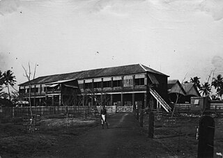
Beypore or Beypur is an ancient port town and a locality town in Kozhikode district in the state of Kerala, India. It is located opposite to Chaliyam, the estuary where the river Chaliyar empties into Arabian Sea. Beypore is part of Kozhikode Municipal Corporation. The place was formerly known as Vaypura / Vadaparappanad and also as Beydary. Tippu Sultan, ruler of Mysore, named the town "Sultan Pattanam". There is a marina and a beach while Beypore port is one of the oldest ports in Kerala, which historically traded with the Middle East. Beypore is noted for building wooden ships, known as dhows or urus in the Malayalam language. These ships were usually bought by Arab merchants for trading and fishing but are now used as tourist ships. According to Captain Iwata, founder member of the Association of Sumerian ships in Japan, Sumerian ships might have been built in Beypore. There is evidence to prove that Beypore had direct trade links with Mesopotamia and was a prominent link on the maritime silk route. The first railway line of Kerala was laid in 1861 from Tirur to Beypore (Chaliyam) passing through Tanur, Parappanangadi, Vallikkunnu, and Kadalundi.

Malabar District, also known as British Malabar or simply Malabar was an administrative district on the southwestern Malabar Coast of Bombay Presidency (1792–1800), Madras Presidency (1800–1950) and finally, Madras State (1950–1956) in India. It was the most populous and the third-largest district in the erstwhile Madras State. The historic town of Kozhikode was the administrative headquarters of this district.

Tanur is a coastal town, a municipality, and a block located in Tirur Taluk, Malappuram district, Kerala, India. It is located on the Malabar Coast, 9 kilometres (5.6 mi) north of Tirur and 9 kilometres south of Parappanangadi. It is the 17th-most populated municipality in the state, the fourth-most populated municipality in the district, and the second-most densely populated municipality in Malappuram district, having about 3,568 residents per square kilometre as of the year 2011.

Conolly Canal, sometimes spelled as Canoly Canal, is the part of the West coast canal (WCC) network of Kerala and the canal was constructed by combining the rivers and streams along the coast with the intention of creating a vast waterway from Kozhikode to Kochi. It was constructed in the year 1848 under the orders of then collector of Malabar, H.V. Conolly, initially to facilitate movement of goods to Kallayi Port from hinter lands of Malabar through Kuttiyadi and Korapuzha river systems.

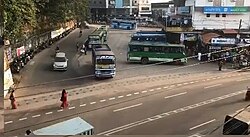
Ramanattukara is a municipality census town in Kozhikode district in the Indian state of Kerala. The town was formerly called Kadungan Chira village. Ramanattukara is located 15 km away from Kozhikode city.

Idimuzhikkal or Chelembra is a town in Malappuram district, Kerala, India. Chelembra is the Panchayath and Idimuzhikal is the capital of this Panchayath. Chelembra grama panchayat in the district.

Parappanangadi is a major town and a municipality in Tirurangadi taluk of Malappuram district, Kerala, India. It is a coastal town located close to the Arabian Sea.

Thenhipalam is a census town and a panchayat in Tirurangadi taluk in Malappuram district of Kerala, India, with a population of 27,273 as per 2001 census, consisting of 13,293 males and 13,980 females. Tenhipalam forms a portion of the Malappuram metropolitan area as of 2011 Census. University of Calicut, the first university in the Malabar region, is located north-west part of the Panchayat. 'Chelari' is the main commercial place in Tenhipalam panchayat while 'Panambra' is considered the headquarters of the panchayat. The small town between Chelari and the university is called Kohinoor.

Vallikkunnu is a village in Tirurangadi Taluk of Malappuram district in the state of Kerala, India with an area of 25 km2. It is located 5 km north of Parappanangadi town and comes under the jurisdiction of Parappanangadi Police Station and Parappanangadi Judicial First Class Magistrate Court. Its latitude and longitude are 11'07" N and 7'51"E respectively. Vallikkunnu was awarded the best panchayath of Kerala in 1997. Vallikunnu is situated on Tirur-Kadalundi Road. Vallikkunnu is also a part of the Oldest Railway Line of Kerala laid in 1861 from Tirur to Chaliyam via Tanur, Parappanangadi, Vallikkunnu, and Kadalundi.

Kadalundi is a village in Kozhikode district, Kerala, India. It is a coastal village close to the Arabian Sea. Kadalundi is famous for its bird sanctuary, which is home to various migratory birds during certain seasons and has been recently declared as a bio-reserve. The Kadalundi–Vallikkunnu Community Reserve is the first community reserve in Kerala. The Kadalundi River and the Chaliyar river, two of the longest rivers of Kerala, merges with the Arabian Sea at Kadalundi. The first railway line in Kerala was laid in 1861 from Tirur to Chaliyam through Tanur, Parappanangadi, Vallikkunnu, and Kadalundi.

Cheruvannur is a census town and Cheruvannur-Nallalam Part of Kozhikode Corporation.
Eranad also known as Ernad refers to the erstwhile province in the midland area of Malabar, consisting of Malappuram and nearby regions such as Anakkayam, Manjeri, Kondotty, Nilambur, etc. Currently Eranad Taluk is a Taluk in Malappuram district. Eranad was ruled by a Samanthan Nair clan known as Eradis, similar to the Vellodis of neighbouring Valluvanad and Nedungadis of Nedunganad. The rulers of Eranad were known by the title Eralppad/Eradi. They also used the title Thirumulpad.
Parappanad was a former feudal city-state in Malabar, India. The headquarters of Parappanad Royal family was at the town Parappanangadi in present-day Malappuram district. In 1425, the country divided into Northern Parappanad and Southern Parappanad. Southern Parappanad included parts of Tirurangadi Taluk and the town Parappanangadi. Northern Parappanad included Panniyankara, Beypore, and Cheruvannur of Kozhikkode Taluk. Parappanad royal family is a cousin dynasty of the Travancore royal family.
Chaliyam is a village situated at the estuary of Chaliyar in Kozhikode district of Kerala, India. Chaliyam forms an island, bounded by the Chaliyar in the north, and River Kadalundi in south, and the Conolly Canal in the east. It is located just opposite to Beypore port. Chaliyam was the former terminus of the South-West Line of the Madras Railway. Chaliyam is also famous for the Guinness World Records holder Muhammed Adil, a P.M who covered around seven km in the Chaliyar River with his hand and legs tied with ropes.
Thiruthiyad is a village near Vazhayur in Malappuram district, also accessible from Mavoor town through the Oorkkadavu bridge. It is on the Chaliyar river. The village contains lots of banana cultivation and paddy fields.

middi.in
Malappuram is one of the 14 districts in the South Indian state of Kerala. The district has a unique and eventful history starting from pre-historic times. During the early medieval period, the district was the home to two of the four major kingdoms that ruled Kerala. Perumpadappu was the original hometown of the Kingdom of Cochin, which is also known as Perumbadappu Swaroopam, and Nediyiruppu was the original hometown of the Zamorin of Calicut, which is also known as Nediyiruppu Swaroopam. Besides, the original headquarters of the Palakkad Rajas were also at Athavanad in the district.

South Malabar refers to a geographical area of the southwestern coast of India covering some parts of the present-day Kerala state. South Malabar covers the regions included in present-day Kozhikode and Thamarassery taluk of Kozhikode district, Wayanad district excluding Mananthavady taluk, the whole area of Malappuram district, Chavakkad taluk of Thrissur district, and Palakkad district, excluding parts of Chittur taluk. The Fort Kochi region of Kochi city also historically belongs to South Malabar. The term South Malabar refers to the region of the erstwhile Malabar District south to the river Korapuzha, and bears a high cultural similarity to both the Cochin and the North Malabar regions.