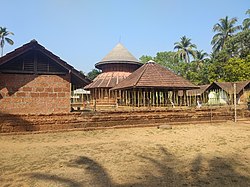
Kalpetta is the largest and first City, Town and municipality in the Wayanad district of the Indian state of Kerala. Kalpetta is the headquarters of Wayanad district, as well as the headquarters of Vythiri taluk. It is a bustling city, town surrounded by dense coffee and tea plantations and mountains. It lies on the Kozhikode-Mysore National Highway NH 766 at an altitude of about 780 m above sea level. Kalpetta is 72 km from Kozhikode and 140 km from Mysore.

Balussery is a town located about 25 km northeast of Kozhikode city, situated on State Highway 34. It is one of the 12 block Panchayats in the Kozhikode district and serves as the northeastern entry point to Kozhikode city.

Mavoor is a town situated in Kozhikode district in Kerala, India. It is 19 km away from Kozhikode city.

Mayyil is a Census Town and Grama Panchayat in Kannur District of Kerala State. Mayyil Panchayat established in 1962 by merging the villages of Kayaralam, Mayyil and Kandakkai.
Paravur Taluk, IPA:[pɐrɐʋuːr], is a taluk of Ernakulam District in the Indian State of Kerala. North Paravur is the capital of the taluk. Paravur Taluk lies in the north western part of Ernakulam district bordering Thrissur district. The surrounding taluks are Kochi to the west consisting of Vypin Island, Kodungallur to the north, Chalakudy to the north consisting of Mala, Aluva to the east consisting of Angamaly, Nedumbassery and Aluva, Kanayanur to the south consisting of Cochin City. Paravur is a part of Kochi urban agglomeration area. The western parts of taluk are coastal areas with cultivations like prawn and pokkali rice. The eastern parts are fertile lands. The heavy industries of Kochi is located in Udyogmandal area of the taluk.
Koyonkara is a small village situated in Trikarpur Panchayath of Kasaragod district, Kerala, India. It constitutes the main part of North Trikarpur Village.
Meppayur is a town in Kozhikode district of Kerala state, South India.

Perambra is a major town in Koyilandy taluk of Kozhikode district in North Malabar region of Kerala state, India. It is one of the 140 assembly constituencies in Kerala, and one of the 12 block Panchayats in Kozhikode district. Perambra lies almost at the centre of the district. The area which was formerly known as Payyormalanadu, eventually became Perambra. In the Northern Songs, there are references to the Payyormalanadu of Old Kurumbranadu.
Palangad is a village in the Kozhikode District of Kerala, India.
Kottur is a grama panchayat and a community development block in the Kozhikode district of Kerala, India.

Thenhipalam is a census town and a panchayat in Tirurangadi taluk in Malappuram district of Kerala, India, with a population of 27,273 as per 2001 census, consisting of 13,293 males and 13,980 females. Tenhipalam forms a portion of the Malappuram metropolitan area as of 2011 Census. University of Calicut, the first university in the Malabar region, is located north-west part of the Panchayat. 'Chelari' is the main commercial place in Tenhipalam panchayat while 'Panambra' is considered the headquarters of the panchayat. The small town between Chelari and the university is called Kohinoor.
Chittilamchery is a village in the Palakkad district of Kerala located in Vadakkanchery - Kollengode main road. It is under the administration of the Melarcode Panchayath in the Alathur Taluk.
Chelannur is a village in Kozhikode district in the state of Kerala, India.The village is currently ruled by the United Democratic Front (UDF)
Naduvannur is a Grama Panchayath and a Census town in Kozhikode district in the state of Kerala, India. It lies at the center of the district. Naduvannur is part of Kozhikode Urban Agglomeration. The name Naduvannur denotes that it was the center of the territory of Kurumbranad. 'Nadu' means center and ur(oor) means place.

Narikkuni is a town in Kozhikode district in the state of Kerala, India. According to Census 2011 information the location code or village code of Narikkuni town is 627402. Narikkuni town is located in Kozhikode Tehsil of Kozhikode district in Kerala, India. It is situated 20 km away from Kozhikode.
Ulliyeri is a village in Kozhikode district in the state of Kerala, India. Ulliyeri is between Koyilandy and Balussery and also between Kuttiyadi and Kozhikode.
Kuppadi is a village near Sultan Bathery in Wayanad district in the state of Kerala, India.The famous St Mary's College, Sulthan Bathery is situated in this village.

Poothadi is a village near Kenichira, Panamaram area in Wayanad district in the state of Kerala, India.

Thamarassery, formerly known as Thazhmalachery, is one of the taluks and a major hill town in the Kozhikode district of Kerala, India, 30 km north-east of Kozhikode (Calicut) city and 29 km east of Koyilandy. The town lies on National highway 766.
Kakkodi is a Panchayath in Kozhikode district of Kerala. The Panchayath borders Kozhikode corporation on one side and the panchayaths kuruvattur, Chelannur, thalakkulathur and Elathur, on the other sides.


