Chathamangalam

Last updated

Chathamangalam
village
Nitcoat.jpg
NIT Stadium
Coordinates: 11°17′46″N75°54′54″E / 11.296°N 75.915°E / 11.296; 75.915 Coordinates: 11°17′46″N75°54′54″E / 11.296°N 75.915°E / 11.296; 75.915
CountryFlag of India.svg  India
State Kerala
District Kozhikode
Area
  Total40.23 km2 (15.53 sq mi)
Population
 (2001)
  Total45,628 (2,001 Census)
  Density900/km2 (2,000/sq mi)
Languages
  Official Malayalam, English
Time zone UTC+5:30 (IST)
PIN
673601
Vehicle registration KL-
Nearest cityKunnamangalam
Lok Sabha constituencyKozhikode
Website chathamangalam.org

Chathamangalam is a village in Kozhikode district of Kerala state, India.

Contents

Geography

Chathamangalam is a gram panchayat is an agricultural village comprising hills, valleys, and paddy fields. It spreads over 40.23 km2 [1] and 20 km east of Kozhikode city. [2] The village is bordered by the Cherupuzha river to the south, west and north, and the east is bordered by the Iruvazhanhia. Both these tributaries join the Chaliyar. Chathamangalam is situated 22 km away from the town of Kozhikode. [2] Chathamangalam came into existence on 24 September 1956. It has twenty-two wards spread across two villages.

Demographics

The population is 45,628 (2001 Census [1] ). Of these, 23,368 are women and 7,763 are scheduled caste.

Landmarks

The village is known for its educational institutions including the National Institute of Technology Calicut and National Institute of Electronics and Information Technology (NIELIT) (Formerly DOEACC ). The village's health infrastructure includes PHC (primary health centre) Choolur and its 9 sub-centres, Ayurveda Hospital Vellanoor, and the government's Homeopathic Hospital Nairkuzhi.

The village has a sub-registrar's office that was established in 1906, a sub-post office with 7 branches, a telephone Exchange, and banks including a State Bank of India, the Chathamangalam Service Co-operative Bank, and the Chathamangalam Urban Bank. The Chathamangalam Public Library and Reading Room was established in 1944 and has eleven libraries.

History

One story regarding the origin of Chathamangalam can be traced back to a fight between two groups who came to see a festival at Chethukadavu. The fight resulted in many deaths; the area was later named Kunnamangalam. The victims were called Chathamangalam, and those who led the fight were called Padanilam. Another story behind Chathamangalam is related to the ancient temple of Chathamangalathappan. It is believed that this temple, which is related to the Guruvayur temple, had its stone laid by Naranathu Bhranthan. As the families of the sorcerers live here, it is called the place of Kuttichathan, or Chathamangalam.

The market of Chathamangalam is Kattangal. It originated from the name Kettuthangal because the place had been a relief, a place of rest for people who carried heavy loads on the Mukkam-Kozhikode route. [3]

Attractions

The village contains a large variety of religious buildings, including churches, mosques, temples and kavu . Festivals of Nagakali, Kuttichathan and Bhagavathi are popular. The village's Areekulangara Devi temple is on a scale equal to the Kadampuzha Devi temple of the Malappuram district.

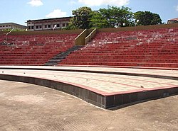
Clubs and youth organizations play an active part in the development of culture. There are also mini stadiums in Pazhur and Poolakkode. Football, volleyball and cricket are popular sports in the region.

Distance from major towns

From Calicut (Kozhikode) - 20 km

From Mukkam - 8 km

From Koduvally - 11 km

From Mavoor - 7.3 km

Transportation

Chathamangalam village connects to other parts of India through Calicut city on the west and Thamarassery town on the east. Nearest main town is Mukkam. National highway No.66 passes through Kozhikode and the northern stretch connects to Mangalore, Goa and Mumbai. The southern stretch connects to Cochin and Trivandrum. The eastern National Highway No.54 going through Adivaram connects to Kalpetta, Mysore and Bangalore. The nearest airports are at Kozhikode. The nearest railway station is at Kozhikode.

Related Research Articles

Meppayur is a town in Kozhikode district of Kerala state, South India.

Cherupuzha (Kannur) Town in Kerala, India

Cherupuzha is a town in Kannur district, Kerala, India. It is the headquarters of the Cherupuzha Panchayat which is a special grade panchayat in Kerala.

Kadampuzha Small town in Kerala, India

Kadampuzha is a small town and a pilgrimage centre in Malappuram district of Kerala situated near the Thrissur-Calicut national highway.

Omanoor Village in Kerala, India

Omanoor is a village in the Malappuram district, Kerala, India. The village is in Cheekode Panchayath. There have LP, UP, HSS in this village, and most of the people are daily workers. Omanoor has many historical mythologies.

Kodiyathur Village in Kerala, India

Kodiyathur is a gram panchayat in Kozhikode district in the state of Kerala, India.

Velom Grama Panchayath is a village in Kozhikode district in the state of Kerala, India.

Marakkara Grama Panchayath in Kerala, India

Marakkara is a grama panchayath in Kuttippuram Block Panchayat, Tirur Taluk, Malappuram district in the state of Kerala, India.

Parappur Census town in Kerala, India

Parappur (Malayalam: പറപ്പൂര്‍) is a village and townland two kilometers north of Kottakkal in Malappuram district in the state of Kerala, India.

Purathur Village in Kerala, India

Purathur is a beautiful sandy coastal village and a Grama Panchayat in Tirur Taluk, Malappuram district in the state of Kerala, India. Bharathappuzha river and Tirur River merges together in Purathur and join with the Arabian Sea at Padinjarekara Azhimukham, which is also the southernmost tip of Purathur Gram panchayat. Opposite to Padinjarekara Azhimukham is Ponnani port. The village is located at the southernmost tip of Tirur Taluk and is bordered by historically important Ponnani port in Ponnani Municipality of Ponnani taluk to south.

Edavaka, Mananthavady Grama Panchayat in Kerala, India

Edavaka is a Grama Panchayath in the Wayanad district of the Kerala State, India.

Thamarassery Place in Kerala, India

Thamarassery, formerly known as Thazhmalachery, it is one of the taluk in Kozhikode district and major hill town in the Kozhikode district of Kerala, India, 30 km north-east of Kozhikode (Calicut) City and 29 km east of Koyilandy. It lies on the Calicut - Wayanad - Mysore route.

Kunnamangalam Town in Kerala, India

Kunnamangalam is a growing census town located about 14 km east of Kozhikode (Calicut) city on the Calicut - Bangalore National Highway. Nearby places are Koduvally, Mukkam, Chathamangalam, and Kattangal. India's premier educational institutions like Indian Institute of Management, Kozhikode (IIMK), National Institute of Technology Calicut, National Institute of Electronics & Information Technology, Indian Institute of Spices Research, and Kerala School of Mathematics, Kozhikode are located here. Kunnamangalam is developing as a suburb of Kozhikode, Kunnamangalam is the east side entry of Calicut city.

Mukkam Municipality/suburb/town in Kozhikode, Kerala, India

Mukkam is a major municipality town in Kozhikode, state of Kerala, India. Mukkam is one of the major regional suburb of the Kozhikode district. Mukkam is located about 27 km east of Calicut city on the bank of river Iruvanjippuzha, one of the major tributaries of river Chaliyar .Mukkam is also well knows for its secularistic features. The urban region of Mukkam is spread across Mukkam Municipality and the North Karassery region of Karassery Grama Panchayath. The town begins from North Karassery junction region and runs till Agasthianmuzhi Junction region.

Omassery Town in Kerala, India

Omassery is a town in Kozhikode district, Kerala, India and it is a junction between Thiruvambady, Thamarassery, Mukkam, Koduvally, Kodenchery and Kattangal. Omassery is located 29 kilometers southeast of Kozhikode in the eastern part of Kerala; better known as Malabar. Omassery is a fast developing place and is well connected to the other parts of the state. Besides that, it is known as the gateway to the hill ranges of Western Ghats in Malabar.

Orkkatteri is a small town in Kozhikode district in the North Malabar region of state of Kerala, India. This is the center town for Eramala grama panchayath.

Puthuparamba or puthuparambu is a natural village in Edarikode Grama Panchayath which located near to NH 66 Pookipparamba Malappuram District of Kerala, India. Postal code is 676501

Chungathara Village in Kerala, India

Chungathara is a village panchayat in Nilambur Taluk in Malappuram district, Kerala, India. It is one of the smallest gramapnachayat in Kerala. It is surrounded by Western Ghats.

Thalappara Town in Kerala, India

Thalappara is a place located in the Malappuram district of Kerala in India near to Moonniyur. It is on the NH 17. It is located in the highway that connects between Thrissur and Calicut.

Cherukavu Census town in Kerala, India

Cherukavu is a census town in Malappuram district in the state of Kerala, India.

Kozhikode East Town in Kerala, India

Kozhikode East is a suburb of Kozhikode city in India. Kozhikode East includes areas outside the city jurisdiction but they are still closely associated with the city in terms of commerce and everyday life.

References

  1. 1 2 "Chathamangalam Grama Panchayath". chathamangalam.org. Archived from the original on 22 August 2013. Retrieved 19 January 2014.
  2. 1 2 "Kozhikode, Kerala to chathamangalam distance - Google Maps". maps.google.co.in. Retrieved 19 January 2014.
  3. "Chathamangalam Grama Panchayath". chathamangalam.org. Archived from the original on 21 August 2013. Retrieved 19 January 2014.