This article needs additional citations for verification .(August 2016) |
Kadampuzha | |
|---|---|
Small town | |
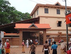 Kadampuzha Temple | |
 | |
| Coordinates: 10°56′0″N76°2′0″E / 10.93333°N 76.03333°E | |
| Country | |
| State | Kerala |
| District | Malappuram |
| Government | |
| • Body | Marakara Panchayat |
| Languages | |
| • Official | Malayalam, English |
| Time zone | UTC+5:30 (IST) |
| Vehicle registration | KL-55 |
| Lok Sabha constituency | Ponnani |
| Nearest city | Malappuram |
Kadampuzha is a small town and a pilgrimage centre in Malappuram district of Kerala situated near the Thrissur-Calicut national highway.