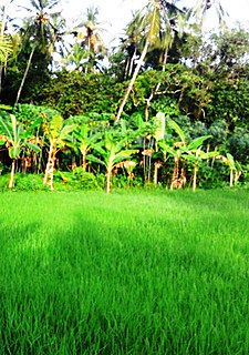
Feroke, IPA: [fɐroːkːɨ̆], is a Municipality and a part of Kozhikode metropolitan area under Kozhikode Development Authority (K.D.A) in the Kozhikode district of the Indian state of Kerala.

Desur is a Town panchayat in Tiruvanamalai district in the Indian state of Tamil Nadu.
Dhanauli is a census town in Agra district in the Indian state of Uttar Pradesh, India.
Herohalli is a census town in Bangalore district in the Indian state of Karnataka.
Kachhwa is a town and a nagar panchayat in Mirzapur district in the Indian state of Uttar Pradesh.
Kokkothamangalam is a census town in Alappuzha district in the Indian state of Kerala.
Kothnur is a census town in Bangalore district in the Indian state of Karnataka.
Krishnasamudram is a census town in Tiruchirappalli district in the Indian state of Tamil Nadu.
Kumbhkot is a census town in Kota district in the Indian state of Rajasthan.
Kureekkad is a census town in Ernakulam district in the Indian state of Kerala.
Red Hills is a town in Thiruvallur district in the Indian state of Tamil Nadu.
Neyyoor is a panchayat town in Kanniyakumari district in the Indian state of Tamil Nadu.
Parbatsar is a town and a municipality in Nagaur district in the Indian state of Rajasthan. As of the 2001 India census, Parbatsar had a population of 80,000. Males constitute 54% of the population and females 46%. Parbatsar has an average literacy rate of 80%, higher than the national average of 59.5%: male literacy is 72%, and female literacy is 47%. In Parbatsar, 16% of the population is under 6 years of age.
Peerkankaranai is a suburban neighborhood of Chennai in the Indian state of Tamil Nadu. It is governed by Tambaram Municipal Corporation.
Perumbaikad is a census town in Kottayam district in the Indian state of Kerala.

Ramanattukara is a municipality census town in Kozhikode district in the Indian state of Kerala. This town was formerly called Kadungan Chira village. Ramanattukara is located 14 km away from Kozhikode city.
Salumbar is a statutory town in Udaipur district in the Indian state of Rajasthan.
Thevaram is a town in Theni district in the Indian state of Tamil Nadu. Thevaram is located in Tamil Nadu near on border of Kerala at the Eastern side foot-hill of the Western Ghats. It is connected with State Highway SH100.
Vengathur is a census town in Thiruvallur district in the Indian state of Tamil Nadu.
Jafarabad is a town and nagar panchayat in Jaunpur district in the Indian state of Uttar Pradesh.


