Gudalur | |
|---|---|
City | |
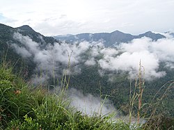 Needle Rock View Point at Gudalur | |
 Gudalur Location in Tamil Nadu, India | |
| Coordinates: 11°30′N76°30′E / 11.50°N 76.50°E | |
| Country | |
| State | Tamil Nadu |
| District | Nilgiris |
| Government | |
| • Type | Second Grade Municipality |
| • Body | Gudalur Municipality |
| • Chairperson | Rama Mani [1] |
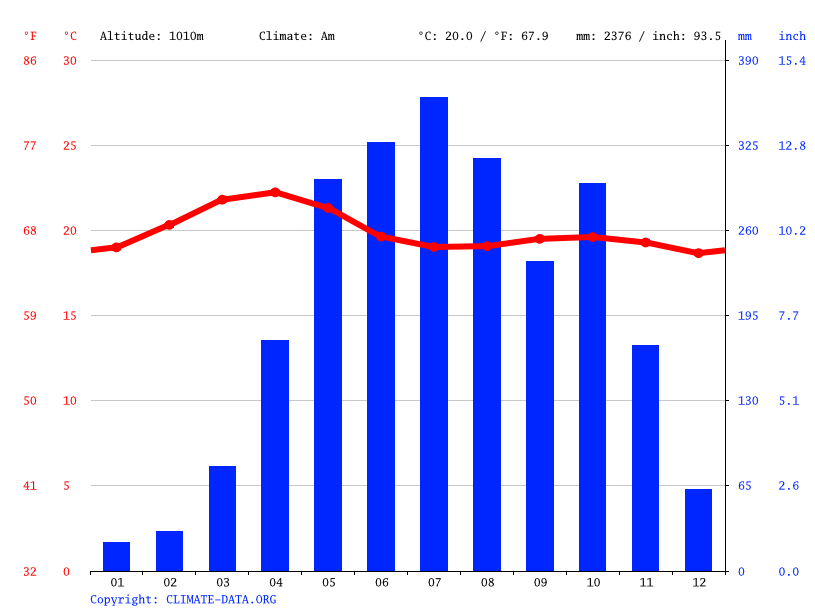
| Elevation | 1,072 m (3,517 ft) |
| Population (2011) | |
• Total | 49,540 |
| • Density | 200/km2 (520/sq mi) |
| Language | |
| • Official | Tamil |
| • Regional | Malayalam, Tamil [2] |
| Time zone | UTC+5:30 (IST) |
| PIN | 643212, 643211 |
| Telephone code | 04262 |
| Vehicle registration | TN 43 Z, TN 43 Y, TN 43 X, TN 43 W |
| Sex ratio | 900/1000 ♂/♀ |
Gudalur is a city and municipality and taluk in Nilgiris district in the Indian state of Tamil Nadu.


