
The Deschutes River in central Oregon is a major tributary of the Columbia River. The river provides much of the drainage on the eastern side of the Cascade Range in Oregon, gathering many of the tributaries that descend from the drier, eastern flank of the mountains. The Deschutes provided an important route to and from the Columbia for Native Americans for thousands of years, and then in the 19th century for pioneers on the Oregon Trail. The river flows mostly through rugged and arid country, and its valley provides a cultural heart for central Oregon. Today the river supplies water for irrigation and is popular in the summer for whitewater rafting and fishing.

The Nilgiris district is one of the 38 districts in the southern Indian state of Tamil Nadu. Nilgiri is the name given to a range of mountains spread across the borders among the states of Tamil Nadu, Karnataka and Kerala. The Nilgiri Hills are part of a larger mountain chain known as the Western Ghats. Their highest point is the mountain of Doddabetta, height 2,637 m. The district is contained mainly within the Nilgiri Mountains range. The administrative headquarters is located at Ooty. The district is bounded by Malappuram district of Kerala to the west, Coimbatore and Palakkad to the south, Erode to the east, and Chamarajnagar district of Karnataka and Wayanad district of Kerala to the north. As it is located at the junction of three states, namely, Tamil Nadu, Kerala, and Karnataka, significant Malayali and Kannadiga populations reside in the district. Nilgiris district is known for natural mines of Gold, which is also seen in the other parts of Nilgiri Biosphere Reserve extended in the neighbouring states of Karnataka and Kerala too.

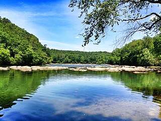
The McCloud River is a 77.1-mile (124.1 km) long river that flows east of and parallel to the upper Sacramento River, in Siskiyou County and Shasta County in northern California in the United States. Protected under California's Wild and Scenic Rivers Act (1972), it drains a scenic mountainous area of the Cascade Range, including part of Mount Shasta. It is a tributary of the Pit River, which in turn flows into the Sacramento River. The three rivers join in Shasta Lake, formed by Shasta Dam north of Redding.

Bhavani is an Indian river flows through Indian states of Kerala and Tamil Nadu, India. It is a major tributary of the Kaveri River.
Lake Taneycomo is a man-made lake or reservoir on the White River in the Ozark Mountains of Taney County, Missouri. The reservoir is named for the county in which it is located: Taney County, MO.

Table Rock Lake is an artificial lake or reservoir in the Ozarks of southwestern Missouri and northwestern Arkansas in the United States. Designed, built and operated by the U.S. Army Corps of Engineers, the lake is impounded by Table Rock Dam, which was constructed from 1954 to 1958 on the White River.

Mukurthi National Park (MNP) is a 78.46 km2 (30.3 sq mi) protected area located in the western corner of the Nilgiris Plateau west of Ootacamund hill station in the northwest corner of Tamil Nadu state in the Western Ghats mountain range of South India. The park was created to protect its keystone species, the Nilgiri tahr.

The West Canada Creek is a 76-mile-long (122 km) river in upstate New York, United States. West Canada Creek is an important water way in Hamilton, Oneida, and Herkimer counties, draining the south part of the Adirondack Mountains before emptying into the Mohawk River near the Village of Herkimer. The name "Canada" is derived from an Iroquoian word for "village" (Kanata).
Chattahoochee River National Recreation Area (CRNRA) preserves a series of sites between Atlanta and Lake Sidney Lanier along the Chattahoochee River in Georgia, U.S. The 48-mile (77 km) stretch of the river affords public recreation opportunities and access to historic sites. The national recreation area, a National Park Service unit, was established on August 15, 1978, by President Jimmy Carter.

Strawberry Reservoir is a large reservoir in the U.S. state of Utah. It is Utah's most popular fishery, receiving over 1.5 million angling hours annually and is part of the Blue Ribbon Fisheries program. Game fish in the reservoir include sterilized rainbow trout, bear lake cutthroat trout, kokanee salmon and crayfish. It is located 23 miles (37 km) southeast of Heber, Utah on U.S. Route 40. The reservoir is situated in Strawberry Valley. This valley is normally part of the Colorado River drainage. The dam was constructed to divert water into Utah Valley.

Sispara, സിസ്പാര, a proper noun, is a combination of the Badaga language words si:su + pore; meaning: magnetite bearing rock + gorge. It may refer to:
C. J. Strike Dam is an earth-fill type hydroelectric dam on the Snake River, just below the Bruneau River confluence, in the U.S. state of Idaho. Its location is near Grand View, Idaho. Its impoundment extends 36 miles (58 km) up the Snake River and 12 miles (19 km²) up the Bruneau River.

Oaky River, a perennial stream of the Macleay River catchment, is located in the Northern Tablelands district of New South Wales, Australia.

Holter Dam is a hydroelectric straight gravity dam on the Missouri River about 45 miles (72 km) northeast of Helena, Montana, in the United States. The dam, which was built between 1908 and 1918, is 1,364 feet (416 m) long and 124 feet (38 m) high. The reservoir formed by the dam, Holter Lake is 25 miles (40 km) long and has a storage capacity of 243,000 acre-feet (300,000,000 m3) of water when full. The dam is a "run-of-the-river" dam because it can generate electricity without needing to store additional water supplies behind the dam.

The Kamaraj Sagar Dam is in the Nilgiris district of Tamil Nadu state in India. It is located at a distance of 10 km from the Ooty bus stand. It is a picnic spot and a film shooting spot on the slopes of the Wenlock Downs.

The Kateri (Katery) hydro electric power station is located in Nilgiris, Tamil Nadu, India. It is a series of dams and a power house with four 125 KW generators and one 500 KW. The site was the first hydro-electric plant in India, and powers the Cordite Factory at Aruvankadu.
The Kundah Power House is located in the Nilgiris, Tamil Nadu, India. It is the one of the biggest electricity generating schemes in Tamil Nadu. The group of peaks Devarbatta, Karaikada, Koulingabetta and Porthimund, all over 2400 Metres ASL drain into two streams, Avalanche and Emerald. Total estimated cost of the Kundah scheme is Rs. 35 44 lakhs. This project is whole of it Canadian Aid under the Colombo Plan Avalanche and Emerald Dams, along with Upper Bhavani, form the major source of water for the Kundah hydro-electric project. The project is a symbol of India-Canada friendship and co-operation. The project was executed by then TNEB Civil engineer R.S. Sankaranarayanan (Retd.), who now resides in Vanandurai, Besant Nagar, Chennai The Power houses were commissioned from the year 1960 to 1964.

The Moyar Power House is a hydroelectric power station located in the Nilgiris, Tamil Nadu, India. It is run by the Tamil Nadu State Electricity Board. It is 48 km from Ooty and 36 km from Gudalur. The power plant is situated at the bottom of the Moyar Gorge and is accessed by a winch system from the plateau above.

Maravakandy Power House is located in Gudalur, Nilgiris, Tamil Nadu, India. It is controlled by the Tamil Nadu State Electricity Board and is 32 km from the Ooty. The elevation of the power house is above 884 meters and the installation capacity is 750KW.

Avalanche Lake is located 28 kilometers from Ooty in the Nilgiris district in Tamil Nadu.

