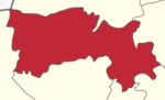
Attur or Aathur is a municipality and headquarters of Attur taluk in the Salem district in the state of Tamil Nadu, India. As of the 2011 census, the town had a population of 61,793. Attur is growing economically.
Sattur or Saathur is a town in Virudhunagar district in the Indian state of Tamil Nadu. As of 2011, the town had a population of 29,398.
Alandur is a zone of Chennai corporation, and an urban node in Chennai district in Guindy division in the state of Tamil Nadu, India. It is surrounded by Guindy in the north and east, Adambakkam in the south, Pazhavanthangal in the south-west and Parangimalai in the north-west. As of 2011, Alandur had a population of 164,430. The town agglomeration of Alandur will have an estimated population of 300,000 by 2030. Alandur neighbours the St. Thomas Mount Cantontment, the Officers Training Academy of the Indian army and the nearby towns of Guindy and Adambakkam. M. G. Ramachandran, a former chief minister of Tamil Nadu started his political career by winning his first legislative election from Alandur in 1967. Alandur also holds famous landmarks of Chennai namely Nehru Statue and Kathipara Junction.
Puzhuthivakkam, commonly known as Ullagaram or Ullagaram–Puzhuthivakkam, is a southern neighbourhood of Chennai in Tamil Nadu, India. Puzhuthivakkam loosely translates to dust neighborhood. The neighbourhood is part of the Greater Chennai Corporation, following Chennai's expansion into Kanchipuram district. Puzhuthivakkam is located between the neighborhoods of Madipakkam, Adambakkam, Velachery, Pallikaranai, and Nanganallur. Puzhuthivakkam was initially developed in the late 1960s and early 1970s. Upon completion of the MRTS extension line, the neighborhood will be served by Puzhuthivakkam railway station. As of 2011, the town had a population of 53,322.
Maduravoyal is a residential neighbourhood located in the west of Chennai, India. As of 2011, the town had a population of 86,195.
Ambasamudram is the principal town of the Ambasamudram taluk in Tirunelveli district in the state of Tamil Nadu, India. The entire taluk had a population of 392,226 as of 2001, with 42.5% classified as rural. The town of Ambasamudram had a population 35,645 as of 2011.
Anaiyur is an area of the Madurai district in the state of Tamil Nadu, India. As of 2011, the town had a population of 63,917.
Anakaputhur is a neighborhood in the city of Tambaram, situated within the Chennai Metropolitan Area, Tamil Nadu, India.

Kavundampalayam is an area located in Coimbatore, Tamil Nadu, India. It is within the Coimbatore Corporation, about 6 km north of the city centre. Goundampalayam is along Mettupalayam road in Coimbatore, one of the arterial roads of the city. As of 2011, the town had a population of 83,908.

Inam Karur is a municipality in Karur district in the Indian state of Tamil Nadu. As of 2011, the town had a population of 67,131.

Kallakurichi is a Municipality in the Indian state of Tamil Nadu and the administrative headquarters of Kallakurichi district in Tamil Nadu. As of 2019, the town had a population of 73528.
Kasipalayam is a neighbourhood locality in the City of Erode. Until 2010, it was an independent Municipal Administrative body with a population of about 55,000 and in 2011, it has been officially combined with the Integrated Erode Municipal Corporation.
Katthivakkam is an residential and industrial area located in the northern part of Chennai. It is a part of zone 1 in Greater Chennai Corporation. It is under Thiruvottiyur taluk in Chennai district. It is a part of Thiruvottiyur(state assembly constituency) and Chennai North. Formerly a town and a municipality of Thiruvallur district in the Indian state of Tamil Nadu, it has now been absorbed by Chennai city in September 2011 and within Chennai District limit since January 2018. The neighbourhood is served by Katthivakkam railway station. As of 2011, the town had a population of 36,617.

Kuniyamuthur is a part of South Coimbatore. It is about 6 km from Coimbatore City center in the South. Kuniyamuthur is sometimes spelled Kuniamuthur or Kunimattoor. It is one of the busiest markets in the city. It is located on Palakkad road, one of arterial roads of Coimbatore city. The Coimbatore International Airport is about 17 km and Coimbatore Junction is about 6 km from here, Podanur Junction railway station is about 5 km from Kuniyamuthur. As of 2011, the town had a population of 95,924.
Kurichi is a neighborhood of Coimbatore city in the Indian state of Tamil Nadu. It was upgraded to a municipality in 2004, it was recently merged with the Coimbatore Corporation. As of 2011, the town had a population of 123,770
Periyasemur is a neighbourhood of the city of Erode in the Indian state of Tamil Nadu. Until 2010, it was an independent Municipal Administrative body with a population of about 35,000 and in 2011, it has been officially combined with the Integrated Erode Municipal Corporation.
Velampalayam is a third grade municipality in Tiruppur district in the Indian state of Tamil Nadu. As of 2011, the town had a population of 87,427.
Vickramasingapuram or V.K.Puram is a Municipal town in Tirunelveli District in the Indian state of Tamil Nadu. It falls under the Ambasamudram Taluk. As of 2011, the town had a population of 47,241.
Gudalur is a municipal town in Theni district in the Indian state of Tamil Nadu. As of 2011, its population was 41,915.
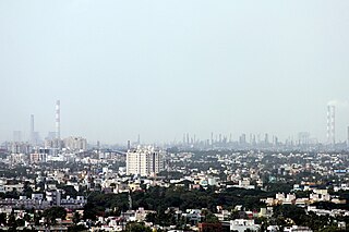
Manali is an industrial and residential part of Chennai, India. It is a zone in Greater Chennai Corporation located in the northern part of Chennai district in the Indian state of Tamil Nadu. As of 2011, the neighborhood had a population of 35,248.