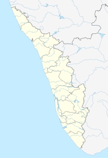
Puthunagaram is a town and gram panchayat in the Palakkad district, state of Kerala, India.

Athipattu is a census town in Chennai in Thiruvallur district in the state of Tamil Nadu, India. The neighbourhood is served by Athipattu railway station of the Chennai Suburban Railway network. it is a suburb in northern part of Chennai.

Bharveli is a census town in Balaghat district in the state of Madhya Pradesh, India.

Choornikkara is a census town in Aluva in Ernakulam District in Kerala, India.

Devarshola is a panchayat town in The Nilgiris district in the state of Tamil Nadu, India.

Ezhudesam is a town panchayat in Kanniyakumari district in the state of Tamil Nadu, India.

Hanumanthanpatti is a town panchayat located in uthamapalayam taluk, theni district in the state of Tamil Nadu, India.

Kappiyarai is a panchayat town in Kanniyakumari district in the Indian state of Tamil Nadu.

Keezhapavur is a town panchayat, primary municipality in Tenkasi district in the Indian state of Tamil Nadu.

Manglaya Sadak is a census town in Indore district in the Indian state of Madhya Pradesh.

Nallur (Nalloor) is a panchayat town in Kanniyakumari district in the Indian state of Tamil Nadu.

Nathampannai is a panchayat town in Pudukkottai district in the Indian state of Tamil Nadu.

Pappakurichi is a census town in Tiruchirappalli district in the Indian state of Tamil Nadu. It was merged with the Tiruchirappalli Corporation in 2011.

Peerkankaranai is a neighborhood in Southern part of the metropolitan city of Chennai in the Indian state of Tamil Nadu.

SAYALGUDI is a town panchayat in Ramanathapuram district of Tamil Nadu State in India.

Sethia is a census town in Chhindwara district in the Indian state of Madhya Pradesh.

Thevaram is a town in Theni district in the Indian state of Tamil Nadu. Thevaram is located in Tamil Nadu near on border of Kerala at the Eastern side foot-hill of the Western Ghats. It is connected with State Highway SH100.

Thiruporur is a panchayat town in Chengalpattu district in the Indian state of Tamil Nadu. The Thiruporur Kandaswamy temple is situated in the center of the town. There is a large temple tank in the vicinity of the temple. Thiruporur is located on Old Mahabalipuram Road and is flanked by Kelambakkam on one side and Alathur Pharmaceutical Industrial Estate on the other side, both of which are also on Old Mahabalipuram Road.
Valvaithankoshtam is a panchayat town in Kanniyakumari district in the Indian state of Tamil Nadu.

Uthukottai is a border town and panchayat town in Tamil Nadu, next to Andhra Pradesh, located on the banks of the Arani river. The town features a channel which helps to direct water from the Krishna river for local irrigation.


