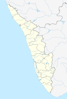
Puthunagaram is a town and gram panchayat in the Palakkad district, state of Kerala, India.

Madipakkam is residential locality situated in south of Chennai, India. It has been recently placed under the Greater Chennai Corporation.

Athipattu is a census town in Chennai in Thiruvallur district in the state of Tamil Nadu, India. The neighbourhood is served by Athipattu railway station of the Chennai Suburban Railway network. it is a suburb in northern part of Chennai.

Population

Birwadi is a census town in Raigad district in the state of Maharashtra, India.

Chinnasekkadu is a neighbourhood of Chennai in Chennai district in the state of Tamil Nadu, India. Chinnasekkadu used to be a town panchayat in Thiruvallur district. In 2011, Chinnasekkadu town panchayat wss merged with Chennai Corporation. Chinnasekkadu comes under ward 29 in Zone 3(Madhavaram) of Chennai Corporation.

Desur is a Town panchayat in Tiruvanamalai district in the Indian state of Tamil Nadu.

Dhanuha is a census town in Jaunpur district in the state of Uttar Pradesh, India.

Herohalli is a census town in Bangalore district in the Indian state of Karnataka.

Injambakkam is a locality in the south of Chennai in the Indian state of Tamil Nadu. Being a part of the Walajabad block of the district, its panchayat is part of Walajabad panchayat union. Injambakkam is located along the ECR.

Karuvanthuruthy is a census town in Kozhikode district in the Indian state of Kerala.

Naravarikuppam is a town in Thiruvallur district in the Indian state of Tamil Nadu.also called redhills

Peerkankaranai is a neighborhood in Southern part of the metropolitan city of Chennai in the Indian state of Tamil Nadu.

Perumbaikad is a census town in Kottayam district in the Indian state of Kerala.

Sahnewal is a town and a municipal council in Ludhiana district in the Indian state of Punjab. The town is situated on National Highway No. 44, between Khanna and Ludhiana.

Thevaram is a town in Theni district in the Indian state of Tamil Nadu. Thevaram is located in Tamil Nadu near on border of Kerala at the Eastern side foot-hill of the Western Ghats. It is connected with State Highway SH100.

Thiruporur is a panchayat town in Chengalpattu district in the Indian state of Tamil Nadu. The Thiruporur Kandaswamy temple is situated in the center of the town. There is a large temple tank in the vicinity of the temple. Thiruporur is located on Old Mahabalipuram Road and is flanked by Kelambakkam on one side and Alathur Pharmaceutical Industrial Estate on the other side, both of which are also on Old Mahabalipuram Road.
Vengathur is a census town in Thiruvallur district in the Indian state of Tamil Nadu.

Shirahatti is a panchayat town in Gadag district in the Indian state of Karnataka.

Kerur is a City in Bagalkot district in Karnataka, which located on NH 218. It has an average elevation of 617 meters (2024 feet). It's a birthplace of Jagadish Shettar, a former Chief Minister of Karnataka. Kerur is a Town Panchayat city in district of Bagalkot, Karnataka. The Kerur city is divided into 16 wards for which elections are held every five years. The Kerur Town Panchayat has population of 19,731 of which 9,929 are males while 9,802 are females as per report released by Census India 2011.


