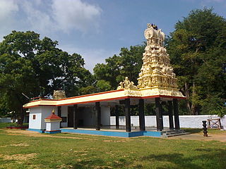
Perundurai is a Special Grade Town Panchayat in Erode district in the Indian state of Tamil Nadu. Perundurai is the only special grade town panchayat among 42 in the district. Perundurai has developed as the industrial center with SIPCOT Industrial Estate and SEZ Complex. It is the Asia's Second largest SIPCOT.
Rasipuram is a Municipality in the Indian state of Tamil Nadu and suburb of city of Salem located in Namakkal District. It is the headquarters for the Rasipuram taluk. As of 2015, the town had a population of 88,584 and an area of 24 km2 (9.3 sq mi). It has 27 wards and steps have been taken to increase the wards to 33. Rasipuram is known for ghee and tapioca sago.

Chithode or Chittode is a neighbourhood and a panchayat town adjoining Erode City in the state of Tamil Nadu, India. It is situated near the intersection of National Highway 544 connecting Salem with Kochi and the State Highway (SH-15) connecting Erode-with Sathy and Mysore.
Edappadi is a municipality in the Salem district in the state of Tamil Nadu, India. Edappadi was once known for its thriving power loom industry. The economy is diversified by agriculture, heavy truck transport, granite, entertainment and foundries.
Kalappanaickenpatti is a panchayat town in Senthamangalam Taluk, Namakkal district in the Indian state of Tamil Nadu
Kannankurichi is a part of Salem City Municipal Corporation in Salem district in the Indian state of Tamil Nadu.
Karumathampatti is a Municipality in the Coimbatore district in the state of Tamil Nadu, India. It is one of the prominent developing suburb in Coimbatore metropolitan area, about 25 km away from the city centre. It is situated in between NH544 which connects the city of Coimbatore with Salem – Erode – Tirupur and also in between the State Highway 165 connects Annur – Kamanaikenpalayam. Nearby places are Somanur-3 km, Avinashi-10 km, Tirupur-20 km, Sulur-15 km, Annur-16 km. Coimbatore -27,Mettupalayam-38,Palladam-19. Karumathampatti lies near the junction of two major roads, NH544(Coimbatore – Salem) and Karumathampatti – Annur road.
Karuppur is a panchayat town in Salem District in the Indian state of Tamil Nadu. It is located on the National Highway 7 between Salem and Bangalore. The Periyar University, with which many Salem colleges are affiliated, is located here. Government College of Engineering, referred as GCE-Salem is also located here. It is a railway station on the Chennai-Shoranur railway line.
Kondalampatti is a Zonal Region in Salem City consisting of 15 wards in the Indian state of Tamil Nadu. As of 2022 Thiru. N. Palanisamy is the councillor from this region.
Konganapuram is a panchayat town in Salem district in the Indian state of Tamil Nadu.
Kunnathur is a panchayat town in Tirupur district in the Indian state of Tamil Nadu. It was previously under the jurisdiction of the Erode district. However kunnathur is in tiruppur district, legislative assembly consistency for kunnathur is Perundurai which is in Erode district.

Mallasamudram is a Panchayath town in Thiruchengode taluk, Namakkal district in the Indian state of Tamil Nadu. It is the headquarter of the Mallasamudram block. Mallasamudram is also known as "Mallai Managaram", "Mallai".

Manapparai is a municipality in Tiruchirappalli district in the Indian state of Tamil Nadu. Manapparai Town is located 38 km from Trichy. Manapparai is the headquarters of the Manapparai Taluk. Manapparai is famous for murukku and cattle market. As of 2011, the town had a population of 40,510.
Nangavalli is a panchayat town in Salem district in the Indian state of Tamil Nadu.
Pallipattu is a town in Tamil Nadu and a border town located between the Chittoor District of Andhra Pradesh and Tiruvallur District of Tamil Nadu. It is known for its fertile agricultural lands and the west-to-east flowing Kusasthalai river.
Paramathi is a panchayat town in Namakkal district in the Indian state of Tamil Nadu. It is the headquarter of Paramathi block.

Tharamangalam is a municipality in Salem district in the Indian state of Tamil Nadu.
Kulasekharam is a town located in the district of Kanyakumari, Tamil Nadu, India. It is one of the most important business centres in the district, after Marthandam.
Eriyodu is a panchayat town located in Dindigul district of Madurai Region in the state of Tamil Nadu, India. It is a part of vedasandur legislative constituency and karur parliamentary constituency. Eriyodu is in the administrative district of Dindigul. Eriyodu is located in Dindigul next to Karur State Highway road.

Peyode is located near Nagercoil, a suburb of Kanyakumari in the Indian state of Tamil Nadu. It is a southern suburb of Kanyakumari city, located on Nagercoil-Colachel SH 46. Nearby places are Rajakkamangalam, Vellichanthai and Muttom.


