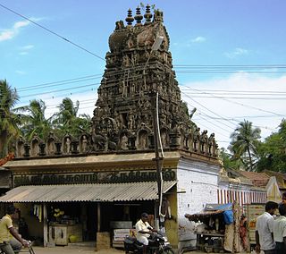
Tiruchirappalli District is one of the 38 districts, located along the Kaveri River, in Tamil Nadu, India. The headquarters of the district is the city of Tiruchirappalli.

Salem District is one of the 38 districts of Tamil Nadu state in southern India. The district is now divided into Dharmapuri, Krishnagiri, Namakkal as individual districts. Salem is the district headquarters and other major towns in the district include Mettur, Thammampatti, Attur, Omalur, Sankagiri and Edappadi. That Salem dates to at least two thousand years ago is evident from the discovery of silver coins from the Roman Emperor Nero Claudius Caesar Augustus Germanicus found by Koneripatti of Salem in 1987. It was ruled by Mazhavar King Kolli Mazhavan and kings Adhiyaman and Valvil Ori of Sangam age. It is part of Kongu Nadu and Mazhanadu, a vast region that dates to the 2nd century BCE. Salem was the largest district of Tamil Nadu. It was bifurcated into Salem and Dharmapuri districts in 1965 and Namakkal district in 1997. Now Salem has been developed a lot by building many bridges and is considered to be the smart city. Salem is famous for cultivating mangoes.

Ayothiapattinam is a panchayat town in Salem district in the state of Tamil Nadu, India.
Kadayampatti is a town panchayat and headquarters of Kadayampatti taluk, in Salem district, Tamil Nadu, India.

Pethanaickenpalayam is a town panchayat and headquarters of Peddanayakkan Palayam taluk, in Salem district, Tamil Nadu, India.
Pudupalayam is a panchayat town in Chengam taluk of Tiruvanamalai district in the Indian state of Tamil Nadu. Its pincode number is 606 705.It is well connected with Tiruvannamalai and Bangalore. This is at Bangalore Road at 33 km away from the famous Annamalaiyar Temple located in Thiruvannamalai.
Vazhapadi is a town panchayat in Salem district in the Indian state of Tamil Nadu. It is the headquarters of Vazhapadi taluk, one of the 13 taluks of Salem district.
Attur Taluk is one of the taluks, or administrative division of Salem District in the state of Tamil Nadu, India. The division's headquarters is Attur town.
Kamakkapalayam is a village in Salem district, Thalaivasal block in the Indian state of Tamil Nadu.
Edappadi is a taluk of Salem district in the Indian state of Tamil Nadu. The administrative centre is the town of Edappadi. The taluk contains two panchayat towns, Konganapuram and Poolampatti, and ten panchayat villages. The Edappadi revenue block is coterminous with the taluk.

Sendamangalam is a Taluk in the Indian state of Tamil Nadu is situated in Namakkal District.
Belur is a first-grade town panchayat in the Vazhapadi taluk of Salem district, in Tamil Nadu, India.
Masinaickenpatti is a census town in the Vazhapadi taluk of Salem district, in Tamil Nadu, India.
Kurichi is a village in the Vazhapadi taluk of Salem district, in Tamil Nadu, India.
Tukkiyampalayam is a village in the Vazhapadi taluk of Salem district, in Tamil Nadu, India.
Singapuram is a village in the Vazhapadi taluk of Salem district, in Tamil Nadu, India.
Tirumanur is a village in the Vazhapadi taluk of Salem district, in Tamil Nadu, India.
Vellalakundam is a village in the Vazhapadi taluk of Salem district, in Tamil Nadu, India.
M.Perumalpalayam is a village in the Vazhapadi taluk of Salem district, in Tamil Nadu, India.
Minnampalli is a village in the Vazhapadi taluk of Salem district, in Tamil Nadu, India.


